

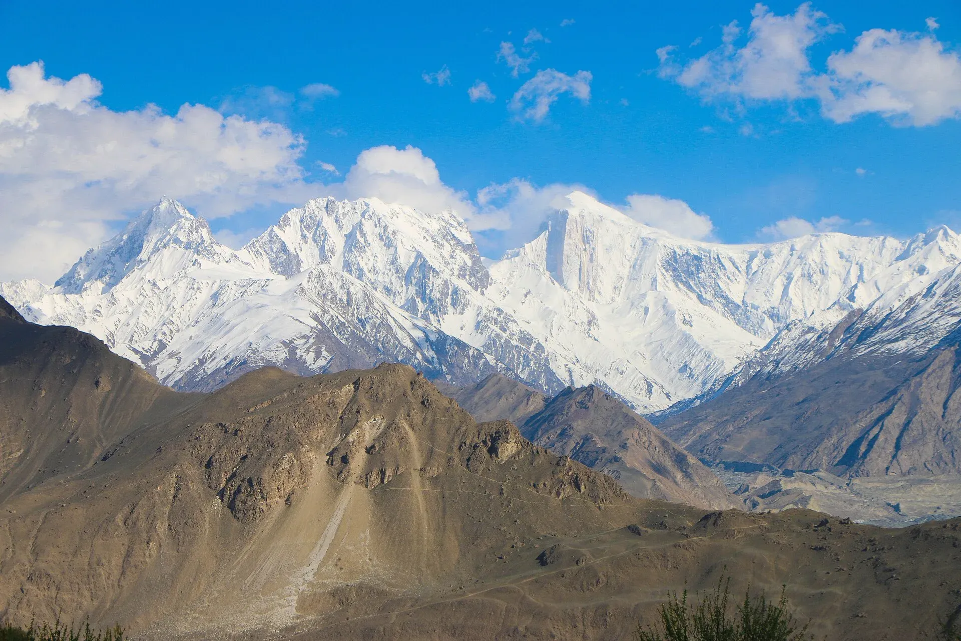
Photo: Akbar Khan Niazi, with thanks · CC BY-SA 3.0 · via Wikimedia Commons · temporary stand-in photo
Other treks in Hunza
A roundup of lesser-known Hunza treks: Altit Peak and Duikar, the Shishpar and Muchutshil glaciers near Hassanabad, and the Ahmedabad Glacier. Moderate, open-zone treks with local guides advised.
This page collects several shorter treks in Hunza. Each heading below is a separate route with its own season, grade and permit rules, so read the notes for the one you plan to walk.
5 routes: Altit Peak and Duikar · Shishpar Glacier (Hassanabad) · Muchutshil Glacier · Ahmedabad Glacier · Permits and current notes
The Hunza Valley floor is at about 2,438 m, with Rakaposhi (7,788 m) and the Batura Muztagh peaks, including Ultar Sar (7,388 m), above it. Burushaski, Wakhi and Shina are spoken. The routes below start from villages along the Karakoram Highway or its link roads, and all of them climb quickly into summer pastures.
Altit Peak and Duikar
Duikar is a summer village about 300 m above Altit, with wide views over the Hunza Valley and the old Altit Fort at the foot of the slope. The viewpoint above it is known as Eagle's Nest. Above it lie summer pastures and dry, rocky peaks, including little-known Altit Peak (5,075 m). A road turns off the Altit link road west of the polo ground. The drive from Karimabad or Altit takes about an hour, and walking takes five to six hours. A moderate trek of four or five days into the high pastures is possible. It is popular in winter with hunters, so take someone who knows the peaks.
Shishpar Glacier (Hassanabad)
Two glaciers drain into the Hassanabad Nala from the south side of the Batura Wall (about 7,500 m): Shishpar (also Hassanabad) from the north-east, and Muchutshil from the north-west. Both treks reach summer pastures. They are moderate and best from late May to early October. The trailheads are at the KKH bridge over the Hassanabad Nala, just above Murtazabad and about 5 km below Aliabad. Glacier routes change every year, so take a local guide.
The Shishpar trek takes about four days and gives views of the unseen sides of Bubulimating, Ultar and Shishpar. Day 1 follows the east bank to the glacier snout, then climbs the moraine, crosses the glacier for about 1.5 km and leaves it by a steep gully to the dry camp of Bras I (3 to 4 hours from the KKH). Day 2 goes up the glacier past Bras II to the Khaltar Harai pasture (also called Dudara Harai), about 7 km and 4 to 5 hours further, with views of Ultar and Passu peaks. Return the same way.
Peaks above the Hassanabad Nala include Shispare, first climbed in 1974, and the Bublimotin (Ladyfinger) spire, climbed in 1982.
Muchutshil Glacier
This six-day trek has views of Muchu Chhish (7,453 m), which was long considered the world's second-highest unclimbed peak until a Czech team reached its summit in 2024, and Hachindar Chhish (7,163 m) and leads to Sangemarmar Sar Base Camp. Sangemarmar Sar was first climbed in 1984. Day 1 follows the west bank beside the power-station canal to a sandy camp below the snout (2 to 3 hours). Day 2 climbs high, crosses the debris-covered glacier to its north-east side and goes through the pastures of Tochi and Bakor to Gaymaling (about 3,600 m), an unused pasture 5 to 7 hours on. From there you can explore Sangemarmar Sar (7,050 m) and its base camp. Day 3 climbs north to a large meadow with huts and a mill. Return takes until day 6. The Swiss map spells some names differently, such as Muchuhar and Gychalin.
Ahmedabad Glacier
The Ahmedabad Glacier lies east of the Ultar Glacier and few visitors go there. From Altit, a narrow road above the Hunza River leads through Faizabad to Ahmedabad village. From there you climb to summer pastures and come down to Sarat on the link road. Herders can show the way. It is a moderate trek of five or six days, in five stages from Ahmedabad: Gurpi, Teish, Godian, Baldiat and Sarat. Special hires run from Karimabad to Ahmedabad.
Permits and current notes
The old guidebook lists all these treks as open zone. The Dawn newspaper reported in March 2026 that foreigners need permits only for restricted zones. Check local rules before you go. Costs and road times from 2002 are out of date.
Planning notes
These routes are less visited than Ultar, Rakaposhi or Barpu, so there is less up-to-date information. Treat the times above as rough, and plan with a local guide who has done the route in the last season or two. Ask your Karimabad hotel or an operator for the current state of roads to Duikar and Ahmedabad, and for river and glacier conditions on the Hassanabad treks.
Highlights
- Duikar viewpoint above Altit
- Batura Wall views from Shishpar and Muchutshil
- Sangemarmar Sar Base Camp approach
- Quiet Ahmedabad Glacier pastures
Getting there
All treks start near Karimabad, Altit or Aliabad on the Karakoram Highway. Duikar and Ahmedabad are reached by narrow link roads from Altit, and the Shishpar and Muchutshil trailheads are at the KKH bridge over the Hassanabad Nala, about 5 km below Aliabad. Special hires work from Karimabad. Ask locally for current road conditions.
Permits and rules
- Fee
- Current fees will be added soon
- Last checked
- 16 November 2026
Rules differ between the routes on this page; this is a general note for Hunza.
Zone: open. Dawn reported on 29 March 2026 that foreign visitors to open-zone areas do not need a trekking permit, while permits from the Gilgit-Baltistan tourism department are needed only for treks and climbs in restricted zones. Older rules (a 2017 interior-ministry NOC for foreigners) were reported at the time; there is no known 2025-26 source confirming that it still applies. No fee or camping rule was found for this route. Check with the Gilgit-Baltistan Tourism Department in Gilgit, or a local operator, before you go.
How trekking permits, NOCs and registration work: Visa and permits.
Season
Best: Jun – Sep · general guide; each route differs
Water and camps
Camps vary by route and are mostly pastures or moraine sites. Water at Bras I is absent, as it is dry. Check each route with a guide.
Gear and safety
Glacier routes change each year, so use a local guide. These treks are less travelled, so tell someone your plan, and bring your own food, stove and first-aid kit. Altitudes reach about 3,600 m or more.
Variations
See the Ultar Meadow trek (ultar), the Barpu Glacier trek (barpu-glacier) and the Rakaposhi Base Camp trek (rakaposhi-base-camp) for better-documented routes.
Tips
- Take a local guide: glacier routes change each year
- Check road and bridge status before you start
- Pack food and fuel from Karimabad or Aliabad
- Confirm current permit rules before you go
Photos we still need: Ahmedabad Glacier and its summer pastures; Shishpar glacier snout and the moraine route from the KKH bridge. Send us yours
Health and emergency
Mobile signal is patchy on most treks, so tell someone your plan before you go. Emergency numbers
Sources and last checked
Last checked Confidence low4 sources5 still to check
- Last checked
- Method
- Desk research from published sources
- Confidence
- low
- Checked by
- trek.pk research team
Researched from published sources; not yet checked on the ground by our team. Spot something out of date? Report a mistake.
Sources
- Trekking in the Karakoram and Hindukush (route facts, ~2002) · Lonely Planet · checked
- Gilgit-Baltistan tourism bounces back despite Middle East war (permit rules for open and restricted zones, 29 March 2026) · Dawn · checked
- Batura Muztagh · Wikipedia · checked
- Hunza Valley · Wikipedia · checked
Still to be checked on the ground (5)
- All stage times, camps and altitudes: taken from a 2002 guidebook and not re-checked
- Road access to Duikar and Ahmedabad
- Whether these treks are still done and which guides run them
- Permit status for foreigners
- Current names on maps


