

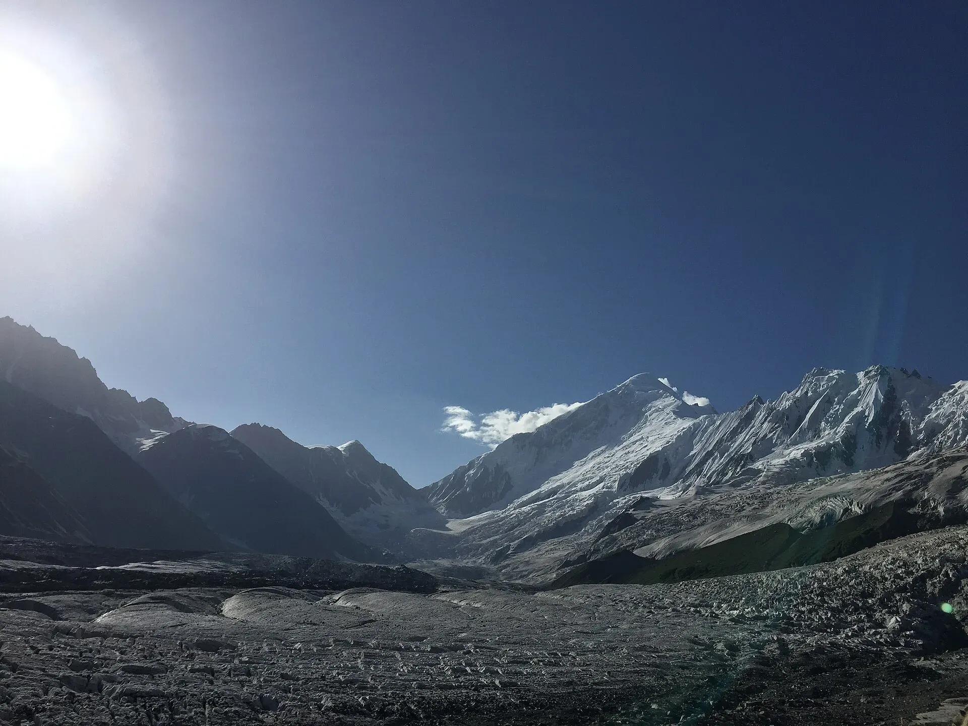
Photo: Chaudharybilal, with thanks · CC BY-SA 4.0 · via Wikimedia Commons · temporary stand-in photo

Rakaposhi Base Camp
- Duration
- 2–3 days
- Distance
- 17.6 km
- Grade
- Easy
- Max altitude
- 3,261 m
- Season
- Jun – Sep
A short, popular trek from Minapin in Nagar to Tagaphari, the meadow beneath the Rakaposhi-Diran ice ridge. About 17.6 km over 3 days, with a 1,250 m climb. Open zone, no foreigner permit reported.
Overview
Rakaposhi Base Camp is one of the easiest ways to stand in front of a 7,000 m Karakoram wall. The trail starts in Minapin, a village in Nagar beside the Karakoram Highway, and climbs to Tagaphari, the meadow below the 16 km ice ridge that joins Rakaposhi and Diran. It is a short trek with a big payoff: Diran, the Minapin Glacier and its icefalls fill the view, and avalanches fall off the ridge all afternoon.
Most people take two days up and one day down. Fit walkers do the round trip in a long day. The climb is about 1,250 m, so a night at Hapakun makes it more comfortable.
The mountain
Rakaposhi is 7,788 m high, the 27th highest mountain in the world. On its north side it rises about 5,900 m above the Hunza River over a horizontal distance of 11.2 km, a steep relief that is rare anywhere. The name is often glossed from Burushaski as "Shining Wall", and the mountain is also called Dumani, "Mother of Mist". A British expedition made the first ascent in 1958, when Mike Banks and Tom Patey climbed the south-west spur. From the Karakoram Highway the closest roadside viewpoint is the "Zero Point of Rakaposhi" at Ghulmet, near the turn-off for Minapin.
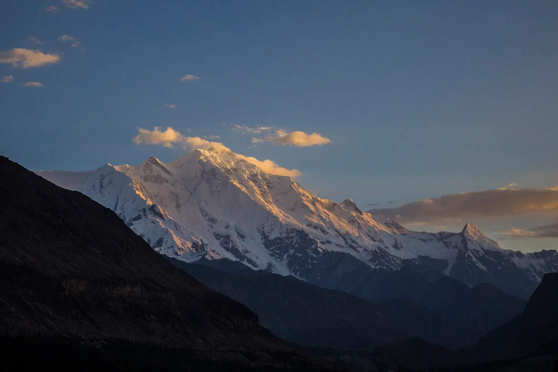
Photo: Saadzafar91, with thanks · CC BY-SA 3.0 · via Wikimedia Commons · temporary stand-in photo

Who it suits
First-time Karakoram trekkers, families with strong teenagers, and anyone who wants a short acclimatisation walk before a bigger trip. The trail is clear and there is no glacier crossing. The grade is easy by Karakoram standards, but the climb is steady and the top is above 3,200 m.
Going onto the Minapin Glacier toward Diran Base Camp is different. That route crosses broken ice with seracs. Take a local guide and a rope.
When to go
June to September is the normal season. Operators and recent hikers also report trekking from mid-May to early October. Early and late in that window you may meet snow on the ridge, and nights at Tagaphari can fall below freezing. Late afternoon and sunset are the best light on Diran.
The route
From Minapin (about 2,000 m), a lane and canal path leads to a footbridge over the Minapin torrent. The trail then climbs by switchbacks into juniper forest and reaches Hapakun (about 2,800 m) in 3 to 4 hours. This grassy, tiered meadow has fir trees, free camping and a spring. Diran and Rakaposhi are still hidden.
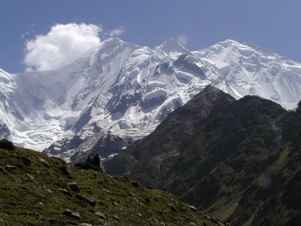
Photo: Waqas Usman, with thanks · CC BY 2.5 · via Wikimedia Commons · temporary stand-in photo

Day 2 goes through fir forest, a flower bowl and more juniper to a windy ridge. Here the whole Rakaposhi-Diran ridge appears. A short traverse above the broken Minapin Glacier brings you to Tagaphari (about 3,260 m). Sources give its height as 3,260 to 3,500 m. Rakaposhi's main summit is hidden behind Rakaposhi East (7,010 m).
Side trips from Tagaphari:
- Askoreshung viewpoint (about 3,780 m): a steep climb west over two ridges, with views to Batura, Shishpar and Ultar above Hunza.
- Diran Base Camp (Kacheli, about 3,650 m): a long day that needs a guide for the glacier crossing.
- Kacheli Lake: a steep two-hour climb above Diran Base Camp.
Terrain changes in three stages. The lower slopes are gravel and rocky paths with zigzags and a canal-side track. The middle section is forest, first juniper and then fir, on a trail that is steady uphill and has few views. Above the tree line the path is open and exposed to wind, with the glacier moraine close on one side. A hiker who walked it in October 2018 reported strong wind on the ridge and below-freezing nights.
For the return you can retrace your steps, or go over the ridge west of Tagaphari and down through Gutumerung pasture to join the Hapakun trail.
Culture and people
Minapin is a Burushaski-speaking village. It is welcoming but conservative. Dress modestly (shalwar kameez is the safe choice) and ask before photographing people. Women travelling should expect to be accompanied in the village and by the guide. The village has a porters' union overseen by the headman, so hire porters and donkeys through it.
Fitness and what to carry
The climb is steady rather than technical. A fit walker can reach Tagaphari in a day. One hiker who did the round trip in October 2018 started at about 8 am, turned round at 2 pm to keep daylight for the descent and was back in Minapin at 4.30 pm, including a two-hour break at the ridge. Another source gives 8 to 10 hours for a round trip. Pack a windproof shell, a warm layer and rain gear even on a settled day, because the weather can change quickly. Take two litres of water, a filter or tablets, and food for the whole day. Hiking down in the dark is a stated risk, so set a firm turn-round time.
Practical information
- Food and gear: bring trek food from Gilgit or Karimabad. A guesthouse in Minapin has long been the main base and has rented tents and bags in the past. Check current availability.
- Water: reliable at Hapakun (spring behind the huts) and Tagaphari (stream, seasonal spring). Treat it.
- Camping: free in the open meadows. A spring at Hapakun is on private land, so ask first.
- Map: DAV 1:50,000 Minapin (Rakaposhi Range).
- Guide: not required by the route, but useful on the glacier and for the high ridge in poor weather.
Getting the timing right
If you do the trek as a single long day, start at first light and set a firm turn-around time. Most people allow 8 to 10 hours for the round trip. If you stay overnight at Tagaphari, sunrise on Diran is the reward for the cold night.
Highlights
- Close view of the 16 km Rakaposhi-Diran ice ridge
- Avalanches and icefalls from Tagaphari moraine
- Juniper and fir forest on a clear trail
- Side trips to Askoreshung viewpoint and Diran Base Camp
Day by day
| Day | Camp | Altitude |
|---|---|---|
| 1 | Hapakun | 2,804 m |
| 2 | Tagaphari | 3,261 m |
| 3 | Minapin | 2,012 m |
| Day | Route | Hours | Distance | Ascent / descent | Camp and altitude |
|---|---|---|---|---|---|
| Day 1 | Minapin to Hapakun | 3–4 h | 5.8 km | +792 m | Hapakun, 2,804 m |
Day 1 notesLeave Minapin by the canal path and cross the footbridge over the torrent. Climb switchbacks for about half an hour, then walk a broad, shaded trail through open juniper forest to the huts at Bang-i-das. Follow the stream to the foot of its waterfall, take the smaller left fork and climb 15 minutes to Hapakun. The meadow is free to camp in and has views north to Hachindar and Maiun. Diran and Rakaposhi are still hidden. Use the clear spring behind the huts. | |||||
| Day 2 | Hapakun to Tagaphari (Rakaposhi Base Camp) | 2–3 h | 3 km | +457 m | Tagaphari, 3,261 m |
Day 2 notesTake the trail that runs south, away from the canal, then climb through fir forest. After a flat section and a flower-filled bowl, switchback through juniper to a windy ridge where Diran, Rakaposhi and the connecting ice wall come into view. A short traverse above the Minapin Glacier leads to Tagaphari, a level pasture with a herders' hut and good camp sites by a stream. Watch avalanches from the moraine and the sunset on Diran. | |||||
| Day 3 | Tagaphari to Minapin | 3–3.5 h | 8.8 km | −1,249 m | Minapin, 2,012 m |
Day 3 notesRetrace the route through Hapakun. An alternative goes over the ridge west of Tagaphari (about 3,650 m), drops steeply to Gutumerung pasture and follows the valley down past the Bang-i-das waterfall to join the main trail. It is 8.4 km and takes 4 to 4.5 hours, so allow for the extra time and the steep descent. | |||||
Getting there
Minapin is about 80 km (1.5–2 hours) from Gilgit on the Karakoram Highway. A 4 km link road leaves the KKH at Pisan, just east of Ghulmet. Shared vans to Pisan and Minapin have run from Gilgit's Khazana (Bank) Road in the early afternoon, returning early in the morning. Timings change, so ask locally. There is no direct public transport between Karimabad and Minapin: get to the KKH and use a passing vehicle, or hire a car. From Pisan it is a 45-minute walk to Minapin.
Permits and rules
- Permit needed
- Usually not, Open zone
- Fee
- Current fees will be added soon
- Last checked
- 16 November 2026
Zone: open. Dawn reported on 29 March 2026 that foreign visitors to open-zone areas do not need a trekking permit, while permits from the Gilgit-Baltistan tourism department are needed only for treks and climbs in restricted zones. Older rules (a 2017 interior-ministry NOC for foreigners) were reported at the time; there is no known 2025-26 source confirming that it still applies. No fee or camping rule was found for this route. Check with the Gilgit-Baltistan Tourism Department in Gilgit, or a local operator, before you go.
How trekking permits, NOCs and registration work: Visa and permits.
Season
Best: Jun – Sep
Water and camps
Water is reliable at Hapakun (spring behind and below the huts, 5 minutes away) and at Tagaphari (stream, plus a small seasonal spring at the base of the rocky slope). Streams can be silty, so filter or treat. Camping in the open meadows is free, though the Hapakun spring sits on private land, so ask first. Both camps have herders' huts and level grass.
Gear and safety
Tagaphari is about 3,260 m, so altitude trouble is unlikely, but take it slowly on day 1. Nights can be near freezing at either end of the season. Rockfall and avalanche noise from the ridge is normal at a distance; do not camp on the lateral moraine edge. Do not walk onto the Minapin Glacier without a local guide and a rope: the route crosses seracs and changes every year. Mobile signal is patchy. Rescue, if needed, is by helicopter from Gilgit through the army or an operator, and takes time.
Variations
Add Askoreshung viewpoint, Kacheli Lake or a guided glacier crossing to Diran Base Camp (Kacheli) from Tagaphari. The long way back goes via Gutumerung. For the south side of the same ridge, see the Diran Base Camp trek from Bagrot (diran-base-camp-rakaposhi-diran-ridge). The Hon Pass day hike above Ultar Meadow (ultar) gives a view of this ridge from the other side of the Hunza.
Tips
- Spend a night at Hapakun to split the 1,250 m climb
- Take a local guide before stepping onto the Minapin Glacier
- Dress modestly in Minapin and ask before taking photos of people
- Start early: the ridge is windy and clouds build in the afternoon
- Bring trek food from Gilgit or Karimabad
Photos we still need: Hapakun meadow and the forest section of the trail. Send us yours
Health and emergency
Mobile signal is patchy on most treks, so tell someone your plan before you go. Emergency numbers
Sources and last checked
Last checked Confidence medium6 sources7 still to check
- Last checked
- Method
- Desk research from published sources
- Confidence
- medium
- Checked by
- trek.pk research team
Researched from published sources; not yet checked on the ground by our team. Spot something out of date? Report a mistake.
Sources
- Trekking in the Karakoram and Hindukush (route facts, ~2002) · Lonely Planet · checked
- Gilgit-Baltistan tourism bounces back despite Middle East war (permit rules for open and restricted zones, 29 March 2026) · Dawn · checked
- Hiking Rakaposhi Base Camp: a complete guide (times, altitude ~3,500 m, season; updated 2026) · BucketListly · checked
- Rakaposhi Base Camp Trek (itinerary, Tagaphari ~3,300 m) · Hunza Guides Pakistan · checked
- Rakaposhi Base Camp Trek (Tagaphari 3,260 m) · Apricot Tours · checked
- Rakaposhi · Wikipedia · checked
Still to be checked on the ground (7)
- Tagaphari height: Bucketlistly gives about 3,500 m, other sources about 3,260 to 3,300 m (the page uses 3,261 m); one blog gives 4,150 m, which looks wrong
- Current van schedules and fares from Gilgit to Minapin: Bucketlistly (updated Oct 2026) gives no fare, says about 1.5 to 2 hours and to confirm locally; the author waited hours for a van to fill (2018)
- Whether any porter, camping or conservancy fee now applies
- Tent rental in Minapin (Bucketlistly names Diran Guesthouse and Roomy Yurts as places to stay; no source for tent hire)
- Whether the 2017 interior-ministry NOC for foreigners still applies to open zones (Dawn, 29 Mar 2026, says foreigners need no permit in open zones and does not mention an NOC; no official statement found)
- Minapin Glacier crossing route (changes each year)
- Whether the Minapin trailhead route is signed or needs a local guide (Bucketlistly's author walked it alone in 2018; operators supply guides)
Nearby and related

Diran Base Camp (Rakaposhi-Diran ridge, from Bagrot)

Ultar Meadow

Other treks in Hunza
Tagaphari (Rakaposhi Base Camp)
The meadow at the end of the Rakaposhi Base Camp trek above Minapin, about 3,260 m, facing the Rakaposhi-Diran ice ridge.
Hapakun Meadow
A grassy, tiered meadow with fir trees and a spring at about 2,800 m, the usual first night on the Rakaposhi Base Camp trek above Minapin.