

Photo: Shujaat Aly, with thanks · CC BY-SA 3.0 · via Wikimedia Commons · temporary stand-in photo

Shimshal Village
- Duration
- 1–5 days
- Distance
- 62.8 km
- Grade
- Easy
- Max altitude
- 3,000 m
- Season
- Apr – Oct
Gojal's most remote Wakhi village, now reached by a 3-hour jeep road from Passu (since 2003), or on a two-day footpath from the roadhead at Boi. A base for treks, with an easy day walk to Gar-e-Sar.
Overview
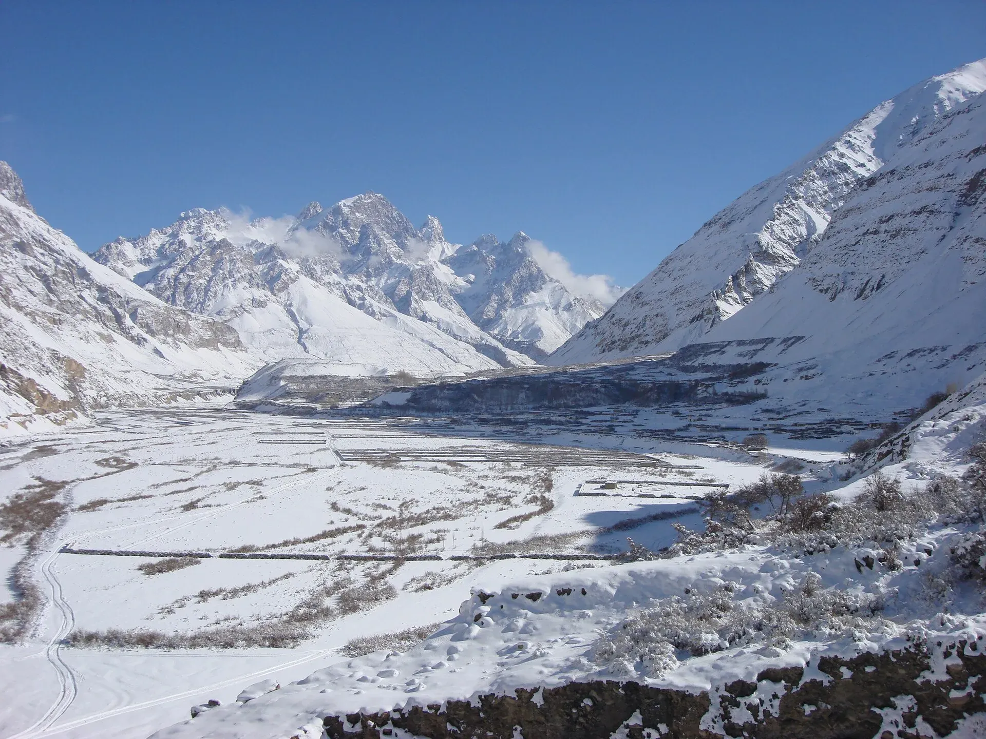
Shimshal is the most remote village in Gojal. It sits at about 3,000 m (Wikipedia gives 3,113 m in its text) on the Shimshal River, below Adver Sar and the huge Mulungutti Glacier flowing from Destaghil Sar. Until 2003 you could only reach it on foot. Wikipedia dates the first motor road to October 2003 and puts the village 56 km from Passu. Dawn's 2016 feature says people had walked for three days, crossing glacial streams and wading the icy Shimshal River, to reach the rest of Hunza. Since then a rough jeep road, built by the villagers over about two decades, links it to the Karakoram Highway at Passu. This page covers the village, the road and the old two-day walk from the roadhead that is now an optional route.
Shimshal has three settlements: Aminabad (once called Shulalaksh), Centre Shimshal and Khizarabad (once Chukurth Dasht). The Adver stream separates Aminabad from Centre Shimshal. Wikipedia gives about 2,000 to 3,000 people.
Who it suits
Anyone who wants to see a living Wakhi mountain village and is comfortable with a long, exposed jeep ride. The walk-in option is graded easy, but it crosses big scree slopes and rockfall zones. Shimshal is also the base for every harder trek beyond it, so many people spend a night or two here to acclimatise first.
When to go
April to October for walking. Snow and landslides can block the road in winter and spring, and floods or rockfall can close it in summer. Check with Passu or Gulmit before you set off.
The route
By jeep: the road leaves the Karakoram Highway just south of the bridge over the Batura Glacier stream. It crosses the Hunza River on a suspension bridge, then follows the Shimshal gorge for about 56 km (other sources say 53 km to 60 km) past Jurjur, Nagarmushk and Dut. It takes about three hours. The road is narrow, unsealed and high above the river, with long drops and rockfall. Drivers know it well. Do not travel in bad weather.
On foot (the old route): when the road ended at Boi, trekkers walked two days to the village. The trail climbs galleries on the cliff face, crosses big scree slopes, and passes the huts at Ziarat, where the shrine of Shams-e-Tabriz stands across the river. Kuk (2,840 m) is a green oasis with a warm spring and a view of the end of the Mulungutti Glacier. From Kuk it is a half-day walk through the fields at Rezgeen-e-Ben to Centre Shimshal. Ask locally whether this footpath is still maintained.
Culture and people
Shimshal is a Wakhi village. In 1985 villagers began building the road themselves, with government help later for bridges and blasting. The village has a Jamat Khana, an Aga Khan Diamond Jubilee school for girls, a government boys' school and a small cultural museum. Many Shimshalis are mountaineers and guides. Several families host visitors in spare rooms and cook Shimshal meals. Wild rue (spandr) grows here. Its seeds are burned as incense on ceremonial occasions.
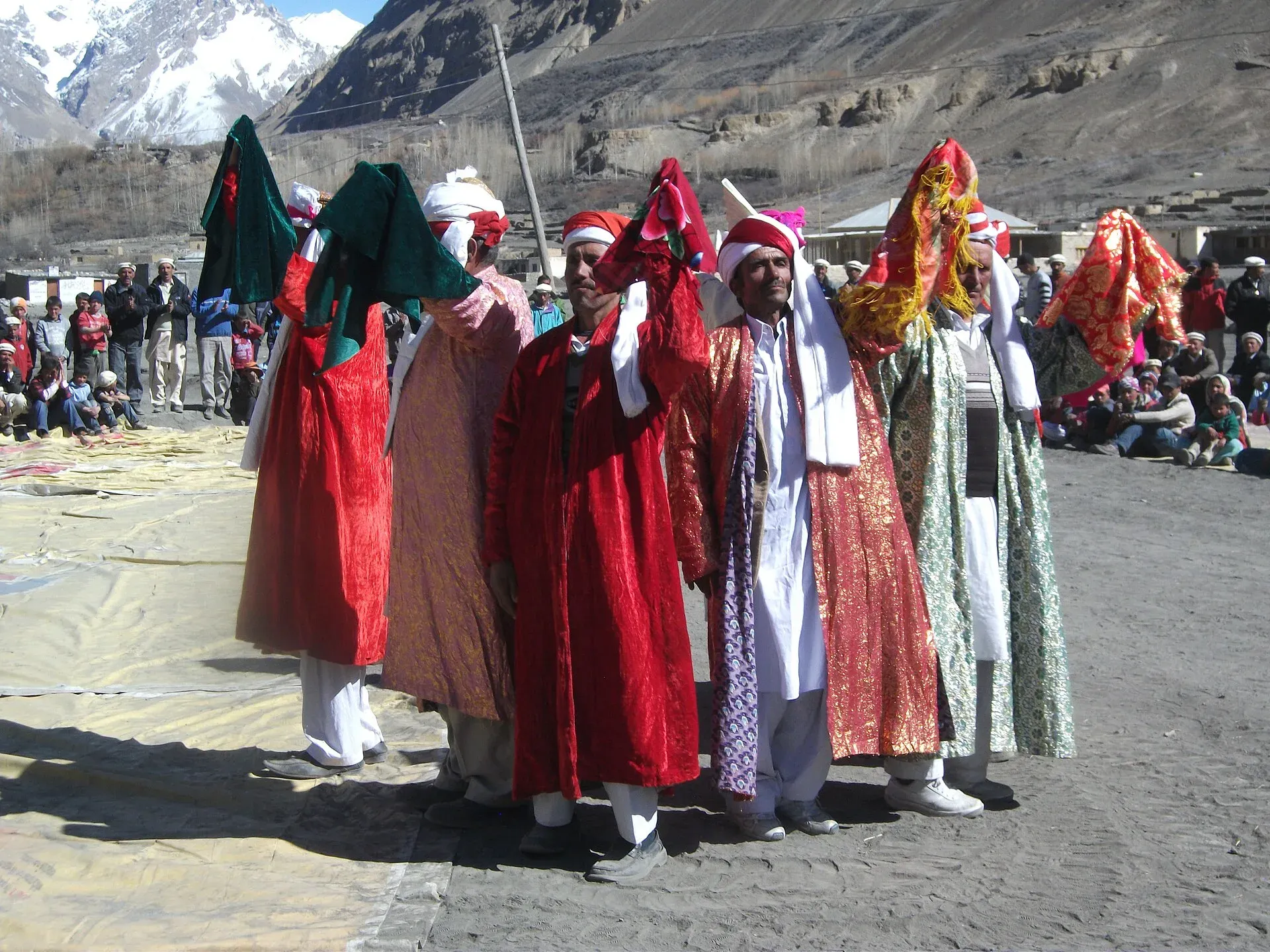
Photo: Spiture, with thanks · CC BY-SA 4.0 · via Wikimedia Commons · temporary stand-in photo

Farming, pastures and daily life
Dawn describes most residents as farmers who keep sheep, goats and yaks, with many also working in tourism and services. In summer herders take animals to high pastures. Wikipedia names Shimshal Pamir, Gujerav, Yazghail and Loopghar among the valley's extensive pasture lands. Blue sheep and Marco Polo sheep live in the valley (Dawn). Dawn counted about 200 houses in 2016, nearly all with rooftop solar panels, and says a small hydropower station built with the Aga Khan Rural Support Programme in 1997 cannot run for more than about three months at a stretch because water is not available all year. Wikipedia's estimate of about 3,000 people in 450 households is higher than the 2,000 in its summary box.
The village is Ismaili Muslim, and Wakhi is the first language. The Naubahar school runs on solar power, and the small Lok Versa Museum shows local objects.
Mountaineers and the Shimshal Pass
Shimshal is called the "Valley of Mountaineers" in Wikipedia and has produced climbers including Samina Baig, the first Pakistani woman to climb Everest, and Rajab Shah and Mirza Ali Baig. The Shimshal Pass, which rises to 4,735 m above the village and sits on the Indus-Tarim watershed, is a landmark above the village. Francis Younghusband is thought to have been the first Englishman to reach it, in 1889. A yak race, called Woolyo in Wakhi, is held on the pass in late July or early August, with singing and dancing afterwards.
Practical information
Take a 10 or 20 litre water container, because springs are scattered around the village. Michael Bridge, built in 1984, is a 15-minute walk east of the village, and the stream west of it is the usual place for washing. All treks beyond Shimshal gain height quickly, so spend at least one day here. A good day trip is Gar-e-Sar, a viewpoint with views of the Yazghil Glacier, Adver Sar and the Hispar Muztagh (a 6 to 8 hour round trip with about 500 m of climbing). Supplies are limited. At the time of the guidebook, the village dispenser was short of medicine, so bring your own first-aid kit and consider donating spare medical supplies.
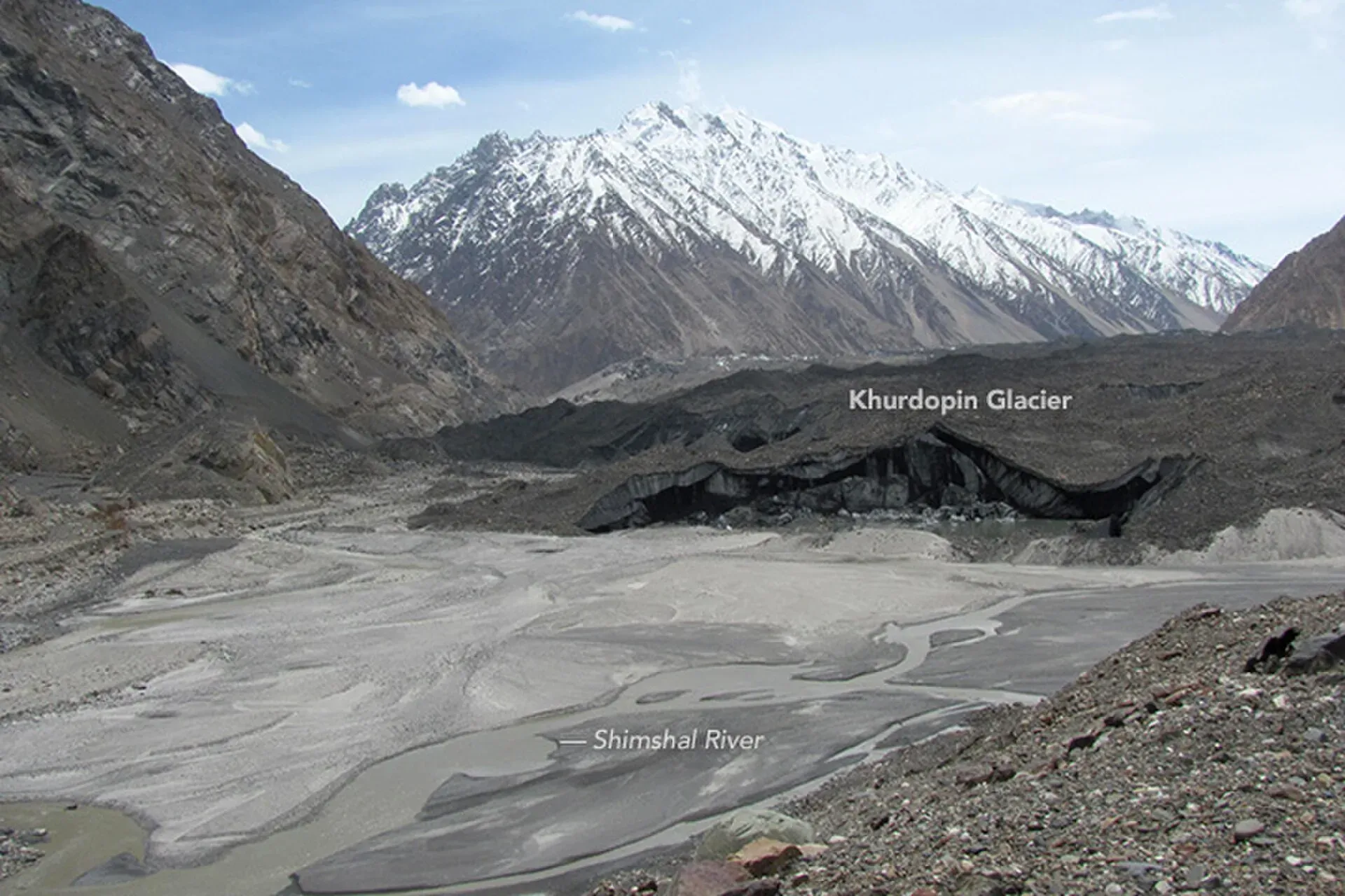
Photo: Waheed Anwar and NASA Earth Observatory, with thanks · Public domain (CC0) · via Wikimedia Commons · temporary stand-in photo

Highlights
- Remote Wakhi village with three settlements below Adver Sar
- The 2003 jeep road through the Shimshal gorge, built by the villagers
- The old walking route past Ziarat and the warm spring at Kuk
- Day trip to the Gar-e-Sar viewpoint over the Yazghil Glacier and Hispar Muztagh
Day by day
| Day | Camp | Altitude |
|---|---|---|
| 1 | Kuk | 2,840 m |
| 2 | Shimshal village | 3,000 m |
| 3 | Shimshal village | 3,000 m |
| Day | Route | Hours | Distance | Ascent / descent | Camp and altitude |
|---|---|---|---|---|---|
| Day 1 | Boi to Kuk (old footpath) | 5½–7 h | 18.6 km | +180 m / −190 m | Kuk, 2,840 m |
Day 1 notesFrom Boi (2,850 m) the trail climbs galleries cut into the cliff and crosses scree slopes, passing Uween-e-Sar and Uween-e-Ben. Two footbridges avoid the Shams rockfall slides. Ziarat (2,760 m) has two huts and the shrine of Shams-e-Tabriz. Many people stay there, but Kuk (2,840 m) has a warm spring and a better view of the Mulungutti Glacier and Destaghil Sar. Stop and look before you cross big scree slopes. | |||||
| Day 2 | Kuk to Shimshal village | 3½–4 h | 12.8 km | +160 m | Shimshal village, 3,000 m |
Day 2 notesFord a side stream and cross a footbridge to the left bank. Pass Buland Sum and the junction with the Mulungutti trail. Reach the first fields at Rezgeen-e-Ben (2,880 m), then a long easy trail to Centre Shimshal, passing Mazar Sheet (plain of tombs). Ford the Adver stream. If the water is too high, cross by the footbridge at Aminabad. | |||||
| Day 3 | Rest day in Shimshal (or Gar-e-Sar) | 6–8 h | 16.3 km | +500 m / −500 m | Shimshal village, 3,000 m |
Day 3 notesA few families offer rooms and home-cooked meals. A day here helps you acclimatise. If you have energy, hike to Gar-e-Sar, the best day walk from the village, with views over the Yazghil Glacier, Adver Sar and the Hispar Muztagh. This is the first day of the Shimshal Pamir trek. | |||||
Getting there
From the Karakoram Highway near Passu, a rough jeep road runs about 56 km up the Shimshal River gorge to Shimshal village. It opened in 2003 and takes about three hours by jeep. It is unsealed, narrow and exposed, with rockfall and washouts, so allow for delays. Arrange the jeep in Passu or Gulmit, or through your operator. One travel guide (updated January 2023) mentions a public van from Aliabad leaving around noon and taking about five hours; check locally, as there is no known official timetable or fare.
The trek starts and finishes at the village. When you leave, send word ahead to have a jeep meet you.
On foot, the old way is to drive to the old roadhead at Boi (2,850 m), 1½ hours from Passu in the guidebook's day, and walk. Walking the old road from Passu takes 2½ to 3 hours to Jurjur, two hours more to Dut and one to 1½ hours more to Boi.
Permits and rules
- Permit needed
- Usually not, Open zone
- Fee
- Current fees will be added soon
- Last checked
- 16 November 2026
The old guidebook says Shimshal village needs no permit. Treks beyond the village are treated differently (see the Shimshal Pamir, Qachqar-e-Dur and Boisum pages). Dawn reported in March 2026 that foreign visitors need permits for restricted zones (open zones need none), and in February 2026 that permit fees had risen sharply. A travel guide (published 2021, updated January 2023) says no special permit is needed to visit the village if you stay there, but you show your passport or ID at the checkpoint, and multi-day treks need permits through an agency. There is no known official notice, so check with your operator or the GB tourism department.
How trekking permits, NOCs and registration work: Visa and permits.
Season
Best: Apr – Oct
Water and camps
At Ziarat there are huts, a small spring and a more reliable clear stream a few minutes east. Kuk has a warm spring. In Shimshal, clear water comes from springs below the old houses in Centre Shimshal, along the river at the east end, and west of Michael Bridge. Camp at Kuk or Ziarat, and use village homes if invited.
Gear and safety
The road and trail are both prone to rockfall. Rain and strong afternoon winds set off slides, so wait until the slope is quiet before you cross. The Shimshal road is narrow with steep drops. Choose an experienced driver, avoid night driving, and do not travel after heavy rain. The old trail has long scree slopes, glacier streams that are knee-deep in the afternoon, and no phone signal. The Khurdopin Glacier above the village is known to surge, and surges have blocked the river and caused floods, so ask locals about current river conditions. A satellite messenger is advisable.
Variations
Gar-e-Sar is the standard day walk. From the village you can start the Shimshal Pamir, Qachqar-e-Dur and Shpodeen Pass, or Boisum and Chafchingol Passes treks. Yazghil Sar Base Camp and Kanjut Sar Base Camp are described in the roundup of other treks in Gojal.
Tips
- Do not drive the road in rain or after landslides, and expect delays.
- Bring a 10 or 20 litre water container, as springs are scattered.
- Spend at least a day here before any trek beyond the village.
- Ask locally whether the old Boi to Shimshal footpath is passable before walking it.
- Bring medicines or supplies to donate, as they are scarce.
Health and emergency
Mobile signal is patchy on most treks, so tell someone your plan before you go. Emergency numbers
Sources and last checked
Last checked Confidence medium7 sources10 still to check
- Last checked
- Method
- Desk research from published sources
- Confidence
- medium
- Checked by
- trek.pk research team
Researched from published sources; not yet checked on the ground by our team. Spot something out of date? Report a mistake.
Sources
- Trekking in the Karakoram and Hindukush (Lonely Planet, ~2002), Gojal chapters; old trek.pk text · Lonely Planet / trek.pk archive · checked
- Shimshal · Wikipedia · checked
- Hunza Shimshal Pass trek (road details) · Lokalee · checked
- GB winter adventure tourism hit by soaring permit fee, visa delays · Dawn (1 Feb 2026) · checked
- Shimshal Travel Guide: The Lost Valley of Hunza (published 2021, updated January 2023) · Off the Atlas · checked
- Gilgit-Baltistan tourism bounces back despite Middle East war · Dawn · checked
- How the residents of Shimshal are setting a shining example for Pakistan (28 January 2016) · Dawn · checked
Still to be checked on the ground (10)
- Current length of the road: Wikipedia says 56 km; an Off the Atlas guide says about 53 km; other sources 53 to 60 km. No official figure
- Jeep fares and where to arrange vehicles in Passu or Gulmit (no published fare found; one guide says a private hire is costly)
- Whether the old foot trail from Boi to Shimshal is still maintained, or is replaced by the road in sections
- Road winter closure and current condition
- Whether foreigners need a permit to visit Shimshal village itself: the guidebook and a 2023 travel guide say none, with an ID check at the checkpoint; no official notice found
- Distances and times on the old trail are from the ~2002 guidebook
- Village altitude: 3,000 m (old guide, Dawn) vs 3,113 m (Wikipedia text) vs 3,100 m (Wikipedia summary box)
- Population: Wikipedia gives more than 2,000 in its summary box and about 3,000 in its text; Dawn counted about 200 houses in 2016 while Wikipedia says 450 households
- Dates of the Woolyo yak race (reported as late July or early August) and whether visitors can attend
- Whether visitors can reach the Shimshal Pass or the pastures without a guide
Nearby and related

Shimshal Pamir

Qachqar-e-Dur and Shpodeen Pass

Boisum and Chafchingol Passes
Kanjut Sar
Kanjut Sar (7,760 m) is the highest peak of the Hispar Muztagh between the Shimshal and Hispar valleys. It was first climbed in 1959 by an Italian expedition.
Shimshal Pamir
The high summer pastures above Shimshal village at about 4,350 to 4,700 m, grazed by yaks, sheep and goats, with two lakes and Shimshal Pass (4,735 m) at the upper edge. Reached on foot only.
Jurjur Khona Sar
Jurjur Khona Sar (6,029 m) is an unclimbed peak of the South Ghujerab Mountains near Passu and Sust. Our Boibar trek page gives 6,055 m and places it south of the Boibar terrace.