

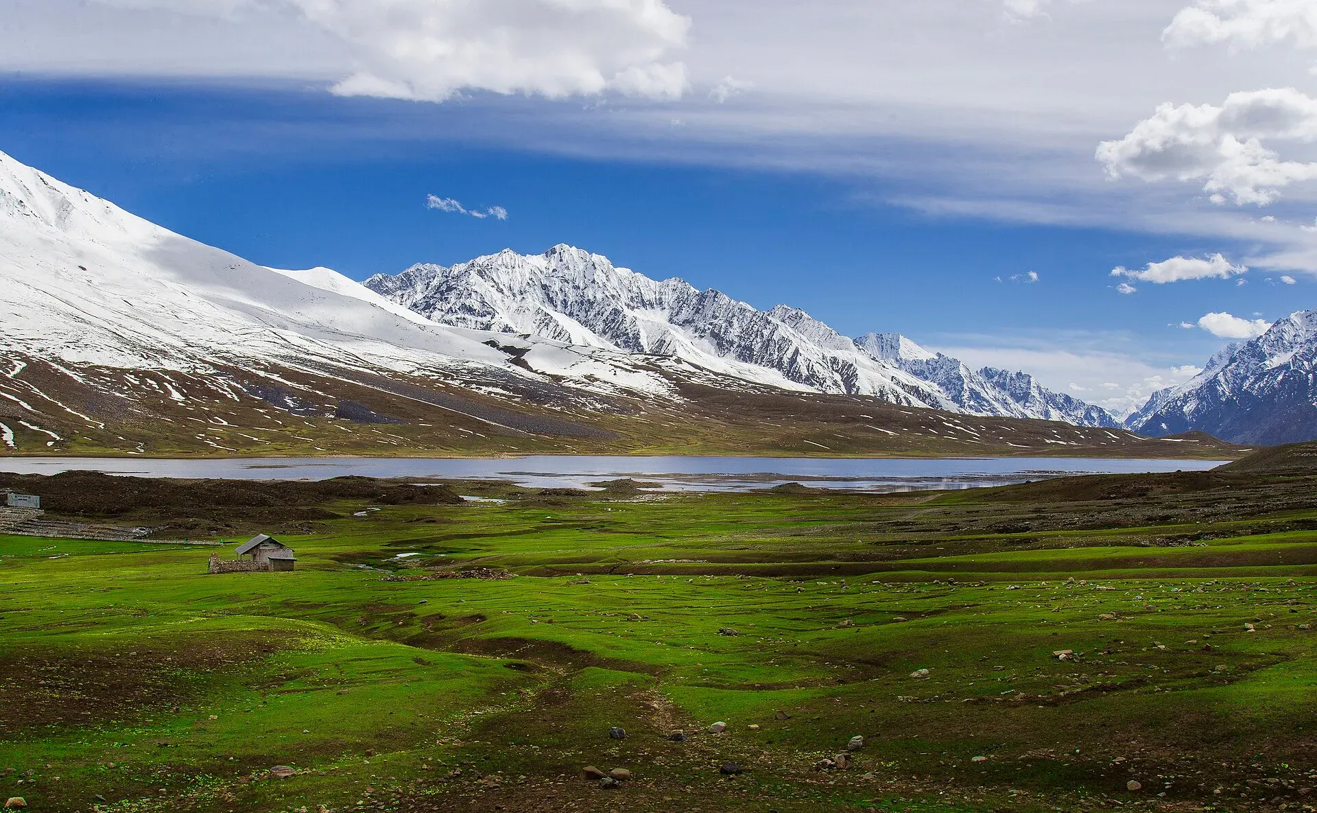
What the festival is
Every summer, polo teams from Chitral and from Gilgit-Baltistan meet on the Shandur plateau for a three-day tournament. It is played in the freestyle style, on a rough pitch of about 200 m by 56 m, with low stone walls instead of boards. Wikipedia describes six players a side, and few rules beyond the basics. The ground sits at about 3,700 m, and the tourism departments describe it as the highest polo ground in the world. Around the matches there is a tent village, folk music, dancing and a good deal of picnicking, so it works as a mountain fair as much as a sporting event.
The 2026 festival ran from 11 to 13 June. It was organised jointly by the Khyber Pakhtunkhwa and Gilgit-Baltistan governments with army support, and Dawn reported that Gilgit-Baltistan beat Chitral 6-5 in the final, in front of about 30,000 fans. The 2026 programme also added a paragliding display and cultural nights.
Dates: expect them to move
Older listings, including the 2021 TDAP guide, give 7 to 9 July. In 2026 the festival was held a month earlier. So the timing has shifted between June and July over the years, and each year's dates are set by the provincial governments. Dawn carried the 2026 dates on 24 April 2026. There is no known published date for 2027, so treat any date as provisional until the tourism departments announce it, and book rooms and transport only after that.
Where it is
Shandur Top lies on the boundary between Upper Chitral district (Khyber Pakhtunkhwa) and Ghizer district (Gilgit-Baltistan). Dawn notes that the area is claimed by both sides and is being considered by a boundary commission, so this guide describes it simply as the pass between the two. The pass is a wide, flat plateau rather than a narrow saddle, about 3,720 m by Wikipedia's figure (3,734 m in the TDAP guide). A small lake sits beside the polo ground.
Getting there
There are two approaches, and both are long days.
- From Gilgit. The Ghizer valley road runs through Gupis and Phander to the pass. Wikipedia puts the pass about 212 km from Gilgit. The road is mostly paved as far as Phander, then narrower. Phander has a trout lake and guesthouses and is a sensible overnight stop.
- From Chitral. The road goes through Mastuj and Laspur. The stretch from the pass down to Mastuj is rough dirt and rock, best done with a 4x4 or an experienced motorbike rider. Road distances measured on 16 November 2026 are about 105 km from Mastuj and about 159 km from Chitral.
Both roads are summer roads, usually workable from about June to September, and a road upgrade has been planned but its status is unconfirmed. The Gilgit, Shandur and Chitral crossing is also described on the route page for bikers.
Where to stay
Near the pass, accommodation means tents at festival time and a few simple guesthouses in the villages on either side: Phander and Gupis on the Ghizer side, Mastuj and Laspur on the Chitral side. Rooms and tent spaces fill up, and prices rise during the festival. Ask the tourism departments or a registered operator for the current camp arrangements and any entry or camping charges. Current fees will be added soon.
Altitude and weather
At around 3,700 m, headaches and tiredness are common if you drive up quickly. Plan a night or two at lower altitude first, drink water and go slowly. Our article on altitude sickness covers the warning signs and why the height where you sleep matters. Nights are cold even in June, and rain, mud and snow can appear at either end of the season. Landslides can block the roads, so leave spare days either side of the festival.
Etiquette at the ground
- Keep clear of the field and the horses, and stand behind the walls where marshals direct you.
- Follow police and volunteer instructions, and do not throw anything onto the pitch.
- Dress modestly. Ask before photographing local women, and ask before photographing anyone up close.
- Take your rubbish away with you. The plateau is fragile, and Leave No Trace habits apply as much here as on a trek.
- Be generous with space and patience. It is a crowded day for a small valley.
Packing checklist
- Warm layers, a windproof jacket and a rain shell
- Warm hat, gloves and a sleeping bag if you plan to camp
- Sun hat, sunglasses and high-factor sun cream; the sun is strong at height
- Water bottle and a way to treat water
- Head torch, snacks and any medicines you take
- Cash for the whole trip, since there are few cash machines along the road
- Printed or offline copies of your bookings and insurance details
Before you go: travel advice
Ask the district administration or local police about current conditions before you go. For foreign visitors: the UK FCDO page for Pakistan (updated 27 October 2026, checked 17 November 2026) advises against all travel on the N-45 up to the edge of Chitral city, including the Kalash valleys. It advises against all travel to Swat, Upper and Lower Dir and other listed Khyber Pakhtunkhwa districts, and on the Karakoram Highway between Mansehra and Chilas. It does not advise against Gilgit-Baltistan generally. The Ghizer route from Gilgit does not use those roads, but the usual road routes to the Chitral side do, so work out how you will reach the start of your journey. It also notes emergency measures and Governor's Rule in Khyber Pakhtunkhwa since 11 October 2026. Read the live page, check road reports locally and make sure your insurance covers your route.
A sensible plan
Treat the festival as one part of a longer northern trip. Fly or drive to Gilgit, spend time at lower altitude, travel up the Ghizer valley over two days with a night at Phander, then enjoy the pass for a night or two. If you want to walk, treks such as Thui An and Chumarkhan An start from this road. Keep a flexible mindset: the dates, the road and the weather can all change.


