

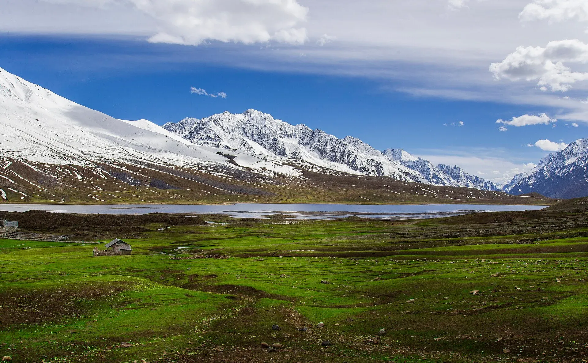
Photo: Mudassir Ahmed, with thanks · CC BY-SA 4.0 · via Wikimedia Commons · temporary stand-in photo

Gilgit-Shandur-Chitral Summer Biker Route
A 3-4 day summer ride from Gilgit over Shandur Pass (about 3,720 m) to Chitral through the Ghizer and Yarkhun valleys. Rough track on the Chitral side; summer only.
Customise this route Change the dates, stops and how you travel in the Road Trip Planner.
Overview
This route links Gilgit-Baltistan and Chitral over Shandur Pass, the high saddle between the Karakoram, Hindu Kush and Hindu Raj. You ride up the Ghizer valley beside a clear river, cross the plateau with its lake and polo ground, and descend the Yarkhun side to Mastuj and Chitral. It is a ride for experienced riders in summer.
Who it suits
Motorbike riders with off-road experience and a support plan, small 4x4s, and strong cyclists. The Gilgit side is mainly paved; the Shandur to Mastuj section can be rough dirt. It is not a trip for low cars or beginners.
When to go
Summer, between about June and September. The pass is under snow for much of the year and is usually closed in winter; a Chitral Today report says it normally reopens by the end of April, though it may stay closed to traffic longer in some years (it was kept closed in June 2020). Road-side damage matters too: Radio Pakistan reported on 24 July 2026 that the NHA had restored the Gilgit-Shandur road for all traffic after rain and landslides washed away a bridge at Yangal in Ghizer. The Shandur Polo Festival, between Chitral and Gilgit teams, was held on 11 to 13 June in 2026 (Dawn, 24 April 2026) and in early July in older years (the 2021 TDAP guide gives 7 to 9 July), so the dates move. The plateau fills with tents and traffic; book well ahead or avoid those days. No 2027 dates are announced yet, so ask GB Tourism or Chitral district administration.
The route in short
From Gilgit take the Ghizer road through Gakuch, Gupis and Phander (a lake and trout stream stop), climb to Shandur, then descend to Laspur, Mastuj and Chitral. Wikipedia lists the Gilgit end to Shandur at 212-216 km, and OSRM measures 214 km, which agrees. For the Chitral side Wikipedia gives 172 km while OSRM measures 158 km, so the whole Gilgit to Chitral run is about 372 km by OSRM (up to roughly 385 km by the Wikipedia figures). Sources differ; the OSRM route may cut corners on the track.
Along the way
Ghizer is Khowar and Shina speaking, with Ismaili and Sunni communities. Phander Lake is a calm trout lake with a village on its shore. Shandur Top has a lake and a polo ground that is among the highest in the world. Mastuj has an old fort, and the Chitral valley has Kalash villages a day away, as covered in the Chitral and Kalash trip.
Stages and stops
Distances are from the stop table above (OSRM, measured from Gilgit); real times are longer, particularly beyond Phander.
Gilgit to Gupis. The first stretch follows the Ghizer valley beside the river. Gakuch, about 70 km out, is the food stop on the table above. Gupis is the headquarters area of the Gupis-Yasin district and the last town with real supplies before the pass. The stop table marks it for fuel and supplies.
Phander. Phander Valley is known for trout, and Wikipedia's Gupis page describes the lake as abounding in them. The Gupis page puts the lake about 170 km from Gilgit, roughly five hours, which fits the 163 km on our table. The stop table lists it as the usual overnight stop.
Shandur Top. The pass is about 3,720 m and lies on the boundary between Upper Chitral District and Gilgit-Baltistan. The Gupis page reports about 250 km and 15 hours from Gilgit by jeep on the older road, which shows how slowly this stretch has traditionally been driven. Plan the crossing for daylight and check that the pass is open before leaving Phander.
Laspur and Mastuj. Descending the Chitral side you pass the Laspur valley and reach Mastuj, a valley town at about 2,359 m. Mastuj Fort is now a ruin, first built in the eighteenth century and rebuilt several times. Wikivoyage notes that shared jeeps run from Chitral to Mastuj, and that people travelling by public transport between Gilgit and Chitral have usually needed a night in Mastuj.
Chitral. Chitral Fort, on the bank of the Chitral river, is believed to date from 1774 and was restored in 1911. A small British force held it under siege in 1895. Wikivoyage gives Islamabad to Chitral as about 8 to 10 hours by car, and Gilgit to Chitral by jeep as about 14 hours when connections are arranged.
Distances
Distances and times in this plan are from OSRM / OpenStreetMap, measured on 16 November 2026. They are driving time only, without stops, and OSRM is optimistic on mountain roads, unpaved tracks and in traffic, so real journeys are usually clearly longer; treat the times as a minimum.
Treks and side trips
Nearby treks that start from this road include Chumarkhan An, Thui An and Karambar An and Darkot An. In Chitral see Tirich Mir Base Camp.
Highlights
- Shandur Pass and the polo ground
- Phander Lake and the Ghizer river
- Mastuj fort and the Yarkhun valley
- Descent to Chitral beneath Tirich Mir
Stops
- GakuchGhizer valley, food stop
- GupisFuel and supplies; last real town
- PhanderOvernight; lake and trout
- Shandur TopAbout 3,720 m; polo ground and lake
- MastujFort and overnight; about 45 km from the pass
- ChitralAbout 120 km from Mastuj
km: distance from the start along the route.
Numbers follow the stops in order. The map shows the 5 stops that have a trek.pk page, not the road itself.
Day by day
Day 1 · Gilgit to Phander
Follow the Ghizer river through Gakuch and Gupis. The road is mostly paved with patches of damage. Stay at Phander and rest at the lake.
Day 2 · Phander over Shandur to Mastuj
Climb to the plateau (about 51 km from Phander to Shandur Top), cross Shandur Top and descend towards Laspur and Mastuj. This is the roughest day and wet or snow can slow it.
Day 3 · Mastuj to Chitral
A dusty, rocky road beside the river; a 4x4 jeep takes about four hours by one report. Pass Booni and Buni on the way.
Day 4 · Spare day or Kalash
Use as a buffer, or visit the Kalash valleys from Chitral (see the Chitral and Kalash trip; Bumburet is about 29 km each way).
Road conditions
- Gilgit to Gupis and Phander: mostly paved; older reports mention damaged patches.
- Phander to Shandur: narrower, part paved, part track.
- Shandur to Mastuj: rough dirt and rock; one 2010s report calls it very rough. A large upgrade, the 153 km Chitral-Booni-Mastuj-Shandur road, is under construction: APP (30 July 2026) gave package progress of 47.5 per cent (Chitral-Pret), 34.8 per cent (Pret-Booni), 38.2 per cent (Booni-Shaidas) and 29.8 per cent (Shaidas-Shandur), with a December 2026 target that needs more funding, and ARY (30 October 2026) put overall progress at 40 per cent. Expect works and diversions, and a rough surface until it is finished.
- Mastuj to Chitral: not in good condition, but a regular jeep route.
- Season: the pass is usually snow-bound outside summer. Treat June to September as the working window and check locally. Radio Pakistan reported on 24 July 2026 that the NHA had restored the Gilgit-Shandur road for all traffic after a landslide and flood blockade, with an alternative route built at Yangal. There is no known source for the pass's opening state in November 2026; assume snow-bound until spring.
Distances and times in this plan are from OSRM / OpenStreetMap, measured on 16 November 2026. They are driving time only, without stops, and OSRM is optimistic on mountain roads, unpaved tracks and in traffic, so real journeys are usually clearly longer; treat the times as a minimum.
Fuel and services
Fuel at Gilgit, Gupis and some stations in Chitral; do not rely on fuel at Phander or Mastuj. Carry spare fuel for the rough sections. Basic guesthouses at Gupis, Phander, Teru, Mastuj and Chitral; the plateau has only tents during the festival. Phone coverage is patchy.
Safety
- Altitude and weather: the pass is about 3,720 m. Cold, hail and sudden snow can happen even in July.
- Remote road: long stretches without help; ride in a group and tell someone your plan.
- Landslides and washouts: common in the Yarkhun gorge after rain.
- Advisories: no route-specific advisory found as of 16 November 2026. NDMA issued landslide alerts for GB and KP in 2026; check with local police and district administrations before crossing.
For foreign visitors: the UK FCDO advises against all travel on the N-45 from north of the Mardan ring road to the edge of Chitral city, including the Kalash valleys (advice updated 27 October 2026, checked 16 November 2026). It does not advise against Gilgit-Baltistan generally. Read the live advice before you plan.
Tips
- Tell your hotel in Phander and Mastuj when you plan to cross; conditions change.
- Carry a puncture kit, spare cable and fuel; there is none on the plateau.
- Start the pass crossing early; afternoon wind and rain are common.
- Stay clear of the festival dates unless you have booked.
- Ride with at least one other vehicle.
Photos we still need: the Ghizer valley road and the Mastuj to Chitral descent. Send us yours
Sources and last checked
Last checked Confidence low15 sources5 still to check
- Last checked
- Method
- Desk research from published sources
- Confidence
- low
- Checked by
- trek.pk research team
Researched from published sources; not yet checked on the ground by our team. Spot something out of date? Report a mistake.
Sources
- Pakistan Tourism Guide 2021 · Trade Development Authority of Pakistan (TDAP) · checked
- Shandur Pass · Wikipedia · checked
- Chitral-Shandur Road · Wikipedia · checked
- Gilgit-Shandur Road · Wikipedia · checked
- NDMA issues landslide alerts for KP, Balochistan, GB, AJK (January 2026) · Radio Pakistan · checked
- OSRM driving route service: distances and times measured 16 November 2026 (drive times are without stops) · OSRM / OpenStreetMap contributors · checked
- Gilgit-Shandur road completely restored for all types of traffic (24 July 2026, NHA) · Radio Pakistan · checked
- Shandur road opens after winter closure · Chitral Today · checked
- Chitral-Shandur highway set to complete by December (30 July 2026) · APP · checked
- NHA directed to accelerate progress on M-6, M-25 and Quetta-Zhob Road (30 October 2026) · ARY News · checked
- Shandur polo festival to begin on June 11 (24 April 2026) · Dawn · checked
- Mastuj · Wikipedia · checked
- Gupis Tehsil · Wikipedia · checked
- Chitral Fort · Wikipedia · checked
- Chitral · Wikivoyage · checked
Still to be checked on the ground (5)
- Road quality from Mastuj to Shandur today: the upgrade is about 40 per cent complete (October 2026), so expect works and rough sections; no dated surface report found
- Whether the pass is open when you plan to ride; no official opening notice found for 2027, and the 2027 polo festival dates are not announced
- Fuel availability at Phander, Gupis and Mastuj (no source found)
- OSRM times for the unpaved Shandur section are very optimistic; Gilgit to Chitral is about 372 km by OSRM but 385 km by older figures
- Whether a night in Mastuj is still needed for public transport (Wikivoyage statement, undated)
Nearby and related

Chumarkhan An

Thui An

Karambar An and Darkot An

Tirich Mir Base Camp

Gilgit
Gateway to Gilgit-Baltistan on the Karakoram Highway: a busy mountain town with the Kargah Buddha and the base for Hunza, Naltar and Skardu.

Shandur Pass
A high grassy pass of about 3,720 m between Ghizer in Gilgit-Baltistan and Upper Chitral. Home to the Shandur polo ground and a summer festival, reached by a rough road.
Shandur Plateau
The high grassland plateau of Shandur at about 3,700 m on the Ghizer-Chitral boundary: part of Handrap-Shandur National Park (declared 1993), with a lake, a polo ground and a summer festival.
Shandur Polo Ground
The high-altitude polo field on Shandur Pass, at about 3,700 m, home of the annual Shandur Polo Festival between Chitral and Gilgit-Baltistan teams. In 2026 it ran 11 to 13 June.

Phander Lake
A small, deep lake in Phander village, Gupis-Yasin district, in the far west of Gilgit-Baltistan. It is fed by the Ghizer River and sits on the road between Gilgit and Shandur.

Ghizer Valley
The long upper Gilgit River valley running west from Gilgit to Shandur, with Punial orchards, Gahkuch, Gupis, Khalti and Phander lakes, trout fishing and side valleys to Yasin and Ishkoman.
Yasin Valley
A high Hindu Kush valley in northern Ghizer, reached by road from Gupis, with Burusho villages, the Thui and Darkot routes and Darkot village at its head.

Chitral
The main town of Lower Chitral District, at about 1,500 m on the Chitral River, with a historic fort, a royal mosque and views of Tirich Mir. The base for the Kalash valleys.

Chitral Fort (Shahi Qila)
The fort and royal residence on the Chitral river, with a history reaching back to the 18th century and the 1895 siege. It is still the home of the ceremonial Mehtar, so access is limited.

Kalash Valleys (Bumburet, Rumbur, Birir)
Three side valleys of the Chitral River, home to the Kalasha people, who keep their own religion, language and festivals. Visit with respect and check security advice first.

Chitral and Kalash
A 6-7 day road trip from Islamabad to Chitral through Dir and the Lowari Tunnel, with the Kalash valleys of Bumburet, Rumbur and Birir, Chitral Fort and Tirich Mir views.

Grand Northern Loop
A 12-14 day circuit of the north from Islamabad: Naran and Babusar, Hunza and Khunjerab, Skardu and Deosai, Gilgit, then Swat or the KKH back. Distances, passes and seasons.