

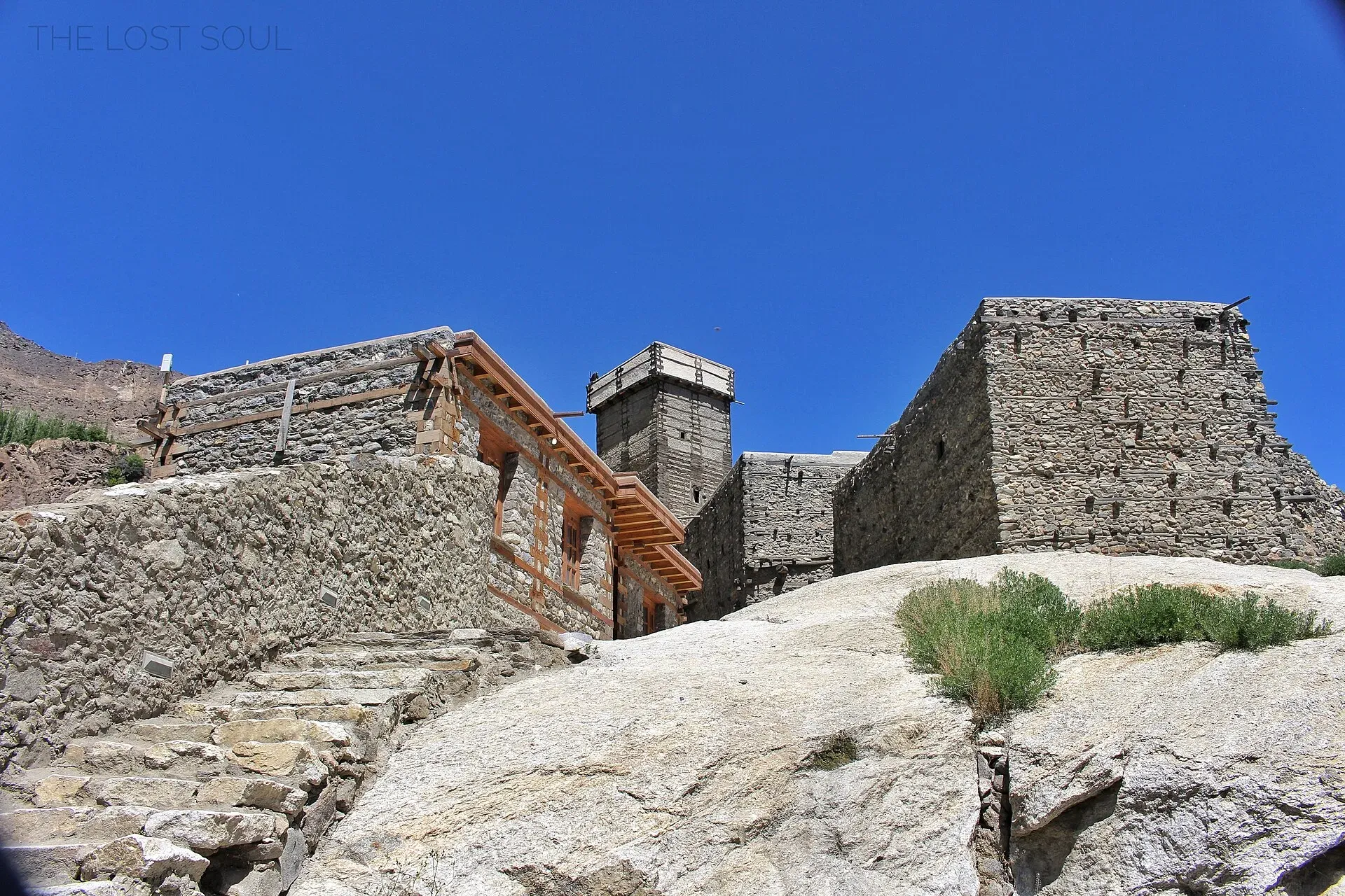
Photo: Fassifarooq, with thanks · CC BY-SA 4.0 · via Wikimedia Commons · temporary stand-in photo

Altit Cliff Viewpoint
The cliff-edge terraces at Altit Fort in Hunza look straight down to the Hunza River more than 1,000 feet below, with Hunza Peak and the valley beyond.
Overview
Altit Fort stands on a high cliff above the Hunza River at Altit, about 4 km from Karimabad by road (OSRM). A Dawn report describes the fort as over 1,000 feet (about 300 m) above the river; other reports give 300 to 400 m. This page covers the viewing edge at and around the fort.
Plan your visit
- Nearest town
- Karimabad
- Getting there
From Karimabad about 4.3 km by road (OSRM 7 minutes, optimistic). The Hunza tourist sheet gives 9 km from Aliabad, about 28 minutes by jeep. Local taxis run from Karimabad; you can also walk down through the fields. More
Best months
Apr – Jun, Sep – Oct
- Altit Cliff Viewpoint
- Related places nearby: Altit Fort, Karimabad (Hunza), Baltit Fort, Hunza Valley, Ultar Sar
The fort
The Shikari Tower is about 1,100 years old, which makes it the oldest monument in Gilgit-Baltistan, and the fort was first home to the hereditary Mirs of Hunza. In the 16th century a local prince married a Baltistan princess who brought Balti craftsmen to help build Altit and Baltit forts. Later, a dispute between two royal brothers led to Baltit Fort becoming the capital. Hunza remained a princely state until 1972.
The fort was handed to the Aga Khan Foundation in 1990 and restored by the Aga Khan Trust for Culture, with funding from the Government of Norway. It has been open to visitors since 2007 and won a UNESCO Asia-Pacific Award of Distinction in 2011.
What to see and do
From the terraces and the watchtower you look down the gorge to the river and across the valley's terraced fields and orchards, with apricots drying on rooftops in season. Inside, visitors see low doorways, restored wooden doors, windows and stairs, and vessels and utensils used by the royal family. A local legend tells of Prince Ali being buried alive against a pillar in the watchtower. Photographs of the fort show Hunza Peak (6,270 m) rising behind the fort. Tourism sites also name Rakaposhi (7,788 m) and Ultar Sar (7,388 m) among the mountains seen from the fort, but the angle depends on where you stand, so this is unconfirmed. The Kha Basi cafe garden is part of the restored site. For the fort itself see the Altit Fort page, and for the second royal fort the Baltit Fort page.
When to visit
Early morning and late afternoon give softer light and cooler terraces (general advice). Spring blossom and autumn colour are usual in Hunza (general advice). Check opening hours locally; they are not confirmed here.
Where to stay and eat
Altit and Karimabad have guesthouses and small restaurants. The fort has its own cafe garden.
Good to know
- Getting there: From Karimabad about 4.3 km by road (OSRM, 7 minutes, optimistic). The Hunza tourist sheet gives 9 km from Aliabad, about 28 minutes by jeep. Taxis run from Karimabad, and you can walk down through the fields.
- Altitude: Not confirmed for the viewing edge.
- Entry: A fort entry fee applies. Current fees will be added soon; ask on site.
- Safety: The edges are steep, and the stairs and narrow doors of the old fort are uneven. Keep children close and stay behind low walls.
- For foreign visitors: the UK FCDO does not advise against Gilgit-Baltistan generally (updated 27 October 2026). Check the live page.
Highlights
- A drop of over 1,000 feet to the Hunza River
- Views down the gorge and over the valley
- Hunza Peak behind the fort
- Restored fort with a cafe garden
Getting there
From Karimabad about 4.3 km by road (OSRM 7 minutes, optimistic). The Hunza tourist sheet gives 9 km from Aliabad, about 28 minutes by jeep. Local taxis run from Karimabad; you can also walk down through the fields.
Tips
- Visit in the early morning or late afternoon.
- Keep well back from unfenced edges.
- Combine with Baltit Fort and Duikar sunset in one day.
- Wear shoes with grip for the stone stairs.
Facilities
- Fort and museum
- Cafe garden
- Guesthouses nearby
Photos we still need: the view down to the Hunza River from the fort terrace; the Shikari Tower. Send us yours
Sources and last checked
Last checked Confidence medium6 sources3 still to check
- Last checked
- Method
- Desk research from published sources
- Confidence
- medium
- Checked by
- trek.pk research team
Researched from published sources; not yet checked on the ground by our team. Spot something out of date? Report a mistake.
Sources
- Altit Fort (Dawn, 2016) · Dawn · checked
- Altit Fort (Wikipedia) · Wikipedia · checked
- Hunza Valley (Wikipedia) · Wikipedia · checked
- District Hunza tourist guide and map · Government of Pakistan tourism portal · checked
- OSRM driving route service: distances and times measured 16 November 2026 (times are optimistic, without stops) · OpenStreetMap / OSRM · checked
- Pakistan travel advice: warnings and insurance (updated 27 October 2026) · UK Foreign, Commonwealth & Development Office · checked
Still to be checked on the ground (3)
- Cliff height: Dawn says over 1,000 feet; other reports 300 to 400 m
- Which peaks are visible from the edge (Wikipedia confirms only Hunza Peak, in a photo taken from the Karakoram Highway)
- Opening hours and current fort fee (no official page found; ask on site)
Nearby and related

Altit Fort
An old fort above the Hunza River at Altit, restored by the Aga Khan Trust for Culture and open to visitors since 2007. Often described as the oldest monument in Gilgit-Baltistan.

Karimabad (Hunza)
The main town of Hunza, set on a terrace below Baltit Fort with Rakaposhi, Ultar and Diran in view. A good base for forts, viewpoints, Attabad Lake and the road to Gojal.

Baltit Fort
A restored fort and museum above Karimabad in Hunza, once the home of the Mirs of Hunza. Its core is centuries old and it has been on UNESCO's tentative list since 2004.

Hunza Valley
A long Karakoram valley on the Karakoram Highway, with Karimabad, Baltit and Altit forts, Ganish village and Attabad Lake, below Rakaposhi and Ultar Sar. About 100 km from Gilgit.

Hunza River
The river that runs beside the Karakoram Highway through Gojal, Hunza and Nagar before joining the Gilgit River. It formed Attabad Lake in 2010, when a landslide blocked it.

Ultar Sar
Ultar Sar (7,388 m) towers about 10 km north-east of Karimabad in Hunza. Its south flank rises over 5,300 m above the river. The Ultar Meadow trek is the standard way to get close.
Hunza and Khunjerab (KKH)
A 7-8 day road trip from Islamabad up the Karakoram Highway to Hunza and on to Khunjerab Pass (4,693 m), with overnight stops at Besham, Chilas and Gilgit.