

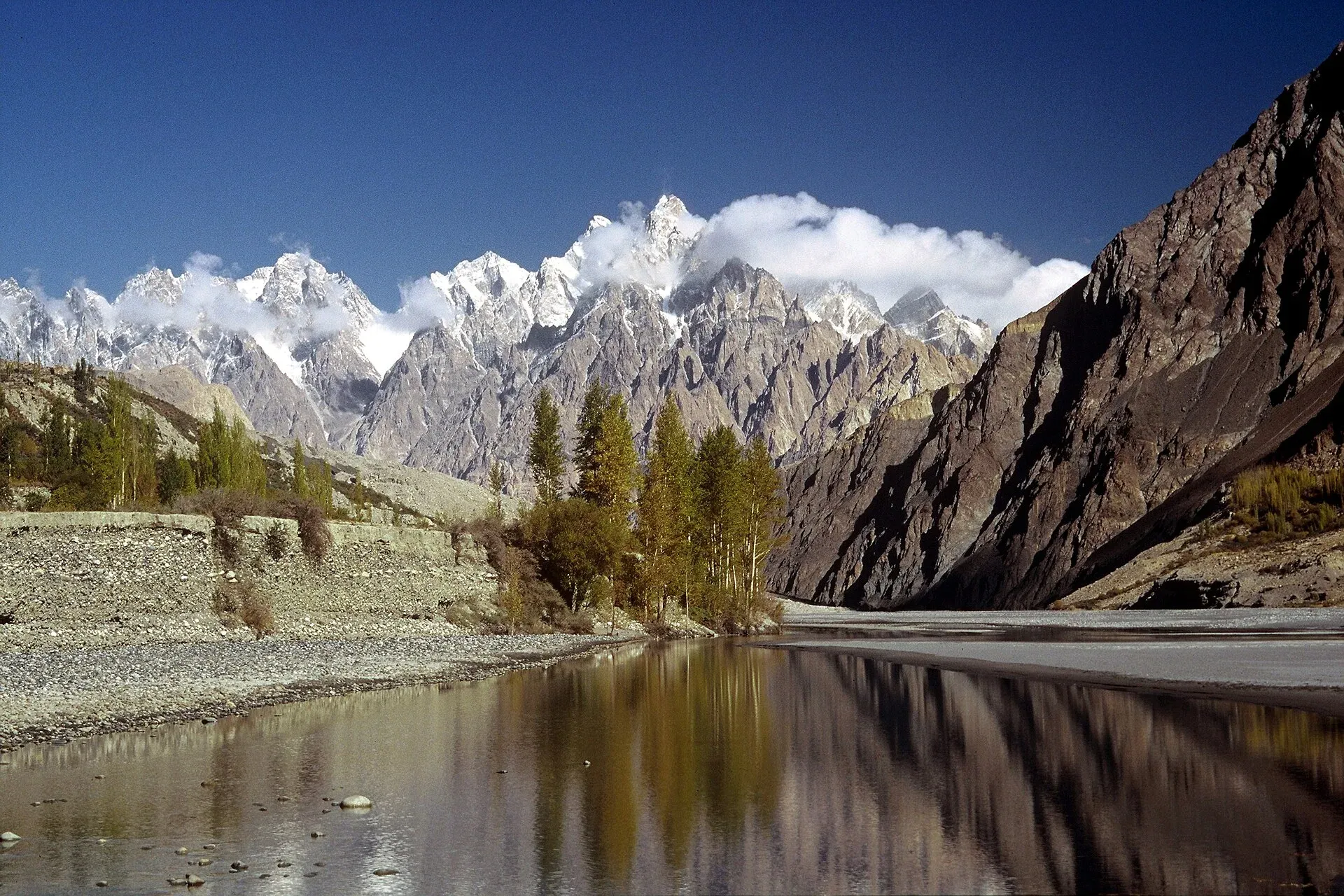
Photo: Ghazi Ghulamraza, with thanks · CC BY-SA 3.0 · via Wikimedia Commons · temporary stand-in photo

Hunza River
The river that runs beside the Karakoram Highway through Gojal, Hunza and Nagar before joining the Gilgit River. It formed Attabad Lake in 2010, when a landslide blocked it.
Overview
The Hunza River is the Gilgit River's main tributary. It forms where the Chapursan and Khunjerab streams meet, both fed by glaciers, and flows from north to south through the Karakoram. The Karakoram Highway (N-35) follows the valley, using the Khunjerab River valley above the confluence to reach the China border at Khunjerab Pass. The river's catchment is about 13,733 sq km and its mean annual flow is about 323 cubic metres a second. Much of the highway scenery of Gojal, Hunza and Nagar is built around it.
The valley floor at Hunza lies at about 2,438 m. Roughly nine-tenths of the Hunza area is above 3,000 m, so the river runs in a deep cut between very high ground. Peaks above it include Rakaposhi (7,788 m), Ultar Sar (7,388 m) and Distaghil Sar (7,885 m).
Plan your visit
- Nearest town
- Aliabad
- Getting there
By road on the Karakoram Highway from Gilgit or from Sost on the China-border side. Check the KKH route and security advice before you travel; flights go to Gilgit from Islamabad when weather allows. More
Best months
Apr – Oct
Course
- Upper Hunza (Gojal). The Khunjerab and Chapursan streams drain north. Sost, Passu and Gulmit lie on the river's banks. Glaciers such as Passu and Ghulkin descend close to the river.
- Attabad Lake. In January 2010 a landslide blocked the river and formed Attabad (Gojal) Lake. Wikipedia's Hunza River article gives about 30 km long and 122 m deep, but its Attabad Lake article gives a maximum of 21 km and 109 m (2010 measurements), so treat the size as approximate. The lake covered about 26 km of the highway, according to one Wikipedia article. The highway now bypasses it through five tunnels, about 7 km in total, opened on 14 September 2015. See the Attabad Lake page for access and boat trips.
- Central Hunza and Nagar. The river passes between Karimabad and Aliabad on one bank and Nagar on the other. Rakaposhi and Diran rise above.
- Confluence. It joins the Gilgit River near Gilgit, which then joins the Indus at Jaglot. The river is dammed for part of its route.
Forts and history above the river
Hunza began separating from Gilgit around 997 CE, and a firmer split came with the Ayash family's rule in the 15th century. Two forts overlook the valley: Baltit Fort in Karimabad, the former home of the Mirs (rulers) and said to be about 800 years old, and Altit Fort lower down the valley. Ancient watchtowers stand in Ganish village, and forts in Nilt, in Nagar, were the scene of the Anglo-Brusho war of 1 to 23 December 1891, which ended in a British victory. Hunza and Nagar remained princely states until 1974, when they were dissolved.
Before Islam, Buddhism and, to a lesser extent, Bon were the main religions. The Sacred Rock of Hunza carries petroglyphs and Kharoshthi inscriptions.
What to see and do
- Drive the KKH between Sost and Aliabad, with stops at the Passu cones, Gulmit and Karimabad.
- Take a boat on Attabad Lake and see the former road drowned beneath.
- Walk down to the river near Gulmit for photography. Do not wade in.
- Rafting. Operators advertise rafting between Passu and Gulmit. This is not verified by an official source, so confirm with Gilgit-Baltistan Tourism that a trip is licensed and that guides carry safety gear.
- Fishing. Fishing is allowed in some streams only under a licence and in open seasons. Current fees will be added soon; ask the Gilgit-Baltistan Wildlife and Fisheries Department.
Culture and people
Hunza's terraced villages depend on channels drawn from the river and its side streams. The Wakhi people of Gojal, who migrated from north-eastern Afghanistan from the 19th century, and the Burusho (Burushaski speakers) and Shina speakers of the lower valley all live along it. Most residents are Ismaili Muslims. The valley is popularly linked with the Shangri-La of James Hilton's novel Lost Horizon (1933).
When to visit
April to October is the main season. Spring brings blossom, autumn brings gold. Flow peaks in July and August. The KKH over Khunjerab Pass has its own seasonal closures; check before travelling.
Good to know
- Glacier outbursts and landslides can dam the river or flood it. Treat riverside camping as unsafe, particularly near side streams.
- For foreign visitors: the UK FCDO page (updated 27 October 2026, checked 16 November 2026) does not advise against Gilgit-Baltistan generally. It advises against all travel on the KKH between Mansehra and Chilas, so ask about the current road route from the south before travelling.
- Read the river crossings guide before walking beside glacier streams.
Highlights
- Follows the Karakoram Highway through Gojal and Hunza
- Formed by the Chapursan and Khunjerab streams
- Blocked by the 2010 landslide, forming Attabad Lake
- Largest tributary of the Gilgit River
- Passes beneath Rakaposhi, Diran and Passu
Getting there
By road on the Karakoram Highway from Gilgit or from Sost on the China-border side. Check the KKH route and security advice before you travel; flights go to Gilgit from Islamabad when weather allows.
Tips
- Do not wade or camp beside the river
- Confirm rafting operators are licensed
- Check KKH status and the Khunjerab Pass season
- Keep drone and camera gear dry near the lake
Photos we still need: the Hunza River near Karimabad or at the Attabad Lake outlet, for the Course section. Send us yours
Sources and last checked
Last checked Confidence medium6 sources4 still to check
- Last checked
- Method
- Desk research from published sources
- Confidence
- medium
- Checked by
- trek.pk research team
Researched from published sources; not yet checked on the ground by our team. Spot something out of date? Report a mistake.
Sources
- Hunza River (Wikipedia) · Wikipedia · checked
- Gilgit River (Wikipedia) · Wikipedia · checked
- Pakistan Tourism Guide 2021 · Trade Development Authority of Pakistan (TDAP) · checked
- Pakistan travel advice (updated 27 October 2026) · UK Foreign, Commonwealth & Development Office · checked
- Attabad Lake · Wikipedia · checked
- Hunza Valley (Wikipedia) · Wikipedia · checked
Still to be checked on the ground (4)
- River length (Wikipedia's Hunza River and Gilgit River pages give none)
- Rafting licensing and sections (no official source found)
- Attabad lake current size (sources disagree: 21 km/109 m vs 30 km/122 m) and boat arrangements
- Whether the KKH tunnels are currently open without disruption (open since 2015; no current status)
Nearby and related

Hunza Valley
A long Karakoram valley on the Karakoram Highway, with Karimabad, Baltit and Altit forts, Ganish village and Attabad Lake, below Rakaposhi and Ultar Sar. About 100 km from Gilgit.

Attabad Lake
A turquoise lake about 21 km long in Gojal, Hunza. It formed when a landslide blocked the Hunza River on 4 January 2010. The Karakoram Highway now passes it through five tunnels.

Gojal and Shimshal
Upper Hunza: Gulmit, Ghulkin, Passu and Sost on the Karakoram Highway, with big glaciers and the Passu Cones, plus the remote Shimshal valley, its Wakhi village and its mountaineering community.

Passu
A Wakhi village in Gojal beside the Passu Glacier, below the jagged Passu Cones (Tupopdan, 6,106 m). Known for Hussaini Suspension Bridge, glacier walks and Batura views.

Gulmit
The administrative centre of Gojal (Upper Hunza), at 2,465 m on the Karakoram Highway. A calm base for Ghulkin, Borith Lake, the museum and fort walks.

Karimabad (Hunza)
The main town of Hunza, set on a terrace below Baltit Fort with Rakaposhi, Ultar and Diran in view. A good base for forts, viewpoints, Attabad Lake and the road to Gojal.

Aliabad (Hunza)
The commercial hub of Hunza, on the Karakoram Highway about 9 km from Karimabad, with the main bazaar, transport offices and a base for Hunza and Nagar.

Nagar Valley
The quieter bank of the Hunza River, facing Karimabad: Minapin, Hoper and Hispar villages, Rakaposhi viewpoints and easy treks below Rakaposhi, Diran and Spantik.

Sost
The last town on the Karakoram Highway before the Chinese border, at about 2,800 m. Sost has Pakistan's immigration and customs offices, a dry port, and is the base for Khunjerab Pass.

Khunjerab Pass
The 4,693 m pass on the Karakoram Highway where Pakistan meets China. It is the road crossing between Sost in Gojal and Tashkurgan in Xinjiang, now agreed to run all year.

Gilgit River
A glacier-fed river of about 240 km that rises at Shandur and runs through Ghizer to Gilgit, picks up the Hunza, and meets the Indus near Jaglot where the Karakoram, Hindu Kush and Himalaya join.

Hunza and Khunjerab (KKH)
A 7-8 day road trip from Islamabad up the Karakoram Highway to Hunza and on to Khunjerab Pass (4,693 m), with overnight stops at Besham, Chilas and Gilgit.