

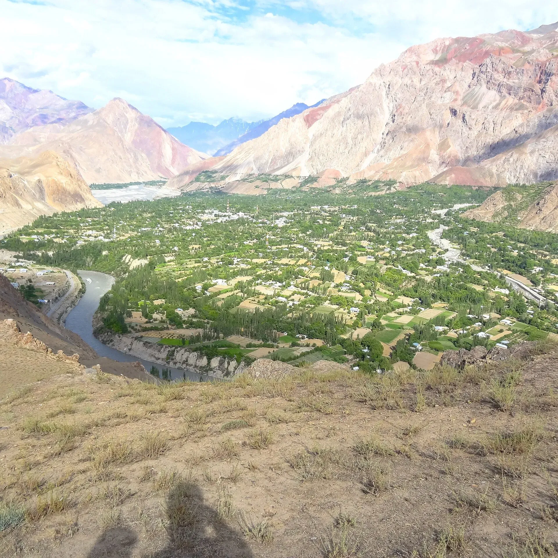
Photo: Naveedanjumkhan, with thanks · CC BY-SA 4.0 · via Wikimedia Commons · temporary stand-in photo

Booni
Headquarters of Upper Chitral District at about 2,085 m, near the foothills of Buni Zom and the Qaqlasht meadows. It is a base for local walks and a stop on the road to Mastuj and Shandur.
Overview
Booni (also spelled Buni) is the headquarters of Upper Chitral District in Khyber Pakhtunkhwa, at about 2,085 m. It lies in Mastuj tehsil, near the foothills of Buni Zom, with glacial lakes above the town. Wikipedia gives 1885 as the year it was established under the British. The district also includes the tehsils of Mastuj and Mulkhow.
The residents are mainly Kho (Chitralis), who speak Khowar; Urdu is widely understood. Wikipedia's headline figure gives 50,000 for Buni in 2023, but its article on Upper Chitral District gives 195,528 for the whole district (2023 census), so the 50,000 is not a reliable town figure.
Plan your visit
- Getting there
Road: about 81 km from Chitral, around 2 hours (OSRM, checked 16 November 2026), but the road is rough and being rebuilt, so allow more. Mastuj is about 29 km further (about 40 minutes). More
Best months
May – Oct
- Booni
- Related places nearby: Chitral, Mastuj, Chitral Valley, Shandur Pass, Buni Zom
Setting and climate
Wikipedia classes the local climate as Mediterranean (Köppen Csa), with an average annual temperature of 15.6 °C. Its rainfall figures conflict (about 418 mm in the text, 800 mm in the table), so none is stated here. Winters are cold at this height.
Booni has suffered floods from glacial melt and heavy monsoon rain, including in August 2024 (Wikipedia). Treat it as a flood-prone area when planning a summer trip.
What to see and do
- Qaqlasht meadows: around 2,500 m near the town. Wikipedia calls it the site of a major festival in the region, and cites a 2018 Gulf News report on a culture festival held there. Dates and access are unconfirmed.
- Buni Zom views: the mountain stands above the valley. See Buni Zom.
- Bazaar and village walks: orchards, terraced fields and old wooden-and-stone houses.
- Road to Mastuj: the next stop on the way to Shandur Pass. See Mastuj and Shandur Pass.
When to visit
June to September is the usual season. Spring and autumn are cool. Heavy rain and glacial melt can cause floods and road damage in summer.
Getting there
Booni is about 81 km from Chitral, around 2 hours by road (OSRM estimate, checked 16 November 2026), but the road is rough and being rebuilt, so allow more. Mastuj is about 29 km further (about 40 minutes). See Chitral for the starting point.
The Chitral-Shandur road is being rebuilt in four packages. APP reported on 30 July (2026) that physical progress was 47.5% for Chitral to Pret, 34.8% for Pret to Booni, 38.2% for Booni to Shaidas and 29.8% for Shaidas to Shandur, all targeted for December 2026. It did not state the final surface.
Where to stay and eat
Expect a few guesthouses and simple hotels near the bazaar and main road, with basic local food. Chitral city has the larger choice.
Good to know
- Services are limited. Carry cash and fuel from Chitral, and ask your host about clinic facilities.
- Dress modestly and ask before photographing people.
- Ask the district administration or local police about current road conditions before you go.
- For foreign visitors: the UK FCDO advises against all travel on the N-45 highway from north of the Mardan ring road to the edge of Chitral city, including the Kalash valleys (advice updated 27 October 2026, checked 16 November 2026), and notes KP emergency measures and Governor's Rule since 11 October 2026. Read the live advice before you plan. Booni lies north of that stretch, but the usual road approach is via the N-45.
Highlights
- District headquarters of Upper Chitral
- Qaqlasht meadows nearby
- Buni Zom foothills
- Stop on the Chitral to Shandur road
Hotels, food, fuel and services in Booni
Places to stay
- Booni Guest HouseCall Booni Guest HouseMap of Booni Guest House in Google Maps
- PTDC Motel BooniCall PTDC Motel BooniMap of PTDC Motel Booni in Google Maps
- ALAM'S Guest HouseCall ALAM'S Guest HouseMap of ALAM'S Guest House in Google Maps
- White Rock GuesthouseCall White Rock GuesthouseMap of White Rock Guesthouse in Google Maps
- Best Western Hotel and Guest HouseCall Best Western Hotel and Guest HouseMap of Best Western Hotel and Guest House in Google Maps
- Mountain View Guest House BooniCall Mountain View Guest House BooniMap of Mountain View Guest House Booni in Google Maps
Places to eat
- Nan CafèCall Nan CafèMap of Nan Cafè in Google Maps
- Kashmir Bakers BooniCall Kashmir Bakers BooniMap of Kashmir Bakers Booni in Google Maps
- Boni Zoom Bakers BooniCall Boni Zoom Bakers BooniMap of Boni Zoom Bakers Booni in Google Maps
- Al Bustan Restaurant BooniCall Al Bustan Restaurant BooniMap of Al Bustan Restaurant Booni in Google Maps
Essential services fuel stations, ATMs and hospitals and clinics
Fuel
ATMs
- HBL Booney BranchCall HBL Booney BranchMap of HBL Booney Branch in Google Maps
Hospitals and clinics
- Aga Khan Medical Centre BooniCall Aga Khan Medical Centre BooniMap of Aga Khan Medical Centre Booni in Google Maps
- THQ Hospital BooniCall THQ Hospital BooniMap of THQ Hospital Booni in Google Maps
Listings come from Google Maps data and are unverified: phone numbers, opening months and prices may have changed. Report a problem · Own one of these? Claim it
Tips
- Carry cash and fuel from Chitral.
- Check recent flood and road news before you go.
- Ask locally about Qaqlasht access.
- Read the live FCDO advice.
Photos we still need: Qaqlasht meadows, Booni bazaar, and the road to Mastuj. Send us yours
Sources and last checked
Last checked Confidence medium6 sources6 still to check
- Last checked
- Method
- Desk research from published sources
- Confidence
- medium
- Checked by
- trek.pk research team
Researched from published sources; not yet checked on the ground by our team. Spot something out of date? Report a mistake.
Sources
- Buni · Wikipedia · checked
- Chitral–Shandur Road · Wikipedia · checked
- Chitral-Shandur highway set to complete by December · Associated Press of Pakistan · checked
- OSRM driving routes (road distances and times) · Project OSRM / OpenStreetMap · checked
- Pakistan travel advice · UK FCDO (GOV.UK) · checked
- Upper Chitral District · Wikipedia · checked
Still to be checked on the ground (6)
- Population of the town itself (50,000 in the Wikipedia infobox is unconfirmed; district is 195,528 in 2023)
- Qaqlasht festival dates and access (Wikipedia names it only as a major regional festival)
- Surface and passability of the road from Chitral now (reconstruction in progress; surface type not stated)
- Fuel, ATM and clinic availability
- Current glacial lake risk (Wikipedia confirms past floods, including August 2024; no current official assessment found)
- Booni establishment date (1885 per Wikipedia infobox, no history section)
Nearby and related

Chitral
The main town of Lower Chitral District, at about 1,500 m on the Chitral River, with a historic fort, a royal mosque and views of Tirich Mir. The base for the Kalash valleys.

Mastuj
The main settlement of Mastuj valley in Upper Chitral, at about 2,359 m. It has an old fort ruin, big mountain views, and is the last major stop on the road to Shandur Pass and Gilgit.

Chitral Valley
The long Chitral River valley at the foot of the Hindu Kush, with Chitral town's fort and Shahi Mosque, the Lowari Tunnel route, Tirich Mir views and side valleys leading to Kalash and Shandur.

Shandur Pass
A high grassy pass of about 3,720 m between Ghizer in Gilgit-Baltistan and Upper Chitral. Home to the Shandur polo ground and a summer festival, reached by a rough road.

Buni Zom
Buni Zom (6,542 m) is the highest peak of the Buni Zom massif in the Hindu Raj, in Upper Chitral. It was first climbed in 1957 by two New Zealanders.