

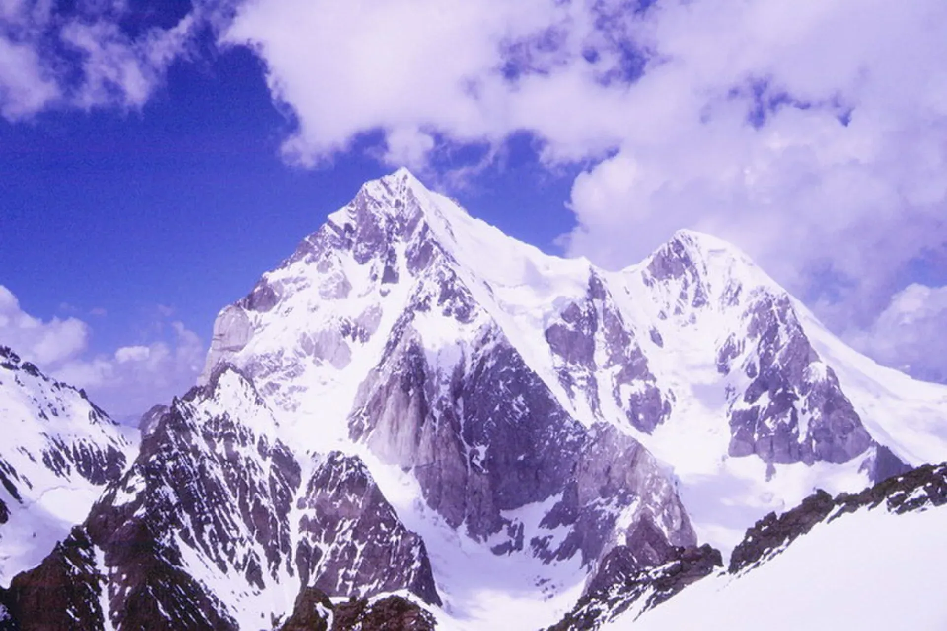
Photo: Nkroup, with thanks · CC BY-SA 3.0 · via Wikimedia Commons · temporary stand-in photo

Buni Zom
Buni Zom (6,542 m) is the highest peak of the Buni Zom massif in the Hindu Raj, in Upper Chitral. It was first climbed in 1957 by two New Zealanders.
Overview
Buni Zom is 6,542 m high, the highest point of a group of peaks in the Hindu Raj, in Chitral District, Khyber Pakhtunkhwa. Wikipedia places it about 50 km north-east of Chitral town and about 50 km east of Tirich Mir (7,708 m), the highest peak of the Hindu Kush. Its prominence is 2,845 m, which ranks it 117th in the world among peaks. Its slopes drain towards the Turikho and Mastuj rivers. The town of Booni lies near its foothills.
The massif is a mountaineering objective, but most visitors only see it from trek passes and from the valley roads.
Plan your visit
- Nearest town
- Chitral
- Getting there
Buni Zom is about 50 km north-east of Chitral town. The treks that give views of it start from villages in Mulkho and Turikho; see the individual trek pages. More
Best months
Jun – Sep
- Buni Zom
- Related places nearby: Booni, Mastuj, Chitral, Chitral Valley
The massif
The Himalayan Index list quoted by Wikipedia names 29 peaks above 6,000 m in the Buni Zom group, and Wikipedia says 12 of them are unclimbed. The better known ones include:
- Awi Zom: 6,484 m.
- Buni Zom North: 6,338 m.
- Ghochhar Sar: 6,249 m, also spelled Ghuchhar Sar.
- Gordoghan Zom: 6,240 m.
- Buni Zom South: 6,220 m.
- Buni Zom SS: 6,110 m.
Heights for several neighbouring summits are disputed between sources, and the Wikipedia table lists one peak (Rahman Zom) as disputed. The 6,542 m figure for the main summit is not contested in the sources checked.
First ascents
W.K.A. Berry and C.H. Tyndale-Biscoe, both from New Zealand, made the first ascent in 1957. Wikipedia describes their route as the steep north ridge, while the Himalayan Index lists the south-west ridge; the sources differ. Japanese climbers Masao Okabe, Hideo Sato and Shigeru Tabe made the second ascent in 1975, and the Americans Joe Reinhard and Richard Isherwood made the third in 1979 from the south face. Buni Zom SS was first climbed on 31 July 2007 by Nikolas Kroupis and George Voutiropoulos, a climb published in the American Alpine Journal.
Seeing Buni Zom from the passes
- Phargam An: an old route that passes between Buni Zom and Ghuchhar Sar. It is rarely walked today. See Phargam An.
- Zani An (3,840 m): from the pass the Buni Zom massif appears above the Turikho and Mastuj rivers to the east. See Zani An.
- Owir An (4,337 m): the trek page says the pass gives views of the Buni Zom massif on the far horizon, beside close views of Tirich Mir. See Owir An.
- Kasavir: views of Buni Zom from Chaghbini in Chitral Gol National Park, according to the earlier listing on this site. See Kasavir.
When to visit
The nearby treks are listed for roughly June to September. Snow lies on the high passes into July.
Where to stay and eat
Chitral town and Booni have hotels and guesthouses; see Booni and Chitral. On the passes you camp.
Good to know
Climbing context. Buni Zom is a technical expedition peak for experienced, well-equipped mountaineers only. It is not a trekking peak and this page does not describe a climbing route. Climbing needs an expedition permit. Buni Zom is in Chitral, Khyber Pakhtunkhwa, so arrange the permit through a licensed Pakistani operator and confirm which authority issues it. No permit fees are quoted here; ask the operator for the current rules. Check with the Chitral district administration for the rules that apply to the route you want.
Getting there safely. For foreign visitors: the UK FCDO (updated 27 October 2026) advises against travel on the N45 Highway to the edge of Chitral City, including the Kalash valleys, and against all travel within 10 miles of the Pakistan-Afghanistan border. Check the current advice and ask a licensed operator before planning.
Highlights
- 6,542 m peak of the Hindu Raj
- First climbed in 1957 by two New Zealanders
- Seen from Zani An, Owir An and Phargam An
Getting there
Buni Zom is about 50 km north-east of Chitral town. The treks that give views of it start from villages in Mulkho and Turikho; see the individual trek pages.
Tips
- Ask a Chitrali operator about local conditions.
- The passes give better views than the roads.
Photos we still need: Buni Zom from a trek pass or the Turikho or Mastuj valley, and the massif from Booni. Send us yours
Sources and last checked
Last checked Confidence low2 sources5 still to check
- Last checked
- Method
- Desk research from published sources
- Confidence
- low
- Checked by
- trek.pk research team
Researched from published sources; not yet checked on the ground by our team. Spot something out of date? Report a mistake.
Sources
- Buni Zom (Wikipedia) · Wikipedia · checked
- Pakistan travel advice: warnings and insurance (updated 27 October 2026) · UK FCDO · checked
Still to be checked on the ground (5)
- Nearest village and trailhead (Wikipedia gives only the distance from Chitral)
- Coordinates differ slightly between Wikipedia's summary box and its peak table
- Current royalty and permit rules (not confirmed from an official source)
- Permit authority for Buni Zom (the page says Gilgit-Baltistan, though the peak is in Chitral, Khyber Pakhtunkhwa)
- North ridge or south-west ridge for the 1957 first ascent (Wikipedia and the Himalayan Index differ)
Nearby and related

Phargam An
Zani An

Kasavir (Chitral Gol National Park)

Booni
Headquarters of Upper Chitral District at about 2,085 m, near the foothills of Buni Zom and the Qaqlasht meadows. It is a base for local walks and a stop on the road to Mastuj and Shandur.

Mastuj
The main settlement of Mastuj valley in Upper Chitral, at about 2,359 m. It has an old fort ruin, big mountain views, and is the last major stop on the road to Shandur Pass and Gilgit.

Chitral
The main town of Lower Chitral District, at about 1,500 m on the Chitral River, with a historic fort, a royal mosque and views of Tirich Mir. The base for the Kalash valleys.

Chitral Valley
The long Chitral River valley at the foot of the Hindu Kush, with Chitral town's fort and Shahi Mosque, the Lowari Tunnel route, Tirich Mir views and side valleys leading to Kalash and Shandur.