

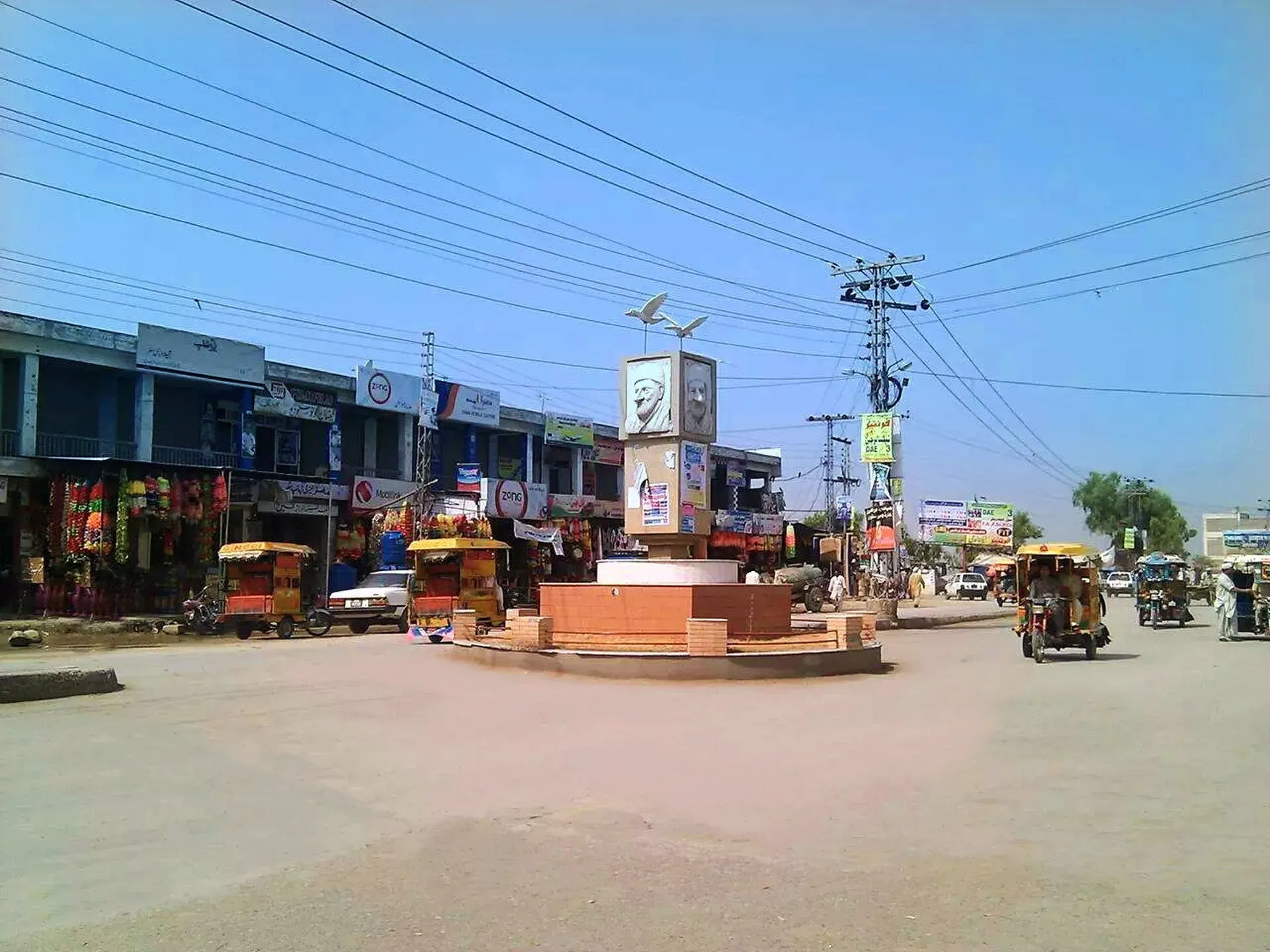
Photo: Zeeshan afand, with thanks · CC BY-SA 4.0 · via Wikimedia Commons · temporary stand-in photo

Charsadda
District headquarters about 29 km north of Peshawar on the plain of the Kabul and Swat rivers, and the site of Pushkalavati, an ancient capital of Gandhara.
Overview
Charsadda is the headquarters of Charsadda District, about 29 km from Peshawar on the Peshawar valley plain at 276 m (Wikipedia). The name means "four roads". An 1874 account, the Tawarikh-i Peshawar, gives a different origin: a son of the Pashtun conqueror Ilyas Khan Muhammadzai. The 2023 census counted 120,170 people in the town, and 99.2 per cent gave Pashto as their language. The district has three tehsils, Charsadda, Tangi and Shabqadar, and 49 union councils.
Three rivers cross the district: the Jindi, the Kabul and the Swat. They supply the irrigation and then join the Indus.
Plan your visit
- Getting there
Road: about 33 km from Peshawar (OSRM about 35 min, optimistic) and about 30 km from Nowshera (about 27 min). Local vans run from Peshawar. More
Best months
Oct – Mar
- Charsadda
- Related places nearby: Peshawar, Mardan, Nowshera, Takht-i-Bahi and Sahr-i-Bahlol, Khyber Pakhtunkhwa, Pushkalavati Museum, Bala Hisar Fort (Peshawar)
The ancient city of Pushkalavati
Charsadda matters for history. The ancient city of Pushkalavati ("Lotus City"), a capital of Gandhara from about the 6th century BCE to the 2nd century CE, stood on the outskirts, on the Jindi river near where the Swat and Kabul rivers meet. It was in two parts, split by the small Shambor river.
- Bala Hisar is the southern part, a clay mound with two summits. It holds the earliest deposits, from about 1400 BCE. Radiocarbon dates of 1420 to 1160 BCE are reported for the early levels, and an iron-working industry grew up between the 14th and 6th centuries BCE. This is not the same place as the Bala Hisar fort in Peshawar (see Bala Hisar Fort).
- Shaikhan Dheri is the northern part. Bactrian Greeks founded a new city here, Peucela, in the 2nd century BCE. It was held in turn by Indo-Scythians, Indo-Parthians and Kushans and lived in until the early 3rd century CE. Ahmad Hasan Dani partly excavated it in the 1960s. Wikipedia says a change in the river's course flooded the city in the 2nd century CE and the town moved to what is now Rajjar. Dheri is the Pashto word for a mound.
According to Arrian, the city surrendered to Alexander the Great in 327 or 326 BCE, and he left a garrison. A coin from the time of Azes I (about 58 to 12 BCE) was struck here. An Athenian "owl" coin of about 500 to 485 BCE found in the Shaikhan Dheri hoard is the earliest of its type known from so far east. The Chinese pilgrim Xuanzang recorded the city in the 7th century CE. Stucco Buddhist statues were found about 3 km east, at Palatu Dheri and Ghaz Dheri, and Gandharan statues from Charsadda are in museum collections. The grammarian Panini is said to have come from this area.
Little is on show at the mounds, so a visit is for those who already know the story. See Pushkalavati Museum, about 4 km north-east of the town, and Takht-i-Bahi for a Gandharan monastery site that is easier to visit. The mounds of Mir Ziarat, Rajar and Shahr-i-Napursan are reported as still unexcavated.
The cemetery and town sights
A large cemetery lies south of the tehsil bazaar. Wikipedia gives its size as about 3 by 4 km, with each clan (khel) having its own section. About 90 per cent of graves are marked with small black and white stones laid in geometric or floral patterns, a style called Hashtnaghri. Several saints' tombs draw pilgrims to annual urs festivals (the death-anniversary gatherings of a saint) with qawwali, and families visit graves on Ashura and on the first day of Eid al-Adha. Parts of the town have been built over the cemetery. Visit with care and ask before photographing graves or mourners.
Other points of local interest are the square named for Bacha Khan (Abdul Ghaffar Khan) and Bacha Khan University, a public university.
Food and shopping
The sources give no dishes or bazaars for Charsadda. Wikivoyage lists a market (as Capal Market), a tikka grill on Ghani Khan Road and a sweet-and-bakery shop, last updated in 2018. Ask locally for current names.
A day from Peshawar
An honest outline, built only from the sights above: leave Peshawar in the morning, spend a few hours at Pushkalavati Museum and the mounds with a guide who knows the story, see the cemetery and the square, and return before dark. Check the safety position first, as set out below.
Getting there
- From Peshawar: about 33 km, OSRM about 35 minutes (optimistic).
- From Nowshera: about 30 km, OSRM about 27 minutes.
- Local vans run from Peshawar's bus stands.
When to visit
October to March is the best time. Summers on the plain are very hot.
Where to stay and eat
There are simple local restaurants. Most visitors stay in Peshawar.
Basic services
Hospitals, pharmacies, fuel stations and ATMs are normal in a district headquarters, but none is confirmed for this town from an official source. Ask at your hotel, and use the business listings on this site.
Safety and good to know
Ask the district administration or local police about current conditions before you go. For foreign visitors: the UK FCDO (updated 27 October 2026, checked 16 November 2026) advises against all travel to Charsadda. This is government advice, not a closure. Read the page in full and check the current position with local police and a trusted contact before you decide. Nearby Mardan and Nowshera are also listed on the FCDO page.
Highlights
- Site of ancient Pushkalavati, Gandhara capital
- Bala Hisar mound with deposits from about 1400 BCE
- About 33 km from Peshawar
Hotels, food, fuel and services in Charsadda
Places to eat
- Mid Town Cafe CharsaddaCall Mid Town Cafe CharsaddaMap of Mid Town Cafe Charsadda in Google Maps
- Kouzzina River ResortCall Kouzzina River ResortMap of Kouzzina River Resort in Google Maps
- Bacha HotelCall Bacha HotelMap of Bacha Hotel in Google Maps
- Baba Mota ChawalCall Baba Mota ChawalMap of Baba Mota Chawal in Google Maps
- Mohmand Sweets & BakersCall Mohmand Sweets & BakersMap of Mohmand Sweets & Bakers in Google Maps
- Kamal RestaurantCall Kamal RestaurantMap of Kamal Restaurant in Google Maps
Essential services fuel stations, mechanics, ATMs, pharmacies, hospitals and clinics and Rescue 1122
Fuel
- Prang CNGCall Prang CNGMap of Prang CNG in Google Maps
- Sardaryab CNG StationCall Sardaryab CNG StationMap of Sardaryab CNG Station in Google Maps
- ShellCall ShellMap of Shell in Google Maps
- Haidery Il CNG Station CharsaddaCall Haidery Il CNG Station CharsaddaMap of Haidery Il CNG Station Charsadda in Google Maps
- Attock Petrol PumpMap of Attock Petrol Pump in Google Maps
- Hoti CNGMap of Hoti CNG in Google Maps
Mechanics and tyre shops
- Mohammad Tariq Namak ChakkiCall Mohammad Tariq Namak ChakkiMap of Mohammad Tariq Namak Chakki in Google Maps
- Haji keem adaCall Haji keem adaMap of Haji keem ada in Google Maps
- SHAKEEL HONDA SERVICEMap of SHAKEEL HONDA SERVICE in Google Maps
ATMs
- Habib Bank LimitedCall Habib Bank LimitedMap of Habib Bank Limited in Google Maps
Pharmacies
- "Dr Farhan Endocrine & Diabetes clinic"Call "Dr Farhan Endocrine & Diabetes clinic"Map of "Dr Farhan Endocrine & Diabetes clinic" in Google Maps
- Ahmad RX PharmacyCall Ahmad RX PharmacyMap of Ahmad RX Pharmacy in Google Maps
- Sky pharmacyCall Sky pharmacyMap of Sky pharmacy in Google Maps
- A+ PHARMACYCall A+ PHARMACYMap of A+ PHARMACY in Google Maps
- Dawakhana Hakeem Masal khan charsaddaCall Dawakhana Hakeem Masal khan charsaddaMap of Dawakhana Hakeem Masal khan charsadda in Google Maps
Hospitals and clinics
- Women and Children Hospital RajjarCall Women and Children Hospital RajjarMap of Women and Children Hospital Rajjar in Google Maps
- Dr fahad Tahir hospitalMap of Dr fahad Tahir hospital in Google Maps
- Alshifa Eye Hospital (Eye Center and Optics) , Eye consultation, Eye checkup and OpticsCall Alshifa Eye Hospital (Eye Center and Optics) , Eye consultation, Eye checkup and OpticsMap of Alshifa Eye Hospital (Eye Center and Optics) , Eye consultation, Eye checkup and Optics in Google Maps
- RMC Riaz Medical ComplexCall RMC Riaz Medical ComplexMap of RMC Riaz Medical Complex in Google Maps
- Al Hafeez Surgical HospitalCall Al Hafeez Surgical HospitalMap of Al Hafeez Surgical Hospital in Google Maps
- ORTHOPEDIC CENTER CHARSADDACall ORTHOPEDIC CENTER CHARSADDAMap of ORTHOPEDIC CENTER CHARSADDA in Google Maps
Rescue 1122
- Rescue 1122 Office Ring RoadCall Rescue 1122 Office Ring RoadMap of Rescue 1122 Office Ring Road in Google Maps
Listings come from Google Maps data and are unverified: phone numbers, opening months and prices may have changed. Report a problem · Own one of these? Claim it
Tips
- Read the FCDO advice before you consider a visit.
- See the Gandhara collections at Peshawar Museum first.
- Hire a local guide for the archaeological mounds.
- Avoid travel in the hot months.
Photos we still need: Bala Hisar or Shaikhan Dheri mound; the Hashtnaghri cemetery stones. Send us yours
Sources and last checked
Last checked Confidence medium5 sources4 still to check
- Last checked
- Method
- Desk research from published sources
- Confidence
- medium
- Checked by
- trek.pk research team
Researched from published sources; not yet checked on the ground by our team. Spot something out of date? Report a mistake.
Sources
- Charsadda · Wikipedia · checked
- Pakistan travel advice (updated 27 October 2026) · UK Foreign, Commonwealth & Development Office · checked
- OSRM driving route service: distances and times measured 16 November 2026 (times are optimistic, without stops) · OSRM / OpenStreetMap · checked
- Pushkalavati · Wikipedia · checked
- Charsadda · Wikivoyage · checked
Still to be checked on the ground (4)
- Population: 120,170 is the Wikipedia figure for the city, citing the 2023 census; the census site itself was not opened
- Current condition and visitor access at Bala Hisar and Shaikhan Dheri (no official source found)
- Hotels and services
- Current names of food and sandal markets
Nearby and related

Peshawar
Khyber Pakhtunkhwa's capital and one of South Asia's oldest living cities: the Gandhara museum, Qissa Khwani Bazaar, mosques and a strong food culture.

Mardan
The second-largest city in Khyber Pakhtunkhwa, set in the Peshawar valley, and the gateway to Gandhara's Takht-i-Bahi monastery (UNESCO), Shahbaz Garhi's Ashoka edicts and the Guides Memorial.

Nowshera
A Grand Trunk Road and railway town on the Kabul River, about 43 km east of Peshawar, with a large cantonment. Mostly a stop on the way between Peshawar and Islamabad.

Takht-i-Bahi and Sahr-i-Bahlol
A hilltop Buddhist monastery near Mardan, founded in the early 1st century CE, with the ruins of a small walled town at Sahr-i-Bahlol. UNESCO World Heritage Site since 1980.

Khyber Pakhtunkhwa
Mountains, Buddhist ruins and old bazaars in north-west Pakistan: Swat, Kaghan, Chitral, the Kalash valleys, the Khyber Pass and Peshawar.
Pushkalavati Museum
A district museum of archaeology and ethnology at Ghani Dheri near Charsadda, also called Charsadda Museum, close to the ruins of ancient Pushkalavati.

Bala Hisar Fort (Peshawar)
A high old citadel on the edge of Peshawar's walled city, rebuilt by the Sikhs and British and now a Frontier Corps headquarters. Public access is limited and should be checked first.