

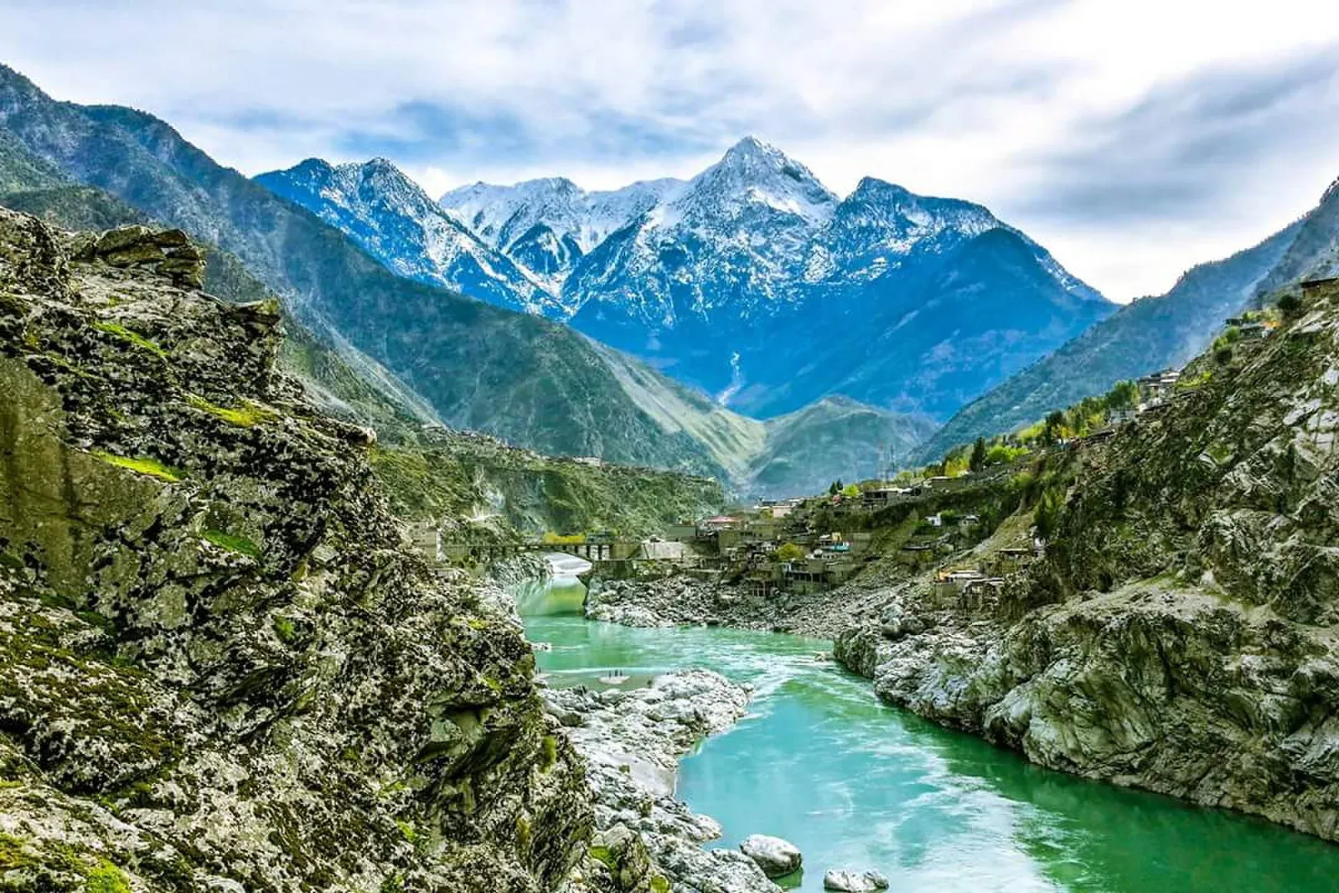
Photo: CerelacKhan, with thanks · CC BY-SA 3.0 · via Wikimedia Commons · temporary stand-in photo

Dasu
The headquarters of Upper Kohistan District on the Karakoram Highway, beside the Indus. A rest and checkpoint stop between Besham and Chilas, and the site of a large dam project.
Overview
Dasu (also Dassu) is the district headquarters of Upper Kohistan District on the Karakoram Highway, at about 841 m beside the Indus. The district was created in 2014 when Kohistan was split into Upper and Lower. The 2023 census gave Upper Kohistan 422,947 people (Wikipedia). Wikipedia gives the 2017 census figure for Dasu city as 2,372; there is no known town-level 2023 figure.
Plan your visit
- Getting there
Road: about 73 km from Besham (OSRM about 50 min, optimistic), about 135 km from Chilas (about 1 h 35 min) and about 314 km from Islamabad (about 4 h). Buses to Gilgit stop here. More
Best months
Apr – May, Sep – Oct
- Dasu
- Related places nearby: Besham, Shatial Rock Carvings, Dasu Dam
Kohistan and its people
Indus Kohistan is a meeting point of the Hindu Kush, Karakoram and Himalaya, and the district's mountains hold snow leopard and the western tragopan pheasant. Until 1 May 1934 the area was part of the Gilgit Agency, and then passed to the North-West Frontier Province. The people are mainly Dardic-speaking and are called Kohistani. The Indus divides two unrelated languages: Kohistani Shina is spoken east of the river, in eastern Upper Kohistan, and Indus Kohistani to the west. The district is mostly rural, and visitors will see terraced fields and houses high on the slopes above the highway.
What to see and do
Dasu is not a tourist stop. It is a highway town with a bazaar, tea shops and fuel, used for a break on the way between Besham and Chilas. The Indus is wide and fast at this point and the slopes are steep.
For sights, continue to Chilas and the rock carvings, or stop at Shatial. Plan travel through Kohistan in daylight, and expect delays.
The Dasu Dam
Dasu Dam is a roller-compacted-concrete gravity dam on the Indus near the town, owned by the government and built by WAPDA. It is planned to be 242 m high and 570 m long, with a reservoir of 1.41 billion cubic metres. The power station is designed for 4,320 MW in two stages of 2,160 MW, each with six 360 MW turbines, and water is diverted about 3.5 km downstream to the powerhouse (Wikipedia). Groundbreaking was on 25 June 2014 and main civil works began in February 2018. Funding includes World Bank loans. Wikipedia gives completion dates between 2027 and 2029, which conflict. Works have included relocating the Karakoram Highway (as of December 2020) and building resettlement sites for affected people, so you may see heavy machinery and checkpoints. Wikipedia gives no current road details. See Dasu Dam.
Getting there
- From Besham: about 73 km, OSRM about 50 minutes (optimistic; real times are longer, with checkpoints and slow trucks).
- From Chilas: about 135 km, OSRM about 1 hour 35 minutes.
- From Islamabad: about 314 km, OSRM about 4 hours.
- Long-distance buses to Gilgit stop here.
When to visit
July is the hottest month (mean about 29 C) and January the coldest (about 8 C). November is the driest month, with about 13 mm of rain, and July the wettest (about 93 mm), with 648 mm a year in all (Wikipedia). The monsoon brings landslides. Spring and autumn are best.
Where to stay and eat
There are a few basic hotels and many tea and kebab places. Most travellers sleep in Besham or Chilas.
Basic services
Hospitals, pharmacies, fuel stations and ATMs are normal in a district headquarters, but none is confirmed for this town from an official source. Ask at your hotel, and use the business listings on this site.
Safety and good to know
Ask the district administration or local police about current conditions before you go. For foreign visitors: the UK FCDO (updated 27 October 2026, checked 16 November 2026) advises against all travel on the Karakoram Highway between Mansehra and Chilas via Battagram, Besham City, Dasu and Sazin. The page does not otherwise name Kohistan. This is government advice, not a closure. Read it, and check road news with the police and your hotel. A bus carrying Chinese workers was destroyed by an explosion near Dasu on 14 July 2021 (Wikipedia), which is one reason travellers are cautious here.
Highlights
- District headquarters of Upper Kohistan
- Karakoram Highway rest stop
- Near the Dasu Dam project
Hotels, food, fuel and services in Dasu
Places to stay
- Pak-China Hotel & RestaurantCall Pak-China Hotel & RestaurantMap of Pak-China Hotel & Restaurant in Google Maps
Essential services fuel stations and hospitals and clinics
Fuel
- PSO Filling StationCall PSO Filling StationMap of PSO Filling Station in Google Maps
- Quraquram filling station dassuCall Quraquram filling station dassuMap of Quraquram filling station dassu in Google Maps
- Asad filling stationCall Asad filling stationMap of Asad filling station in Google Maps
Hospitals and clinics
- RHCCall RHCMap of RHC in Google Maps
- DHQ Dassu KohistanMap of DHQ Dassu Kohistan in Google Maps
- Kohistan Medical CenterMap of Kohistan Medical Center in Google Maps
Listings come from Google Maps data and are unverified: phone numbers, opening months and prices may have changed. Report a problem · Own one of these? Claim it
Tips
- Read the FCDO advice on the Karakoram Highway before you go.
- Travel in daylight only.
- Fill the tank at Besham or Chilas.
- Check road news for landslides and queues.
Photos we still need: Indus and the Karakoram Highway at Dasu; Dasu bazaar. Send us yours
Sources and last checked
Last checked Confidence medium6 sources4 still to check
- Last checked
- Method
- Desk research from published sources
- Confidence
- medium
- Checked by
- trek.pk research team
Researched from published sources; not yet checked on the ground by our team. Spot something out of date? Report a mistake.
Sources
- Dasu · Wikipedia · checked
- Upper Kohistan District · Wikipedia · checked
- Pakistan travel advice (updated 27 October 2026) · UK Foreign, Commonwealth & Development Office · checked
- OSRM driving route service: distances and times measured 16 November 2026 (times are optimistic, without stops) · OSRM / OpenStreetMap · checked
- Dasu Dam · Wikipedia · checked
- Kohistan District, Pakistan · Wikipedia · checked
Still to be checked on the ground (4)
- Services and hotels
- Where the relocated Karakoram Highway now runs, and any current delays from dam works
- Current security situation at Dasu (follow the FCDO page)
- Dasu Dam completion date (Wikipedia gives 2027 and 2029)
Nearby and related

Besham
A busy Indus-side town and junction on the Karakoram Highway at about 613 m, long used as the first overnight stop from Islamabad towards Gilgit and Hunza.

Chilas
Headquarters of Diamer on the Karakoram Highway and the Indus, with thousands of ancient rock carvings, views towards Nanga Parbat, and the road junctions for Fairy Meadows and Babusar Pass.

Shatial Rock Carvings
A site beside the Indus on the Karakoram Highway with more than 1,000 inscriptions, many by Sogdian merchants of the 3rd to 7th centuries, plus Buddhist carvings.

Khyber Pakhtunkhwa
Mountains, Buddhist ruins and old bazaars in north-west Pakistan: Swat, Kaghan, Chitral, the Kalash valleys, the Khyber Pass and Peshawar.

Kolai-Palas District
Kolai-Palas is a rural Kohistan district on the east bank of the Indus in Khyber Pakhtunkhwa, formed in 2017. Its headquarters is Sair Ghaziabad, notified in 2019 in place of Batera, a choice that has been contested. It is a remote area with little visitor infrastructure.
Dasu Dam
A large hydropower dam under construction on the Indus near Dasu in Kohistan. It is a construction site for a 4,320 MW project and is not open to visitors.