

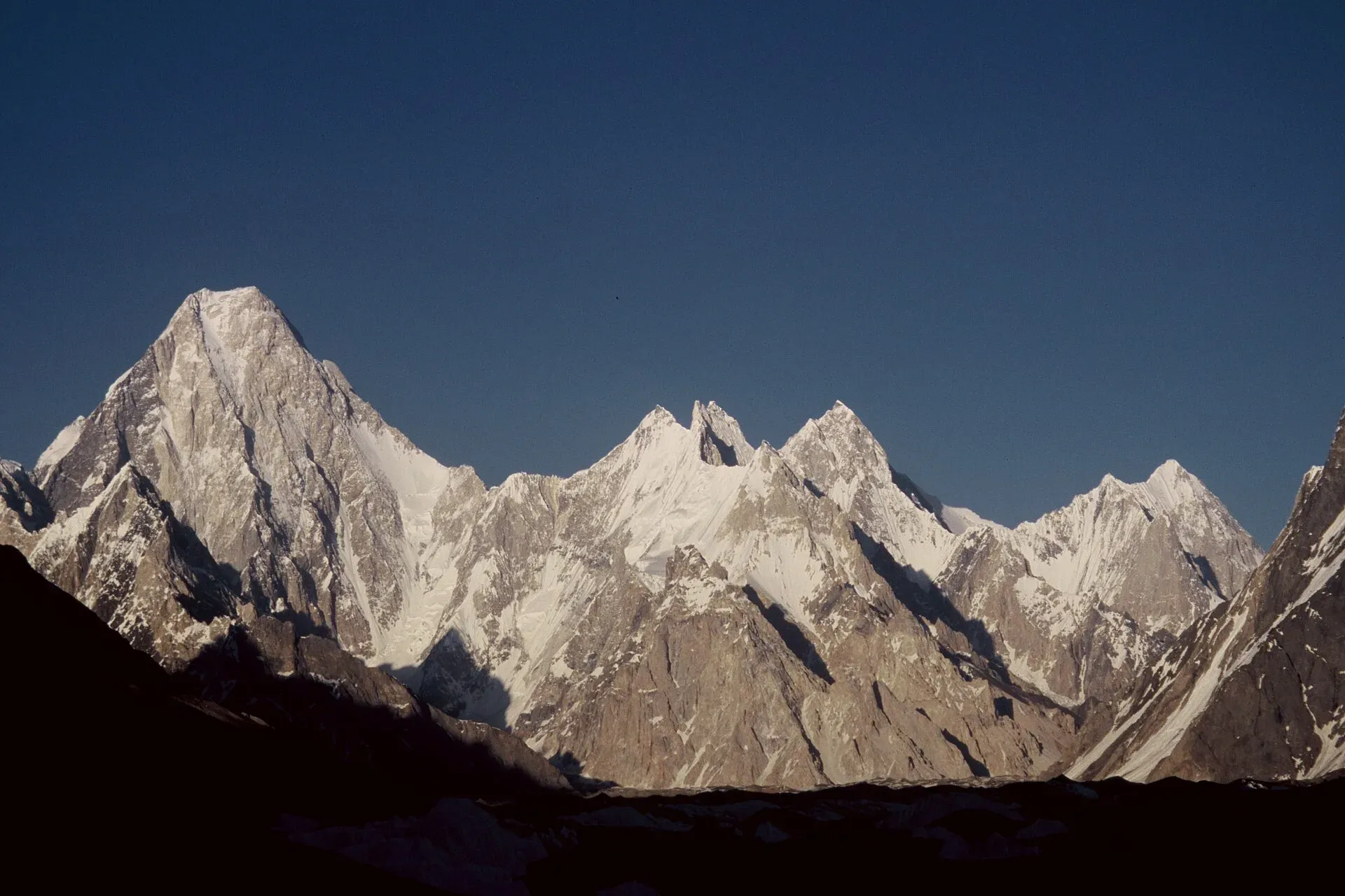
Photo: Florian Ederer, with thanks · CC BY 2.5 · via Wikimedia Commons · temporary stand-in photo

Gasherbrum IV
Gasherbrum IV (7,925 m) is a steep marble and limestone fin in the Baltoro Muztagh, seen at the head of the Baltoro Glacier near Concordia. Italians Bonatti and Mauri made the first ascent in 1958.
Overview
Gasherbrum IV is 7,925 m high, the 17th highest mountain on earth and the highest independent peak under 8,000 m in Pakistan. It stands in the Baltoro Muztagh of the Karakoram, in Gilgit-Baltistan, and was first surveyed as K3. The name comes from the Balti words rgasha (beautiful) and brum (mountain), so "beautiful mountain". It is often said to mean "shining wall", but that is a popular guess. Some sources give the height as 7,932 m.
The mountain is a steep, fin-shaped peak of marble and limestone, with a prominence of 718 m. An icefall on the South Gasherbrum Glacier separates it from Gasherbrum III.
Plan your visit
- Nearest town
- Skardu
- Getting there
Fly or drive to Skardu, then drive to Askole, the road end, and walk up the Baltoro Glacier for several days to reach Concordia. See the Baltoro Glacier trek page for the full route. More
Best months
Jun – Aug
- Gasherbrum IV
- Related places nearby: Baltoro Glacier, Central Karakoram National Park
What to see and do
The view. Its huge West Face is the sight that most trekkers remember. It looms over Concordia, at about 4,600 m, where the Baltoro Glacier meets the Godwin-Austen Glacier, and is visible for many hours as you walk up the glacier. The Baltoro is about 63 km long, and K2 (8,611 m) and three other peaks above 8,000 m lie within 20 km of Concordia. You reach the view on the Baltoro Glacier and K2 Base Camp trek, a long restricted-zone expedition from Askole. See also Concordia and Mitre Peak and K2.
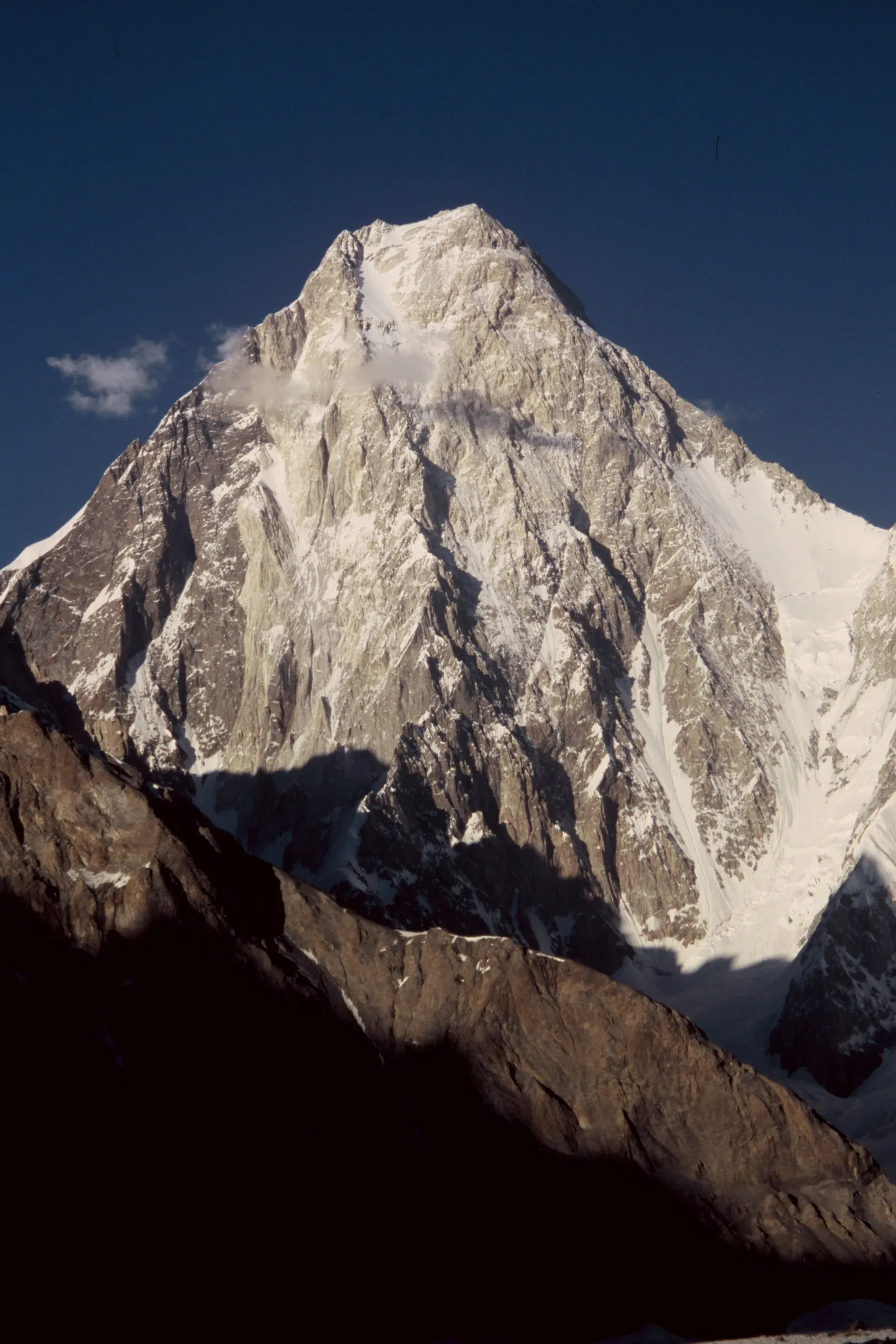
Photo: Florian Ederer, with thanks · CC BY 2.5 · via Wikimedia Commons · temporary stand-in photo

Climbing. Gasherbrum IV is a respected goal for elite alpinists, not a trekking peak. The notes below are a short history of the main climbs.
The first ascent, 1958
On 6 August 1958 Walter Bonatti and Carlo Mauri of Italy made the first ascent, on an Italian expedition led by Riccardo Cassin. They climbed the north-east ridge to the North Summit, and the long traverse along the pinnacled ridge to the main summit was the crux. The easiest route to the top is the north-west ridge. No repeat of the 1958 route is listed; in 2018 an Italian expedition trying to repeat it lost Maurizio Giordano to falling ice on the descent.
The West Face and later climbs
The West Face is about 2,500 m high. Five earlier attempts by American, Japanese and British teams had failed when Wojciech Kurtyka of Poland and Robert Schauer of Austria climbed it in alpine style (carrying everything, without fixed camps or ropes left behind) in July 1985. Kurtyka's account in the American Alpine Journal describes rock that was either rotten or very compact marble, deep snow on mixed ground, and a storm that held them on a small ledge near 7,800 m for two nights. They reached the summit ridge on 20 July, gave up the traverse to the top and abseiled down the north ridge. His record puts their high point at about 7,900 m.
Other recorded events, from Wikipedia:
- 1982. Three of five Japanese climbers on the West Face died after a serac (ice tower) fell at about 6,100 m.
- 1986. Greg Child, Tim Macartney-Snape and Tom Hargis made the second ascent of the peak, by the north-west ridge.
- 1995 to 1997. Miroslav Svetičič died on a solo attempt in 1995. A Korean team climbed the West Face in 1997 and found his body at about 7,000 m.
- 1999. A Korean team made the second ascent of the north-west ridge.
- 2016. Aleš Česen and Luka Lindič reached the North Summit by the north-west ridge, after changing plan from the West Face because of weather.
- 2023 and 2024. Dmitry Golovchenko was lost in a fall on a new south-east ridge route in 2023, and a serac fall in 2024 hit a team trying to recover his body.
The East and South faces and ridges have turned back every attempt, some of them fatally. The North Face lies in the Chinese Karakoram and has not been attempted.
When to visit
Baltoro treks run roughly June to August; most groups go up in June and return in August, with early summer easier for river crossings. The mountain is snow-covered all year.
Where to stay and eat
There are no lodgings on the glacier. Trekkers sleep in tents at camps such as Urdukas, Goro II and Concordia, with meals prepared by the operator's cook. Skardu has hotels and guesthouses for before and after.
Good to know
- Permits. Peaks above 6,500 m need a climbing permit through a licensed operator. Baltoro trekkers need a restricted-zone trekking permit, a licensed guide and Central Karakoram National Park fees. Current fees will be added soon; ask a licensed operator or Gilgit-Baltistan Tourism.
- Height. 7,925 m is the value Wikipedia gives (citing SummitPost).
- Safety. The Baltoro involves glacier travel, rockfall and altitude. Do not walk it alone. Wikipedia notes that litter and poor sanitation have built up on parts of the route, so carry out all rubbish.
- Ask the district administration or local police about current conditions before you go. Travel advice. For foreign visitors: the UK FCDO does not advise against Gilgit-Baltistan as a whole (page updated 27 October 2026, checked 17 November 2026), but it advises against all travel within 10 miles of the Line of Control. Read the live page before you plan.
Highlights
- 17th highest mountain on earth, 7,925 m
- Dramatic West Face above Concordia
- First climbed by Bonatti and Mauri on 6 August 1958
- Seen on the Baltoro Glacier trek
- Name means beautiful mountain in Balti
Getting there
Fly or drive to Skardu, then drive to Askole, the road end, and walk up the Baltoro Glacier for several days to reach Concordia. See the Baltoro Glacier trek page for the full route.
Tips
- Choose a clear morning at Concordia for the best West Face views.
- Book through a licensed operator; the Baltoro is a restricted zone.
- Start in June if you want easier river crossings.
Photos we still need: the Gasherbrum IV West Face seen from Concordia (the second photo may show the peak from elsewhere). Send us yours
Sources and last checked
Last checked Confidence medium7 sources3 still to check
- Last checked
- Method
- Desk research from published sources
- Confidence
- medium
- Checked by
- trek.pk research team
Researched from published sources; not yet checked on the ground by our team. Spot something out of date? Report a mistake.
Sources
- Gasherbrum IV · Wikipedia · checked
- Pakistan travel advice: warnings and insurance · UK Foreign, Commonwealth & Development Office (FCDO) · checked
- Fees and Paperwork for a Karakorum Trek (peaks above 6,500 m need a climbing permit; Alpine Club of Pakistan quoted) · ExplorersWeb · checked
- Trekking in the Karakoram and Hindukush (peak table; facts only) · Lonely Planet · checked
- Pakistan Tourism Guide 2021 (peak list) · Trade Development Authority of Pakistan (TDAP) · checked
- The Shining Wall of Gasherbrum IV (Wojciech Kurtyka) · American Alpine Journal, 1986 · checked
- Baltoro Glacier · Wikipedia · checked
Still to be checked on the ground (3)
- Current permit and national park fees (the only figures found are in a 2020 ExplorersWeb article, which is not an official source; no official page reachable)
- Climbing permit rules for the 2027 season (nothing current found)
- Height: 7,925 m on the Gasherbrum IV page against 7,932 m on the Baltoro Glacier page; no survey figure found
Nearby and related

Baltoro Glacier and K2 Base Camp

Rush Phari (Rush Lake)

Baltoro Glacier
About 62 km long, the Baltoro is the glacier you walk up to reach K2 Base Camp and Concordia. A restricted-zone trek of about two weeks from Askole, inside Central Karakoram National Park.

Central Karakoram National Park
Pakistan's largest protected area, covering about 10,500 square kilometres of the highest mountains on earth: K2, Gasherbrum I and II, Broad Peak and the Baltoro, Biafo and Hispar glaciers.

Skardu
The main town of Baltistan, where the Indus meets the Shigar river. Skardu is the base for the Deosai Plains, the Kachura and Satpara lakes, Shigar, and the K2 and Baltoro treks.