

Photo: Zacharie Grossen, with thanks · CC BY-SA 4.0 · via Wikimedia Commons · temporary stand-in photo

K2
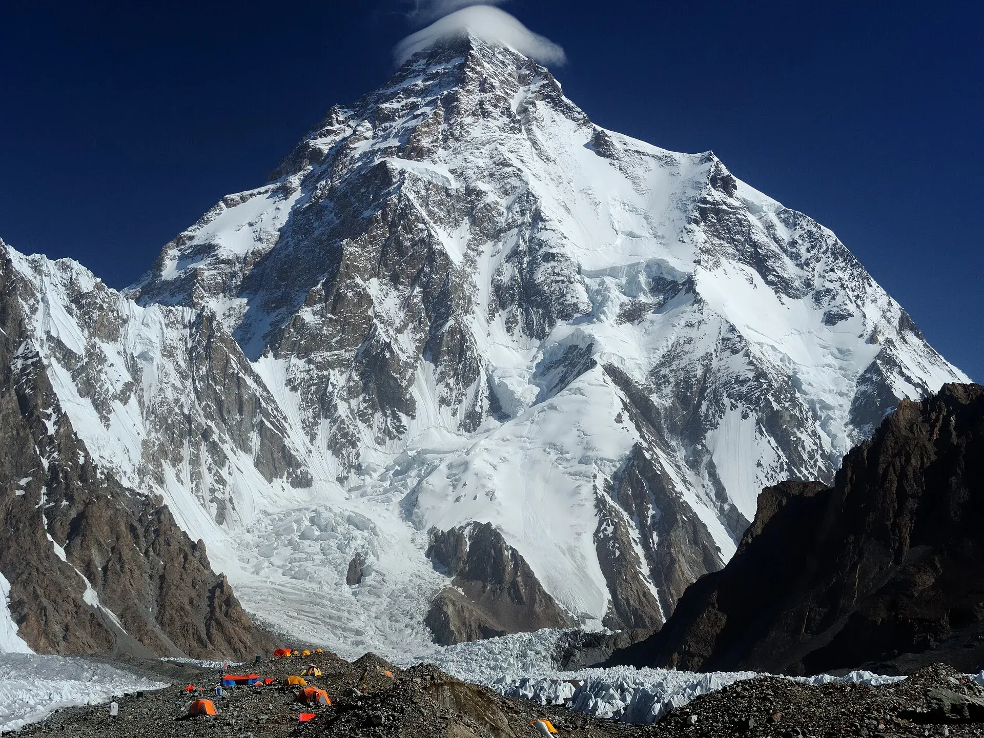
K2 (8,611 m) is the second-highest mountain on Earth, on the Pakistan-China border in the Karakoram. Trekkers see it from Concordia and K2 Base Camp on the Baltoro Glacier; climbing it is a serious expedition.
Overview
K2 is the second-highest mountain in the world, at 8,611 m, after Everest. It stands in the Karakoram on the border between Gilgit-Baltistan, Pakistan, and Xinjiang, China. A 2014 Pakistani-Italian expedition measured it by satellite navigation at 8,609.02 m; maps and encyclopaedias still use 8,611 m. Geologically, its core is a gneiss formed from a granite about 115 to 120 million years old, which was buried, metamorphosed and later uplifted (Wikipedia).
Plan your visit
- Nearest town
- Askole
- Getting there
Fly or drive to Skardu, then take a jeep road through the Shigar and Braldu valleys to Askole, the roadhead. From Askole it is a multi-day trek up the Baltoro Glacier to Concordia and K2 Base Camp. More
Best months
Jun – Aug
- K2
- Related places nearby: Central Karakoram National Park, Godwin-Austen Glacier (K2 Base Camp)
How K2 got its name
The name comes from the British survey of the 1850s. Thomas Montgomerie marked the two most prominent peaks he could see as K1 and K2 in an 1856 sketch, with the K standing for Karakoram. K1 turned out to be Masherbrum, but K2 never gained a widely used local name. "Mount Godwin-Austen" was proposed for it after the explorer Henry Godwin-Austen. The Royal Geographical Society rejected that name, though it appeared on some maps. "Chogori" is sometimes quoted, and it is the basis of the Chinese name Qogir, but evidence for local use is thin. Balti speakers now say "Ketu".
Climbing history
In 1909 an expedition led by the Duke of the Abruzzi reached about 6,250 m on the south-east spur and turned back because of the steepness. That spur is now known as the Abruzzi Spur and is the usual route. Italian climbers Lino Lacedelli and Achille Compagnoni made the first ascent on 31 July 1954, on an expedition led by Ardito Desio. Walter Bonatti and Amir Mehdi carried oxygen to about 8,100 m. The ascent is still debated, because the top camp was placed higher than agreed and the two men had to spend the night in the open. Mehdi lost his toes to frostbite. A Pakistani, Colonel Muhammad Ata-ullah, was also a member of that expedition.
The first native Pakistani to reach the summit was Ashraf Aman, on 9 August 1977, during a Japanese expedition led by Ichiro Yoshizawa. In 1986, five climbers died in the "K2 disaster", after eight others had died in the preceding weeks; Wanda Rutkiewicz became the first woman to summit, on 23 June 1986. Ten Nepali climbers made the first winter ascent on 16 January 2021.
What to see and do
You do not need to climb K2 to see it. The classic trek is the Baltoro Glacier from Askole to Concordia, where K2 stands to the north with Broad Peak and the Gasherbrums in view. K2 is not visible from Askole, and you only catch glimpses of it near the end of the glacier. A side trip from Concordia reaches K2 Base Camp at about 5,135 m, close to the memorial for climbers who died on the mountain.
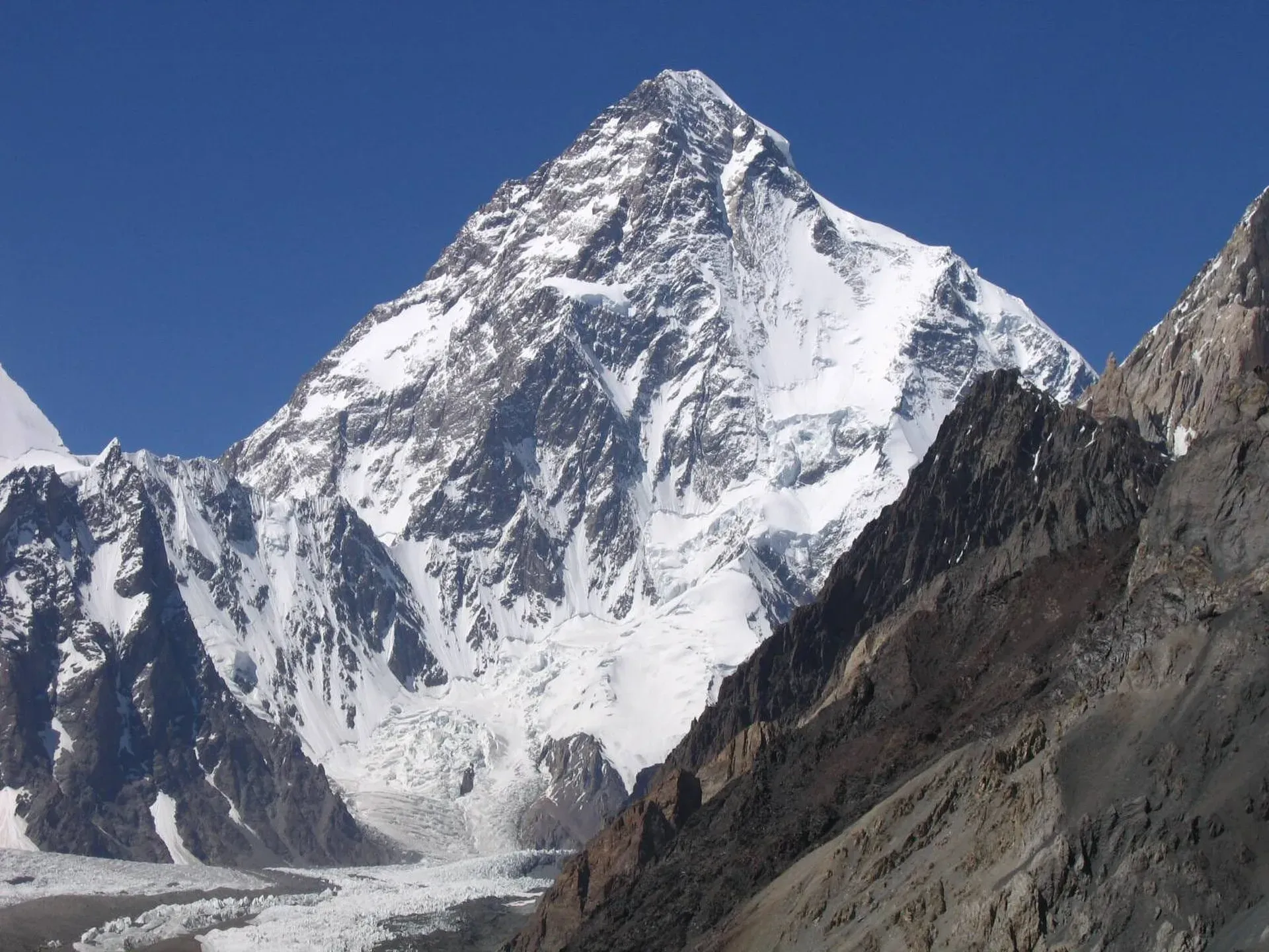
Photo: Svy123, with thanks · CC BY 3.0 · via Wikimedia Commons · temporary stand-in photo

Trekkers who finish over the Gondogoro La (about 5,585 m) get another long view of K2 from the pass. That route is technical and needs a guide. See the Baltoro Glacier and Gondogoro La pages for stages.
The Baltoro approach
The Baltoro is 63 km long and covers about 1,500 sq km, and its meltwater feeds the Braldo River, which joins the Shigar River and then the Indus. Concordia, at about 4,600 m, is where it meets the Godwin-Austen Glacier flowing down from K2. Three other peaks above 8,000 m stand within 20 km of K2: Gasherbrum I (8,080 m), Broad Peak (8,047 m) and Gasherbrum II (8,035 m). Closer to the route are the Trango Towers and Mitre Peak (6,010 m). The glacier sits in a wide trough with icefalls where side glaciers join it and lakes in hollows scoured by the ice (Wikipedia). See Central Karakoram National Park for the park rules.
When to visit
Trekking and climbing both centre on July and August, which are typically the warmest months. Concordia can see first snow from mid-September. K2 has also been climbed in winter, but that is an expedition for specialists, not a trek.
Where to stay and eat
Skardu has hotels and guesthouses of all kinds and is where licensed operators organise permits, porters and jeeps. After the road ends at Askole, everything is camping, with meals cooked by your trekking crew.
Good to know
Climbing context. K2 is far harder than a trek. Wikipedia reports about 800 summits and 96 deaths by August 2023; before 2021 roughly one climber died for every four who reached the top. It calls K2 a more difficult and dangerous climb than Everest because of its steep faces and weather. Most climbers use the Abruzzi Spur. In 2008, 11 climbers died after an avalanche and falling ice damaged the fixed ropes on part of the route. The eastern face has never been climbed.
Permits and royalty. Climbing a named peak needs an expedition permit and a royalty, arranged through a licensed Pakistani operator with the Gilgit-Baltistan tourism department. The royalty and trekking fees were raised in 2024 and challenged in the Gilgit-Baltistan Chief Court (Dawn, 1 March 2025). In May 2025 the Gilgit-Baltistan Tourism Department notified a reduced fee schedule after a cabinet decision (The News, 25 May 2025). No official schedule for 2026 was found, so current fees will be added soon; ask your operator for the written fee list. Dawn reported on 29 March 2026 that foreign visitors do not need permits in open-zone areas, while treks and climbs in restricted zones need a permit from the tourism department before arrival. The Baltoro trek is a restricted-zone route and needs a permit, a licensed guide and Central Karakoram National Park fees; see the trek page.
Ask the district administration or local police about current conditions before you go. Getting there safely. For foreign visitors: the UK FCDO (checked 16 November 2026) advises against travel on the Karakoram Highway between Mansehra and Chilas but does not advise against Gilgit-Baltistan as a whole. Skardu can also be reached by other routes, so ask your operator which one they use.
Highlights
- Second-highest mountain on Earth, 8,611 m
- First climbed 31 July 1954 by an Italian expedition
- Seen from Concordia on the Baltoro Glacier trek
- K2 Base Camp at about 5,135 m is a long side trip from Concordia
Getting there
Fly or drive to Skardu, then take a jeep road through the Shigar and Braldu valleys to Askole, the roadhead. From Askole it is a multi-day trek up the Baltoro Glacier to Concordia and K2 Base Camp. See the Baltoro Glacier trek page for stages.
Tips
- Do not expect to see K2 from Askole; the first good view is near Concordia.
- Allow spare days for weather and road closures on the Skardu to Askole jeep road.
- Book a licensed operator: the Baltoro route is a restricted zone and a permit is required.
- Treat height checks at Concordia seriously; Base Camp is a further 500 m higher.
Photos we still need: K2 Base Camp and the memorial (no open-licence photo checked). Send us yours
Sources and last checked
Last checked Confidence high8 sources2 still to check
- Last checked
- Method
- Desk research from published sources
- Confidence
- high
- Checked by
- trek.pk research team
Researched from published sources; not yet checked on the ground by our team. Spot something out of date? Report a mistake.
Sources
- K2 (Wikipedia) · Wikipedia · checked
- List of mountains in Pakistan (heights and prominence) · Wikipedia · checked
- Gilgit-Baltistan tourism bounces back despite Middle East war (permit rules for open and restricted zones, 29 March 2026) · Dawn · checked
- Mountaineering royalty and trekking fee increase challenged in GB Chief Court (1 March 2025) · Dawn · checked
- Pakistan travel advice (updated 27 October 2026) · UK Foreign, Commonwealth and Development Office · checked
- Shigar District · Wikipedia · checked
- Baltoro Glacier · Wikipedia · checked
- GB slashes mountaineering, trekking fees to promote tourism (25 May 2025) · The News · checked
Still to be checked on the ground (2)
- Current royalty and trekking fee amounts (the GB Tourism Department notified a reduced schedule in May 2025 per The News; no official 2026 schedule found)
- Current state of the Skardu-Askole road (on the ground; OSRM models about 105 km)
Nearby and related

Baltoro Glacier and K2 Base Camp

Gondogoro La

Masherbrum Base Camp

Central Karakoram National Park
Pakistan's largest protected area, covering about 10,500 square kilometres of the highest mountains on earth: K2, Gasherbrum I and II, Broad Peak and the Baltoro, Biafo and Hispar glaciers.

Skardu
The main town of Baltistan, where the Indus meets the Shigar river. Skardu is the base for the Deosai Plains, the Kachura and Satpara lakes, Shigar, and the K2 and Baltoro treks.

Shigar Valley
A green valley north-east of Skardu with Shigar Fort, old wooden mosques and orchards, leading to Askole and the trailheads for the Baltoro, Biafo and Hispar treks.

Khaplu and Hushe
Khaplu, the old Yabgo capital on the Shyok River with its restored palace and mosque, and the Hushe valley beyond, the road end for Masherbrum, K6, K7 and the Gondogoro La.
Godwin-Austen Glacier (K2 Base Camp)
The glacier below K2. It meets the Baltoro Glacier at Concordia, and the trek to K2 Base Camp follows its medial moraine.
Braldu River
A glacier-fed river in Shigar District that rises at the Baltoro and Biafo glaciers. It forms the road and trail approach to the Baltoro and K2, and ends at Tingstun where it joins the Basha Basna to form the Shigar River.