

Photo: Vasiq Eqbal, with thanks · CC BY-SA 4.0 · via Wikimedia Commons · temporary stand-in photo

Hispar Glacier
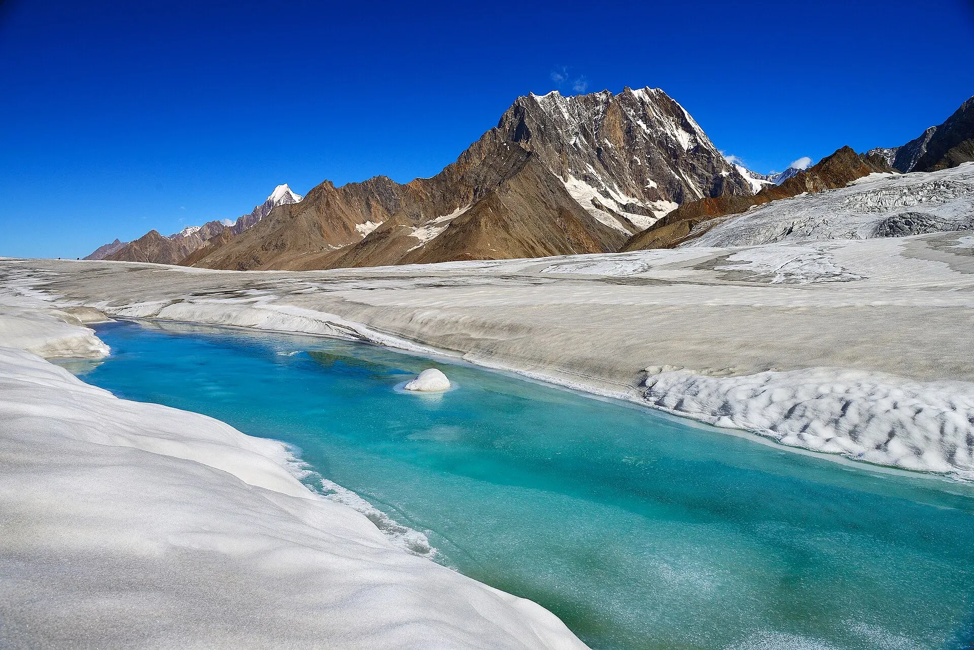
A 49 km glacier flowing west from the Hispar La into Nagar, below Distaghil Sar and Kunyang Chhish. Its lower stretch is summer pasture; the whole length is walked on the Biafo-Hispar traverse.
Overview
The Hispar Glacier flows west from the Hispar La (about 5,128 m) through Nagar District to the Hispar valley. The CKNP and Wikipedia's introduction give its length as 49 km. Wikipedia's headline figure says 100 km, which seems to count the Hispar and Biafo together along the route, so this page uses 49 km for the Hispar alone. Together the two glaciers make one of the longest continuous glacier routes outside the polar regions, roughly 100 to 114 km on foot.
Plan your visit
- Nearest town
- Hispar
- Getting there
The glacier is reached from Hispar village and Huru in Nagar, up the Hispar valley from the KKH near Nagar and Karimabad. Road and jeep access changes with weather and landslides, so ask locally. More
Best months
Jun – Sep
- Hispar Glacier
- Related places nearby: Nagar Valley, Nagar (district HQ), Kanjut Sar
Terrain along the glacier
From the Hispar La the ice runs west for about 49 km, and the character of the surface changes along the way. Our Hispar La trek guide describes the top as a snow ramp between icefalls. The side nearest the pass is more heavily crevassed than the Biafo side, and roped travel is needed until beyond the Khani Basa Glacier, where the crevasses lessen. Lower down, the walk moves onto the boulder-covered trough between the ice and the valley wall, called the ablation valley. The Hispar River, a tributary of the Hunza River, starts from the glacier's meltwater.
Landmarks from the pass to the road
Descending from the pass, the route follows the north margin. The landmarks, in order, are these.
- Baktur Baig Gut Delum (4,470 m). The first camp below the pass, on the north margin.
- Shiqam Baris. Reached by crossing a stream and dropping to the ablation valley, then walking on boulder moraine or a hillside trail that mudslides can block. Hagur Shangali Cham is an alternative camp.
- Dachigan. Reached past Ulum Burum Bun, with a stream crossing best made in the morning when the water is low. The trail towards the Pumari Chhish Glacier may be cut by rockfall, and local people know whether it is open.
- Bitanmal (about 3,660 m). A lush pasture with a shrine, where the trek guide advises carrying water. The route then crosses the edge of the Kunyang Glacier and several streams.
- Hispar village (3,383 m). Reached over the footbridge across the Hispar River, where the village collects a bridge toll. Parties camp in the rest-house compound.
- Huru. The road runs on above the Hispar River, past the Tarkiching Das rock slide, which is a falling-rock hazard, and Apiharai, a small grassy camp. Huru has grass and an apricot orchard, and a jeep road usually runs from here to the Karakoram Highway.
Peaks above the ice
Along the north side the Hispar Muztagh rises, with Distaghil Sar, Kunyang Chhish, Pumari Chhish and Kanjut Sar. Makrong Chhish (6,607 m) stands across the glacier near Bitanmal. The glacier links the former kingdoms of Nagar in the west and Baltistan in the east.
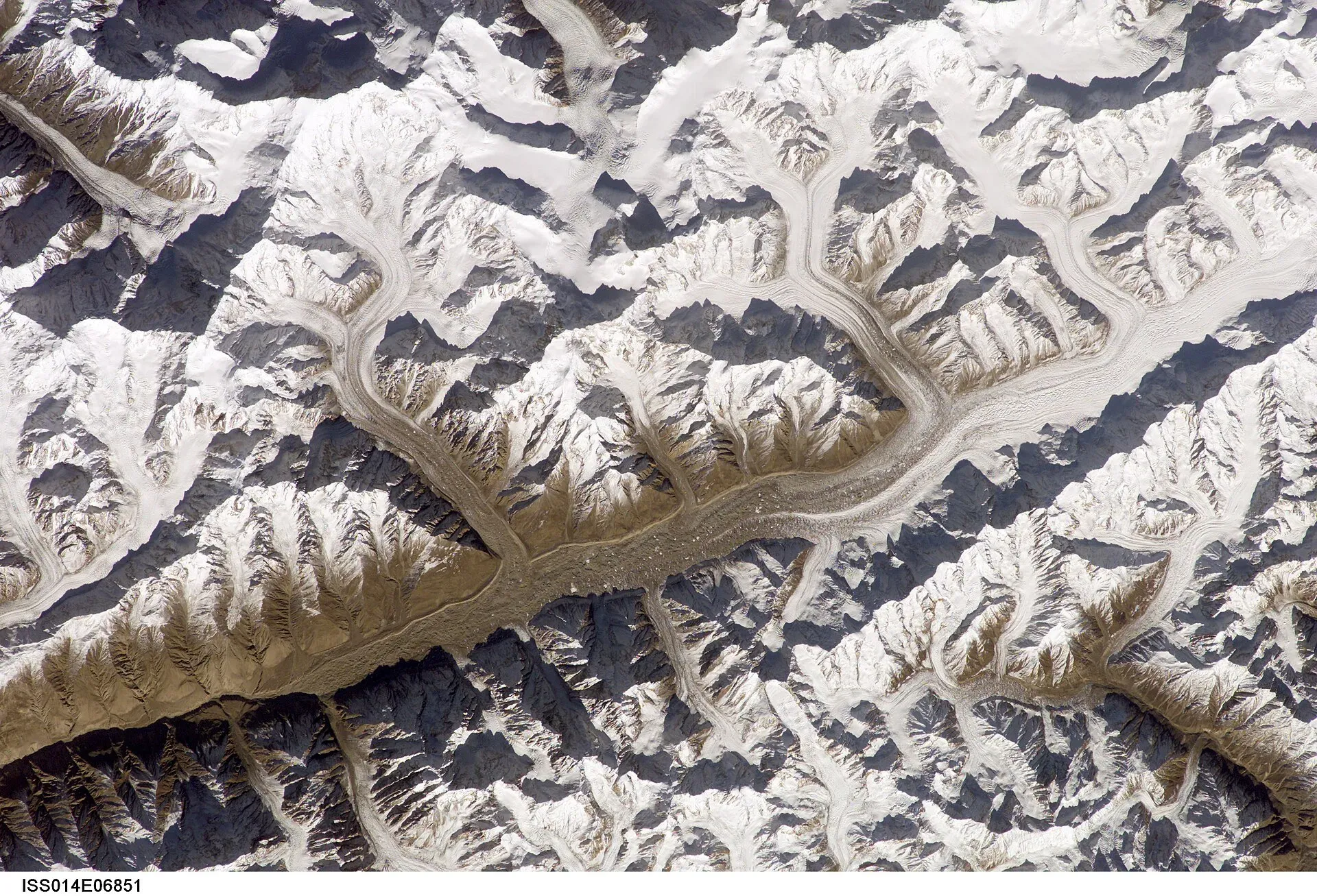
Photo: Nasa, ISS, with thanks · Public domain (CC0) · via Wikimedia Commons · temporary stand-in photo

What to see and do
The lower glacier is mostly rubble and pasture. Below Bitanmal, the grass is used by Burusho herders from Hispar in late summer. Most visitors come on the Biafo-Hispar traverse (see our Hispar La trek), walking from Askole over the pass, or on shorter outings from Huru and Hispar village. The glacier has crevasse fields on its upper sections and chaotic broken ice lower down, so travel with a guide.
When to visit
June to September for glacier travel. Pastures are greenest in July and August.
Where to stay and eat
Camp at Bitanmal and other sites with a guide or operator. In Nagar and Karimabad you can stay in guesthouses and hotels.
Good to know
- Permits. The CKNP lists the Hispar in its core zone (permit, registered guide, park fees), while older sources call it open zone. Police have stopped unaccompanied trekkers at check posts. Ask a licensed operator what applies now. Current fees will be added soon.
- Surging. The CKNP notes that the Hispar has surged in recent decades. A surge makes crevasses and flooding unpredictable.
- Climate. Glaciers in the central and western Karakoram have behaved differently from most of the world's glaciers. Some studies report them holding steady or even gaining mass, which is called the "Karakoram anomaly"; eastern Karakoram glaciers have been retreating more clearly. Even so, rising temperatures bring hazards. Pakistan's climate ministry and UNDP report 3,044 glacial lakes in Gilgit-Baltistan and Khyber Pakhtunkhwa, of which 33 were assessed as prone to dangerous outburst floods (GLOFs). The UNDP-run GLOF II project, funded by the Green Climate Fund, covers 24 valleys with early-warning systems.
- Safety. Read our glacier travel basics page first.
- Travel advice. For foreign visitors: the UK FCDO page for Pakistan (updated 27 October 2026, checked 16 November 2026) does not advise against Gilgit-Baltistan as a whole. It does advise against all travel on the Karakoram Highway (KKH) between Mansehra and Chilas, the usual road route from Islamabad, so check the live page before you plan and consider flying to Gilgit or Skardu (weather permitting).
Highlights
- About 49 km long
- Flows from the Hispar La into Nagar
- Below Distaghil Sar, Kunyang Chhish and Kanjut Sar
- Burusho summer pastures at Bitanmal
Getting there
The glacier is reached from Hispar village and Huru in Nagar, up the Hispar valley from the KKH near Nagar and Karimabad. Road and jeep access changes with weather and landslides, so ask locally. For the other end, go via Skardu and Askole. For foreign visitors: the UK FCDO page for Pakistan (updated 27 October 2026, checked 16 November 2026) does not advise against Gilgit-Baltistan as a whole. It does advise against all travel on the Karakoram Highway (KKH) between Mansehra and Chilas, the usual road route from Islamabad, so check the live page before you plan and consider flying to Gilgit or Skardu (weather permitting).
Tips
- Use a guide who knows the current route; it shifts each year.
- Ask a licensed operator about the permit zone before you book.
- Bring water to Bitanmal; it is scarce on the glacier.
- Respect herders' pastures and huts.
Photos we still need: Bitanmal pasture and the lower glacier near Hispar village; ablation valley trail between Shiqam Baris and Dachigan. Send us yours
Sources and last checked
Last checked Confidence medium8 sources5 still to check
- Last checked
- Method
- Desk research from published sources
- Confidence
- medium
- Checked by
- trek.pk research team
Researched from published sources; not yet checked on the ground by our team. Spot something out of date? Report a mistake.
Sources
- Karakoram glaciers: Baltoro, Biafo, Hispar · Central Karakoram National Park (cknp.org) · checked
- Hispar Glacier · Wikipedia · checked
- Hispar La (old trek.pk page, text from Lonely Planet Trekking in the Karakoram and Hindukush, c. 2002; facts only) · trek.pk / Lonely Planet · checked
- Glacier-Related Hazards Along the International Karakoram Highway: Status and Future Perspectives · Frontiers in Earth Science (2021) · checked
- Glacial Lake Outburst Flood GLOF-II · Ministry of Climate Change and Environmental Coordination, Pakistan · checked
- Scaling-up of GLOF risk reduction in Northern Pakistan (GLOF II) · UNDP Pakistan · checked
- Pakistan travel advice · UK Foreign, Commonwealth & Development Office · checked
- Biafo Glacier · Wikipedia · checked
Still to be checked on the ground (5)
- Glacier area (no source gives one for the Hispar alone)
- Current road access to Hispar and Huru
- Permit zone and fees (the CKNP glaciers page we opened gives no zone; the 'core zone' wording on this page comes from another CKNP source we did not re-open)
- Hispar La height: 5,128 m (Wikipedia) or 5,151 m (CKNP)
- Landmark order and camp names come from our Hispar La trek page; confirm with a guide
Nearby and related

Hispar La (Biafo–Hispar traverse)

Rush Phari (Rush Lake)

Nagar Valley
The quieter bank of the Hunza River, facing Karimabad: Minapin, Hoper and Hispar villages, Rakaposhi viewpoints and easy treks below Rakaposhi, Diran and Spantik.

Nagar (district HQ)
Nagarkhas, also called Oyum-Nagar, the administrative centre of Nagar District in Gilgit-Baltistan and the old capital of the Nagar state, beneath Rakaposhi.

Central Karakoram National Park
Pakistan's largest protected area, covering about 10,500 square kilometres of the highest mountains on earth: K2, Gasherbrum I and II, Broad Peak and the Baltoro, Biafo and Hispar glaciers.
Kanjut Sar
Kanjut Sar (7,760 m) is the highest peak of the Hispar Muztagh between the Shimshal and Hispar valleys. It was first climbed in 1959 by an Italian expedition.