

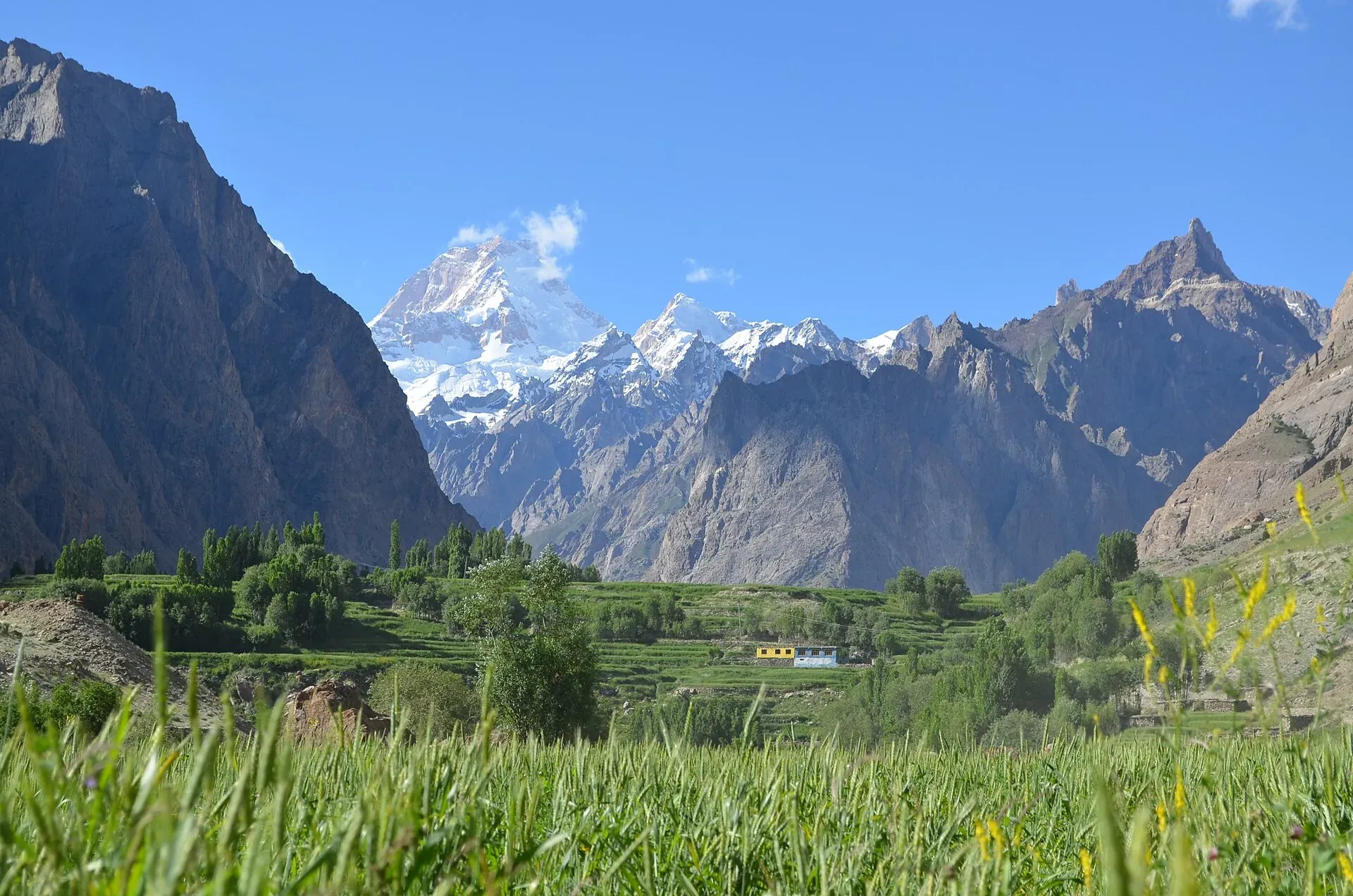
Photo: Zafaryaab, with thanks · CC BY-SA 4.0 · via Wikimedia Commons · temporary stand-in photo

Hushe Masherbrum View
Hushe, the last village on the road in the Hushe valley, looks up to Masherbrum (7,821 m). A walk to Saicho meadow above the village gives a closer view and a fine sunset.
Overview
Hushe is the last village on the road in the Hushe valley of Ghanche, Baltistan, at about 3,200 m (CKNP). Masherbrum, once called K1 in the first survey, is 7,821 m high and dominates the valley beyond it. A photograph on Wikimedia Commons shows the peak from Hushe village.
Plan your visit
- Nearest town
- Khaplu
- Getting there
From Khaplu about 36 km (OSRM 53 minutes, optimistic; reports 2 to 4 hours by jeep). From Skardu about 131 km (OSRM 2 h 20, optimistic; CKNP: 5 to 6 hours by jeep). More
Best months
Jun – Sep
- Hushe Masherbrum View
- Related places nearby: Masherbrum, Khaplu and Hushe, Gondogoro La
The Hushe valley
The Hushe River drains a valley that runs from Masherbrum and its neighbouring glaciers south to the Shyok River, opposite Khaplu. Hushe village lies in the middle of the valley. Wikipedia names several side valleys: Gondogoro, Charakusa, Nagma, Nanbroq and Mashabrum. Laila Peak, K6 and K7 are all above 6,000 m. K7 is given as 6,934 m by the CKNP.
Hushe is a working Balti village of stone-and-timber houses, with terraced barley and apricot fields and a juniper grove on the slope above (CKNP). The CKNP describes it as less commercialised than Karimabad in Hunza, with less English spoken. See also Khaplu and Hushe.
What to see and do
Walk through the fields and houses of the village for the main view. For a closer look, climb about an hour above Hushe to Saicho meadow, which the Central Karakoram National Park (CKNP) says faces Masherbrum's south face and gives an exceptional sunset. Longer treks, such as the Masherbrum Base Camp trek (about 4,300 m, two days on foot), start from here. Multi-day treks above the village need a CKNP trekking permit, which CKNP says is issued at its Skardu office.
Walks and treks from Hushe
The CKNP lists these starts from the village:
- Saicho meadow: about an hour above the village, easy, one night if camping.
- Masherbrum Base Camp: about 4,300 m, two days on foot, moderate. See Masherbrum Base Camp.
- Charakusa valley: two days to the basin below K7, Hassin Peak and Charakusa Tower, a four-night trek rated moderate to demanding.
- Gondogoro La: the fixed-rope pass to Concordia, demanding and technical. The CKNP says it needs a guide certified by the Alpine Club of Pakistan. See Gondogoro La.
When to visit
The CKNP gives June to September, with July and August best. Winters are cold and the road may be closed by snow. Mornings are usually clearer before afternoon cloud builds (general advice).
Where to stay and eat
The CKNP mentions homestays and one or two basic guesthouses in the village, with tent camping on most treks. Mobile signal is patchy in Hushe and absent beyond Saicho.
Good to know
- Getting there: From Khaplu, Hushe is about 36 km (OSRM, 53 minutes, optimistic). Reports describe a rough jeep road of 2 to 4 hours. From Skardu the CKNP gives 5 to 6 hours by jeep (OSRM 131 km). The road is rougher than the Karakoram Highway but easier than the road to Askole.
- Safety: The road crosses rockfall zones and narrow sections. Do not hurry on the climb to Saicho; you gain height quickly. Weather can change fast.
- For foreign visitors: the UK FCDO does not advise against Gilgit-Baltistan generally (updated 27 October 2026). Check the live page. Rules for restricted zones and trekking fees are changing, so ask a licensed operator in Skardu about permits.
Highlights
- Masherbrum (7,821 m) from the last village on the road
- Saicho meadow an hour above Hushe
- Start of the Masherbrum Base Camp trek
- A traditional Balti village
Getting there
From Khaplu about 36 km (OSRM 53 minutes, optimistic; reports 2 to 4 hours by jeep). From Skardu about 131 km (OSRM 2 h 20, optimistic; CKNP: 5 to 6 hours by jeep). Skardu has flights and road links from Gilgit and Islamabad.
Tips
- Book a jeep in Khaplu or Skardu; there is no regular bus beyond the last villages.
- Walk up to Saicho meadow for sunset, but bring a head torch for the walk down.
- Allow time to adjust to 3,200 m before longer walks.
- Ask a licensed operator in Skardu about permits for treks.
Facilities
- Homestays and basic guesthouses
- Camping
- Patchy mobile signal
Photos we still need: Hushe village houses and fields; Saicho meadow; the Hushe road above Khaplu. Send us yours
Sources and last checked
Last checked Confidence medium5 sources3 still to check
- Last checked
- Method
- Desk research from published sources
- Confidence
- medium
- Checked by
- trek.pk research team
Researched from published sources; not yet checked on the ground by our team. Spot something out of date? Report a mistake.
Sources
- Hushe valley: Masherbrum and Charakusa · Central Karakoram National Park (CKNP) · checked
- Hushe Valley (Wikipedia) · Wikipedia · checked
- Masherbrum (Wikipedia) · Wikipedia · checked
- OSRM driving route service: distances and times measured 16 November 2026 (times are optimistic, without stops) · OpenStreetMap / OSRM · checked
- Pakistan travel advice: warnings and insurance (updated 27 October 2026) · UK Foreign, Commonwealth & Development Office · checked
Still to be checked on the ground (3)
- Hushe village altitude: CKNP says 3,200 m, other sources about 3,050 m (Wikipedia's valley page gives none)
- Jeep time from Khaplu (CKNP gives none; reports say 2 to 4 hours)
- Current road condition after floods
Nearby and related

Masherbrum Base Camp
Masherbrum
Masherbrum (7,821 m), once known as K1, is the 22nd-highest mountain on Earth and rises over the Hushe valley in Ghanche. A four-day trek from Hushe reaches its base camp.

Khaplu and Hushe
Khaplu, the old Yabgo capital on the Shyok River with its restored palace and mosque, and the Hushe valley beyond, the road end for Masherbrum, K6, K7 and the Gondogoro La.

Gondogoro La
A fixed-rope trekking pass of about 5,585 to 5,620 m between Concordia on the Baltoro Glacier and the Hushe valley. Famous for its view of K2; technical and restricted-zone.

Shyok River
A long Karakoram river of about 550 km that rises at the Rimo Glacier in Ladakh, flows through Gilgit-Baltistan past Khaplu, and joins the Indus near Keris, close to Skardu.