

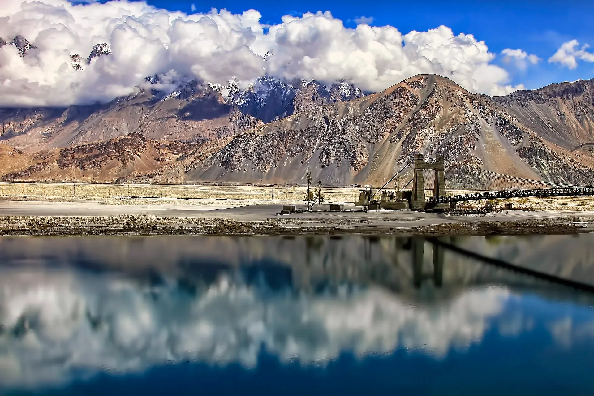
Photo: Tahsin Anwar Ali, with thanks · CC BY-SA 3.0 · via Wikimedia Commons · temporary stand-in photo

Shyok River
A long Karakoram river of about 550 km that rises at the Rimo Glacier in Ladakh, flows through Gilgit-Baltistan past Khaplu, and joins the Indus near Keris, close to Skardu.
Overview
The Shyok River is about 550 km long. It starts at the snout of the Rimo Glacier in the eastern Karakoram at about 4,980 m, in northern Ladakh. It flows south-south-east at first, makes a large V-shaped bend, then runs west-north-west through the Saser Muztagh. It crosses into Gilgit-Baltistan downstream of the Nubra confluence, and joins the Indus near the village of Keris at about 2,289 m. Wikipedia does not state the length within Pakistan or the exact border crossing; it says the river enters Gilgit-Baltistan downstream of the Nubra confluence, near Yagulung.
Plan your visit
- Nearest town
- Khaplu
- Getting there
Khaplu is about 103 km east of Skardu by road. Skardu has flights from Islamabad (weather permitting) and a road from Gilgit. Check current conditions before leaving. More
Best months
May – Oct
Course in Baltistan
The Nubra River, which rises from the Siachen Glacier, joins the Shyok near Diskit on the Ladakh side. On the Pakistani side, the main right-bank tributary is the Hushe River, which joins near the town of Khaplu after being joined by the Saltoro River. Khaplu sits on the Shyok and is the gateway to the Hushe Valley and the Masherbrum and Gondogoro region. From Khaplu the road to Hushe crosses the Shyok by the Saling bridge before following the Hushe River north.
Name, flow and water
The name has three proposed origins: the village of Shyok (Alexander Cunningham), a Tibetan phrase meaning "gravel spreader" (Friedrich Peter) and a Yarkandi phrase meaning "river of death" (Harish Kapadia). The basin covers 33,465 km2, split between India (54%), Pakistan (28%) and China (18%). About 49% of the water comes from glacier melt, 39% from snowmelt and 12% from rain, so flow peaks in summer. Mean discharge at the Yugo gauge in 1981 to 2010 was 390 m3 a second. The river follows the Shyok Suture Zone, a tectonic boundary between the Ladakh and Karakoram blocks, and sediment gives it a braided, gravel-bar pattern in the wide stretches (Wikipedia). In the 19th century British survey teams mapped the valley, which was part of trade routes linking Leh with Baltistan and Tibet.
What to see and do
- Khaplu. Visit Khaplu Palace and the old bazaar, then walk to a viewpoint above the river. See the Khaplu and Hushe page.
- Saling Bridge. The suspension bridge east of Khaplu is the usual place to look at the river up close.
- Drive the Skardu–Khaplu road. It follows the Shyok for much of the way through broad, sandy valley floors and orchards.
- Hushe Valley treks. Gondogoro La and Masherbrum base camp start from Hushe; see their trek pages.
- Rafting and fishing. Wikipedia's Khaplu page says there is rafting on the Shyok, without a source, and its Shyok page mentions snow trout but no fishing arrangements. There is no known official source for either. Check with Gilgit-Baltistan Tourism.
Culture and people
Baltistan is largely Shia Muslim, and the Nurbakhshi Sufi tradition has followers along the Shyok. Many valley villages live on irrigation channels drawn from the river and its side streams. Ask before photographing people, and dress modestly.
When to visit
April to October is the best time to visit. Flow is highest in July and August as the glaciers melt. Autumn colours around Khaplu are particularly good.
Where to stay and eat
Khaplu has heritage hotels and guesthouses, and Skardu has more. Simple restaurants are found in both.
Good to know
- The Siachen area and the Line of Control are not tourist zones. Stay on the main roads and ask local officials about any restrictions.
- A flood in 2000 wiped out a bridge at Kande in the Hushe Valley, according to an earlier guidebook, so roads and bridges here can fail. Ask locally about current access.
- Never wade glacier-fed rivers. See the river crossings guide.
- For foreign visitors: the UK FCDO (updated 27 October 2026, still current when checked on 17 November 2026) does not advise against Gilgit-Baltistan generally, but advises against all travel within 10 miles of the Line of Control. Check which parts of Baltistan are affected before you plan.
Highlights
- About 550 km from the Rimo Glacier to the Indus
- Joins the Indus near Keris, close to Skardu
- The Hushe River joins near Khaplu
- Gateway to Hushe, Masherbrum and Gondogoro La
- Saling Bridge and Khaplu Palace
Getting there
Khaplu is about 103 km east of Skardu by road. Skardu has flights from Islamabad (weather permitting) and a road from Gilgit. Check current conditions before leaving.
Tips
- Start early for the Skardu–Khaplu drive
- Ask about road and bridge status before Hushe
- Do not enter restricted areas near Siachen or the Line of Control
- Dress modestly in Khaplu villages
Photos we still need: Shyok valley between Skardu and Khaplu (road and orchards); Shyok and Hushe confluence near Khaplu. Send us yours
Sources and last checked
Last checked Confidence medium7 sources4 still to check
- Last checked
- Method
- Desk research from published sources
- Confidence
- medium
- Checked by
- trek.pk research team
Researched from published sources; not yet checked on the ground by our team. Spot something out of date? Report a mistake.
Sources
- Shyok River (Wikipedia) · Wikipedia · checked
- Shigar River (Wikipedia) · Wikipedia · checked
- Trekking in the Karakoram and Hindukush (facts only) · Lonely Planet (owner-provided) · checked
- Pakistan Tourism Guide 2021 · Trade Development Authority of Pakistan (TDAP) · checked
- Pakistan travel advice (updated 27 October 2026) · UK Foreign, Commonwealth & Development Office · checked
- Khaplu · Wikipedia · checked
- Hushe Valley · Wikipedia · checked
Still to be checked on the ground (4)
- Length within Pakistan (Wikipedia gives only the 550 km total)
- Rafting and fishing arrangements (Wikipedia's Khaplu page says rafting exists, unsourced; no operator or permit source)
- Current road and bridge status to Hushe (no dated source)
- Which Shyok stretches fall inside the 10-mile Line of Control zone (no source)
Nearby and related

Gondogoro La

Masherbrum Base Camp

Khaplu and Hushe
Khaplu, the old Yabgo capital on the Shyok River with its restored palace and mosque, and the Hushe valley beyond, the road end for Masherbrum, K6, K7 and the Gondogoro La.

Khaplu Palace (Yabgo Khar)
The 1840 palace of the Yabgo rajas of Khaplu, restored by the Aga Khan Trust for Culture (2005-2011) and now a museum and heritage hotel facing the Karakoram.

Skardu
The main town of Baltistan, where the Indus meets the Shigar river. Skardu is the base for the Deosai Plains, the Kachura and Satpara lakes, Shigar, and the K2 and Baltoro treks.

Siachen Glacier
One of the longest glaciers outside the polar regions, about 70 to 76 km, in the eastern Karakoram. It is a restricted military area and not a visitor destination; this page is for information only.

Indus River
Pakistan's greatest river, rising in Tibet and running about 3,180 km to the Arabian Sea. It crosses Gilgit-Baltistan, meets the Gilgit near Jaglot and the Kabul at Attock, and feeds the plains from Tarbela to the delta.