

Photo: Shikari7, with thanks · CC BY-SA 3.0 · via Wikimedia Commons · temporary stand-in photo

Gondogoro La
A fixed-rope trekking pass of about 5,585 to 5,620 m between Concordia on the Baltoro Glacier and the Hushe valley. Famous for its view of K2; technical and restricted-zone.
Overview
Gondogoro La is a high glacier pass that links Concordia, where the Baltoro Glacier meets the Godwin-Austen Glacier, with the Hushe valley in Khaplu. It is a trekking pass, not a road. Most people cross it at the end of a K2 Base Camp trek, so they leave the mountains by a different valley.
Height. Sources disagree. Wikipedia gives 5,585 m, taken from SRTM satellite elevation data. It says the climbing route crosses just to the west at about 5,618 m, citing GPS readings in a 2008 photo-gallery page by Bernhard Krainer. A 2015 Express Tribune list and older guides give 5,940 m. Operators often say 5,600 m. This page gives about 5,585 to 5,620 m and flags it. The CKNP's Hushe valley page gives 5,545 m.
Plan your visit
- Nearest town
- Hushe
- Getting there
You reach the pass only on foot. The usual route starts at Askole, a long drive from Skardu, then runs up the Baltoro to Concordia. You finish in Hushe, which is reached by road from Khaplu and Skardu. More
Best months
Jun – Aug
- Gondogoro La
- Related places nearby: Central Karakoram National Park, Khaplu and Hushe
What to see and do
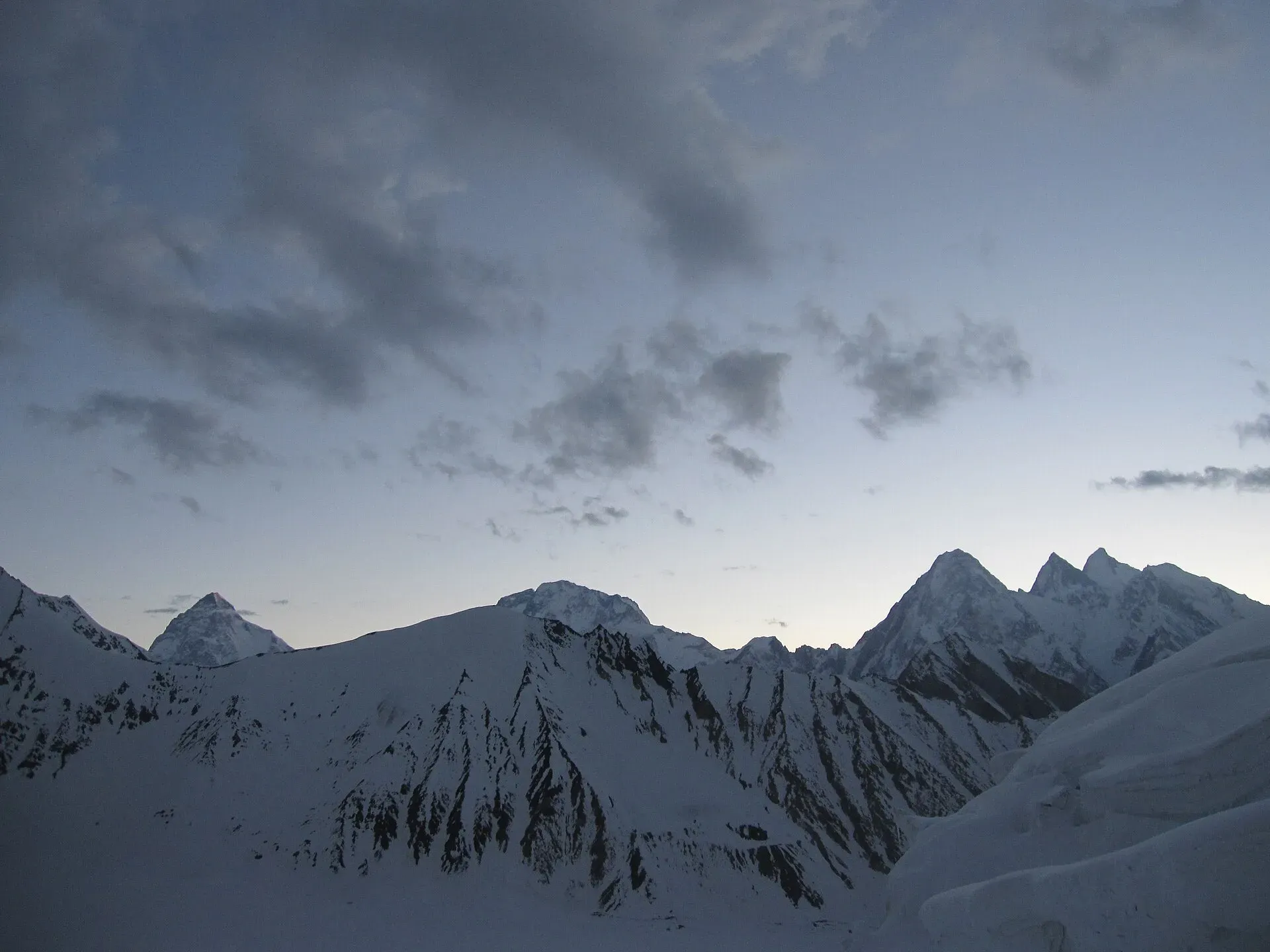
The reward is the view. From the top you see K2, Broad Peak and the Gasherbrums, with Laila Peak to the south. The crossing itself is the hardest day of the trek: you leave Ali Camp (about 5,000 m) in the middle of the night, climb steep snow on the north side with fixed ropes, then descend a loose slope to Gondogoro High Camp (about 4,800 m) and on to Xhuspang and Hushe.
Route and terrain
A route linking Concordia with the Hushe valley over the pass was established in 1986 (Wikipedia). The pass joins the Vigne Glacier on the north-east with the Gondogoro Glacier on the south-west, about 25 km south of K2.
From Concordia, trekkers go to Ali Camp on the Vigne Glacier (the CKNP gives about 4,950 m). The north side is steep snow of up to about 50 degrees, usually with fixed ropes. The south-west side is a longer continuous slope of about the same angle, with rockfall and avalanche risk. Both sides have fixed ropes, and local high-altitude climbers stay near the top in season to maintain them and help. Crossing still needs fitness, earlier acclimatisation and basic mountaineering skills.
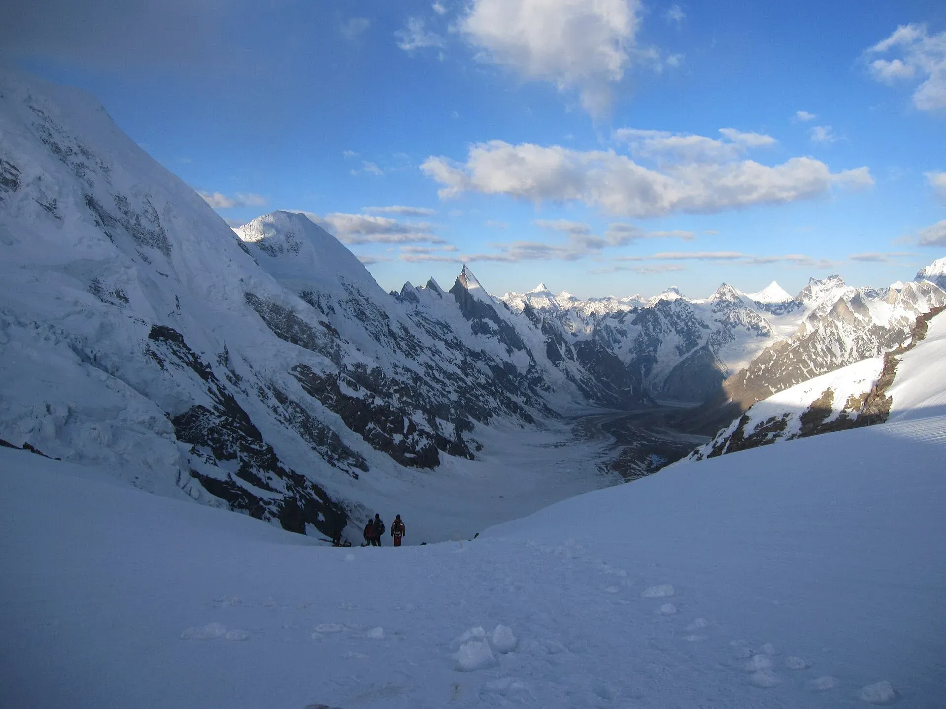
Photo: Shikari7, with thanks · CC BY-SA 3.0 · via Wikimedia Commons · temporary stand-in photo

On the Hushe side the route passes the mouths of the Charakusa and Masherbrum glacier valleys and runs just west of Laila Peak, then reaches the village of Hushe (about 3,200 m). The pass is easier early in the season, from the last days of June, and riskier by August as snow melts and crevasses, avalanches and rockfall increase. Galen Rowell called the area north-east of the pass the "Throne Room of the Mountain Gods". Visible peaks from the top include K2, Broad Peak, Masherbrum, Laila Peak, Gasherbrum I to IV and Trinity Peak. See also Hushe Masherbrum View and Baltoro Glacier.
When to visit
Late June to August. Conditions are best early, when the snow is firm. Later, crevasses open and rockfall increases. Fixed ropes are put up by a rescue team from Hushe, usually from late June to late August, so confirm the dates with your operator.
Where to stay and eat
All camping, with porters and a cook from your operator. The last village on the south side is Hushe, which has guest houses.
Good to know
- Technical. Both sides are snow slopes of up to about 50 degrees. Use harness, helmet, crampons and ice axe. The north side has avalanche danger and a cornice; in 1998 part of it fell and killed two porters (Lonely Planet).
- Permit. Restricted zone. You need a trekking permit through a licensed Pakistani operator, a licensed guide and Central Karakoram National Park fees. Current fees will be added soon.
- Direction. Concordia to Hushe is the usual way: it acclimatises you and has the shorter, easier-to-read north side.
- Rescue. Helicopter evacuation depends on weather. Take insurance.
Highlights
- View of K2, Broad Peak and the Gasherbrums
- Fixed-rope crossing at about 5,585 m
- Links Concordia and the Hushe valley
- Usually the finish of a K2 trek
Getting there
You reach the pass only on foot. The usual route starts at Askole, a long drive from Skardu, then runs up the Baltoro to Concordia. You finish in Hushe, which is reached by road from Khaplu and Skardu.
Tips
- Confirm when the Hushe ropes are fixed
- Leave Ali Camp early so you are on the pass at dawn
- Do the Baltoro approach first to acclimatise
- Hire Hushe guides and porters who know the pass
Photos we still need: Ali Camp and the north-side fixed ropes. Send us yours
Sources and last checked
Last checked Confidence medium7 sources5 still to check
- Last checked
- Method
- Desk research from published sources
- Confidence
- medium
- Checked by
- trek.pk research team
Researched from published sources; not yet checked on the ground by our team. Spot something out of date? Report a mistake.
Sources
- Gondogoro La (old trek.pk page, text from Lonely Planet Trekking in the Karakoram and Hindukush, c. 2002; used for facts only) · trek.pk / Lonely Planet · checked
- Gondogoro Pass · Wikipedia · checked
- Is Gondogoro La trek the king of all treks in Pakistan? · Dawn · checked
- Visiting CKNP: permits, season, logistics (unofficial-looking summary; figures approximate) · cknp.org · checked
- Trekkers and Climbers Stranded Amid Pakistan Permit Dispute (March 2025) · ExplorersWeb · checked
- 9 amazing mountain passes in Pakistan (3 March 2015) · The Express Tribune · checked
- Hushe Valley, Masherbrum and Charakusa (CKNP) · checked
Still to be checked on the ground (5)
- Pass height: 5,585 m (SRTM, Wikipedia) versus about 5,618 m (GPS on the route) versus 5,940 m (2015 list); no official survey figure
- Official permit and CKNP fees (a May 2026 cknp.org article gives figures but is not an official notice, so none is quoted here)
- Dates the Hushe rope team fixes the ropes
- Pass height also given as 5,545 m by CKNP's Hushe valley page
- Photo reuse: the dawn hero photo appears on three pages
Nearby and related

Gondogoro La
Gondogoro Valley

Baltoro Glacier and K2 Base Camp

Masherbrum Base Camp

K7 Base Camp

Central Karakoram National Park
Pakistan's largest protected area, covering about 10,500 square kilometres of the highest mountains on earth: K2, Gasherbrum I and II, Broad Peak and the Baltoro, Biafo and Hispar glaciers.
Khaplu and Hushe
Khaplu, the old Yabgo capital on the Shyok River with its restored palace and mosque, and the Hushe valley beyond, the road end for Masherbrum, K6, K7 and the Gondogoro La.