

Photo: Rizwan Saeed, with thanks · CC BY-SA 4.0 · via Wikimedia Commons · temporary stand-in photo

Shigar Valley
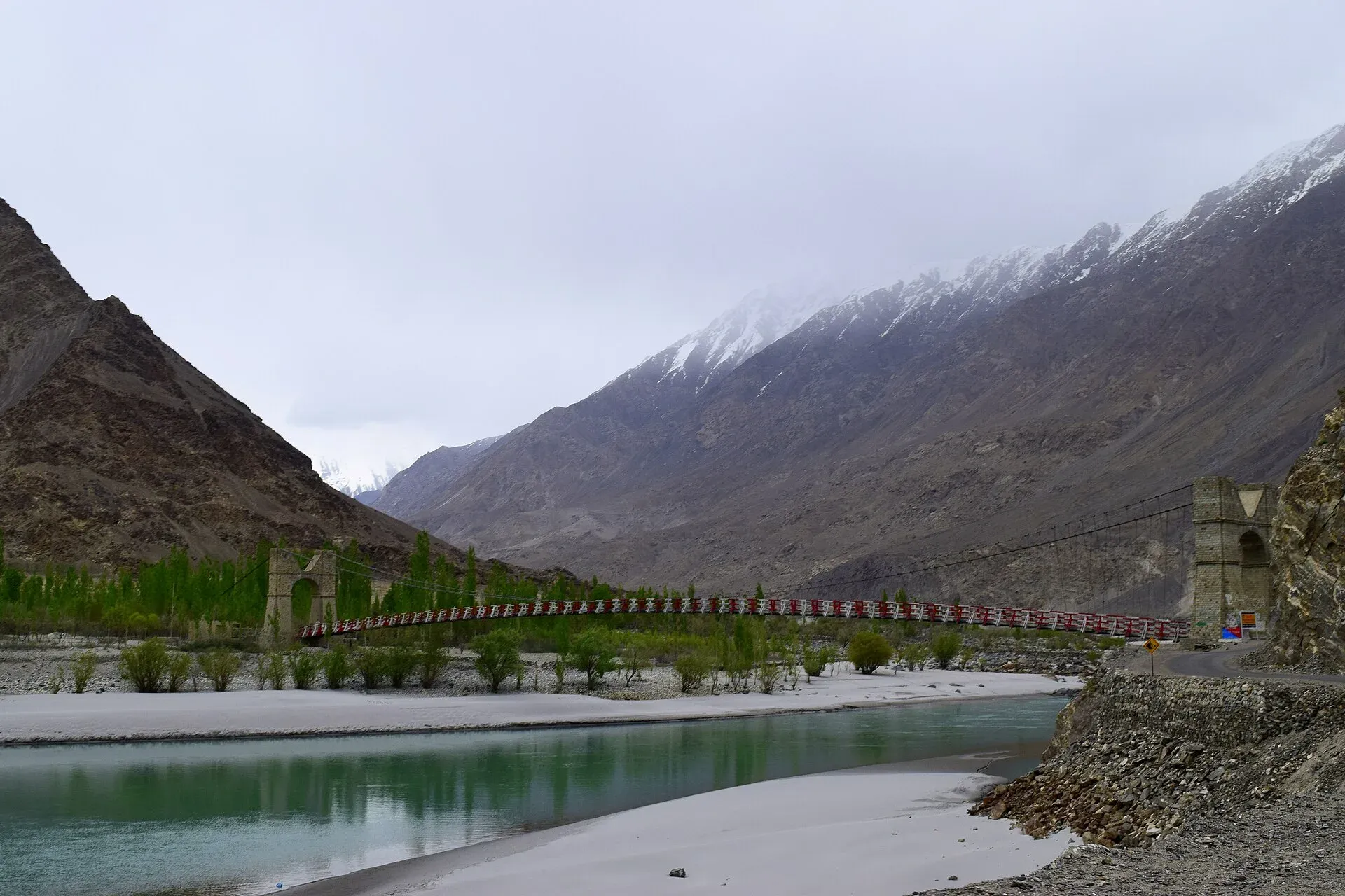
A green valley north-east of Skardu with Shigar Fort, old wooden mosques and orchards, leading to Askole and the trailheads for the Baltoro, Biafo and Hispar treks.
Overview
Shigar is the green valley that leads north-east from Skardu towards the great glaciers of the central Karakoram. The Shigar River waters orchards of apricot, apple, cherry and mulberry, and the road runs on through Shigar town, then to Askole, the last village, where the Baltoro, Biafo and other treks begin. The valley and its district are home to the Balti people, whose language is related to Tibetan, and to some of Baltistan's finest old architecture.
For most visitors the valley is a day trip from Skardu, or an overnight at Shigar town on the way to a trek or to the K2 region.
Plan your visit
- Nearest town
- Shigar
- Getting there
From Skardu, Shigar town is about 38 km by road (OSRM models about 40 minutes; sources range from half an hour to two hours, so allow one to two hours). Askole is about 101 km from Skardu by a rough jeep road. More
Best months
Apr – Oct
- Shigar Valley
- Related places nearby: Deosai National Park, Satpara Lake, Upper Kachura Lake, Khaplu and Hushe, Shigar, Zharba Lake (Blind Lake), Shigar, Basho Valley, Sarfaranga Cold Desert
Getting there
Shigar town is about 38 km from Skardu by OSRM (checked 17 November 2026), modelled at about 40 minutes. Wikivoyage gives 23 km by jeep road and the Gilgit-Baltistan tourism site says about half an hour, while a Serena listing says two hours, so allow one to two hours depending on where you start and the road. Skardu is itself about 212 km from Gilgit by OSRM (modelled at 2 hours 40; allow a full day) and about 646 km from Islamabad. Flights serve Skardu from Islamabad and are weather dependent.
Beyond Shigar the road continues up the Braldu valley to Askole, about 101 km from Skardu by OSRM. It is a rough jeep road, with landslides and river erosion that can close it for days. Hire a 4x4 with an experienced driver.
Sights
- Shigar Fort (Fong Khar, "Palace on the Rock"). The present building dates from the 17th century and was built by the 20th raja of the local Amacha dynasty, on top of a large boulder. Wikipedia says an earlier Amacha fort, Khar-i-Dong, was reportedly built in the 11th century and destroyed in a Mughal invasion. A square baradari (pavilion) stands in a Mughal-style garden on the east side. The Aga Khan Cultural Service Pakistan restored it between 1999 and 2004, and it won a UNESCO Asia-Pacific Heritage Award in 2006. It now houses a small heritage museum and a guest-room residence (Wikipedia says it is managed by Serena Hotels). Neither the AKDN nor the Gilgit-Baltistan page opened gives visiting hours or an entry fee, so ask the residence before you go.
- Amburik Mosque and Khanqah-e-Muallah. Old wooden mosques linked by tradition with Syed Ali Hamadani, who is said to have brought Islam to Baltistan in the late 14th century. Wikipedia gives the Amburik Mosque a 14th-century date without a source and says it was restored in 1998 to 2000 and won a UNESCO Asia-Pacific award in 2005, so treat the age as tradition. These are living places of worship, so ask before entering and dress modestly.
- Shigar Fort and Shigar town. The fort and the wooden Khilangrong Mosque beside it are within easy walking distance of each other.
- The old bazaar and polo ground. Polo is the traditional sport of Baltistan; matches are held at local grounds.
- Basho and Chunda. The official Skardu district sheet lists the Basho and Chunda valleys as worthwhile side visits.
- Views up the valley. The fields and poplars of the lower valley contrast sharply with the dry brown mountains above.
Treks from the valley
Askole is the road end and trailhead for several of the great Karakoram routes. The Baltoro Glacier trek to K2 Base Camp is the best known, and the Hispar La and Biafo crossing also start here. Both are long, demanding treks in restricted zones; use a registered operator. Chogo Lungma Glacier is reached from Doko in the Basha valley and is a shorter alternative. For more routes, see Other treks in Baltistan.
When to go
Shigar town can be visited from April to October. Spring brings orchard blossom, and autumn leaves colour the valley in October. Trekkers use mainly June to September. Winters are cold and dry and the high road beyond Shigar may be closed.
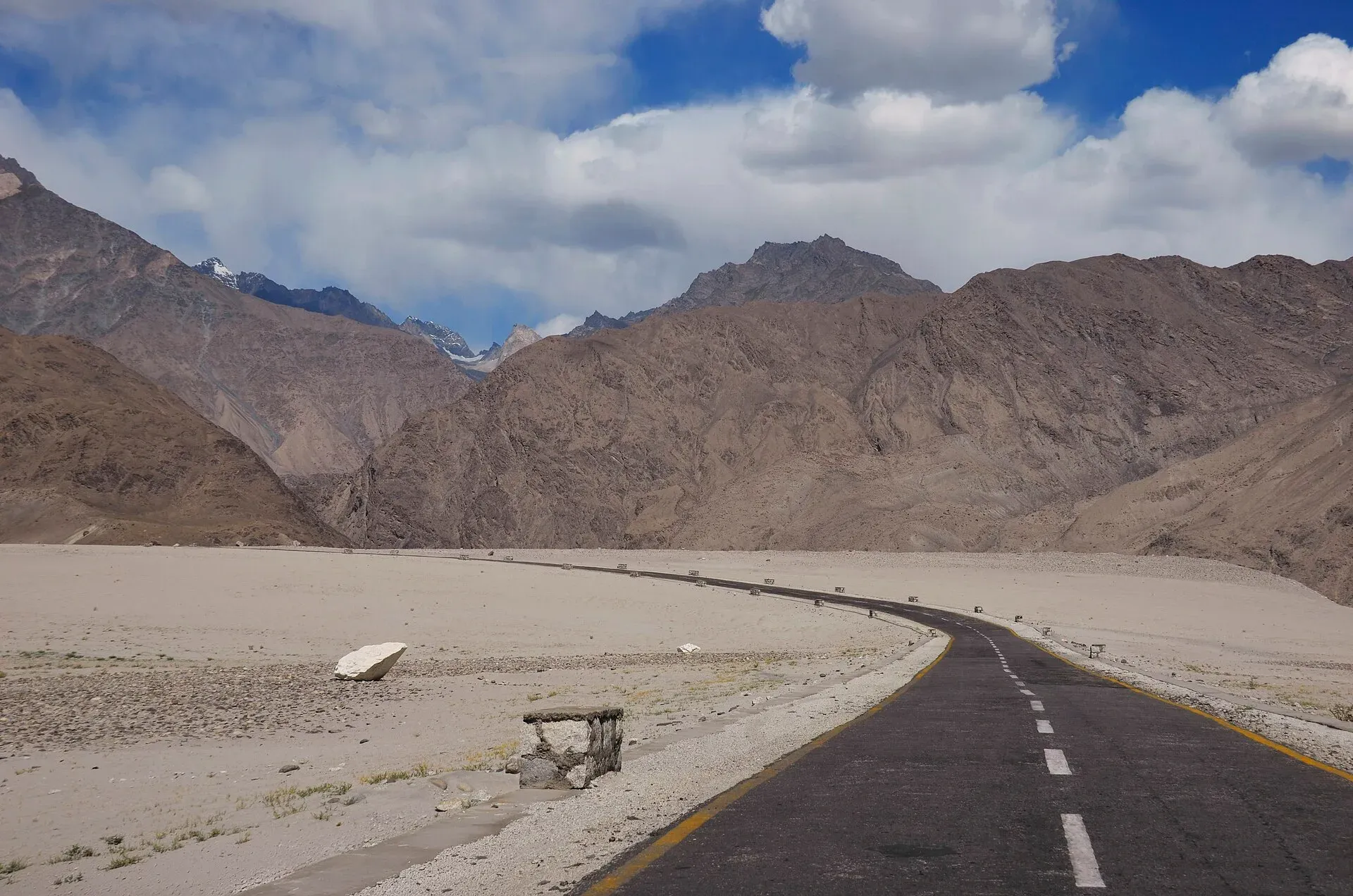
Photo: Raja Munawar, with thanks · CC BY-SA 3.0 · via Wikimedia Commons · temporary stand-in photo

Where to stay and eat
Shigar town has the heritage hotel in the fort and several guest houses, and Skardu has many more options. In villages beyond Shigar, rooms and meals are simple. Local food includes Balti dishes such as soups with noodles, meat or dairy, and apricot products. Order food ahead and carry cash.
Culture and languages
Balti is the local language, and Urdu and English are widely understood. According to Wikipedia, about 65 per cent of the people in Shigar town follow the Shia tradition, 26 per cent follow the Noorbakhshi tradition, and the rest are Sunni. Be respectful of mosques and shrines, and avoid visits during Muharram processions unless invited.
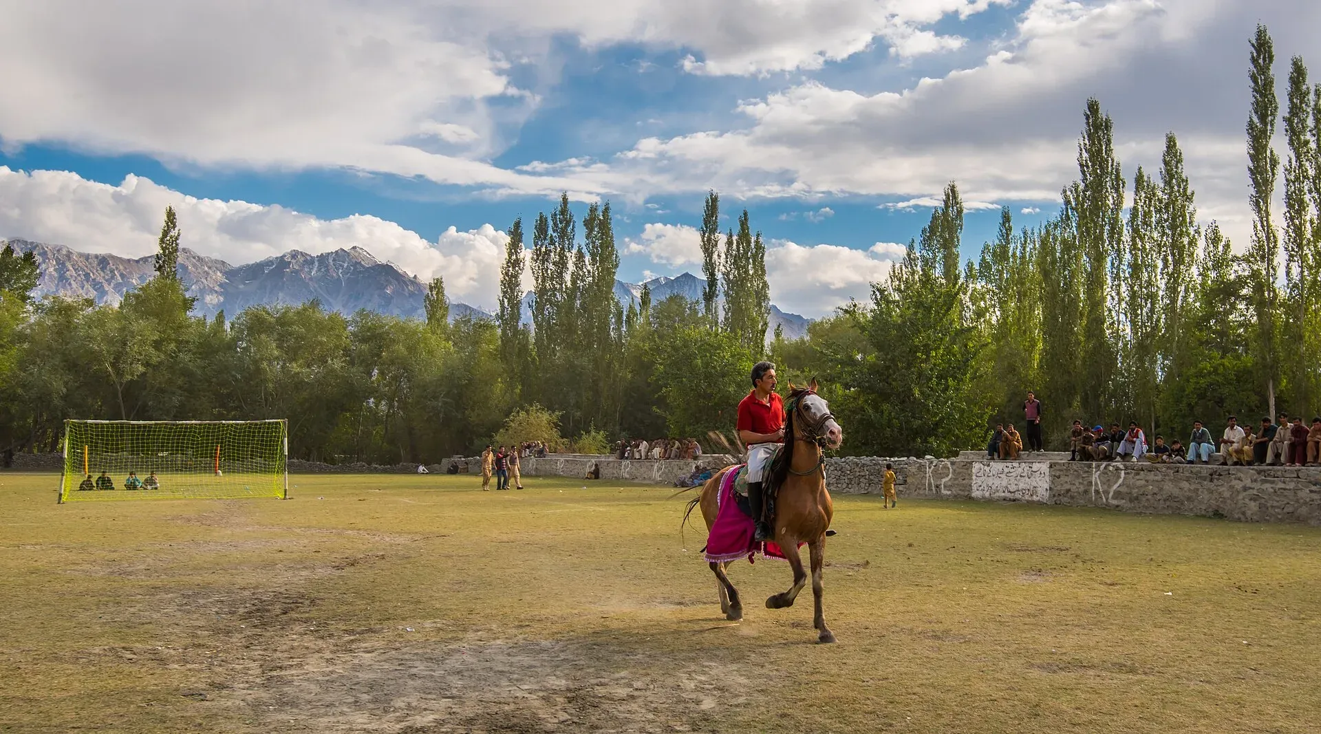
Photo: Moiz Iqbal Ismaili, with thanks · CC BY-SA 4.0 · via Wikimedia Commons · temporary stand-in photo

Safety and practical points
- The road beyond Shigar is rough, and rockfall and washed-out sections are common. Do not travel at night.
- Rivers rise quickly on warm afternoons, so cross only where your guide advises.
- Foreign visitors have not needed an NOC for Gilgit-Baltistan generally since March 2019, but restricted zones need trekking permits. Central Karakoram National Park rules may also apply. Dawn (1 February 2026) reports a sharp increase in permit fees for mountaineering and trekking but gives no amounts. Ask a licensed operator and GB Tourism for current rules and fees.
- Keep your passport or ID with you; there are checkposts.
- The GB Tourist Police helpline is 1422.
Highlights
- Shigar Fort (Fong Khar), restored by the Aga Khan Cultural Service
- Amburik Mosque and Khanqah-e-Muallah
- Orchards, polo and Balti village life
- Road to Askole and the Baltoro and Biafo treks
- Basho and Chunda side valleys
Tips
- Use a 4x4 with an experienced driver beyond Shigar.
- Allow spare days for landslide delays on the Askole road.
- Dress modestly and ask before entering mosques.
- Bring cash; there are few banks beyond Skardu.
Photos we still need: the Braldu valley road to Askole; Askole village and the trailhead; Balti dishes or apricot products. Send us yours
Sources and last checked
Last checked Confidence medium12 sources5 still to check
- Last checked
- Method
- Desk research from published sources
- Confidence
- medium
- Checked by
- trek.pk research team
Researched from published sources; not yet checked on the ground by our team. Spot something out of date? Report a mistake.
Sources
- Land of Peace: District Skardu tourist guide sheet · Tourism & Culture Department, Gilgit-Baltistan · checked
- Shigar (Wikipedia) · Wikipedia · checked
- Shigar Fort (Wikipedia) · Wikipedia · checked
- Shigar Valley (Wikipedia) · Wikipedia · checked
- Skardu (travel guide) · Wikivoyage · checked
- OSRM driving routes (distances and modelled times between towns) · OSRM / OpenStreetMap · checked
- NOC requirements for foreigners visiting Pakistan abolished (26 March 2019) · Dawn · checked
- GB winter adventure tourism hit by soaring permit fee, visa delays (1 Feb 2026) · Dawn · checked
- Amburiq Mosque (Wikipedia) · Wikipedia · checked
- Shigar Valley, district tourist destinations · Gilgit-Baltistan Tourism Department · checked
- Shigar Fort: a new model of conservation · Aga Khan Development Network · checked
- Shigar Fort (Wikipedia), re-read for building history · Wikipedia · checked
Still to be checked on the ground (5)
- Real driving time Skardu to Askole (OSRM gives about 103 km and 2 h 20 but snapped 15 km short of Askole, so it is unreliable; no source with a real jeep time found)
- Entry arrangements and current rates at Shigar Fort (no official page opened gives them; GB tourism page lists a phone, 05811-920173)
- Current trekking permit rules and fees (Dawn, 1 Feb 2026 says fees rose sharply, no amounts; no official fee schedule opened)
- Dating of Amburik Mosque (Wikipedia infobox says 14th century without a source; no scholarly date opened)
- Wooden Khilangrong Mosque photograph (Commons, Goldfish.ranchu) could illustrate Sights once its location next to the fort is confirmed on site
Nearby and related

Baltoro Glacier and K2 Base Camp

Hispar La (Biafo–Hispar traverse)

Chogo Lungma Glacier

Other treks in Baltistan

Central Karakoram National Park
Pakistan's largest protected area, covering about 10,500 square kilometres of the highest mountains on earth: K2, Gasherbrum I and II, Broad Peak and the Baltoro, Biafo and Hispar glaciers.

Deosai National Park
A vast high plateau at about 4,100 m above Skardu and Astore, covered in wildflowers in summer. Created in 1993 to protect the Himalayan brown bear. Open only in summer.

Satpara Lake
A large lake at about 2,600 m, a short drive south of Skardu. It supplies Skardu's water and fed the Satpara Dam. Trout, a small island and the road to Deosai make it an easy half-day outing.

Upper Kachura Lake
A clear lake about 70 m deep at around 2,500 m, near Shangrila, west of Skardu. Also called Foroq Tso, it freezes in winter. A short walk or drive from the road, it is popular for walks and trout fishing.

Khaplu and Hushe
Khaplu, the old Yabgo capital on the Shyok River with its restored palace and mosque, and the Hushe valley beyond, the road end for Masherbrum, K6, K7 and the Gondogoro La.

Shigar
Headquarters of Shigar District in Baltistan, at about 2,230 m on the Shigar River. It is the gateway to the Shigar valley and the Braldu route towards K2, with a 17th-century fort and old mosques.
Zharba Lake (Blind Lake), Shigar
A small lake near the start of the Shigar valley, about 30 minutes by road from Skardu, between the Indus and the Shigar River.
Basho Valley
A side valley in Skardu District, Baltistan, listed as a place worth a side trip from Skardu. Few published details and few visitor services.
Sarfaranga Cold Desert
A dune field at about 2,300 m where the Shigar River meets the Indus, between Shigar and Skardu. Home to the Sarfaranga Cold Desert Jeep Rally, whose 5th edition ran in October 2023.
Skardu, Shigar and Deosai
A 7-day road trip from Islamabad to Skardu, the Shigar valley and the high Deosai Plains, with day-by-day distances, road conditions and the summer-only Deosai season.