

Photo: Gecksproduction, with thanks · CC BY-SA 4.0 · via Wikimedia Commons · temporary stand-in photo

Khunjerab National Park
A high-altitude park on the Pakistan-China border, created in 1975 to protect Marco Polo sheep, snow leopard and Himalayan ibex. It surrounds the Khunjerab Pass on the Karakoram Highway.
Overview
Khunjerab National Park lies at the top of the Hunza valley, along the Karakoram Highway (KKH) as it climbs to the Khunjerab Pass on the border with China. It was formally established on 29 April 1975 on the recommendation of the biologist George Schaller, mainly to protect the Marco Polo sheep. It covers about 2,269 square kilometres (the department's page gives 226,913 hectares), making it one of Pakistan's largest national parks, and more than half of it lies above 4,000 m. It adjoins the Taxkorgan Nature Reserve in China. It is a Category II protected area under IUCN's classification.
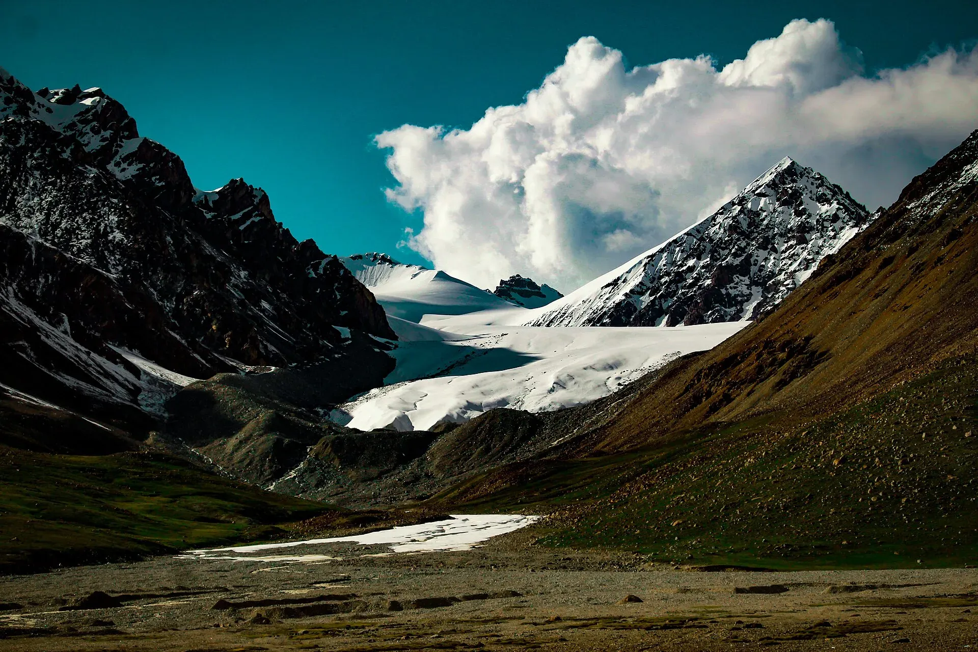
The name comes from Wakhi, and sources explain it differently: one gives "blood" and "stream", another "house" and "creek from a spring". The pass at the border is at 4,693 m (15,397 ft), and the park is a landscape of wide, open valleys, rolling pastures and high ridges, with glaciers above.
Plan your visit
- Nearest town
- Sost
- Getting there
From Gilgit take the Karakoram Highway north through Hunza to Sost, about 8 to 9 hours by road. From Sost the road to the pass takes about 2 to 3 hours. More
Best months
May – Oct
- Khunjerab National Park
- Related places nearby: Khunjerab Pass, Chafchingol Pass, Sost, Passu, Hunza Valley
Landscape and plants
The Gilgit-Baltistan Forest, Wildlife and Environment Department describes five vegetation zones in the park: dry alpine scrub, moist alpine pastures, dry alpine plateau pastures, sub-alpine scrub and birch forest. Its page lists 9 mammals and 66 bird species, and names four landmarks: Jaisam lake, Khunjerab top, Chafchingol peak and Koksil peak. It lists hiking, wildlife viewing, cycling, camping, photography and mountaineering as visitor activities. The Chafchingol area also has a pass; see Chafchingol Pass.
What to see and do
- Drive to the pass. Most visitors make a day trip on the KKH from Sost or Passu to the Khunjerab Pass. The road is paved, but the altitude is the real challenge.
- Wildlife. The park was set up mainly for Marco Polo sheep (Ovis ammon polii; the species Ovis ammon is Near Threatened on the IUCN Red List). Counts are very low: Wikipedia cites about 41 animals in 2012, mostly visitors from China. It also protects Siberian (Himalayan) ibex, blue sheep (bharal), snow leopard (Vulnerable), Tibetan wolf, brown bear, red fox and marmots. Sightings from the road are uncommon; ibex and marmots are the most likely. Birds include lammergeier and golden eagle.
- Khunjerab Pass. The border crossing and the highest point of the road.
- The border. At the top you can see the border gate and a monument. The area around it is sensitive; follow staff instructions and do not photograph military posts.
- Wakhi villages. Villages in the lower valley, such as Shimshal, are reached by jeep or on foot, and their herders use summer pastures near the park's edge.
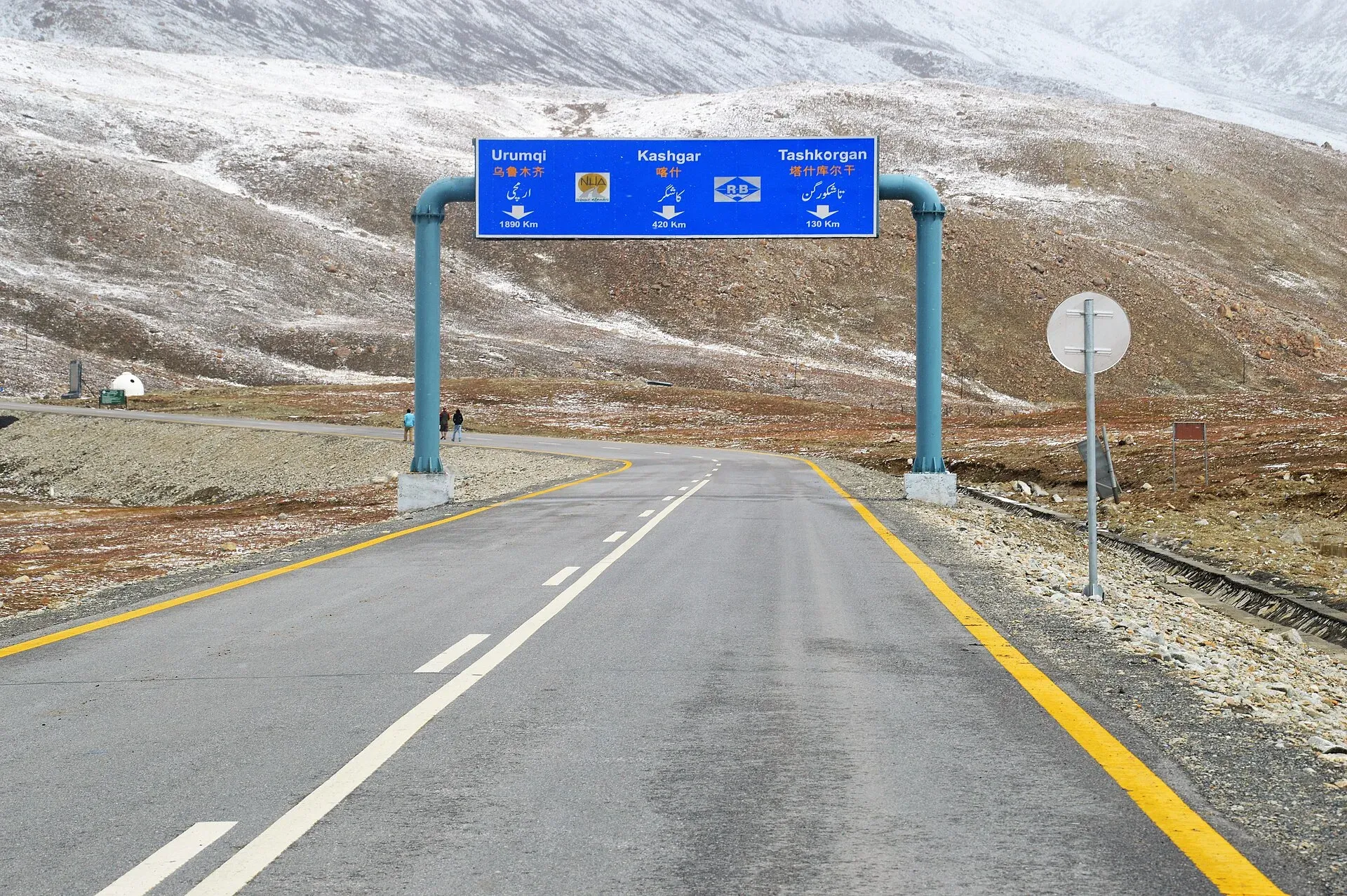
Photo: Muneeb Qazi, with thanks · CC BY-SA 4.0 · via Wikimedia Commons · temporary stand-in photo

When to visit
The road to the pass is usually open to tourists from about April or May to the end of November. Wikipedia reports that it is normally closed to heavy vehicles from 30 November to 1 May and to all vehicles from 30 December to 1 April, but these dates are not fixed and depend on snowfall. The pass is 42 km beyond the park station and checkpoint at Dih, and 75 km from the customs and immigration post at Sost. July to September is warmest, but nights at the top are always cold, and weather can turn quickly. Dates vary each year, so confirm before you travel. The Forest, Wildlife & Environment Department, Gilgit-Baltistan, lists +92 5811-920146 and 920273 for enquiries.
Where to stay and eat
There are guest houses and hotels at Sost and in Passu, Gulmit and Karimabad. There is little at the park itself apart from small tea stalls and the border facilities. Bring water and snacks.
Good to know
- The park has an entry system at the entrance on the highway. A fee may apply. Current fees will be added soon; check with the park office or the provincial wildlife department before you go.
- Foreign visitors use the Sost immigration and checkpoint. Carry your passport and a copy of your visa; check current rules for foreign travellers with the Gilgit-Baltistan tourism department.
- At 4,693 m the air has roughly half the oxygen of sea level. Go up slowly, drink water, and turn back if you have a headache, nausea or dizziness.
- Follow the standard park rules: take your litter out with you, do not light fires outside marked sites, do not pick plants or disturb animals, and do not hunt. Hunting and trapping inside a national park are offences. Ask the park office before flying a drone; many parks need written permission and drones are banned near borders and sensitive sites. Drones are not allowed near the border.
- Marco Polo sheep were once heavily hunted. Report any poaching you see to the park staff.
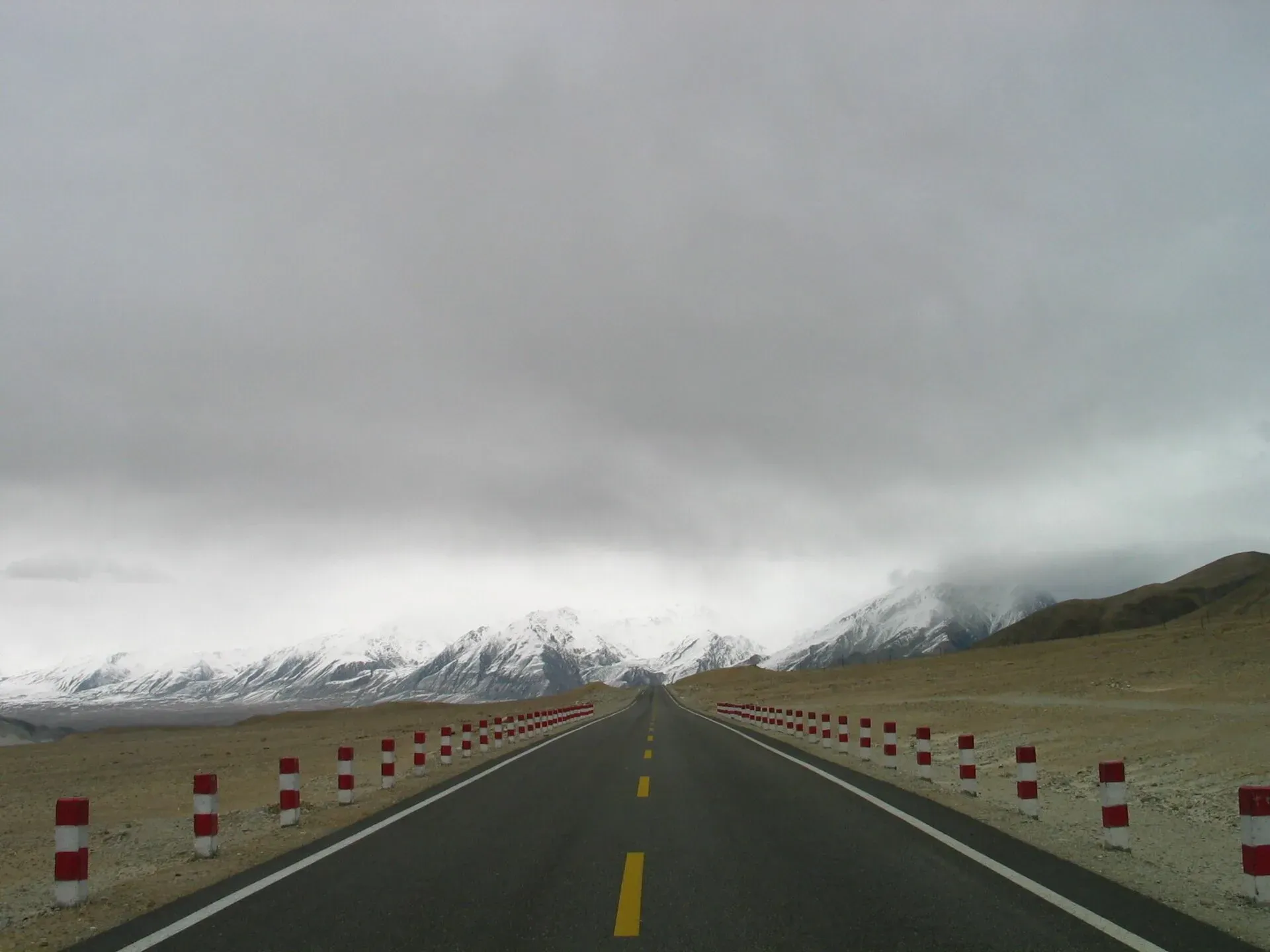
Photo: SandersPoel, with thanks · Public domain (CC0) · via Wikimedia Commons · temporary stand-in photo

Highlights
- Karakoram Highway to the Khunjerab Pass at 4,693 m
- Marco Polo sheep, ibex and snow leopard habitat
- Border crossing to China
- High-altitude grassland and glacier views
Getting there
From Gilgit take the Karakoram Highway north through Hunza to Sost, about 8 to 9 hours by road. From Sost the road to the pass takes about 2 to 3 hours. Most people go from Karimabad, Gulmit or Passu as a long day trip, with an early start. Private cars, hired vehicles and tour coaches use the same road.
Tips
- Allow time for altitude: go slowly and drink water
- Carry warm clothing even in summer
- Confirm road and border opening dates before you go
- Do not photograph military sites
Wildlife
Facilities
- Karakoram Highway access
- Entry checkpoint
- Border gate facilities
- Limited tea stalls
Photos we still need: Marco Polo sheep, ibex or marmots photographed in or near Khunjerab National Park (Commons species photos found are from outside the park). Send us yours
Sources and last checked
Last checked Confidence medium6 sources5 still to check
- Last checked
- Method
- Desk research from published sources
- Confidence
- medium
- Checked by
- trek.pk research team
Researched from published sources; not yet checked on the ground by our team. Spot something out of date? Report a mistake.
Sources
- Khunjerab National Park (Wikipedia) · Wikipedia · checked
- Pakistan Tourism Guide 2021 · TDAP Pakistan · checked
- Khunjerab Pass (Wikipedia) · Wikipedia · checked
- Marco Polo sheep (Wikipedia) · Wikipedia · checked
- Khunjerab National Park (established 1975, about 226,913 ha; department contact numbers) · Forest, Wildlife & Environment Department, Gilgit-Baltistan · checked
- Khunjerab National Park (re-read for vegetation zones, species counts and landmarks) · Forest, Wildlife and Environment Department, Gilgit-Baltistan · checked
Still to be checked on the ground (5)
- Dates the pass is open to tourists this year (Wikipedia gives only the usual closure dates; no official notice found)
- Entry fee and checkpoint procedure at Dih (the department's park page, opened 17 November 2026, lists no fee)
- Current Marco Polo sheep numbers (2012 count of 41 is still the latest found; Mammalia 2018 paper is cited by Wikipedia but was not opened)
- Rules for foreign visitors at Sost (no official source found)
- Whether the Chafchingol area has its own access arrangements or entry fees
Nearby and related

Other treks in Gojal

Khunjerab Pass
The 4,693 m pass on the Karakoram Highway where Pakistan meets China. It is the road crossing between Sost in Gojal and Tashkurgan in Xinjiang, now agreed to run all year.
Chafchingol Pass
A glaciated pass of about 5,100 m between the Ghuzherav and Koksil on the Karakoram Highway. Deep river fords, crevasses and a rope-work descent.

Sost
The last town on the Karakoram Highway before the Chinese border, at about 2,800 m. Sost has Pakistan's immigration and customs offices, a dry port, and is the base for Khunjerab Pass.
Passu
A Wakhi village in Gojal beside the Passu Glacier, below the jagged Passu Cones (Tupopdan, 6,106 m). Known for Hussaini Suspension Bridge, glacier walks and Batura views.

Hunza Valley
A long Karakoram valley on the Karakoram Highway, with Karimabad, Baltit and Altit forts, Ganish village and Attabad Lake, below Rakaposhi and Ultar Sar. About 100 km from Gilgit.