

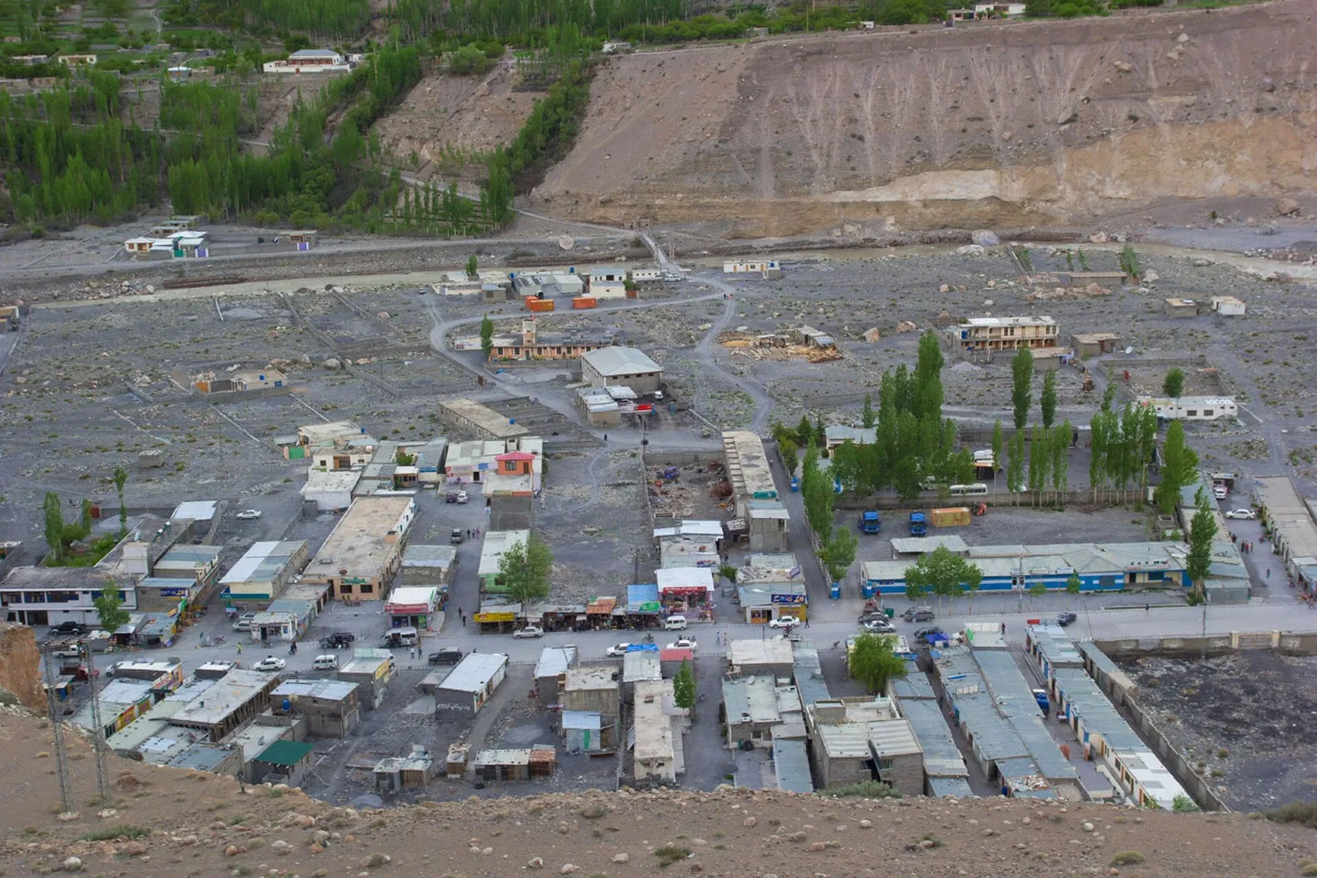
Photo: Sust, with thanks · CC BY-SA 4.0 · via Wikimedia Commons · temporary stand-in photo

Sost
The last town on the Karakoram Highway before the Chinese border, at about 2,800 m. Sost has Pakistan's immigration and customs offices, a dry port, and is the base for Khunjerab Pass.
Overview
Sost (also written Sust) is the border town of Gojal, in Hunza District of Gilgit-Baltistan. It stands at about 2,800 m on the KKH (Wikipedia). Pakistan's immigration and customs departments are based here, and the Silk Route Dry Port handles cargo coming from China. Sost is a working town more than a sightseeing stop, but it is the base for the Khunjerab Pass road.
There is no known census figure for Sost. Wakhi and Burushaski are the main languages. The China-Pakistan Economic Corridor (CPEC), launched in 2016, gave the town a bigger role in trade. Wikipedia reports that trade between the two countries rose from about 50 million US dollars in the mid-1970s to 14.5 billion in 2019, and that the Sost dry port collected over Rs 9.5 billion in 2024, 72 percent more than the year before.
Plan your visit
- Getting there
Road: On the KKH, about 90 km from Karimabad (OSRM, optimistic 1 h 20 min) and about 39 km north of Passu. Khunjerab Pass is about 175 km from Aliabad (GB Tourism). More
Best months
May – Oct
- Sost
- Related places nearby: Khunjerab National Park, Passu, Gulmit, Gojal and Shimshal, Hunza Valley
What to see and do
- Khunjerab Pass: the highest paved border crossing in the world, at 4,693 m (TDAP guide). It is a day trip from Sost.
- Khunjerab National Park: the road to the pass runs through it, with chances to see wildlife such as Marco Polo sheep.
- Border and trade scene: Chinese trucks, customs yards and the bazaar. Wikivoyage describes the immigration office as busy and chaotic, with a health declaration form to fill in, and advises arriving early.
- Chapursan Valley: a side valley that runs north-west from Sost towards Afghanistan, with Wakhi villages, trekking and some guest houses. You reach it by hired jeep. See Gojal and Shimshal.
- Local walks and views: the open valley around the town.
Crossing to China
The Karakoram Highway runs north from Sost to Tashkurgan, Upal and Kashgar in China. Wikivoyage says buses to and from Tashkurgan stop in Sost and that the drive takes roughly five hours. The Northern Areas Transport Corporation (NATCO) runs passenger services between Islamabad, Gilgit and Sost, and a service between Kashgar and Gilgit via Tashkurgan and Sost began in summer 2006. Wikivoyage lists several ticket offices in town; check what is running before you plan, because services and prices change. Crossing needs a Chinese visa and current border rules.
Getting there
- Road: Sost is about 90 km from Karimabad (OSRM about 1 hour 20 minutes, optimistic) and about 39 km from Passu. The Hunza guide gives Khunjerab Pass about 175 km from Aliabad, a drive of about 3 hours 15 minutes.
- Public transport: buses and vans run along the KKH from Gilgit. Check with the Tourist Police (1422).
- To the border: from Sost, Khunjerab Top is roughly 75 to 90 km (sources differ: Wikipedia gives 75 km from the Sost customs and immigration post). Ask at the immigration and tourism offices which permissions you need.
When to visit
May to October is the main season. Dawn reported on 23 April 2025 that Khunjerab Pass was inaugurated for year-round trade and travel (the two governments agreed in December 2024, replacing a 1 April to 30 November schedule), and CGTN reported on 5 January 2026 that it had moved from seasonal to year-round operation. Wikipedia still says heavy vehicles are generally closed from 30 November to 1 May and all vehicles from 30 December to 1 April, but calls those dates not set. Another travel guide for 2026 still says the pass closes when heavy snow makes it impassable. In 2023 the pass was closed for four months in winter, so treat winter opening as uncertain and ask locally.
Where to stay and eat
Accommodation is limited and simple: guesthouses and hotels in the bazaar and customs area, with a larger hotel on the main road. Many people overnight here to start early for the pass. Food is basic: rice, meat, bread and tea. Restaurants and street-food stalls line the highway through town, and general stores, mechanics and souvenir shops serve passing traffic. Mobile coverage (SCOM) is available in town, but internet is slow at peak hours.
Treks and day trips
- Khunjerab Top, with permission.
- Passu and Gulmit, to the south.
- Treks from the Gojal and Shimshal areas; see the trek page.
Safety and good to know
Carry your passport at all times; officials check documents here. Altitude and weather change quickly at Khunjerab. Photography near customs and border facilities is restricted, so ask first. Entry charges and permits for the park are not confirmed here; current fees will be added soon. Crossing into China needs a Chinese visa and current border rules, which change.
Highlights
- Pakistan-side border town for China
- Base for Khunjerab Pass (4,693 m)
- Silk Route Dry Port
- Gateway to Khunjerab National Park
Stay, eat and essentials near Sost
Within 8 km of Sost, nearest first.
Places to stay
- Hotel Blue Moon SostCall Hotel Blue Moon SostMap of Hotel Blue Moon Sost in Google Maps
- Sost BazarMap of Sost Bazar in Google Maps
- Border Taste Point Hotel And RestaurantCall Border Taste Point Hotel And RestaurantMap of Border Taste Point Hotel And Restaurant in Google Maps
- Gems Palace Hotel SostCall Gems Palace Hotel SostMap of Gems Palace Hotel Sost in Google Maps
- Riveria Hotel SostCall Riveria Hotel SostMap of Riveria Hotel Sost in Google Maps
- PTDC Motel Afiyatabad sostCall PTDC Motel Afiyatabad sostMap of PTDC Motel Afiyatabad sost in Google Maps
Places to eat
- Khunjerav Cafe'Map of Khunjerav Cafe' in Google Maps
- Punjab Foods hotelMap of Punjab Foods hotel in Google Maps
Essential services fuel stations, banks and hospitals and clinics
Fuel
- Attock Petrol Pump,Afiyatabad, SostMap of Attock Petrol Pump,Afiyatabad, Sost in Google Maps
- PSO SostCall PSO SostMap of PSO Sost in Google Maps
- Total PARCO, Kashgar Filling Station SostCall Total PARCO, Kashgar Filling Station SostMap of Total PARCO, Kashgar Filling Station Sost in Google Maps
Hospitals and clinics
- Aga Khan Health Center SostCall Aga Khan Health Center SostMap of Aga Khan Health Center Sost in Google Maps
Listings come from Google Maps data and are unverified: phone numbers, opening months and prices may have changed. Report a problem · Own one of these? Claim it
Tips
- Start early for Khunjerab, and bring warm clothes.
- Carry your passport and a copy.
- Check the pass and the road with locals before a winter trip.
- Do not photograph customs or border facilities without asking.
Photos we still need: Sost bazaar and the Chapursan road junction. Send us yours
Sources and last checked
Last checked Confidence medium8 sources4 still to check
- Last checked
- Method
- Desk research from published sources
- Confidence
- medium
- Checked by
- trek.pk research team
Researched from published sources; not yet checked on the ground by our team. Spot something out of date? Report a mistake.
Sources
- Sost, Pakistan · Wikipedia · checked
- Khunjerab Pass opens for year-round trade and travel (23 April 2025) · Dawn · checked
- Khunjerab Pass on CPEC welcomes the New Year's first light (5 January 2026) · CGTN · checked
- District Hunza tourist guide and map · Tourism & Culture Department, Gilgit-Baltistan (tourism.gov.pk) · checked
- OSRM driving route service: distances and times measured 16 November 2026 (times are optimistic, without stops) · OSRM / OpenStreetMap · checked
- Pakistan Tourism Guide 2021 · TDAP Pakistan · checked
- Khunjerab Pass · Wikipedia · checked
- Sost · Wikivoyage · checked
Still to be checked on the ground (4)
- Whether Khunjerab Pass actually stays open in deep winter for tourist traffic (official year-round agreement Dec 2024; Wikipedia still lists snow closures; no winter 2025-26 report for tourists found)
- Distance Sost to Khunjerab Top (Wikipedia 75 km from Sost customs; other sources 80 to 90 km; the tourism.gov.pk Hunza PDF could not be read)
- Permissions for foreign visitors to the pass (Dawn, CGTN and Wikipedia say nothing on tourist permits)
- Current bus and minibus services from Sost to Tashkurgan and their ticket offices (Wikivoyage lists some; undated)
Nearby and related

Khunjerab National Park
A high-altitude park on the Pakistan-China border, created in 1975 to protect Marco Polo sheep, snow leopard and Himalayan ibex. It surrounds the Khunjerab Pass on the Karakoram Highway.

Passu
A Wakhi village in Gojal beside the Passu Glacier, below the jagged Passu Cones (Tupopdan, 6,106 m). Known for Hussaini Suspension Bridge, glacier walks and Batura views.

Gulmit
The administrative centre of Gojal (Upper Hunza), at 2,465 m on the Karakoram Highway. A calm base for Ghulkin, Borith Lake, the museum and fort walks.

Gojal and Shimshal
Upper Hunza: Gulmit, Ghulkin, Passu and Sost on the Karakoram Highway, with big glaciers and the Passu Cones, plus the remote Shimshal valley, its Wakhi village and its mountaineering community.

Hunza Valley
A long Karakoram valley on the Karakoram Highway, with Karimabad, Baltit and Altit forts, Ganish village and Attabad Lake, below Rakaposhi and Ultar Sar. About 100 km from Gilgit.

Gilgit-Baltistan
Pakistan's far north: three great ranges meet here, with K2, Nanga Parbat, giant glaciers, the Karakoram Highway and the valleys of Hunza, Skardu and Gilgit.

Hunza and Khunjerab (KKH)
A 7-8 day road trip from Islamabad up the Karakoram Highway to Hunza and on to Khunjerab Pass (4,693 m), with overnight stops at Besham, Chilas and Gilgit.

Islamabad to Khunjerab and the China Border
An overland guide from Islamabad to Khunjerab Pass (4,693 m) on the KKH, with the border rules to check: who can visit the top, who can cross to China, and the seasons.