

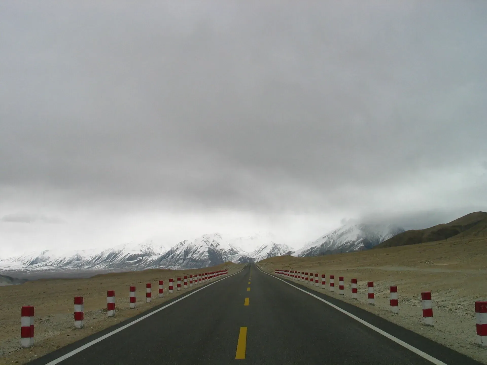
Photo: SandersPoel, with thanks · Public domain (CC0) · via Wikimedia Commons · temporary stand-in photo

Khunjerab Pass
The 4,693 m pass on the Karakoram Highway where Pakistan meets China. It is the road crossing between Sost in Gojal and Tashkurgan in Xinjiang, now agreed to run all year.
Overview
Khunjerab Pass is where the Karakoram Highway (N-35) crosses the border between Gilgit-Baltistan and the Xinjiang region of China. Wikipedia gives its height as 4,693 m, and the 2021 TDAP guide describes it as the highest border crossing in the world. The paved road over the pass was completed in 1982. It is a road pass, not a trekking pass: you drive, and the effort is in the altitude.
Pakistan's customs and immigration post is at Sost, 75 km below the pass. On the Chinese side, the port of entry is about 3.5 km beyond the top, in Tashkurgan County. From there it is 130 km to Tashkurgan and 420 km to Kashgar. The route is part of the China-Pakistan Economic Corridor (CPEC). The name is said to come from Wakhi, the language of Gojal: khun is house and jerab a creek fed by a spring or waterfall.
Plan your visit
- Nearest town
- Sost
- Getting there
From Sost, drive 75 km north on the Karakoram Highway (N-35), about 2 to 3 hours each way. Sost is about 6 to 7 hours from Gilgit and 2 hours from Karimabad. Hire a car with a driver in Sost or Hunza. More
Best months
May – Oct
- Khunjerab Pass
- Related places nearby: Khunjerab National Park, Sost, Passu, Gojal and Shimshal
The road and its history
China and Pakistan chose this line in 1966. Wikipedia says China favoured Khunjerab over the older Mintaka route because Mintaka was more exposed to air attack, even though Khunjerab is steeper. The paved road replaced the unpaved Mintaka and Kilik passes as the main crossing of the Karakoram. A daily bus between Gilgit and Kashgar began on 1 June 2006.
The border is also where traffic changes sides: Pakistan drives on the left and China on the right. The distance board on the approach road gives a sense of scale. It is 270 km from Gilgit and 870 km from Islamabad to the pass, by Wikipedia's figures.
What to see and do
The drive from Sost climbs through Khunjerab National Park. The park station and checkpoint at Dih is about 42 km from the pass. Near the top, the valley opens into bare, rolling high ground. The pass itself is long and fairly flat, and often snow-covered in winter. Visitors see the border gates and the view across into China. A roadside bank machine near the top, run by the National Bank of Pakistan, is described as the highest in the world; the BBC reported on it in October 2022.
Most visitors come as a day trip from Sost, Passu or Karimabad. Take time to adjust to the height before walking about at the top.
The park and its wildlife
Khunjerab National Park was established on 29 April 1975 and covers about 2,269 sq km, making it Pakistan's third largest national park (Wikipedia). More than half of it lies above 4,000 m. It adjoins the Taxkorgan Natural Reserve in China.
Wikipedia lists snow leopard, Marco Polo sheep, Siberian ibex and bharal (blue sheep) among the mammals, and bearded vulture and golden eagle among 45 bird species. Most of these animals are shy and rarely seen from the road. Semi-wild yaks graze in the park. As a national park, hunting and farming are banned; keep to the road and do not feed or chase animals.
When to visit
For years the pass was open to traffic only from 1 April to 30 November under a 1985 agreement. Pakistan and China agreed in December 2024 to keep it open all year, and Dawn reported a virtual inauguration of year-round trade and travel on 22 April 2025. Even so, snow and slides can close the road for days, and Wikipedia notes that the older closure dates (about 30 November to 1 May for heavy vehicles, 30 December to 1 April for all vehicles) were never fixed. Clearing snow can take from days to weeks. For sightseeing, May to October is the practical window. Ask at Sost before you set out.
Where to stay and eat
There is nothing at the top. Stay in Sost, Passu, Gulmit or Karimabad and carry water and snacks. Sost has basic hotels and restaurants.
Good to know
- Permits and fees. Expect checks at Sost and at the national park checkpoint, and a park fee may apply. Current fees will be added soon; check with Gilgit-Baltistan Tourism or the park office.
- Crossing into China. Crossing is not simply a matter of driving over. You need a valid Chinese visa and must follow the rules of both countries. We have not confirmed the current rules for foreign travellers from an official source, so check with the Sost immigration post and your operator before planning a through journey.
- Local conditions. Ask the district administration or local police about current conditions before you go.
- Travel advice. For foreign visitors: the UK FCDO (updated 27 October 2026) advises against all travel on the Karakoram Highway between Mansehra and Chilas, which affects the road from Islamabad. It does not advise against Gilgit-Baltistan generally. Re-check before you travel.
- Altitude. At almost 4,700 m, headaches and breathlessness are common. Do not sleep high on arrival.
Highlights
- Pakistan-China border at 4,693 m on the Karakoram Highway
- Drive through Khunjerab National Park, snow leopard country
- Sost customs post 75 km below the top
- Year-round operation agreed from December 2024
Getting there
From Sost, drive 75 km north on the Karakoram Highway (N-35), about 2 to 3 hours each way. Sost is about 6 to 7 hours from Gilgit and 2 hours from Karimabad. Hire a car with a driver in Sost or Hunza. On the way up the road passes the park checkpoint at Dih, about 42 km below the top. The China-Pakistan friendship monument stands at Attabad, well down the valley, about 150 km from the border. For the full journey from Islamabad see the Khunjerab road-trip pages.
Tips
- Check the road at Sost before leaving: snow and slides close it at short notice
- Carry a passport or CNIC and be ready to register at checkpoints
- Go early, as afternoon cloud and cold arrive quickly
- Do not cross the border line without the correct visa and papers
Photos we still need: Dih checkpoint and the park wildlife (no suitable open-licence image found). Send us yours
Sources and last checked
Last checked Confidence medium5 sources3 still to check
- Last checked
- Method
- Desk research from published sources
- Confidence
- medium
- Checked by
- trek.pk research team
Researched from published sources; not yet checked on the ground by our team. Spot something out of date? Report a mistake.
Sources
- Khunjerab Pass (Wikipedia) · Wikipedia · checked
- Khunjerab Pass virtually inaugurated for year-round trade and travel (23 April 2025) · Dawn · checked
- Pakistan Tourism Guide 2021 · TDAP Pakistan · checked
- Pakistan travel advice (updated 27 October 2026) · UK FCDO · checked
- Khunjerab National Park (Wikipedia) · Wikipedia · checked
Still to be checked on the ground (3)
- Current rules for foreign nationals at the top and crossing to China (no official source found)
- Khunjerab National Park fees and Sost registration (Wikipedia mentions the Dih checkpoint only; no fees)
- Khunjerab National Park entry fee and registration points (no official source)
Nearby and related

Boisum and Chafchingol Passes

Other treks in Gojal

Khunjerab National Park
A high-altitude park on the Pakistan-China border, created in 1975 to protect Marco Polo sheep, snow leopard and Himalayan ibex. It surrounds the Khunjerab Pass on the Karakoram Highway.

Sost
The last town on the Karakoram Highway before the Chinese border, at about 2,800 m. Sost has Pakistan's immigration and customs offices, a dry port, and is the base for Khunjerab Pass.
Passu
A Wakhi village in Gojal beside the Passu Glacier, below the jagged Passu Cones (Tupopdan, 6,106 m). Known for Hussaini Suspension Bridge, glacier walks and Batura views.

Gojal and Shimshal
Upper Hunza: Gulmit, Ghulkin, Passu and Sost on the Karakoram Highway, with big glaciers and the Passu Cones, plus the remote Shimshal valley, its Wakhi village and its mountaineering community.

Hunza Valley
A long Karakoram valley on the Karakoram Highway, with Karimabad, Baltit and Altit forts, Ganish village and Attabad Lake, below Rakaposhi and Ultar Sar. About 100 km from Gilgit.

Karimabad (Hunza)
The main town of Hunza, set on a terrace below Baltit Fort with Rakaposhi, Ultar and Diran in view. A good base for forts, viewpoints, Attabad Lake and the road to Gojal.

Hunza and Khunjerab (KKH)
A 7-8 day road trip from Islamabad up the Karakoram Highway to Hunza and on to Khunjerab Pass (4,693 m), with overnight stops at Besham, Chilas and Gilgit.

Islamabad to Khunjerab and the China Border
An overland guide from Islamabad to Khunjerab Pass (4,693 m) on the KKH, with the border rules to check: who can visit the top, who can cross to China, and the seasons.

Silk Road (KKH)
The Karakoram Highway as an ancient Silk Road: rock carvings, Buddha figures and the forts of Hunza, up to the Khunjerab Pass. A five-day plan from Gilgit with measured distances and current advice.