

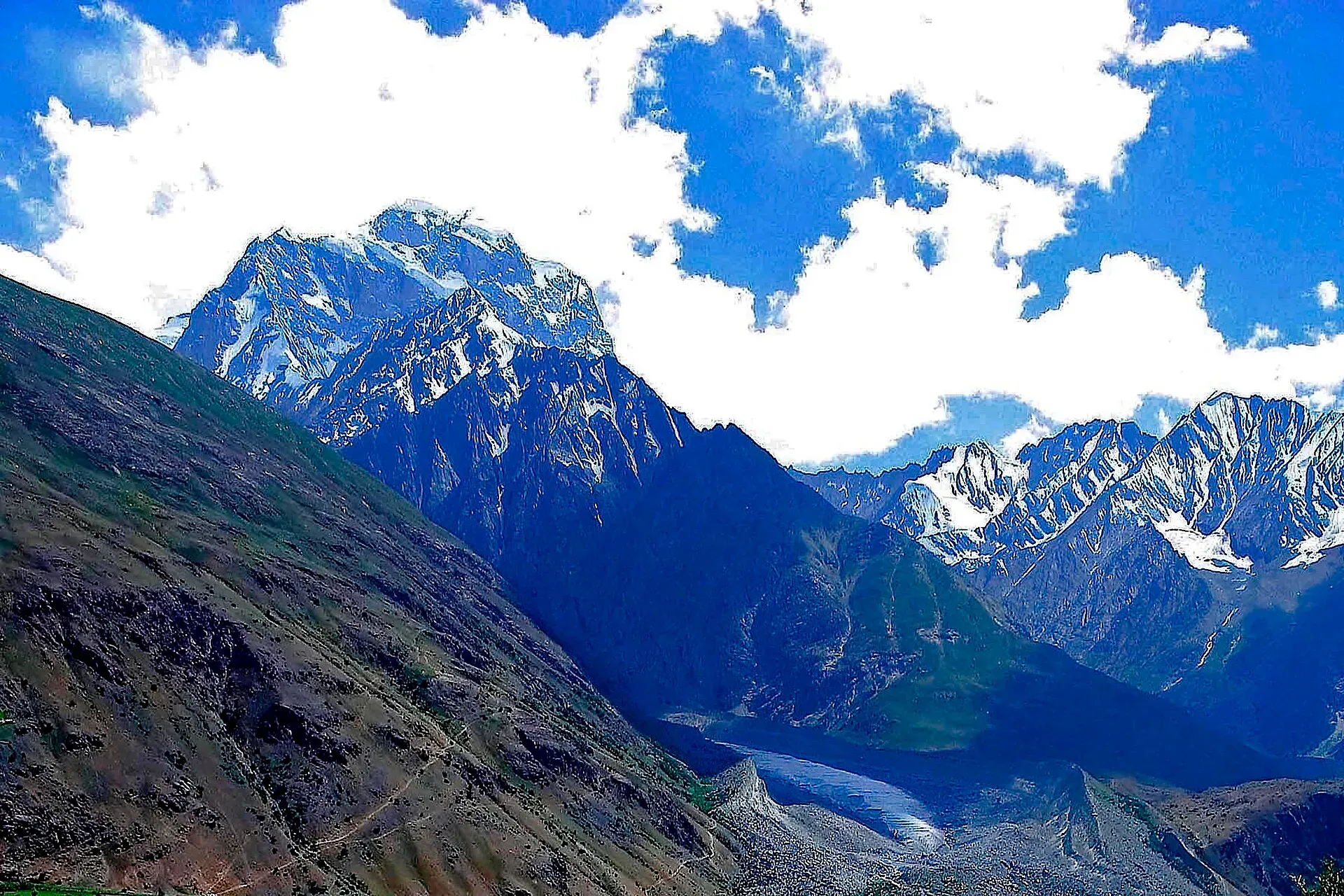
Photo: Pervez Ahmad Khan, with thanks · CC BY-SA 3.0 · via Wikimedia Commons · temporary stand-in photo

Koyo Zom
Koyo Zom (6,872 m) is the highest peak of the Hindu Raj, on the Upper Chitral and Gilgit-Baltistan boundary. First climbed in 1968 by an Austrian expedition via the Yarkhun valley.
Overview
Koyo Zom is the highest peak of the Hindu Raj, the range between the Hindu Kush and the Karakoram. It stands at 6,872 m, on the boundary of Upper Chitral District in Khyber Pakhtunkhwa and Gilgit-Baltistan. The 1968 first ascent report and Wikipedia (citing Peaklist) give 6,872 m; the American Alpine Journal's 2019 report gives 6,877 m.
Plan your visit
- Nearest town
- Chitral
- Getting there
Reach Chitral by road via the Lowari route or by air when flights operate, then travel up the Yarkhun valley towards Pechus. Conditions change; ask KP Tourism in Chitral. More
Best months
Jun – Sep
- Koyo Zom
- Related place nearby: Broghil Valley National Park
Approach
The 1968 Austrian team drove to Chitral and hired 12 donkeys to carry loads up the Yarkhun valley to Pechus. Their base camp stood near a hot spring at Pechus, at 3,255 m, and the team stayed about four weeks. The Himalayan Journal report does not name the villages on the way or give heights for intermediate camps.
The 2019 British team took a different line in. They drove by jeep over dusty, bumpy roads, two days from Chitral, to a footbridge over the Yarkhun River. From there a 90-minute walk up a side valley (a photo caption calls it the Koyo valley) led to base camp at about 3,500 m. Advanced base camp was about 1,000 m higher.
Climbing history
- 1968, first ascent. In the first two weeks the Austrians explored and climbed smaller peaks, then climbed the 6,000 m summits above the Chhatiboi and Pechus glaciers. Either glacier gives access to the upper plateau of the Pechus glacier. On 17 August Viktoria Hribar and Gerulf Wilhelm climbed about 3,500 feet from the highest camp, going up the south-east face to the east ridge. The obstacles were a rock buttress that blocked the ridge, passed by an ice wall on the face, a corniced ridge, an ice-covered rock buttress and an ice ridge that flattened below the summit. About half the climbing was roped. Elfriede Baltuska, Günther Wohrl and Albert Stamm made the second ascent on 23 August. A Japanese expedition had tried the mountain during the same period and failed.
- Other peaks. The same expedition made first ascents of Pechus Zom (6,514 m, 21 August) and Gahkush (6,111 m, 11 August), and second ascents of Das Bar Zom and Gainthir Chish.
- 1974. British climbers repeated the east side route.
- 2019, new route. Ally Swinton and Tom Livingstone climbed the north-west face, a steep icefield leading to a mixed headwall and the summit ridge, rated about 1,500 m, ED+. They started on 24 September and summited around 1 pm on 28 September, then descended the east face to the Pechus glacier. It was only the third ascent of the mountain. The day after the summit one of them fell through a snow bridge into a crevasse and was injured; they used a satellite SOS device, waited about a day and a half and were lifted off by helicopter. The account is a reminder of how remote the mountain is.
Terrain and conditions
The routes described in the sources are glacier and ice-face climbs, with crevasses on the Pechus glacier and cold bivouacs high on the face. No trekking route to a base camp is published beyond the two approaches above. The 2019 team found mostly settled weather in late September.
When to visit
The 1968 expedition climbed in July and August; the 2019 climb was in late September. Winter conditions in the upper Yarkhun are severe.
Nearby
The Yarkhun valley leads up to the Broghil and the Hindu Raj passes. Other treks that look at the Hindu Raj are in the Other Treks in Chitral page.
Where to stay and eat
Chitral town has hotels and shops. Further up the Yarkhun valley there are small village guesthouses and then camping.
Good to know
- Permits. Peaks above 6,500 m need a climbing permit through a licensed operator; Chitral also needs an NOC for foreign visitors. Current fees will be added soon; ask KP Tourism or a licensed operator.
- Access. Current road conditions in the Yarkhun valley are unchecked; the only recent account is the 2019 expedition. Ask in Chitral for the current position.
- Safety. Glaciated terrain, avalanche and remoteness; carry a satellite phone and use experienced guides.
- Travel advice. For foreign visitors: the UK FCDO advises against all travel on the N-45 highway to the edge of Chitral city (page updated 27 October 2026, checked 16 November 2026). Ask the district administration or local police about current conditions, and read the live page.
Highlights
- Highest peak of the Hindu Raj, 6,872 m
- On the Chitral and Gilgit-Baltistan boundary
- First climbed on 17 August 1968
- Approached through the Yarkhun valley
- New route on the north-west face in 2019
Getting there
Reach Chitral by road via the Lowari route or by air when flights operate, then travel up the Yarkhun valley towards Pechus. Conditions change; ask KP Tourism in Chitral.
Tips
- Get local advice in Chitral on the Yarkhun road before leaving.
- Allow time for the NOC and permit.
- Expect a long, remote approach.
Photos we still need: Koyo Zom summit or the Pechus glacier; Yarkhun valley road or the Pechus hot spring base camp. Send us yours
Sources and last checked
Last checked Confidence medium5 sources3 still to check
- Last checked
- Method
- Desk research from published sources
- Confidence
- medium
- Checked by
- trek.pk research team
Researched from published sources; not yet checked on the ground by our team. Spot something out of date? Report a mistake.
Sources
- Koyo Zom · Wikipedia · checked
- Koyo Zom, Pechus Zom and other peaks of Hindu Raj, 1968 · The Himalayan Journal, vol. 29 · checked
- The Great Game: a difficult new route up Koyo Zom · American Alpine Club · checked
- Pakistan travel advice: warnings and insurance · UK Foreign, Commonwealth & Development Office (FCDO) · checked
- Fees and Paperwork for a Karakorum Trek (peaks above 6,500 m need a climbing permit; Alpine Club of Pakistan quoted) · ExplorersWeb · checked
Still to be checked on the ground (3)
- Height: 6,872 m (Wikipedia/Peaklist, 1968 report) or 6,877 m (American Alpine Journal 2020); unresolved
- Current road access up the Yarkhun valley (only a 2019 expedition account found)
- Permit rules and NOC for 2027 (no official source found)
Nearby and related

Other treks in Chitral

Chitral Valley
The long Chitral River valley at the foot of the Hindu Kush, with Chitral town's fort and Shahi Mosque, the Lowari Tunnel route, Tirich Mir views and side valleys leading to Kalash and Shandur.

Chitral
The main town of Lower Chitral District, at about 1,500 m on the Chitral River, with a historic fort, a royal mosque and views of Tirich Mir. The base for the Kalash valleys.

Broghil Valley National Park
A remote high valley at the northern tip of Chitral beside the Wakhan Corridor, with about 30 lakes, glaciers, Wakhi and Kyrgyz communities and rare wildlife. Reached only by a long mountain drive.

Laspur Valley
A high side valley in Upper Chitral on the road to Shandur Pass, with Mastuj, Sor Laspur and lakes, and trek links to Swat and Ghizer. Information is limited, so confirm road and rules locally.
Garam Chashma (Pechugh), Upper Yarkhun
A hot spring in the upper Yarkhun valley, Upper Chitral, reached by a bridge near Vidinkot on the Broghil trek. Not the Garam Chashma of the Lotkoh valley. Known only from trek and climbing reports.