

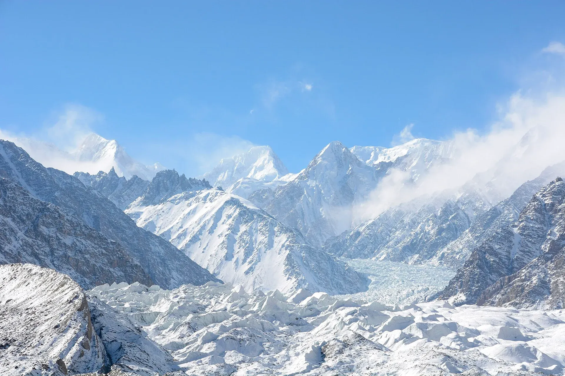
Photo: Theprotrekker, with thanks · CC BY-SA 4.0 · via Wikimedia Commons · temporary stand-in photo

Kunyang Chhish
Kunyang Chhish (7,852 m) is the second highest peak of the Hispar Muztagh, rising over the Hispar Glacier above Nagar and Shimshal. Few have climbed it and it is known for its steep, hard routes.
Overview
Kunyang Chhish, also written Khinyang or Khunyang Chhish, is 7,852 m high, the second highest mountain in the Hispar Muztagh and the 21st highest in the world. Some sources give 7,823 m. In Burushaski the name means roughly "the corner peak". It stands on the northern side of the Hispar Glacier, north-east of the point where the Hispar and Kunyang glaciers meet, and it is the source of the Yazghil Glacier, which ends in the Shimshal valley. Distaghil Sar, the highest peak of the Hispar Muztagh, lies to the north, and the two share a high col. Kunyang Chhish rises about 4,000 m above its southern base camp on the Kunyang Glacier.
Plan your visit
- Nearest town
- Hispar
- Getting there
Drive the Karakoram Highway to Hunza or Nagar, then travel by jeep to Hispar village (for the Hispar glacier) or to Shimshal. Both treks use licensed operators; see the Hispar La trek page. More
Best months
Jun – Sep
- Kunyang Chhish
- Related places nearby: Hispar Glacier, Gojal and Shimshal
The massif
The main massif has five peaks apart from the two Pumari Chhish summits, which lie about 4 km to the east-north-east.
| Peak | Height |
|---|---|
| Main | 7,852 m |
| South | 7,620 m |
| East | about 7,400 m |
| West (Pyramid Peak) | about 7,350 m |
| North | 7,108 m |
Seeing the mountain
The Hispar side. The mountain stands on the north flank of the Hispar Glacier, which the Hispar La trek follows. See the Hispar La and Hispar Glacier pages for the route and access.
The Shimshal side. The Yazghil Glacier flows from the mountain towards the Shimshal valley. On the Shimshal Pamir trek, the Hispar Muztagh peaks, among them Kunyang Chhish and Yukshin Gardan, can be seen from Gar-e-Sar on the gorge trail above the Shimshal river.
Which viewpoints show the main summit best has not been established, so ask a guide to name the peaks you see.
Climbing history
The mountain has a hard record. Six ascents are known, and at least five climbers have died.
- 1962. The first attempt, on the south ridge, ended on 18 July when an avalanche killed two climbers at about 6,100 m.
- 1965. A Japanese party, mainly from the University of Tokyo, also tried the south ridge. One member died when a narrow ridge collapsed at about 7,200 m.
- 26 August 1971. A Polish team led by Andrzej Zawada made the first ascent by the south ridge from the Pumari Chhish Glacier. A team member died in a crevasse during the expedition.
- 1979. A Hokkaido University expedition climbed Kunyang Chhish North (7,108 m) by its north ridge. Base camp was at 4,400 m on the Kunyang Glacier, and all eight climbers reached the summit on 11 July.
- 11 July 1988. British climbers Mark Lowe and Keith Milne made the second ascent of the main peak, up the north-west spur to the north ridge. The route had been tried in 1980, 1981, 1982 and 1987.
- July 2013. An Austrian and Swiss team made the first ascent of the East Summit over the south wall, after four failed expeditions that began in 2003. The climb was one of five finalists for the 2014 Piolet d'Or.
When to visit
Treks in the Hispar and Shimshal areas are done in summer, about June to September.
Getting there and staying
Drive the Karakoram Highway to Hunza or Nagar, then travel by jeep to Hispar village for the Hispar Glacier, or to Shimshal. Hunza and Nagar have guesthouses. Beyond the villages, trekkers camp, and Shimshal has simple village stays.
Good to know
- Permits. Climbing needs a permit for peaks above 6,500 m through a licensed operator. Current fees will be added soon; ask Gilgit-Baltistan Tourism or a licensed operator.
- Safety. Glacier travel, rockfall and altitude apply. Use experienced guides.
- Travel advice. For foreign visitors: the UK FCDO does not advise against Gilgit-Baltistan as a whole (page updated 27 October 2026, checked 16 November 2026). Read the live page.
Highlights
- Second highest peak in the Hispar Muztagh
- 21st highest mountain in the world
- First climbed by a Polish team in 1971
- Six known ascents and a hard record
- Source of the Yazghil Glacier, which ends in the Shimshal valley
Tips
- Ask your guide to name the peaks you see.
- Use a licensed operator for all Hispar and Shimshal treks.
- Expect long glacier days on the Hispar crossing.
Photos we still need: Kunyang Chhish from the Hispar Glacier; the Yazghil Glacier or the Shimshal view of the mountain. Send us yours
Sources and last checked
Last checked Confidence medium5 sources3 still to check
- Last checked
- Method
- Desk research from published sources
- Confidence
- medium
- Checked by
- trek.pk research team
Researched from published sources; not yet checked on the ground by our team. Spot something out of date? Report a mistake.
Sources
- Kunyang Chhish · Wikipedia · checked
- Pakistan travel advice: warnings and insurance · UK Foreign, Commonwealth & Development Office (FCDO) · checked
- Fees and Paperwork for a Karakorum Trek (peaks above 6,500 m need a climbing permit; Alpine Club of Pakistan quoted) · ExplorersWeb · checked
- Trekking in the Karakoram and Hindukush (peak table; facts only) · Lonely Planet · checked
- Shimshal Pamir (trek.pk trek page) · trek.pk · checked
Still to be checked on the ground (3)
- Height: 7,852 m or 7,823 m; the height was not checked against a survey or Peakbagger
- Current climbing permit rules and fees (no official source opened)
- Best viewpoints for the main summit
Nearby and related

Hispar La (Biafo–Hispar traverse)

Shimshal Pamir

Shimshal Village

Hispar Glacier
A 49 km glacier flowing west from the Hispar La into Nagar, below Distaghil Sar and Kunyang Chhish. Its lower stretch is summer pasture; the whole length is walked on the Biafo-Hispar traverse.

Gojal and Shimshal
Upper Hunza: Gulmit, Ghulkin, Passu and Sost on the Karakoram Highway, with big glaciers and the Passu Cones, plus the remote Shimshal valley, its Wakhi village and its mountaineering community.