

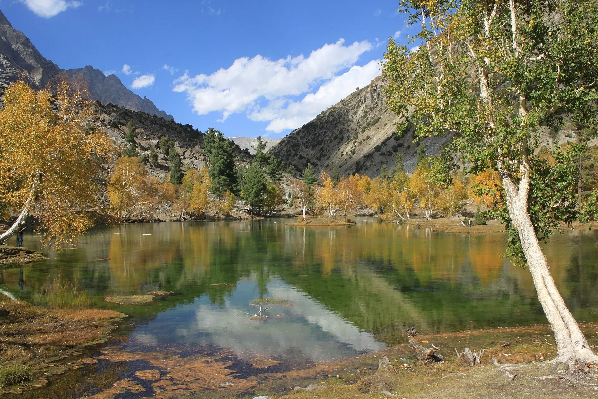
Photo: Tipuabdul, with thanks · CC BY-SA 3.0 · via Wikimedia Commons · temporary stand-in photo

Naltar Lakes Walk (Satrangi, Blue and Pari Lakes)
- Duration
- 1 day
- Grade
- Easy
- Max altitude
- 3,150 m
- Season
- May – Oct
A day walk or drive-and-walk to the lakes of the upper Naltar Valley, above Gilgit. Satrangi Lake is the first, about 12 km from Upper Naltar by a dirt road, with the Blue and Pari lakes beyond. The lakes lie at about 3,050 to 3,150 m.
Overview
The Naltar lakes lie in the upper Naltar Valley, about 13 km beyond Naltar Bala according to Wikipedia. They are alpine lakes at about 3,050 to 3,150 m, surrounded by pine forest. Wikipedia names three main lakes: Bashkiri Lake I (Satrangi, "seven colours"), Bashkiri Lake II (Blue Lake) and Bashkiri Lake III (Feroza, "azure"). The Naltar Valley article lists Satrangi, Halima, Bodo, Dhudia, Pari and Blue lakes, so names and counts differ between sources.
Most visitors reach Satrangi by jeep and walk between the lakes. A walk from Upper Naltar is also possible, because the same dirt road is the start of the Pakora Pass trek.
Getting to Naltar
Naltar Bala (Upper Naltar) is about 34 km from Gilgit and Naltar Paain 40 km, by Wikipedia's figures. The road runs through Nomal and is called the Naltar Expressway on Wikipedia. Wikipedia describes the road to the lakes as unmetalled and narrow, running beside a stream. In winter snow makes the road almost impossible for vehicles. See Naltar Valley for the valley.
The lakes in order
Satrangi (Bashkiri Lake I). The first and largest lake, about 12 km from Upper Naltar by a dirt road beside the stream, according to Wikipedia. Wikipedia attributes its blue and green shades to moss, grasses, aquatic plants and tree roots. Nature Adventure Club calls it the first stop on the journey.
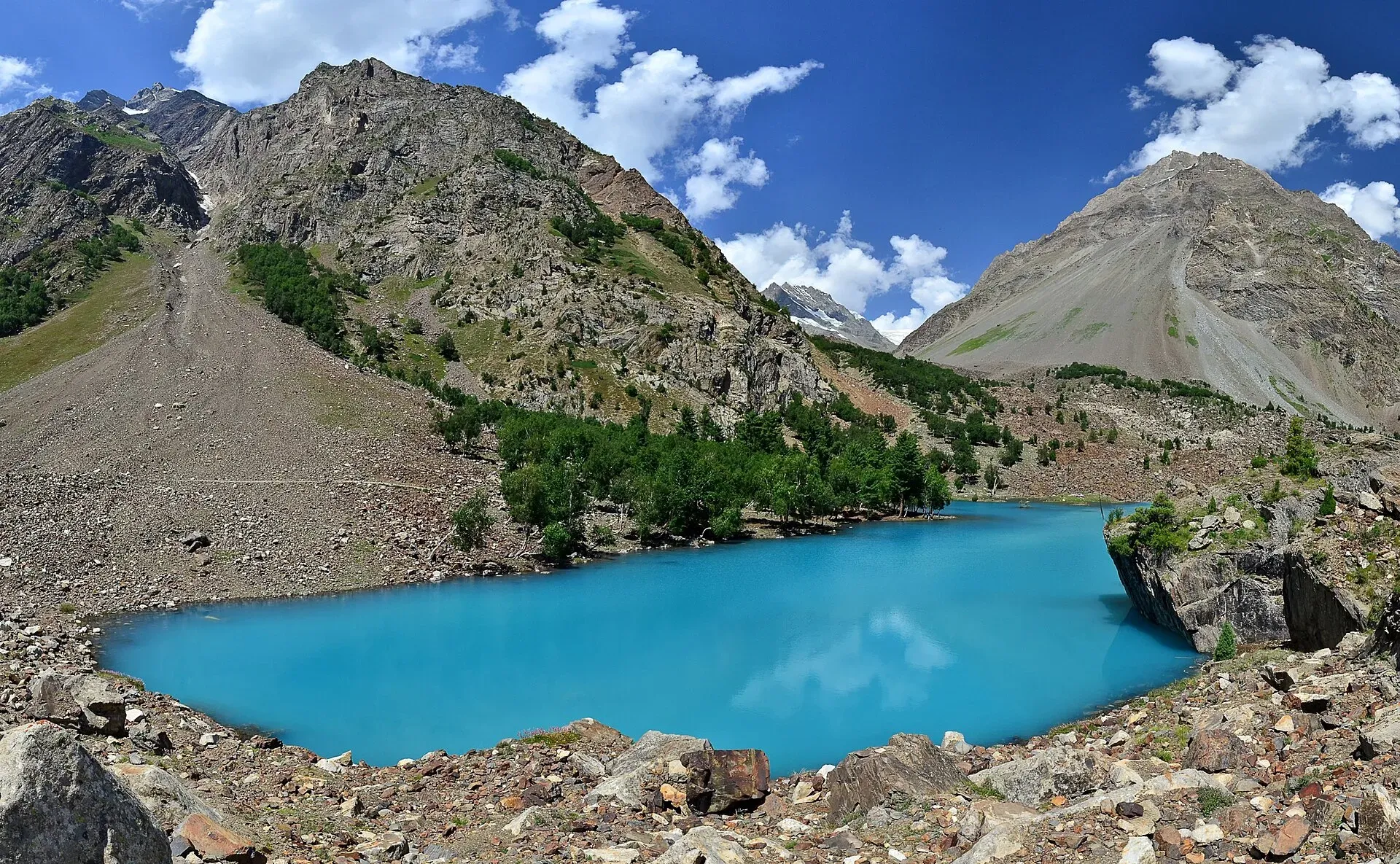
Photo: Thealimir, with thanks · CC BY-SA 3.0 · via Wikimedia Commons · temporary stand-in photo

The other lakes. Nature Adventure Club says Doohdi and Feroza lakes are reached on foot from Satrangi. Wikipedia names Blue Lake as the second lake and Feroza as the third. No source gives the distances between the lakes or the walking times, so allow time and ask your driver or guide at Satrangi.
Walking from Upper Naltar
An operator itinerary for the Pakora Pass trek gives Upper Naltar (Dumian) at 2,820 m and Naltar Lake at 3,270 m. It lists three short legs: about 1.75 hours to cross a side brook at Beshgiri, 45 minutes to Bangla and 45 minutes more to the road's end and the lake, so about 3 hours 15 minutes in all. The operator's page contains a garbled figure for the first leg, so treat these times as approximate. The altitude of 3,270 m also differs from Wikipedia's 3,050 to 3,150 m.
When to go
May to October, according to Wikipedia. Autumn colours, mostly in October, draw photographers according to our place page. In winter the road is blocked by snow, and Wikipedia says the snow on the road can be 10 to 15 feet high.
Wildlife and the valley
Wikipedia says the Naltar Wildlife Sanctuary was established on 22 November 1975 and lists Astor markhor, Alpine ibex, snow leopard, brown bear and grey wolf, as well as almost 35 bird species.
Practical information
- A high-clearance 4x4 and an experienced driver are needed for the road to the first lake.
- Simple camping is possible near the lakes, and the village has guesthouses.
- Carry warm clothing. The lakes are above 3,000 m and nights are cold even in summer.
- Dress modestly and ask before photographing people. The valley has Shia and Sunni communities.
Highlights
- Satrangi, Blue and Feroza lakes at about 3,050 to 3,150 m
- Pine forest around the lakes
- Road and walk can be combined in a day from Gilgit
- Autumn colours in October
Day by day
- StartUpper Naltar (Naltar Bala)
- Day 1Satrangi Lake
| Day | Route | Hours | Distance | Ascent / descent | Camp and altitude |
|---|---|---|---|---|---|
| Day 1 | Upper Naltar to Satrangi Lake and the other lakes | about 3 h on foot from Upper Naltar to the first lake (operator); by jeep, much less | 12 km | not given | Satrangi Lake, 3,100 m |
Day 1 notesFrom Upper Naltar follow the dirt road beside the stream to Satrangi Lake, the first and largest lake. Walk on to the Blue Lake and the lakes beyond, then return the same way. A jeep can take you to the first lake. | |||||
Getting there
From Gilgit drive north-east through Nomal and up the Naltar Valley to Naltar Bala, about 34 km. The lakes are about 13 km further on a narrow dirt road. A 4x4 and an experienced driver are needed. Winter snow usually blocks the road.
Permits and rules
- Permit needed
- Usually not, Open zone
- Fee
- Current fees will be added soon
- Last checked
- 17 November 2026
No confirmed fee or permit was found. Naltar lies in an open zone, and foreign visitors do not need a trekking permit according to operators and GB tourism sources (as on the Pakora Pass page); check with the Gilgit-Baltistan Tourism Department or a registered operator. Current fees will be added soon.
How trekking permits, NOCs and registration work: Visa and permits.
Season
Best: May – Oct
Water and camps
Guesthouses and small hotels are in Naltar village, and simple camping is available near the lakes. Treat stream water before drinking.
Gear and safety
Road
The road beyond Naltar is narrow and rough. Snow, landslides and floods can close it. Ask locally.
Weather
Nights are cold even in summer, and the lakes are above 3,000 m. Take it slowly.
Ask the district administration or local police about current conditions before you go. For foreign visitors: the UK FCDO does not name Gilgit-Baltistan, Astore or Nagar in its list of areas it advises against (advice updated 27 October 2026, checked 17 November 2026). It does advise against travel on the Karakoram Highway between Mansehra and Chilas, so most visitors fly to Gilgit. Read the live advice before you plan.
Variations
The Pakora Pass and Daintar Pass treks both start with the Naltar lakes.
Tips
- Hire a 4x4 with an experienced driver in Gilgit or Naltar
- Start early to have time between the lakes
- Carry warm layers
- Ask about snow and landslides on the road
Stay and eat in Gilgit
Gilgit is the nearest town to the trek: somewhere to sleep and stock up before and after.
Places to stay
- Indus Lodges GilgitCall Indus Lodges GilgitMap of Indus Lodges Gilgit in Google Maps
- Gilgit Serena HotelCall Gilgit Serena HotelMap of Gilgit Serena Hotel in Google Maps
- Park Hotel GilgitCall Park Hotel GilgitMap of Park Hotel Gilgit in Google Maps
- Avari Xpress Hotel, GilgitCall Avari Xpress Hotel, GilgitMap of Avari Xpress Hotel, Gilgit in Google Maps
- Gilgit Gateway HotelCall Gilgit Gateway HotelMap of Gilgit Gateway Hotel in Google Maps
- Hotel shaheen internationalCall Hotel shaheen internationalMap of Hotel shaheen international in Google Maps
Places to eat
- Pizza King GBCall Pizza King GBMap of Pizza King GB in Google Maps
- The CherryTree CaféCall The CherryTree CaféMap of The CherryTree Café in Google Maps
- Dawat Restaurant @ Indus LodgesCall Dawat Restaurant @ Indus LodgesMap of Dawat Restaurant @ Indus Lodges in Google Maps
- Abbas ali shah, Danyore, District Gilgit.Call Abbas ali shah, Danyore, District Gilgit.Map of Abbas ali shah, Danyore, District Gilgit. in Google Maps
- GB Rahat Pizza and Fast Food Gilgit, Since 2020 In GilgitCall GB Rahat Pizza and Fast Food Gilgit, Since 2020 In GilgitMap of GB Rahat Pizza and Fast Food Gilgit, Since 2020 In Gilgit in Google Maps
- GB STEAKHOUSECall GB STEAKHOUSEMap of GB STEAKHOUSE in Google Maps
Essential services fuel stations and hospitals and clinics
Fuel
- Ibex PSO Petrol StationMap of Ibex PSO Petrol Station in Google Maps
- PSOMap of PSO in Google Maps
- Pakistan State Oil (PSO) Gilgit filling station( Chilasi petrol pump)Call Pakistan State Oil (PSO) Gilgit filling station( Chilasi petrol pump)Map of Pakistan State Oil (PSO) Gilgit filling station( Chilasi petrol pump) in Google Maps
Hospitals and clinics
- Aga Khan Hospital, GilgitCall Aga Khan Hospital, GilgitMap of Aga Khan Hospital, Gilgit in Google Maps
- D.H.Q HospitalCall D.H.Q HospitalMap of D.H.Q Hospital in Google Maps
Listings come from Google Maps data and are unverified: phone numbers, opening months and prices may have changed. Report a problem · Own one of these? Claim it
Photos we still need: the road to the lakes beyond Naltar village; the wildlife sanctuary. Send us yours
Health and emergency
Mobile signal is patchy on most treks, so tell someone your plan before you go. Emergency numbers
Sources and last checked
Last checked Confidence medium5 sources6 still to check
- Last checked
- Method
- Desk research from published sources
- Confidence
- medium
- Checked by
- trek.pk research team
Researched from published sources; not yet checked on the ground by our team. Spot something out of date? Report a mistake.
Sources
- Naltar Lakes · Wikipedia · checked
- Naltar Valley · Wikipedia · checked
- Top lakes of Pakistan (Satrangi, Feroza) · Nature Adventure Club · checked
- Pakora Pass Trek (operator itinerary, labelled as operator claims) · Apricot Tours · checked
- Pakistan travel advice · UK FCDO · checked
Still to be checked on the ground (6)
- Distances and walking times between Satrangi, Blue and the other lakes (no source)
- Lake names: Wikipedia lists Satrangi, Blue and Feroza; the valley article lists Satrangi, Halima, Bodo, Dhudia, Pari and Blue
- Lake height: 3,050 to 3,150 m (Wikipedia, uncited) against 3,270 m (operator)
- Operator walking times from Upper Naltar are partly garbled
- Jeep fares and any entry or sanctuary fee
- Whether Pari Lake is a separate walk
Nearby and related

Pakora Pass

Daintar Pass

Asumbar Haghost
Naltar Lakes
A group of three lakes at about 3,050 to 3,150 m above Naltar Valley near Gilgit. The Bashkiri lakes, including Satrangi and Blue Lake, are reached by a rough jeep road and are known for their colours.
Naltar Valley
A forested valley north of Gilgit with Naltar Paain and Naltar Bala villages, a wildlife sanctuary, the colourful Satrangi and Blue lakes and the PAF-run ski resort.

Naltar Meadows
Grazing meadows and pine woods in the Naltar Valley north of Gilgit, between the Nomal turn-off and the lakes, used for summer pasture and camping.
Nomal Valley
A green oasis on the Hunza River about 25 km north of Gilgit, and the turn-off for the Naltar road.

Gilgit
Gateway to Gilgit-Baltistan on the Karakoram Highway: a busy mountain town with the Kargah Buddha and the base for Hunza, Naltar and Skardu.