

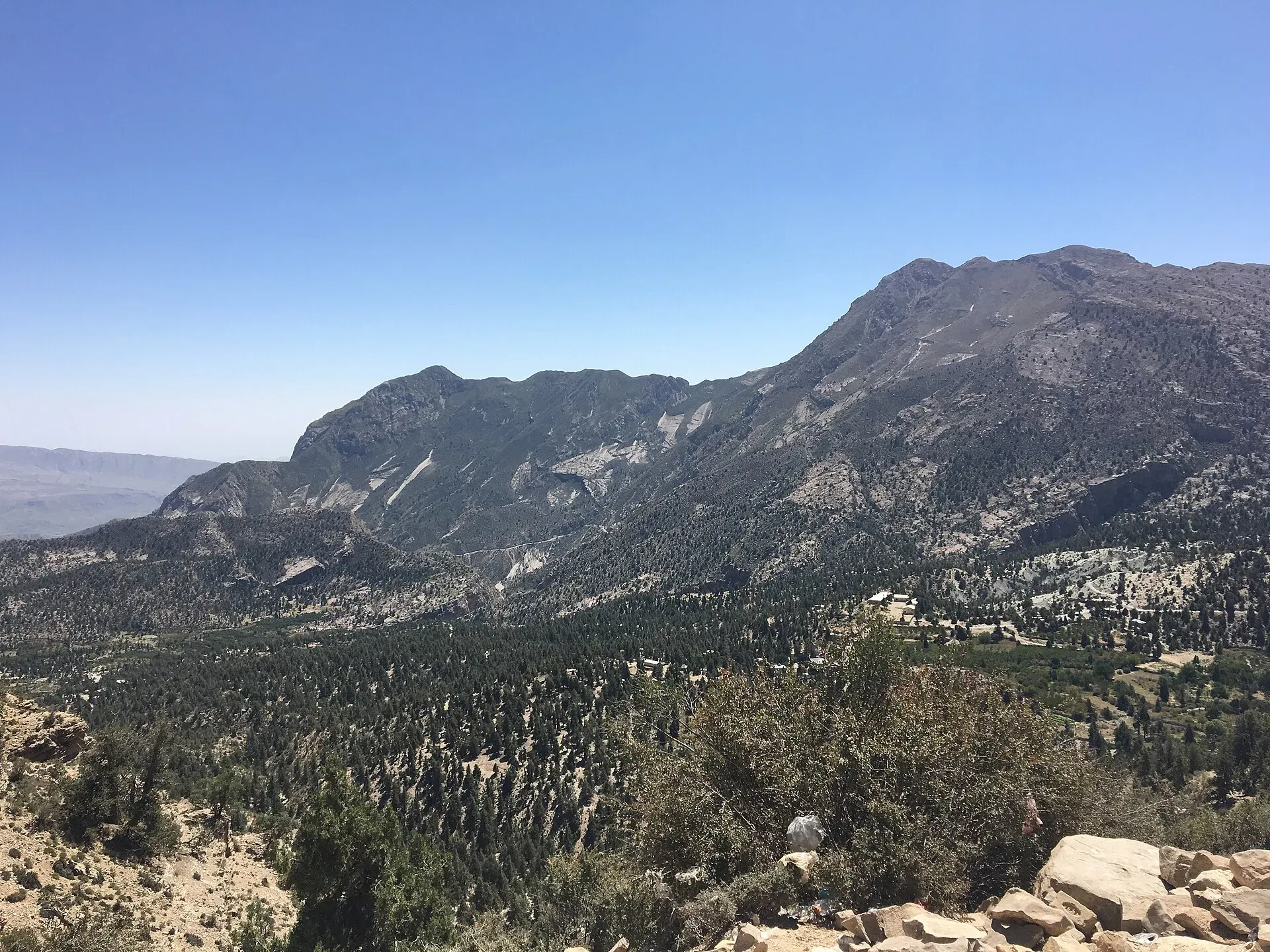
Photo: Faiqah Abdul Jabbar, with thanks · CC BY-SA 4.0 · via Wikimedia Commons · temporary stand-in photo

Prospect Point (Ziarat)
A viewpoint on the ridge above Ziarat, roughly 6 to 8 km from town, looking over the juniper-forested valleys. Balochistan is under a UK FCDO all-travel warning.
Read this first: current advice
Ask the district administration or local police about current conditions before you go. For foreign visitors: the UK FCDO Pakistan page (updated 27 October 2026, checked 17 November 2026) advises against all travel to Balochistan, including Ziarat. This page describes the place for information and is not a recommendation to visit.
Plan your visit
- Nearest town
- Ziarat
- Getting there
From Quetta to Ziarat is about 124 km and 107 minutes by road (OSRM, 16 Nov 2026); allow 2.5 to 3 hours. Prospect Point is a further 6 to 8 km (sources differ) on local road or forest paths. More
Best months
May – Sep
Overview
Prospect Point is a viewpoint above Ziarat town, in the Ziarat district of northern Balochistan. It looks over the valley of Kharwari Baba and the forest around it. Sources agree on the view but not the details. The distance from Ziarat is about 6 km in one guide and about 8 km in another. Altitude figures range from about 2,454 m (8,050 ft) to 2,713 m, and none is official. Ziarat town is at about 2,400 m, so this page leaves the point's own altitude blank.
What to see and do
- The view. The point overlooks the Ziarat valley with an open outlook that suits sunrise and sunset photography, according to a Zameen guide. Visit Silk Road says it looks over the Kharwari Baba valley and the green forest of juniper (an evergreen conifer) around it. Juniper forest here is among the oldest in the world, and cutting is banned. Ages quoted vary widely, from about a thousand years to over 5,000, so treat them as rough. See Ziarat Juniper Forest.
- Walking or driving. A road leads to the point, and you can also walk through the juniper forest from town. One guide describes it as the highest point the road reaches. Beyond it, Visit Silk Road calls the road dangerous as it continues towards Harnai district.
- Walks down into the valleys. The point is the access point for the Zizri, Domera and Kharwari valleys, and a path goes downhill to Kharwari Baba or Zizri. Zizri is known for its apple orchards and fresh fruit.
- Camping and picnics. There is wide open ground. One source describes a government rest house; another says there are no facilities and the site is used only for camping. Treat both as unconfirmed.
- Other things nearby. Ziarat's other sights include the Quaid-e-Azam Residency, where Muhammad Ali Jinnah spent his last days, a wooden colonial-style building in gardens, and the walk to Sandeman Tangi. Zameen also lists the Chashma Walk, a trail past springs.
A day around Ziarat
An outline from the sights above: visit the Residency in the morning, then walk or drive up to Prospect Point for the view and a picnic, and return through the juniper forest on foot if the weather and security situation allow. Zizri's orchards are a separate outing.
When to visit
Not an official figure: May to September is cool and pleasant, and Ziarat has historically been a summer retreat from the hot lowlands. Winters bring snow and can close roads.
Getting there
Ziarat is about 124 km and 107 minutes by road from Quetta (OSRM estimate, 16 Nov 2026). OSRM times are optimistic; allow 2.5 to 3 hours. From Ziarat to the point is a local road of 6 to 8 km. The Quetta, Ziarat and Hanna Lake road trip covers the wider route.
Where to stay and eat
Ziarat has hotels and guest houses and transport services; see the Ziarat page. No verified names are given.
Good to know
- Bring water, food and warm layers; nights are cold.
- Stay on tracks in the juniper forest and do not collect wood or cones.
- Check security conditions with the Ziarat district administration.
- Entry or parking fees are not confirmed.
Highlights
- Valley and forest views above Ziarat
- Juniper forest setting
- Reached by road or on foot
- Not recommended now: FCDO all-travel warning
Tips
- Check the live FCDO advice before planning
- Take warm layers and water
- Stay on paths in the juniper forest
- Confirm road and facilities locally
Photos we still need: Prospect Point itself (the current photo is a general view of Ziarat valley). Send us yours
Sources and last checked
Last checked Confidence low5 sources4 still to check
- Last checked
- Method
- Desk research from published sources
- Confidence
- low
- Checked by
- trek.pk research team
Researched from published sources; not yet checked on the ground by our team. Spot something out of date? Report a mistake.
Sources
- Hiking from Ziarat to Prospect Point · Visit Silk Road · checked
- Discovering Ziarat, the top tourist spot · Zameen.com · checked
- UK FCDO Pakistan travel advice · UK Foreign, Commonwealth & Development Office · checked
- OSRM public routing service (road distances and times, 16 Nov 2026) · OpenStreetMap / Project OSRM · checked
- Foreign travel advice Pakistan: warnings and insurance · UK FCDO · checked
Still to be checked on the ground (4)
- Distance from Ziarat (6 or 8 km; Visit Silk Road says 8 km)
- Altitude (2,454 to 2,713 m reported; Visit Silk Road gives none)
- Rest house and facilities (Visit Silk Road says no facilities, camping only; another guide mentions a rest house)
- Security and access (FCDO advises against all travel to Balochistan, re-checked 17 Nov 2026)
Nearby and related

Ziarat Valley
A cool mountain valley and hill station at about 2,400 m in northern Balochistan, known for ancient juniper forest, orchards and the Quaid-e-Azam Residency. Check security advice before travel.

Ziarat
A cool hill town at about 2,500 m in northern Balochistan, famous for the Quaid-e-Azam Residency and nearby juniper forest. UK advice is against all travel to Balochistan, including Ziarat (checked 16 November 2026).

Ziarat Juniper Forest
Pakistan's largest juniper forest, around 110,000 ha in the hills of Ziarat, with trees thought to be thousands of years old. A biosphere reserve since 2013 and a tentative World Heritage site.
Sandeman Tangi (Ziarat)
A gorge and waterfall village about 4 km from Ziarat, named after the colonial administrator Robert Sandeman. For foreign visitors: the UK FCDO advises against all travel to Balochistan, including Ziarat.

Quetta
Balochistan's high-valley capital, the Fruit Garden of Pakistan: bazaars, sajji, orchard valleys and the base for Hanna Lake and Ziarat.

Balochistan
Pakistan's largest and least populated province: Quetta's high valleys, Ziarat's juniper forest, the Makran coast, Hingol and Gwadar. Security and permission rules need checking first.

Quetta, Ziarat and Hanna Lake
A three-day road trip from Quetta to Hanna Lake and the juniper forests and Quaid-e-Azam Residency at Ziarat, 124 km from Quetta. For foreign visitors: the UK FCDO advises against all travel to Balochistan; check current advice before planning.