

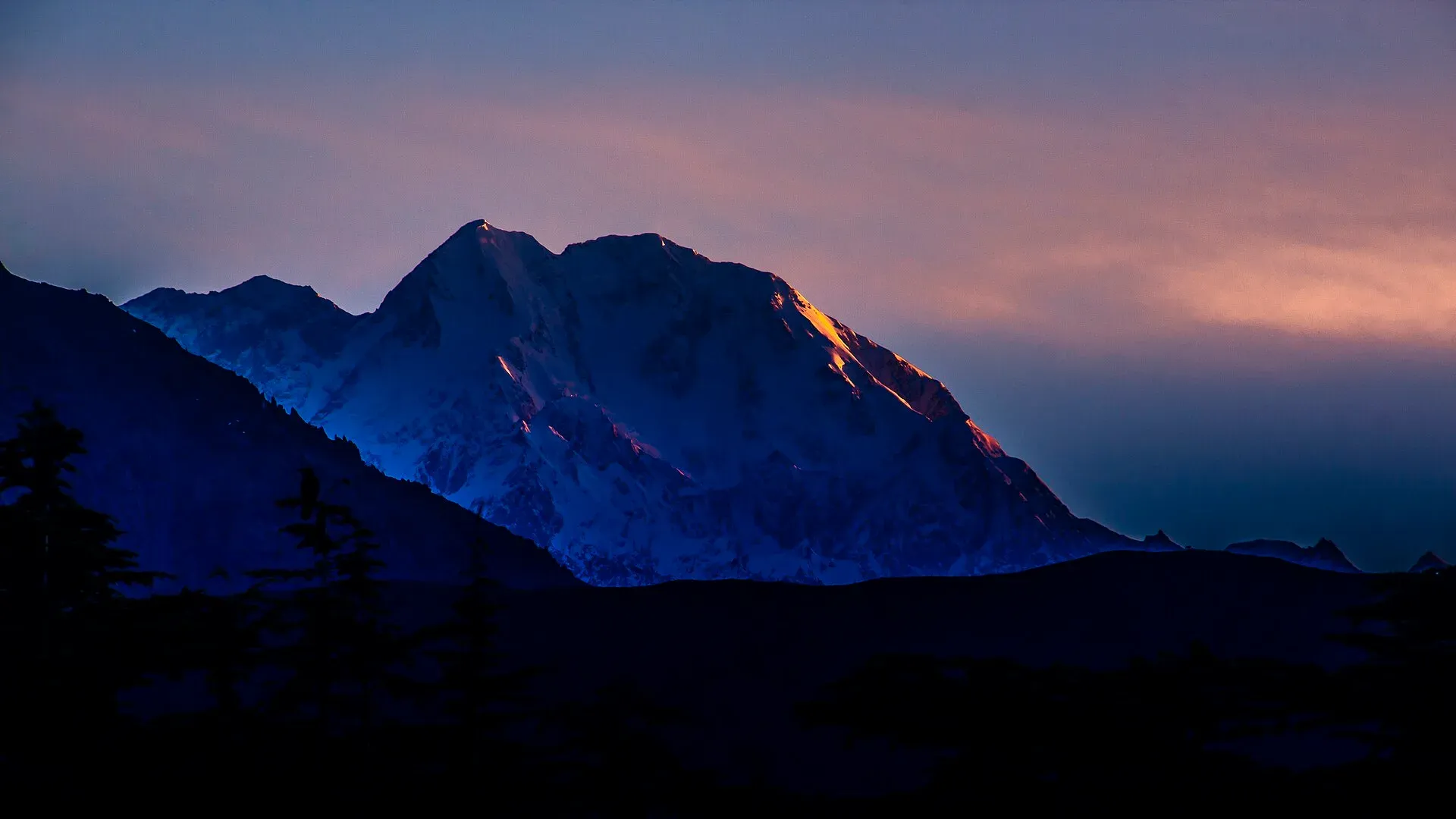
Photo: KaleemUllah550, with thanks · CC BY-SA 4.0 · via Wikimedia Commons · temporary stand-in photo

Tirich Mir
At 7,708 m Tirich Mir is the highest mountain of the Hindu Kush and the great landmark of Chitral, visible from the town's bazaar. First climbed in 1950; today it is a serious expedition peak.
Overview
Tirich Mir (also written Terich Mir) rises to 7,708 m in Chitral District. It is the highest peak of the Hindu Kush and the highest mountain outside the Himalaya–Karakoram. Wikipedia ranks it 33rd in the world by height and 30th by prominence (about 3,908 m). Lonely Planet's older peak table gives 7,706 m, so the figure can differ by a couple of metres between sources.
The name joins "Tirich", the valley below, with "mir", meaning mountain in Khowar. The linguist Georg Morgenstierne traced it to Sanskrit roots for a "peak", and some scholars link it with the sacred Mount Meru.
Plan your visit
- Nearest town
- Chitral
- Getting there
Fly or drive to Chitral (road over the Lowari Pass/tunnel, or flights when operating), then take a jeep up the Turikho and Tirich valleys to Shagrom, the road end for the base camp trek. More
Best months
Jun – Sep
- Tirich Mir
- Related places nearby: Chitral, Chitral Valley, Kalash Valleys (Bumburet, Rumbur, Birir), Chitral Gol National Park, Istor-o-Nal
Geography and climate
The usual approach is up the Tirich valley, which is headed by the Tirich Glacier. Three peaks above 7,000 m ring the glacier: Tirich Mir, Noshaq and Istor-o-Nal. Meltwater runs down the valley to the Torkhow River, a major tributary of the Chitral River. The confluence lies in the Torkhow valley about 100 km north-east of Chitral, a few kilometres south of Shagrom. The snout of the lower Tirich Glacier is fed by glaciers from seven side valleys, which meet at the Tirich Concordia.
The mountain is mainly granite, part of a mid-Cretaceous intrusion cut by many dykes. A weather station at about 4,245 m on the mountain records an annual mean of about -5 degrees C, with a January mean near -17.5 degrees C and July and August means around 6.5 degrees C, so the high ground is permafrost.
Stories about the mountain
The Kalash people of nearby valleys tell of a goddess, Krumai, who is linked with childbirth and appears as a wild goat. In one story she angered the other gods and was thrown into a fast river by Imra. She leapt up the river, climbed a cliff and left hoofprints on it. She then showed her true form, held a feast for the gods and was accepted among them. Many people in Chitral say the mountain is the home of fairies.
What to see and do
Seeing it. You do not have to climb to meet Tirich Mir. It overlooks Chitral town and can be seen from the main bazaar on a clear day. Walkers on the Owir An trek cross a ridge along its southern flanks, and the Chitral Gol National Park crossing to the Kalasha valleys also gives views.
Walking to the base. The usual approach goes up the Tirich valley to the village of Shagrom, the highest year-round settlement, with a jeep track from near the Torkhow confluence. Above it are summer pastures and the Lower Tirich Glacier. Our Tirich Mir Base Camp trek page covers this six-day walk.
Climbing. The first recorded ascent was on 21 July 1950 by a Norwegian–British team of Arne Næss, Per Kvernberg, Henry Berg and Tony Streather, up the south ridge from the South Barum Glacier. A Czechoslovak expedition opened the route now treated as the normal one in 1967, via the Upper Tirich Glacier and the north-west ridge. In July 2023 the Japanese climbers Kazuya Hiraide and Kenro Nakajima made the first ascent of the roughly 2,200 m north face. They spent two days approaching the Lower Tirich Glacier, bivouacked three nights on the climb and came down the 1967 route. This is high-altitude mountaineering, not a trekking peak.
When to visit
For views from Chitral, clear days are most common in late spring and autumn, but the mountain is visible much of the year. Treks and climbs on the Tirich side are done in summer, roughly June to September, when the glacier approach is open.
Where to stay and eat
Chitral town has hotels and guesthouses for every budget, and it is where expeditions buy supplies. Beyond the road end at Shagrom you camp.
Good to know
- Permits. Climbing a peak above 6,500 m needs an expedition permit arranged through a licensed Pakistani operator; the Tirich Mir base camp trek is in a restricted zone. Permit and royalty fees are not confirmed here. Current fees will be added soon; ask a licensed operator or the Ministry of Tourism. Foreign visitors to Chitral have also needed a No Objection Certificate from KP Tourism.
- Height. Check figures against the map or guide you carry: 7,708 m is the most common value.
- Safety. Avalanche, crevasse and altitude risks are serious, and rescue is slow and costly. Go with experienced guides.
- Ask the district administration or local police about current conditions before you go. Travel advice. For foreign visitors: the UK FCDO advises against all travel on the N-45 highway to the edge of Chitral city, including the Kalash valleys (page updated 27 October 2026, checked 17 November 2026). Read the live page before you plan.
Highlights
- Highest peak of the Hindu Kush at 7,708 m
- Seen from Chitral town's bazaar
- First climbed 21 July 1950 by a Norwegian–British team
- Base camp trek up the Tirich valley and Lower Tirich Glacier
- Its north face was first climbed only in 2023
Getting there
Fly or drive to Chitral (road over the Lowari Pass/tunnel, or flights when operating), then take a jeep up the Turikho and Tirich valleys to Shagrom, the road end for the base camp trek. A shorter walking route crosses the Zani An from Uthool. Check current road and security conditions with KP Tourism first.
Tips
- Allow at least 30 days for permit and security clearance if you plan the base camp trek.
- Use a licensed operator and guide; solo travel is not permitted in restricted zones.
- Ask about road and bridge conditions in the Tirich valley before you leave Chitral.
- Check the UK FCDO page and local news close to your travel date.
Photos we still need: the Tirich valley and Shagrom village. Send us yours
Sources and last checked
Last checked Confidence medium5 sources3 still to check
- Last checked
- Method
- Desk research from published sources
- Confidence
- medium
- Checked by
- trek.pk research team
Researched from published sources; not yet checked on the ground by our team. Spot something out of date? Report a mistake.
Sources
- Tirich Mir (Terich Mir) · Wikipedia · checked
- Pakistan travel advice: warnings and insurance · UK Foreign, Commonwealth & Development Office (FCDO) · checked
- Fees and Paperwork for a Karakorum Trek (peaks above 6,500 m need a climbing permit; Alpine Club of Pakistan quoted) · ExplorersWeb · checked
- Pakistan Tourism Guide 2021 (peak list) · Trade Development Authority of Pakistan (TDAP) · checked
- Trekking in the Karakoram and Hindukush (peak table; facts only) · Lonely Planet · checked
Still to be checked on the ground (3)
- Current permit and royalty fees for the peak (Wikipedia cites an Explorersweb piece on free permits for 2024-25 but gives no details; not opened)
- Whether the jeep track to Shagrom is open (Wikipedia says a jeep track runs up the Tirich valley to Shagrom; current state unknown)
- Whether the Chitral mosque in the photo is named on Commons as the Badshahi Mosque; it is described here as the Shahi Mosque
Nearby and related

Tirich Mir Base Camp
Owir An
Zani An

Other treks in Chitral

Chitral
The main town of Lower Chitral District, at about 1,500 m on the Chitral River, with a historic fort, a royal mosque and views of Tirich Mir. The base for the Kalash valleys.

Chitral Valley
The long Chitral River valley at the foot of the Hindu Kush, with Chitral town's fort and Shahi Mosque, the Lowari Tunnel route, Tirich Mir views and side valleys leading to Kalash and Shandur.

Kalash Valleys (Bumburet, Rumbur, Birir)
Three side valleys of the Chitral River, home to the Kalasha people, who keep their own religion, language and festivals. Visit with respect and check security advice first.

Chitral Gol National Park
A mountain park beside Chitral town, set up in 1984 to protect the markhor. About 78 square kilometres rising from 1,450 m to 5,000 m, with snow leopard and ibex.
Istor-o-Nal
Istor-o-Nal (7,403 m) is the third-highest peak of the Hindu Kush, a few kilometres north-east of Tirich Mir. It was first climbed in 1955 by American climbers. Zani An and the Udren Glacier trek see it.