

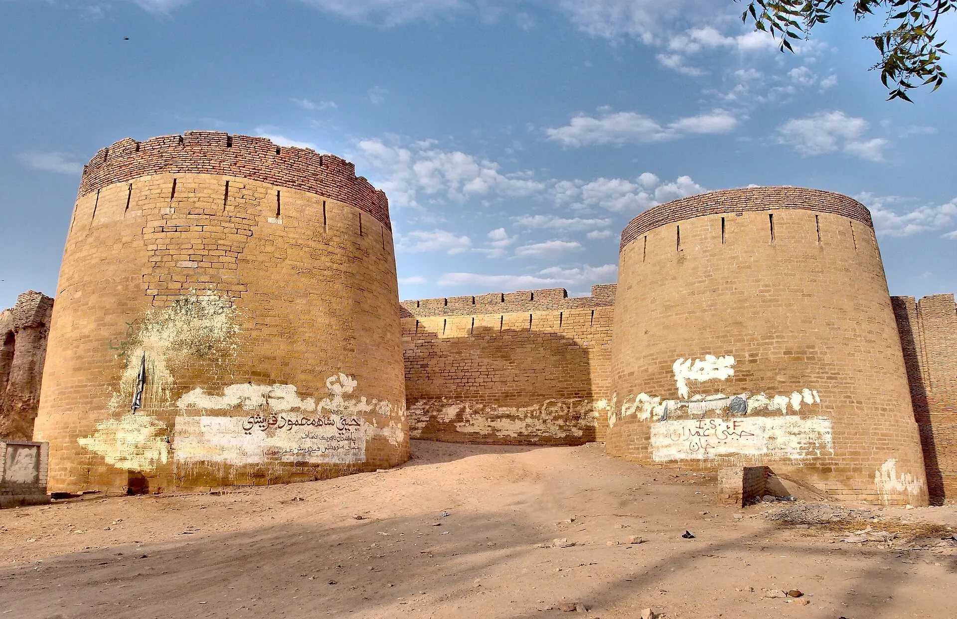
Photo: Saqib Qayyum, with thanks · CC BY-SA 3.0 · via Wikimedia Commons · temporary stand-in photo

N-120 Hyderabad-Khokhrapar
The N-120 runs 220 km from Hyderabad through Mirpur Khas and Umerkot to Khokhrapar on the India border. It crosses the edge of the Thar Desert. For foreign visitors: the UK FCDO warns against all but essential travel within 5 miles of the border.
Overview
The N-120 runs from Hyderabad in Sindh east through Mirpur Khas and Umerkot to Khokhrapar on the Indian border. Wikipedia and the NHA network list give 220 km; we measured 221 km (a rounding difference, so the figures agree), about 3 hours 5 minutes without stops (OSRM, 16 November 2026). It crosses the flat Indus plain, then the edge of the Thar Desert. It is the main road for Umerkot and a base road to Mithi and Nagarparkar, which lie off it.
Read this first
The N-120 starts and runs mostly south of Nawabshah, so the FCDO warning for Sindh north of and including Nawabshah does not cover Hyderabad, Mirpur Khas or Umerkot. For foreign visitors: the UK FCDO (updated 27 October 2026, checked 16 November 2026) does advise against all but essential travel within 5 miles of the India border, which includes the far end near Khokhrapar. Khokhrapar is a border town and not a tourist stop. There is no known official or dated source on access rules there; ask local police and the district administration before you go.
Route and stops
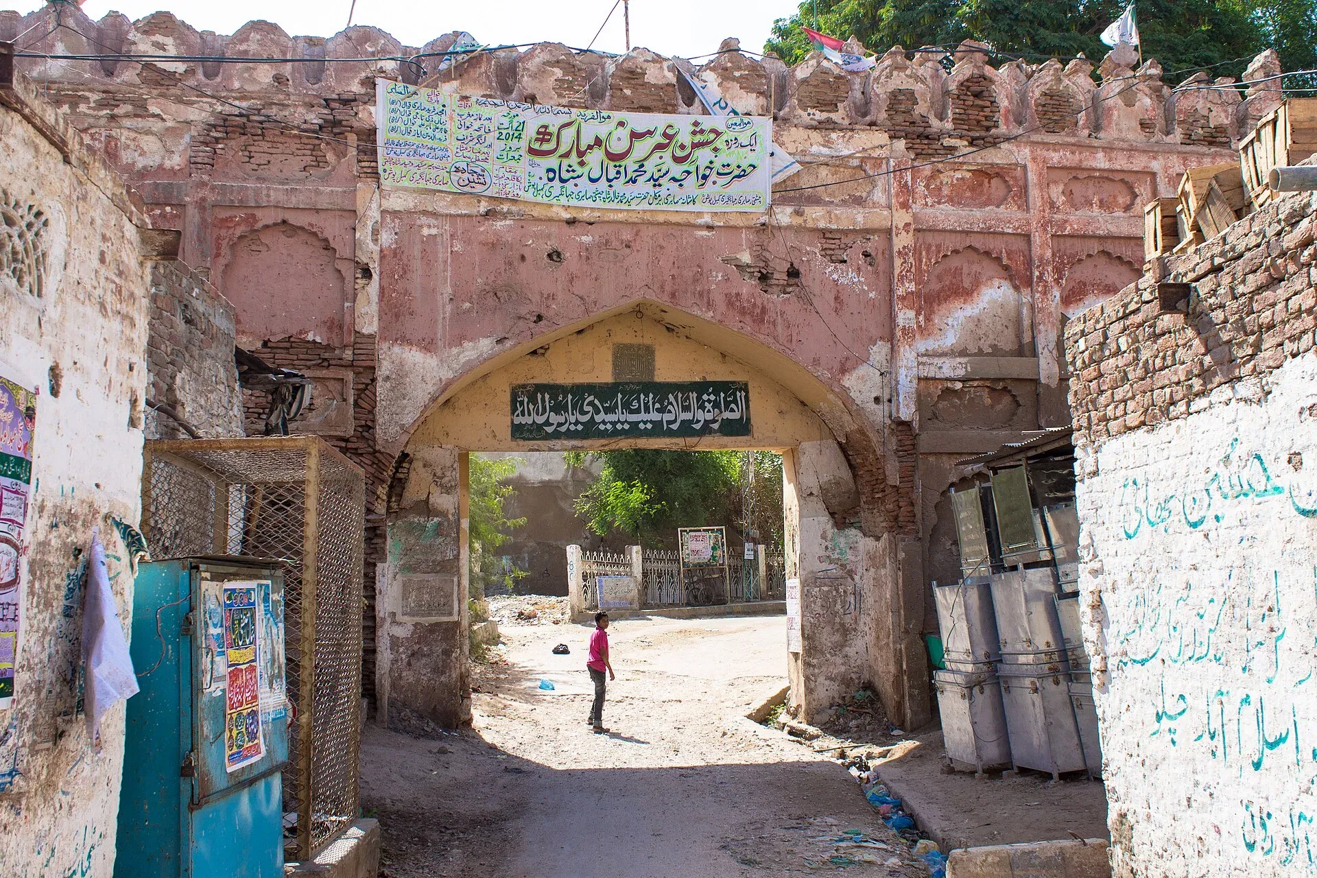
Photo: Soban, with thanks · CC BY-SA 3.0 · via Wikimedia Commons · temporary stand-in photo

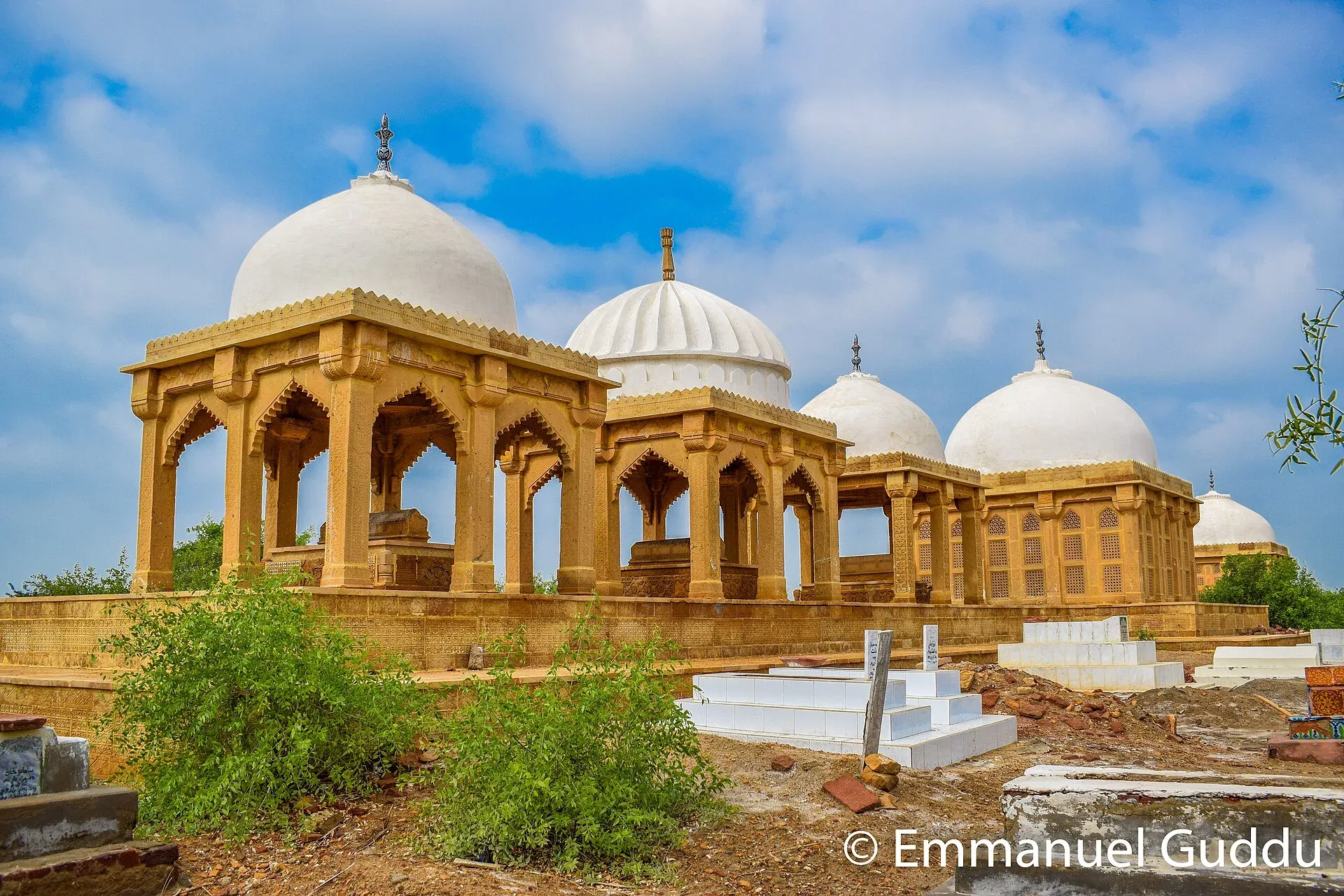
Photo: Guddu Pakistani, with thanks · CC BY-SA 4.0 · via Wikimedia Commons · temporary stand-in photo

Distances are from Hyderabad (OSRM).
- Hyderabad (km 0): Sindh's second-largest city, founded in 1768 and known for its glass bangles. Wikivoyage describes it as a major railway junction and gives the road to Karachi as about 150 km and 2 hours. Pacco Qillo fort and the Talpur tombs are the main sights.
- Mirpur Khas (km 73): the "City of Mangoes", founded by the Talpurs in 1806; the Chitorri tombs and some Buddhist-era remains are nearby.
- Umerkot (km 150): Thar-edge fort city, where Emperor Akbar was born in 1542. It has Hindu temples and an old brick fort, and a population of 144,558 in 2023.
- Khokhrapar (km 221): border town in Tharparkar District, at 71 m. Wikivoyage describes the Thar Express as a weekly train from Karachi to Bhagat Ki Kothi near Jodhpur in India, crossing at Zero Point (Khokhrapar); it is not clear from that page whether it runs now.
Local crafts and food
Wikivoyage lists these Sindh crafts: ajrak, the block-printed shawl that is a key Sindhi symbol; the Sindhi topi, a cylindrical embroidered hat often decorated with small mirrors; and ralli, a patchwork quilt of geometric cloth pieces. It says the bazaars are known for hand-printed fabrics, glass bangles and mirror embroidery. Sindhi biryani is named as the regional speciality, and cheap dhabas serve it along the road. Summer heat is above 45 degrees Celsius from May to August, and the monsoon falls mainly in July and August.
Mithi and Nagarparkar are reached by other roads from Mirpur Khas and Umerkot; check the Thar page for those.
Road conditions
The Hyderabad to Mirpur Khas dual carriageway (about 60 km, built on a 2009 concession, Rs6.2 billion) has repairs under way: the APP showed crews repairing it on 21 February 2025 (the year is taken from the photo's file path and code, not stated in the caption). Dawn reported on 25 January 2023 that about 60 km of the 80 km Mirpur Khas to Umerkot section had been widened or reconditioned and that the Umerkot to Khokhrapar section had not started; heavy rain had damaged it. The Sindh and federal governments have reviewed the N-120 since: an NHA review reported by the Express Tribune on 8 April 2026 listed N-120 among highways where pending work must be sped up. There is no known later surface report.
Hazards and incidents
- Traffic: heavy trucks and buses share the road. There are no known road-specific accident statistics.
- Monsoon and floods: rain damaged the Umerkot-Khokhrapar section (Dawn, 25 January 2023); roads can be cut in the rainy season.
- Heat: summer is very hot.
- There are no known reports of attacks on this road in 2025 or 2026.
Fuel and services
Hyderabad, Mirpur Khas and Umerkot have fuel, food and workshops. Beyond Umerkot the road to Khokhrapar is thinly served; we have no verified station list. An undated PakWheels forum post advises filling up at Chhor or Umerkot. Fill up at Umerkot.
What to see
Hyderabad, Mirpur Khas and Umerkot have pages, as do Umerkot Fort and the Thar desert hub of Mithi. Mithi and Nagarparkar are the usual reasons visitors come this way.
Safety by section
- Hyderabad to Umerkot: no FCDO warning for these districts. Use daylight and normal highway care.
- Umerkot to Khokhrapar: For foreign visitors: the UK FCDO warns against all but essential travel within 5 miles of the India border. Ask local police before approaching the border area.
Highlights
- Hyderabad to the edge of the Thar
- Passes Mirpur Khas and Umerkot
- Umerkot Fort and Akbar's birthplace
- Reaches the India border at Khokhrapar
Stops
- HyderabadStart
- Mirpur KhasCity of Mangoes; Talpur tombs
- UmerkotFort city where Akbar was born
- KhokhraparBorder town on the Indian frontier
km: distance from the start along the route.
Numbers follow the stops in order. The map shows the 3 stops that have a trek.pk page, not the road itself.
Where to stay, eat and fuel up
Places to stay
- Ghosia Guest HouseCall Ghosia Guest HouseMap of Ghosia Guest House in Google Maps
- AS GLOBAL FarmHouseCall AS GLOBAL FarmHouseMap of AS GLOBAL FarmHouse in Google Maps
- Cape Town Guest House Hyderabad, SindhCall Cape Town Guest House Hyderabad, SindhMap of Cape Town Guest House Hyderabad, Sindh in Google Maps
- Teachers Hostel (استادن جي رهائش)Map of Teachers Hostel (استادن جي رهائش) in Google Maps
- Zam Zam Hotel & Guest House MirpurkhasCall Zam Zam Hotel & Guest House MirpurkhasMap of Zam Zam Hotel & Guest House Mirpurkhas in Google Maps
- Rashidi HostelMap of Rashidi Hostel in Google Maps
Places to eat
- The Bombay BakeryCall The Bombay BakeryMap of The Bombay Bakery in Google Maps
- McDonald'sCall McDonald'sMap of McDonald's in Google Maps
- Pizza Max - HyderabadCall Pizza Max - HyderabadMap of Pizza Max - Hyderabad in Google Maps
- Brohi Balochistan Bar B.Q & RestaurantCall Brohi Balochistan Bar B.Q & RestaurantMap of Brohi Balochistan Bar B.Q & Restaurant in Google Maps
- Royal Taj RestaurantCall Royal Taj RestaurantMap of Royal Taj Restaurant in Google Maps
- KFC | Hyderabad- Qasim ChowkCall KFC | Hyderabad- Qasim ChowkMap of KFC | Hyderabad- Qasim Chowk in Google Maps
Essential services fuel stations, ATMs, banks, pharmacies and hospitals and clinics
Fuel
- ShellCall ShellMap of Shell in Google Maps
- Super Shaheen Petroleum PSOCall Super Shaheen Petroleum PSOMap of Super Shaheen Petroleum PSO in Google Maps
- Thar CNG StationCall Thar CNG StationMap of Thar CNG Station in Google Maps
- Pakistan State OilCall Pakistan State OilMap of Pakistan State Oil in Google Maps
- Al-Rehman 2 Filling Station- Total Petrol StationCall Al-Rehman 2 Filling Station- Total Petrol StationMap of Al-Rehman 2 Filling Station- Total Petrol Station in Google Maps
- Taj Filling Station Total Parco Petrol StationCall Taj Filling Station Total Parco Petrol StationMap of Taj Filling Station Total Parco Petrol Station in Google Maps
ATMs
- Telenor Microfinance BankCall Telenor Microfinance BankMap of Telenor Microfinance Bank in Google Maps
- Habib Bank Sindh University BranchCall Habib Bank Sindh University BranchMap of Habib Bank Sindh University Branch in Google Maps
- Bank Al-HabibCall Bank Al-HabibMap of Bank Al-Habib in Google Maps
- National Bank of PakistanMap of National Bank of Pakistan in Google Maps
- Habib Bank LimitedMap of Habib Bank Limited in Google Maps
Banks and money exchange
- Meezan Bank - Mirpurkhas BranchCall Meezan Bank - Mirpurkhas BranchMap of Meezan Bank - Mirpurkhas Branch in Google Maps
Pharmacies
- Hydri Medical StoreCall Hydri Medical StoreMap of Hydri Medical Store in Google Maps
- Faculty Of Pharmacy, University Of Sindh JamshoroMap of Faculty Of Pharmacy, University Of Sindh Jamshoro in Google Maps
- Dr Gulab ChokCall Dr Gulab ChokMap of Dr Gulab Chok in Google Maps
- DVAGO Pharmacy & Wellness ExpertsCall DVAGO Pharmacy & Wellness ExpertsMap of DVAGO Pharmacy & Wellness Experts in Google Maps
- Soofi Naseer Medical StoreCall Soofi Naseer Medical StoreMap of Soofi Naseer Medical Store in Google Maps
Hospitals and clinics
- The Agha Khan Maternal & Child Care CentreCall The Agha Khan Maternal & Child Care CentreMap of The Agha Khan Maternal & Child Care Centre in Google Maps
- Hashim Medical City Hospital (HMC)Call Hashim Medical City Hospital (HMC)Map of Hashim Medical City Hospital (HMC) in Google Maps
- Pet ZoneCall Pet ZoneMap of Pet Zone in Google Maps
- SICVD HyderabadCall SICVD HyderabadMap of SICVD Hyderabad in Google Maps
- Liaquat University Hospital, HyderabadCall Liaquat University Hospital, HyderabadMap of Liaquat University Hospital, Hyderabad in Google Maps
- St. Elizabeth HospitalCall St. Elizabeth HospitalMap of St. Elizabeth Hospital in Google Maps
Listings come from Google Maps data and are unverified: phone numbers, opening months and prices may have changed. Report a problem · Own one of these? Claim it
More safety notes
- FCDO (updated 27 October 2026, checked 16 November 2026): the N-120 lies south of Nawabshah, so the Sindh warning for areas north of Nawabshah does not apply; the FCDO advises against all but essential travel within 5 miles of the India border, which includes the Khokhrapar end.
- Hazards: heavy truck traffic; monsoon damage.
- Ask local police about access near the border.
Tips
- Travel in daylight and avoid the summer midday heat.
- Fill up at Umerkot before the border stretch.
- Check the road after monsoon rain.
- Ask local police before going near Khokhrapar.
Photos we still need: the road near Umerkot or the Thar edge at Khokhrapar; Sindhi ajrak or ralli craft (Local crafts and food section). Send us yours
Sources and last checked
Last checked Confidence medium10 sources5 still to check
- Last checked
- Method
- Desk research from published sources
- Confidence
- medium
- Checked by
- trek.pk research team
Researched from published sources; not yet checked on the ground by our team. Spot something out of date? Report a mistake.
Sources
- OSRM driving route service: distances and times measured 16 November 2026 (drive times are without stops) · OSRM / OpenStreetMap contributors · checked
- Pakistan travel advice: warnings and insurance (updated 27 October 2026) · UK Foreign, Commonwealth and Development Office · checked
- National highways of Pakistan · Wikipedia · checked
- N-120 National Highway · Wikipedia · checked
- Khokhropar · Wikipedia · checked
- Hyderabad Mirpurkhas Dual Carriageway (HMDC) · Government of Sindh · checked
- Sindh CM review of Mirpurkhas-Umerkot-Khokhrapar road (25 January 2023) · Dawn · checked
- Minister orders faster highway work in Sindh (8 April 2026) · The Express Tribune · checked
- Hyderabad-Mirpur Khas road repairs (21 February) · Associated Press of Pakistan · checked
- Sindh (crafts, Sindhi food, Thar Express, Hyderabad) · Wikivoyage · checked
Still to be checked on the ground (5)
- Current surface between Mirpur Khas and Khokhrapar (no report newer than the NHA review of April 2026)
- Whether the Umerkot-Khokhrapar section has been rebuilt (no source found; Dawn gives the section as 20 km in one report and 40 km in another, both undated)
- Access rules at Khokhrapar (no official source found)
- Fuel availability beyond Umerkot (only an undated forum post)
- Whether the Thar Express runs now (Wikivoyage describes a weekly service; no dated report found)
Nearby and related

Hyderabad
Sindh's second-largest city, founded in 1768 and famous for its glass bangles, Pacco Qillo fort and Talpur tombs, about 160 km from Karachi.

Mirpur Khas
Sindh's City of Mangoes, founded by the Talpurs in 1806, with the Chitorri tombs and Buddhist-era remains, about 70 km east of Hyderabad.

Umerkot
Fort city in the Thar region of Sindh, where Emperor Akbar was born in 1542; district headquarters with 144,558 residents in 2023, Hindu temples and an old fort.
Umerkot Fort
A rectangular brick fort in the Thar desert town of Umerkot, linked to the birth of the Mughal emperor Akbar in 1542. Listed on Pakistan's UNESCO tentative list (2026, per Wikipedia).

Mithi
The district headquarters of Tharparkar in Sindh, a Hindu-majority town in the Thar Desert and the practical base for Islamkot, Nagarparkar and the green desert after the monsoon.

Thar Desert: Mithi and Nagarparkar
A three-day, about 475 km road trip from Karachi through Hyderabad to Mithi and the Karoonjhar hills at Nagarparkar, with Jain temples and monsoon greenery. Measured distances; August 2026 brought crowds and accidents.