

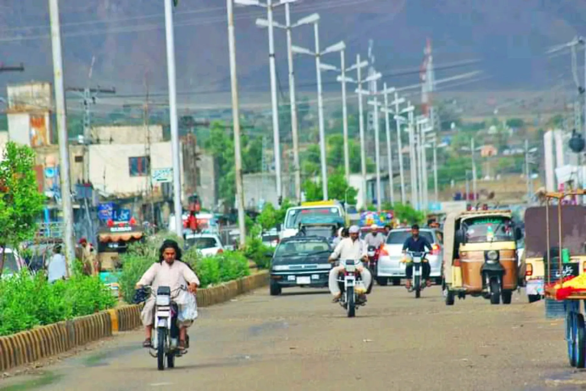
Photo: Khuzdar Balochistan, with thanks · CC BY-SA 4.0 · via Wikimedia Commons · temporary stand-in photo

N-25 Karachi-Quetta-Chaman
The N-25 (RCD Highway) runs about 813 km from Karachi through Khuzdar, Kalat and Quetta to Chaman on the Afghan border. It is a busy, accident-prone road being dualised; the UK FCDO advises against all travel in Balochistan.
Overview
The N-25 is the main road from Karachi to Quetta and on to the Afghan border at Chaman. The National Highway Authority lists it at 813 km (Wikipedia); we measured 806 km from Karachi to Chaman, about 9 hours 35 minutes without stops (OSRM, 16 November 2026). It is also called the RCD Highway and is part of Asian Highway 7. Wikipedia describes it as a mostly single-carriageway road that has a poor safety record and is being upgraded.
Read this first
Ask the district administration or local police about current conditions before you go. For foreign visitors: the UK FCDO (updated 27 October 2026, checked 16 November 2026) advises against all travel to Balochistan Province. The N-25 is in Balochistan from Hub to Chaman, so almost all of it is covered. Only the stretch inside Karachi is in Sindh. This page is a reference, not a recommendation.
Route and stops
Distances are from Karachi (OSRM).
- Hub (km 29): edge of Karachi, the gateway to Balochistan.
- Uthal (km 118) and Bela (km 178): towns in Lasbela.
- Khuzdar (km 382): the main city of central Balochistan, about 1,237 m up.
- Surab (km 477): junction with the N-85.
- Kalat (km 545): historic seat of the Khanate of Kalat.
- Mastung (km 636): valley town south of Quetta.
- Quetta (km 684): provincial capital.
- Pishin (km 734) and Qila Abdullah (km 765): fruit-growing towns.
- Chaman (km 806): border trading city.
Stops in order
- Hub (km 29): an industrial town and district headquarters just over the Sindh border, on the Karachi to Quetta and coastal roads.
- Uthal and Bela (km 118 and 178): Uthal is headquarters of Lasbela District. Bela is the ancient Armabil, with the Gondrani caves nearby.
- Khuzdar (km 382): the main city of central Balochistan at about 1,237 m, once the Jhalawan capital of the Khanate of Kalat.
- Surab (km 477): a valley town at the junction of the N-25 and N-85, headquarters of Surab District since 2017.
- Kalat (km 545): the historic capital of the Khanate of Kalat, in the Central Brahui Range. Wikivoyage mentions a Lak Pass route through the hills between Quetta and Kalat.
- Mastung (km 636): a valley town on the road south of Quetta, mentioned by tenth-century geographers and in the Ain-i-Akbari.
- Quetta (km 684): the provincial capital, called the Fruit Garden of Pakistan. Hanna Lake, a reservoir built in 1894 about 17 km east, is popular for boating, though water levels have been low or dry in several recent years. Ziarat, a juniper hill town at about 8,000 feet, is about 133 km from Quetta, roughly 3 hours by car (Wikivoyage).
- Pishin and Qila Abdullah (km 734 and 765): fruit-growing country on the Pashtun belt.
- Khojak Pass: a 2,290 m pass in the Toba Achakzai range with the road and a 3.9 km British-built rail tunnel, between Qila Abdullah and Chaman.
- Chaman (km 806): the border trading city. Our Chaman page says the border has been closed since October 2025.
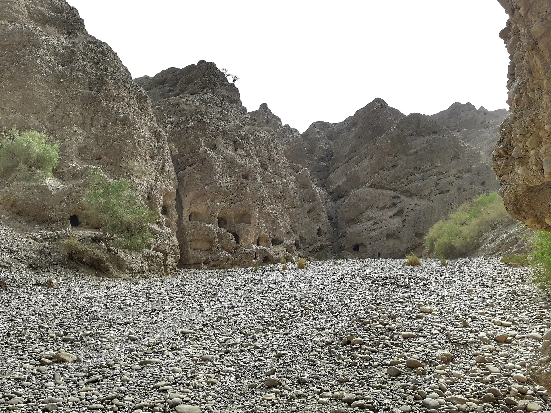
Photo: SALMAN SHAIKH, with thanks · CC BY-SA 4.0 · via Wikimedia Commons · temporary stand-in photo

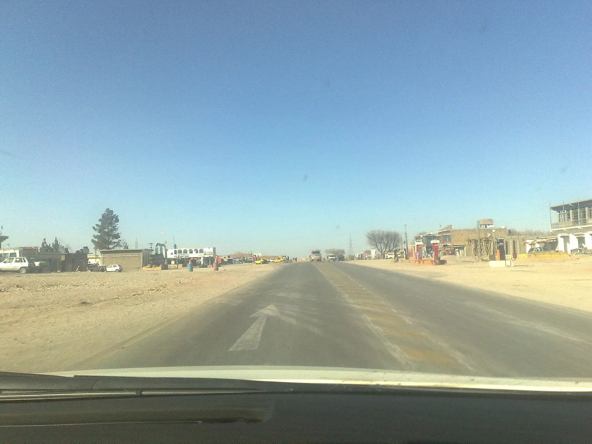
Photo: Najamuddin Shahwani, with thanks · CC BY 3.0 · via Wikimedia Commons · temporary stand-in photo

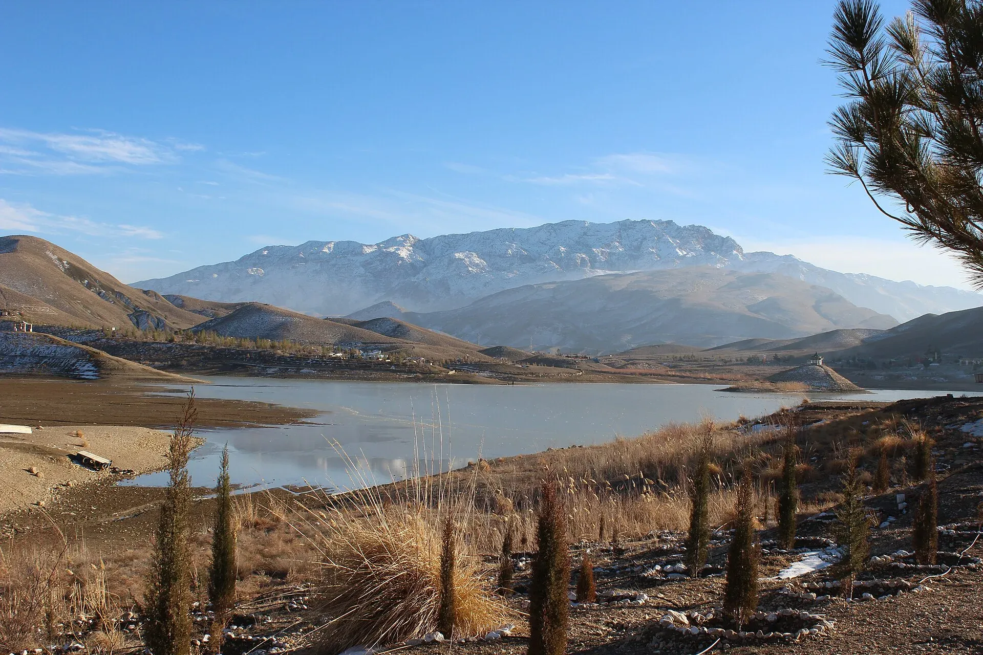
Photo: Aysafaran, with thanks · CC BY-SA 4.0 · via Wikimedia Commons · temporary stand-in photo

Local food and bazaars
Quetta is the best-documented stop. Wikivoyage describes sajji (a whole leg of lamb, marinated in local herbs and barbecued over an open fire), landhi (whole lamb dried for winter) and khandi kebab as specialities, with kawa (sweet green tea) and dood pati (milk tea) as staples. The main bazaar is on Jinnah Road, with Kandahari Bazaar and the Liaquat and Suraj Gang bazaars as other key markets. Local buys include green marble, Balochi mirror work, Pashtun embroidery, carpets and dry fruits. The same page says that, as of February 2025, foreigners needed police permission to visit Quetta and were given an escort; check the current rule locally.
Road conditions
Wikipedia calls the N-25 mostly single-lane and notes the Hub Chowki bridge, which collapsed in the 2022 monsoon, reopened in February 2025. Dualisation to expressway standard is under way. A government review reported by ProPakistani on 29 October 2026 gave these progress figures: Khuzdar to Kuchlak (330.52 km) 61 per cent; the Quetta Western Bypass (22.7 km) 85 per cent, due in November 2026. Karachi to Kararo and Wadh to Khuzdar (273 km) and Kararo to Wadh and Kuchlak to Chaman (187 km) are due in December 2027. The NHA tender for the first package lists Karachi to Karoro (232 km) and Wadh to Khuzdar (41 km), 273 km in all. Expect roadworks, diversions and mixed surface. Quetta is high, and winters are cold.
Hazards and incidents
- Accidents: Wikipedia calls it the "killer highway" and cites more than 4,000 road deaths between 2012 and 2022.
- Armed attacks: on 16 July 2025 gunmen fired on a Karachi-Quetta bus near Nimragh Cross, Kalat; three passengers died and 12 were hurt (Arab News). On the night of 21 August 2026 an explosion damaged a culvert at Khad Koocha, Mastung; no deaths were reported (Express Tribune, 23 August 2026).
- Freight: Arab News (5 August 2026) reported 107 trucks burned on Balochistan highways since January 2026, mostly on the N-25 and N-40.
- Night travel: in March 2025 the Quetta administration barred public transport at night on the N-25 and gave no hours (Dawn, 30 March 2025). Dawn reported on 13 August 2025 that public transport may not run on highways across Balochistan from 5pm to 5am. There is no known notice lifting or changing this, but could not confirm it is still in force, so check with the Balochistan Home Department or local police.
Fuel and services
Fuel and food are available in the towns listed above; gaps of 100 km or more separate several of them, notably Bela to Khuzdar. We have no verified station list. Fill up at every town. The expressway plan includes service areas, but they are not built yet.
What to see
Quetta, Hanna Lake and Ziarat lie near the route, as do the historic towns of Kalat and Khuzdar. See the pages for each. Note that FCDO advice covers all of them.
Safety by section
- Karachi (Sindh): no FCDO warning for Karachi.
- Hub to Chaman (Balochistan): For foreign visitors: the UK FCDO advises against all travel. Check with the Balochistan government and local police for current checkposts, convoy rules and closures.
Highlights
- Main road from Karachi to Quetta and Chaman
- Passes Khuzdar, Kalat and Mastung
- Junction for the N-85 at Surab
- Being dualised to expressway standard
Stops
- KarachiStart
- HubGateway to Balochistan
- UthalLasbela town
- BelaLasbela town
- KhuzdarMain city of central Balochistan
- SurabJunction with the N-85
- KalatHistoric Khanate capital
- MastungValley town south of Quetta
- QuettaProvincial capital
- PishinFruit-growing town
- Qila AbdullahTown before the Khojak area
- Khojak PassPass and rail tunnel between Qila Abdullah and Chaman
- ChamanAfghan border crossing
km: distance from the start along the route.
Numbers follow the stops in order. The map shows the stops, not the road itself.
Where to stay, eat and fuel up
Places to stay
- Avari Towers KarachiCall Avari Towers KarachiMap of Avari Towers Karachi in Google Maps
- Serena Hotel, QuettaCall Serena Hotel, QuettaMap of Serena Hotel, Quetta in Google Maps
- Mövenpick KarachiCall Mövenpick KarachiMap of Mövenpick Karachi in Google Maps
- Ramada Plaza by Wyndham Karachi Airport HotelCall Ramada Plaza by Wyndham Karachi Airport HotelMap of Ramada Plaza by Wyndham Karachi Airport Hotel in Google Maps
- Beach Luxury HotelMap of Beach Luxury Hotel in Google Maps
- Karachi Marriott HotelCall Karachi Marriott HotelMap of Karachi Marriott Hotel in Google Maps
Places to eat
- Port Grand - KarachiCall Port Grand - KarachiMap of Port Grand - Karachi in Google Maps
- Kolachi RestaurantCall Kolachi RestaurantMap of Kolachi Restaurant in Google Maps
- Bar BQ Tonight CliftonCall Bar BQ Tonight CliftonMap of Bar BQ Tonight Clifton in Google Maps
- Kaybees MACHSCall Kaybees MACHSMap of Kaybees MACHS in Google Maps
- Karachi Hassan Zai Koyla KarahiCall Karachi Hassan Zai Koyla KarahiMap of Karachi Hassan Zai Koyla Karahi in Google Maps
- Gul Plaza Shopping CentreMap of Gul Plaza Shopping Centre in Google Maps
Essential services fuel stations, mechanics, banks, pharmacies and hospitals and clinics
Fuel
- PSO Petrol Pump (Stadium Service Station)Call PSO Petrol Pump (Stadium Service Station)Map of PSO Petrol Pump (Stadium Service Station) in Google Maps
- ShellCall ShellMap of Shell in Google Maps
- KHAZAN ASSOCIATES PARCO Petrol PumpCall KHAZAN ASSOCIATES PARCO Petrol PumpMap of KHAZAN ASSOCIATES PARCO Petrol Pump in Google Maps
- PSO Petrol PumpMap of PSO Petrol Pump in Google Maps
- PSO Petrol PumpCall PSO Petrol PumpMap of PSO Petrol Pump in Google Maps
- Attock Petrol Pump (Classic filling Station)Map of Attock Petrol Pump (Classic filling Station) in Google Maps
Mechanics and tyre shops
- Suzuki Naseer AutosCall Suzuki Naseer AutosMap of Suzuki Naseer Autos in Google Maps
- Ghazi Autos Karachi Hybrid & EFI Mechanics | Auto Electrician Services | Scanning & Diagnostic Workshop / GarageCall Ghazi Autos Karachi Hybrid & EFI Mechanics | Auto Electrician Services | Scanning & Diagnostic Workshop / GarageMap of Ghazi Autos Karachi Hybrid & EFI Mechanics | Auto Electrician Services | Scanning & Diagnostic Workshop / Garage in Google Maps
- Toyota Highway MotorsCall Toyota Highway MotorsMap of Toyota Highway Motors in Google Maps
- Bashir Autos Car ACCall Bashir Autos Car ACMap of Bashir Autos Car AC in Google Maps
Banks and money exchange
- State Bank of PakistanCall State Bank of PakistanMap of State Bank of Pakistan in Google Maps
Pharmacies
- Al Jadeed Super MarketCall Al Jadeed Super MarketMap of Al Jadeed Super Market in Google Maps
- Imtiaz Supermarket - Awami Markaz - KHICall Imtiaz Supermarket - Awami Markaz - KHIMap of Imtiaz Supermarket - Awami Markaz - KHI in Google Maps
- Hydri Super MarketCall Hydri Super MarketMap of Hydri Super Market in Google Maps
- Imtiaz Supermarket - Clifton - KHICall Imtiaz Supermarket - Clifton - KHIMap of Imtiaz Supermarket - Clifton - KHI in Google Maps
- SPAR SharfabadCall SPAR SharfabadMap of SPAR Sharfabad in Google Maps
- Springs StoreCall Springs StoreMap of Springs Store in Google Maps
Hospitals and clinics
- Hashmanis Hospital NumaishCall Hashmanis Hospital NumaishMap of Hashmanis Hospital Numaish in Google Maps
- A.O. HOSPITALCall A.O. HOSPITALMap of A.O. HOSPITAL in Google Maps
- Liaquat National Hospital - Institute for Undergraduate and Postgraduate Medical Studies and Health SciencesCall Liaquat National Hospital - Institute for Undergraduate and Postgraduate Medical Studies and Health SciencesMap of Liaquat National Hospital - Institute for Undergraduate and Postgraduate Medical Studies and Health Sciences in Google Maps
- Indus Hospital & Health NetworkCall Indus Hospital & Health NetworkMap of Indus Hospital & Health Network in Google Maps
- National Medical Centre (NMC)Call National Medical Centre (NMC)Map of National Medical Centre (NMC) in Google Maps
- Patel HospitalCall Patel HospitalMap of Patel Hospital in Google Maps
Listings come from Google Maps data and are unverified: phone numbers, opening months and prices may have changed. Report a problem · Own one of these? Claim it
More safety notes
- FCDO (updated 27 October 2026, checked 16 November 2026): advises against all travel to Balochistan Province.
- Incidents: bus fired on near Kalat, 16 July 2025 (Arab News); culvert blown up at Mastung, night of 21 August 2026 (Express Tribune); 107 trucks burned on Balochistan highways January to early August 2026 (Arab News).
- Night travel: public transport leaving Quetta restricted at night (Dawn, 30 March 2025).
- Do not travel without current local advice.
Tips
- Read the current FCDO advice and local notices before planning.
- Do not drive at night.
- Fill up in every town; gaps are long.
- Expect roadworks and diversions through 2027.
More photos
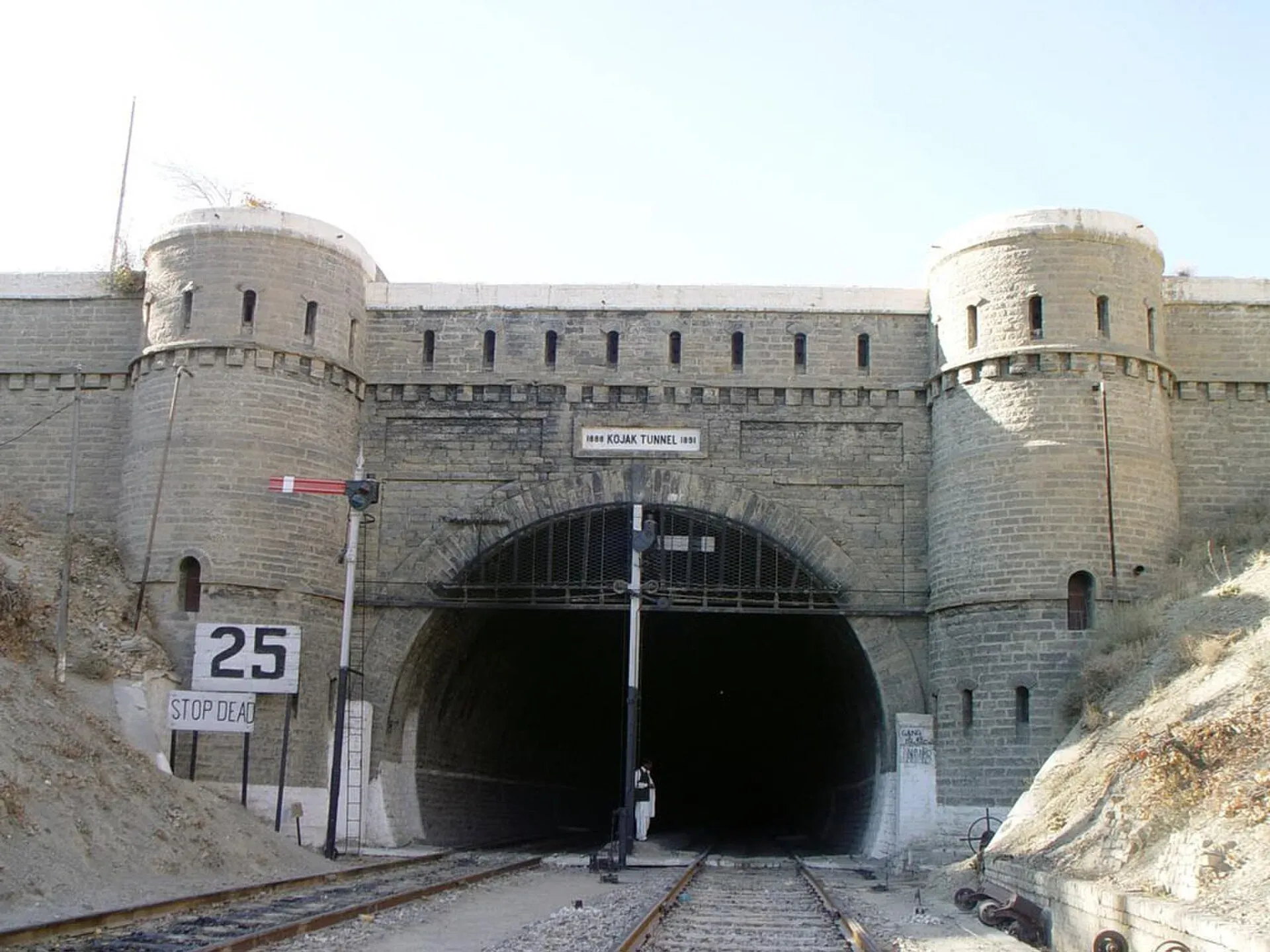
Photo: Amanullahkhan007, with thanks · CC BY-SA 3.0 · via Wikimedia Commons · temporary stand-in photo

Photos we still need: Quetta's bazaars or sajji (Local food and bazaars section). Send us yours
Sources and last checked
Last checked Confidence medium12 sources5 still to check
- Last checked
- Method
- Desk research from published sources
- Confidence
- medium
- Checked by
- trek.pk research team
Researched from published sources; not yet checked on the ground by our team. Spot something out of date? Report a mistake.
Sources
- OSRM driving route service: distances and times measured 16 November 2026 (drive times are without stops) · OSRM / OpenStreetMap contributors · checked
- Pakistan travel advice: warnings and insurance (updated 27 October 2026) · UK Foreign, Commonwealth and Development Office · checked
- National highways of Pakistan · Wikipedia · checked
- N-25 National Highway · Wikipedia · checked
- Night travel banned on key highways in Balochistan (30 March 2025) · Dawn · checked
- Balochistan's 10 mega road projects get opening dates (29 October 2026) · ProPakistani · checked
- Three killed, 12 injured as gunmen target passenger bus in southwestern Pakistan (16 July 2025) · Arab News · checked
- Key bridge blown up in Mastung (23 August 2026) · The Express Tribune · checked
- Militant attacks on Pakistan-Iran highways disrupt trade (5 August 2026) · Arab News · checked
- Plans for the N-25 expressway (2 July 2025) · Dawn · checked
- Night travel banned in Balochistan (13 August 2025) · Dawn · checked
- Quetta (bazaars, sajji, Ziarat, Lak Pass route) · Wikivoyage · checked
Still to be checked on the ground (5)
- Whether the March 2025 and August 2025 night-travel limits are still in force in November 2026 (no lifting notice found; exact hours: 5pm to 5am province-wide per Dawn, August 2025)
- Current checkposts and any convoy rules (no source found)
- Fuel stations between Bela and Khuzdar (only snippet-level anecdotes found; nothing opened)
- Dualisation progress on sections without figures (Karachi-Kararo, Wadh-Khuzdar and Kuchlak-Chaman have a December 2027 target only)
- Length: NHA/Wikipedia 813 km vs 806 km measured by OSRM (no official NHA page opened)
Nearby and related

Hub
Industrial town and headquarters of Hub District, just over the Sindh border from Karachi, on the Karachi–Quetta and coastal roads.
Uthal
Headquarters of Lasbela District and Division, a small agricultural town on the road north of Karachi with a university campus.

Khuzdar
The main city of central Balochistan, once the Jhalawan capital of the Khanate of Kalat, at about 1,237 m on the road between Quetta and Karachi.

Surab
Valley town at the junction of the N-25 and N-85 highways, headquarters of Surab District, created in 2017.

Kalat
Historic capital of the Khanate of Kalat in the Central Brahui Range, now headquarters of Kalat District and Division.
Mastung
District headquarters and valley town on the road south of Quetta, mentioned by tenth-century geographers and in the Ain-i-Akbari.

Quetta
Balochistan's high-valley capital, the Fruit Garden of Pakistan: bazaars, sajji, orchard valleys and the base for Hanna Lake and Ziarat.

Hanna Lake
A reservoir built in 1894 about 17 km east of Quetta at the start of the Urak Valley. Popular for boating, but water levels have been low or dry in several recent years.
Pishin
District headquarters about an hour north of Quetta, a British-founded station and fruit-growing area near the Afghan border.
Qila Abdullah
Small headquarters town of Qila Abdullah District on the Pashtun belt west of Quetta, near the Afghan border and the larger town of Chaman.

Chaman
Border trading city and headquarters of Chaman District, at the end of the Quetta road and railway on the Afghan frontier. 130,139 residents in the 2023 census. For foreign visitors: the UK FCDO advises against all travel to Balochistan.