

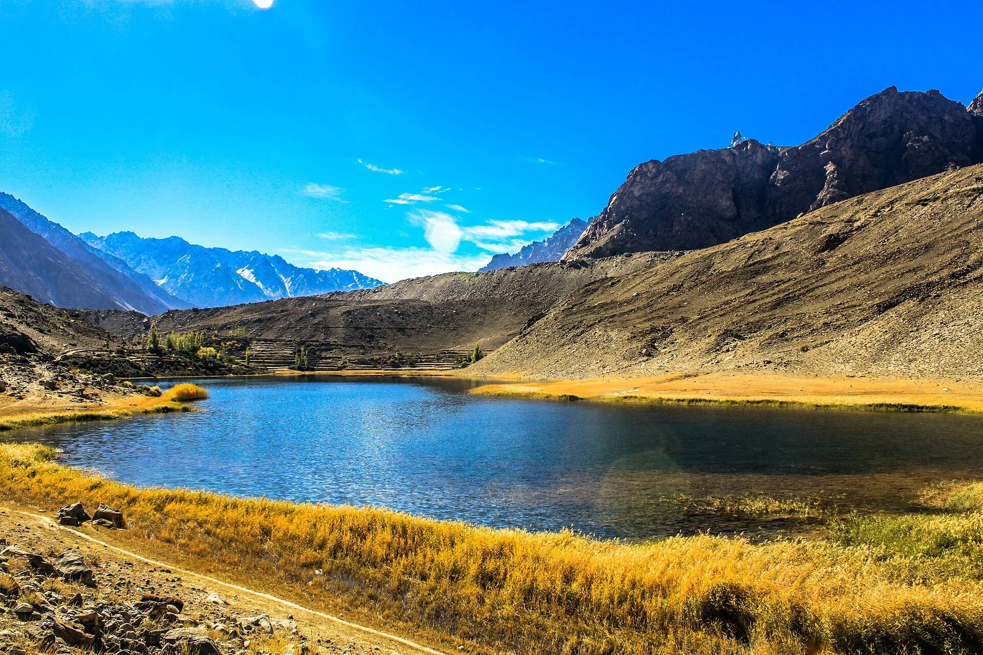
Photo: Muhammad Azeem, with thanks · CC BY-SA 3.0 · via Wikimedia Commons · temporary stand-in photo

Passu Glacier and Borith Lake Walk
- Duration
- 1 day
- Grade
- Moderate
- Season
- May – Oct
A long day walk from Ghulkin past Borith Lake to the Passu Glacier in Gojal, about four to five hours by Wikipedia's account. Two glacier crossings; distance and height gain are not published.
Overview
This walk links Ghulkin, Borith Lake and the Passu Glacier in Gojal, Upper Hunza. Wikipedia describes the walk from Ghulkin to Passu as taking about four to five hours. It crosses the Ghulkin Glacier, passes Borith Lake, crosses the Hussaini Glacier and continues on the south side of the lake. From the Passu Glacier a path leads down to the Karakoram Highway (KKH).
It is a different outing from the two climbs that start at Passu. Avdegar goes up to a yak pasture, and Patundas crosses the Passu Glacier to a high ridge. This walk stays lower and links three viewpoints.
Who it suits
Walkers who are happy on loose moraine and who want a long day without a camp. The sources give no distance and no height gain, so the grade here is a rough guess. Two glaciers are crossed, and local guidance matters on both. Our page on the Passu Glacier advises a local guide for the debris-covered ice. Ask at your guesthouse in Gulmit, Hussaini or Passu.
When to go
May to October is the usual season in Gojal. Wikipedia says ducks and other wildfowl rest at Borith Lake on their way north between March and June, and that the movement reverses from September to November. Mornings are cool even in summer, and the valley is windy, so carry a warm layer.
The route
Ghulkin to the lake. Wikipedia gives two to three hours on foot from Gulmit to Borith Lake across the end of the Ghulkin Glacier. Ghulkin, the village next to the glacier, is the usual start for the longer walk to Passu.
Past the lake. The route crosses the Hussaini Glacier by the same line, then follows the south side of the lake. It passes Borith Bala, a settlement on that side, and Shahabad, a deserted settlement. Wikipedia says Shahabad was abandoned after a lack of continuous water supply turned the land to desert.
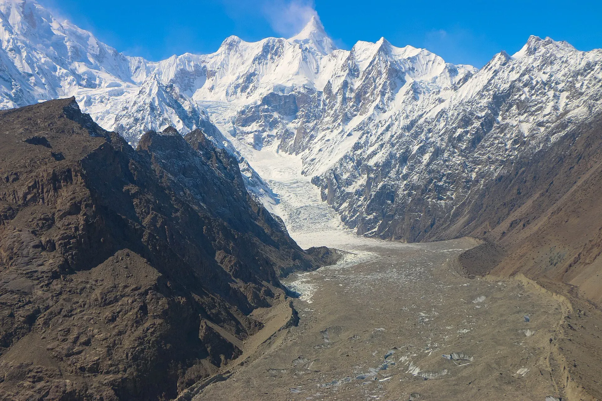
Photo: Akbar Khan Niazi, with thanks · CC BY-SA 3.0 · via Wikimedia Commons · temporary stand-in photo

Towards Passu. Beyond the lake a trail climbs the side of the Passu Glacier. Wikivoyage calls this perhaps the best viewpoint in the area. From the Passu Glacier a path leads down to the KKH, and the road takes you into Passu.
Terrain underfoot
Expect three kinds of ground. The glacier crossings are over rubble-covered ice and loose moraine, where stones move and meltwater streams cut across the line. Around the lake the walking is on the hillside and farm land. Wikipedia describes the lake as sitting in a small hollow, with the saline water fed by meltwater from the Hussaini Glacier. The Passu Glacier trail climbs along the glacier's edge. The line over each glacier can change from season to season.
Borith Lake
The lake lies at about 2,500 to 2,600 m (Wikipedia gives both figures). Wikipedia describes it as a small lake that is a sanctuary for migrating wildfowl. By road it is about 2 km north of Hussaini on a paved route, so many visitors reach it without the long walk. Wikivoyage mentions a campground and a restaurant at the lake and says swimming is possible in summer. Services can vary by season, so ask in Hussaini or Gulmit. Hikers can also walk to the edge of the Hussaini Glacier from the lake. Wikipedia gives about one hour each way.
The Passu Glacier end
The Passu Glacier lies south of Passu village, below Passu Peak, in the Batura Muztagh. Passu Lake sits at its front and drains into the Hunza River. The glacier's meltwater has fed local irrigation for centuries (Wikipedia). It is connected to the Batura Glacier. Published lengths differ widely, so see our Passu Glacier page for the range. For a closer look at the snout from Passu, local paths cross moraine to the ice, and guidance is needed.
Other walks nearby
Wikivoyage describes a cable-and-plank suspension footbridge over the Hunza River. Its path leaves the KKH at the first hairpin south of Passu, and a loop is possible by crossing the Hussaini bridge further downstream. The Hussaini Suspension Bridge has gaps between its planks and a record of accidents, so cross only if you are steady on heights.
Wikivoyage also lists the Yunz valley between the Passu and Batura glaciers, behind Zard Sar. A trail marked with cairns keeps to the right of the lake below the Passu Glacier. Route-finding is not simple, and our Passu page advises a local guide.
Getting there
Both ends are on the KKH. Gulmit and Ghulkin are in the Gojal section, north of Karimabad, and Passu is further north. Buses and vans run along the KKH between Gilgit and Sost, and Wikivoyage says services leave from the northern end of Passu. Passu is about 51 km from Karimabad on our Passu page, where OSRM gives about 40 minutes without traffic (an estimate that is probably optimistic). Hussaini, Gulmit and Passu all have guesthouses, so the walk can be done in either direction. Ask your host about a lift between the Passu Glacier and your bed at the end.
Water and camps
The sources name no water point on the walk. Carry enough for the day. Meltwater streams cross the glacier edges, but do not rely on untreated water. Borith Lake is saline, so it is not a source of drinking water. This is a day walk, and no camp is needed.
Gear and safety
Wear boots with ankle support for the loose moraine. Carry a warm layer, sun protection and a charged phone. Do not step onto debris-covered ice without a guide. Meltwater streams rise on warm afternoons. Rock falls and landslides can close the KKH, especially after summer storms.
Travel advice. For foreign visitors: the UK FCDO page for Pakistan (updated 27 October 2026, checked 17 November 2026) does not advise against Gilgit-Baltistan as a whole. It does advise against all travel on the Karakoram Highway between Mansehra and Chilas, the usual road route from Islamabad. Read the live page before you plan, and consider flying to Gilgit (weather permitting).
Highlights
- Borith Lake, a small saline lake at about 2,500 to 2,600 m that wildfowl use on migration
- Crossings of the Ghulkin and Hussaini glaciers
- A side trail up the Passu Glacier that Wikivoyage calls perhaps the best viewpoint in the area
- The deserted settlement of Shahabad
Day by day
- StartGhulkin
- Day 1the Passu Glacier and the KKH
| Day | Route | Hours | Distance | Ascent / descent | Camp and altitude |
|---|---|---|---|---|---|
| Day 1 | Ghulkin to Borith Lake to the Passu Glacier and the KKH | 4–5 h (Wikipedia, Ghulkin to Passu) | not given | not given | not given |
Day 1 notesCross the Ghulkin Glacier to Borith Lake (two to three hours from Gulmit, by Wikipedia). Cross the Hussaini Glacier, then follow the south side of the lake past Borith Bala and the deserted settlement of Shahabad. Reach the Passu Glacier, where a path leads down to the Karakoram Highway. | |||||
Getting there
Gulmit, Hussaini, Ghulkin and Passu are all on the Karakoram Highway in Gojal, and buses and vans run between Gilgit and Sost. Borith Lake is about 2 km north of Hussaini on a paved route. For foreign visitors: the UK FCDO advises against all travel on the KKH between Mansehra and Chilas (updated 27 October 2026, checked 17 November 2026); it does not advise against Gilgit-Baltistan as a whole. Read the live page before you plan.
Permits and rules
- Permit needed
- Usually not, Open zone
- Fee
- Current fees will be added soon
- Last checked
- 17 November 2026
Zone: open. Dawn reported on 29 March 2026 that foreign visitors to open-zone areas do not need a trekking permit, while permits from the Gilgit-Baltistan tourism department are needed only for restricted zones. No permit is reported for this walk, and no fee was found. Ask the Gilgit-Baltistan Tourism Department or a local operator before you go. Current fees will be added soon.
How trekking permits, NOCs and registration work: Visa and permits.
Season
Best: May – Oct
Water and camps
No water point is named in the sources. Carry enough for the day. Borith Lake is saline. Wikivoyage mentions a campground and a restaurant at the lake; ask locally before you plan to camp.
Gear and safety
Boots with ankle support for loose moraine. Do not step onto debris-covered ice without a guide. Meltwater streams rise on warm afternoons. The Hussaini bridge has gaps between planks. For foreign visitors: the UK FCDO does not advise against Gilgit-Baltistan as a whole but advises against all travel on the KKH between Mansehra and Chilas (updated 27 October 2026, checked 17 November 2026).
Variations
- Borith Lake only: about 2 km north of Hussaini on a paved route, or two to three hours on foot from Gulmit.
- Hussaini Glacier edge: about one hour each way from the lake (Wikipedia).
- Passu Glacier viewpoint trail: climbs the glacier's side beyond the lake (Wikivoyage).
- Yunz valley: a cairn-marked trail between the Passu and Batura glaciers; go with a local guide.
- Avdegar and Patundas: steeper climbs from Passu; see their own pages.
Tips
- Allow four to five hours from Ghulkin to Passu and start early.
- Take a local guide for the glacier crossings; the line over the ice changes.
- Borith Lake can be reached by a 2 km paved route from Hussaini if you only want a short visit.
- Carry all your water; the lake water is saline.
Photos we still need: Borith Bala and Shahabad; the Hussaini Glacier crossing. Send us yours
Health and emergency
Mobile signal is patchy on most treks, so tell someone your plan before you go. Emergency numbers
Sources and last checked
Last checked Confidence low7 sources9 still to check
- Last checked
- Method
- Desk research from published sources
- Confidence
- low
- Checked by
- trek.pk research team
Researched from published sources; not yet checked on the ground by our team. Spot something out of date? Report a mistake.
Sources
- Borith Lake · Wikipedia · checked
- Passu Glacier · Wikipedia · checked
- Passu · Wikivoyage · checked
- Gulmit · Wikivoyage · checked
- Gilgit-Baltistan tourism bounces back despite Middle East war (29 March 2026) · Dawn · checked
- Pakistan travel advice (updated 27 October 2026, still current 17 November 2026) · UK FCDO · checked
- trek.pk pages for Passu, Borith Lake, Passu Glacier, Avdegar and Patundas (used for consistency) · trek.pk · checked
Still to be checked on the ground (9)
- Distance, height gain and a fuller route description (Wikipedia gives only 4 to 5 hours from Ghulkin to Passu; no distance or ascent found in any source)
- Grade: no source rates this walk; 'moderate' is a rough guess
- Whether a guide is required in practice for the Ghulkin and Hussaini glacier crossings, and the current line over each glacier
- Exact start point in Ghulkin and the exact finish where the path from the Passu Glacier meets the KKH
- Whether Borith Bala and Shahabad can still be walked through as described (Wikipedia, undated)
- Fees, if any, at Borith Lake or on the route; camping rules at the lake
- Water sources on the route (none found)
- Wikipedia's Borith Lake page is a stub with citation-needed tags on its wildlife and season claims
- Photo: the 'Passu Glacier end' photo shows Passu village from the glacier, not the walk's own trail
Nearby and related

Avdegar

Patundas

Batura Glacier

Borith Lake
A small lake in Gojal, upper Hunza, a short walk from Hussaini and Gulmit. It lies at about 2,600 m, fed by meltwater from Hussaini Glacier, and is a resting stop for migrating wildfowl.
Passu Glacier
A glacier south of Passu village in Gojal that you can see from the KKH and reach on a short walk. It lies below Passu Sar and has been retreating, so its length depends on the source.

Passu
A Wakhi village in Gojal beside the Passu Glacier, below the jagged Passu Cones (Tupopdan, 6,106 m). Known for Hussaini Suspension Bridge, glacier walks and Batura views.

Ghulkin Glacier
A glacier above Ghulkin village near Gulmit in Gojal that comes down close to the KKH. It is a short stop from the highway and a route to the Patundas pasture.

Hussaini Suspension Bridge
A famous swaying footbridge of wooden planks and cables over the Hunza River in Gojal, about 194 m long. Pedestrians only, with gaps between planks that frighten many visitors.

Gulmit
The administrative centre of Gojal (Upper Hunza), at 2,465 m on the Karakoram Highway. A calm base for Ghulkin, Borith Lake, the museum and fort walks.
Tupopdan (Passu Cones)
Tupopdan (6,106 m) is the highest summit of the Passu Cones, the jagged peaks above Passu village. It is also called Passu Cathedral. It is seen from the Karakoram Highway and on the Avdegar and Patundas walks.