

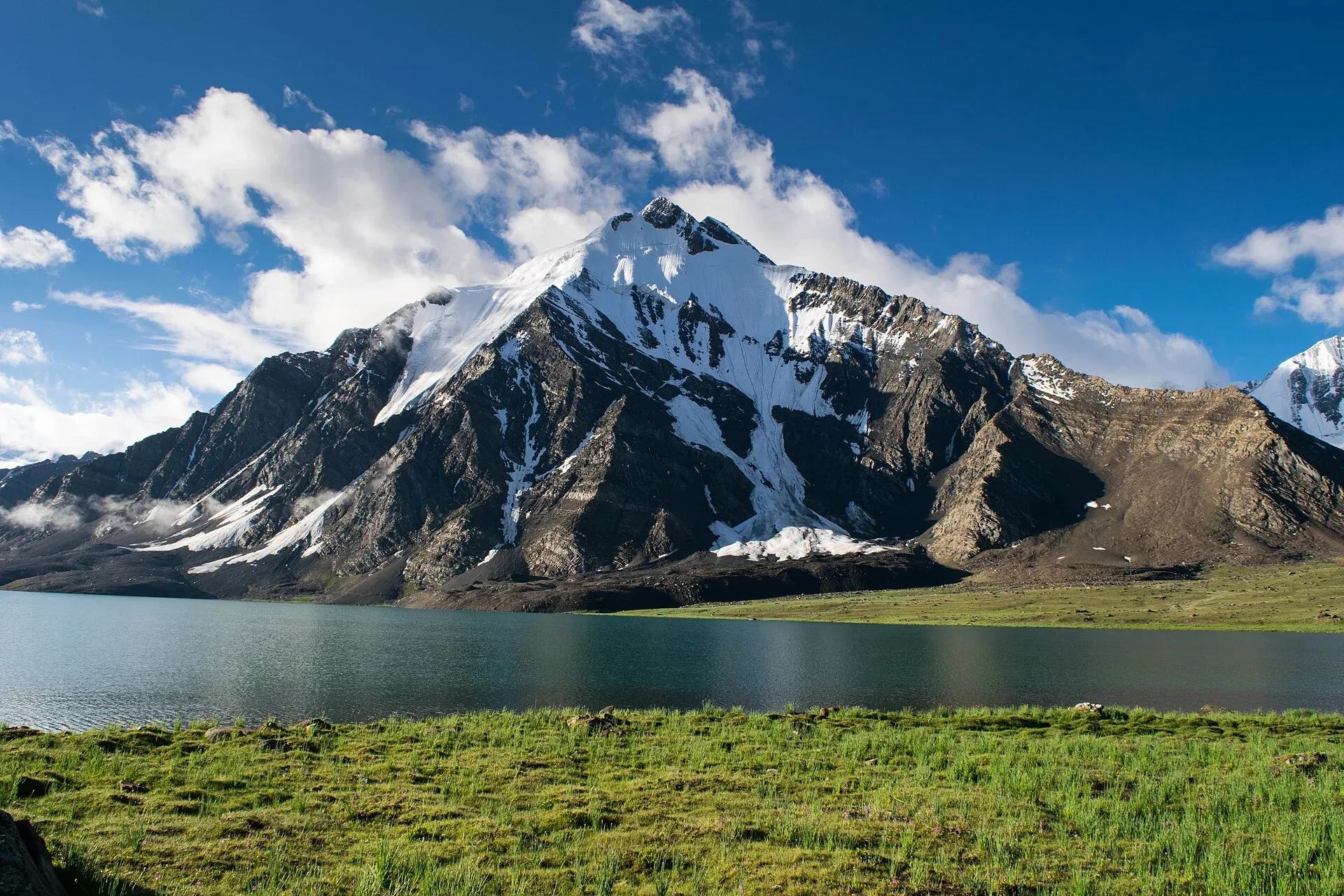
Photo: Talha Mahin Mir, with thanks · CC BY-SA 4.0 · via Wikimedia Commons · temporary stand-in photo

Karambar An
A gentle pass of about 4,320 m beside Karambar Lake, between Broghil in Chitral and the Karambar valley in Ishkoman, Gilgit-Baltistan. Restricted zone near the Afghan border.
Overview
Karambar An (about 4,320 m) is a broad, gentle pass across the Hindu Raj. It links Broghil at the head of the Yarkhun valley in Upper Chitral with the Karambar valley in Ishkoman, Ghizer, Gilgit-Baltistan. It lies beside Karambar Lake (4,260 m in the trek pages; 4,272 m on Wikipedia). A large cairn marks the pass, a short way west of the lake camps.
The pass is rolling, well-watered grassland, with lakes at the top. Wild onions grow thickly here, and the old guide suggests it may be the "wild onion" pass a Chinese pilgrim wrote of more than 1,000 years ago. The Broghil side is now Broghil Valley National Park.
Plan your visit
- Nearest town
- Bort
- Getting there
There is no road over the pass. For the Chitral side, take a jeep from Chitral to Mastuj, then a special hire up the Yarkhun valley to Lasht. For the Karambar side, jeeps run from Bort, Bilhanz or Imit to Gilgit; More
Best months
Jun – Sep
- Karambar An
- Related places nearby: Karambar Lake, Broghil Valley National Park, Ishkoman Valley, Darkot Pass, Broghil Pass
Karambar Lake
Karambar Lake is about 3.9 km long and 2 km wide, with an area of about 2.6 square km. That makes it the second largest lake in northern Pakistan after Attabad Lake. Glaciers feed it, and its water clarity has been recorded as the highest in the literature on Pakistani lakes. The surrounding area has been Qurumbar National Park since 2011. The water is an opaque turquoise, the camp is on the north shore beside a large boulder with a cairn and stone shelters, and Zhui Sar's glacier falls into the far side. The trek pages build in a rest day here for acclimatisation.
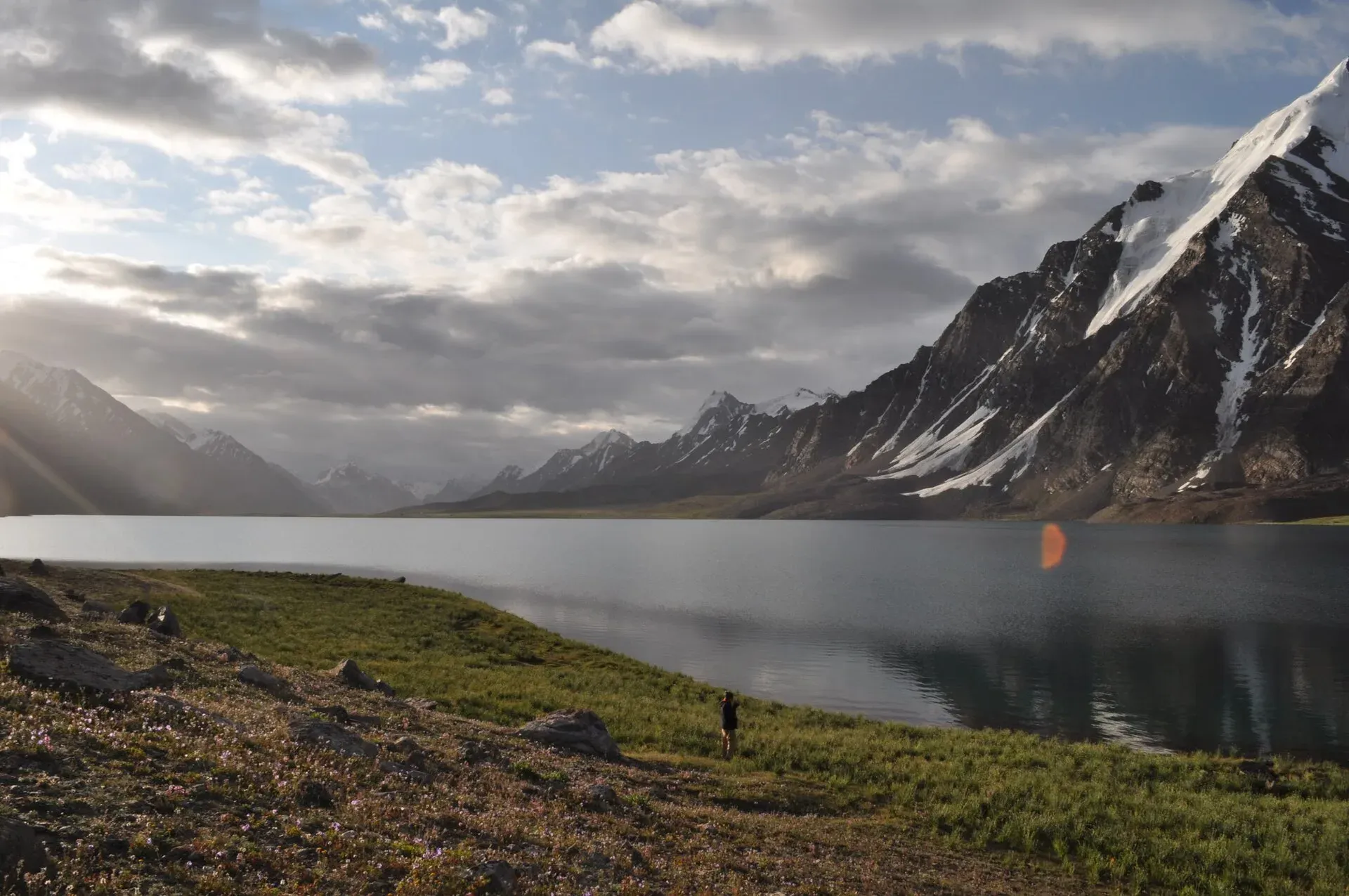
Photo: Omarfarooqhamid, with thanks · CC BY-SA 4.0 · via Wikimedia Commons · temporary stand-in photo

Crossing the pass
It is crossed on foot as part of two long treks, from either side. The crossing itself is easy. The difficulty is altitude, because you sleep above 3,300 m from the first days.
- From Chitral. The Broghil and Karambar An trek takes 10 to 12 days from Lasht (Lutgaz, 3,048 m) up the Yarkhun valley, rated moderate. It passes Kishmanja (3,300 m), Ishkarwaz (3,510 m, with a Chitral Scouts post), hot springs on the way to Tir-e-Dasht (3,480 m), then the summer settlements of Shuwor Sheer and Top Khana, and finally Karambar Lake.
- From Ishkoman. The Karambar An and Darkot An trek starts at Bort (2,728 m) and takes 11 days, with the pass reached about day 5 to 6. It passes Maturamdan (2,895 m), Waraghut (3,300 m), Sokhter Rabot (3,420 m) and Shuyinj (3,930 m).
Terrain underfoot
On the Chitral side the ground is grassy river flats, a long scree slope before Ishkarwaz, rolling grassland and a peat bog at Tir-e-Dasht. Then come gentle hills and rocky ground to the lake. On the Karambar side the route crosses the tongue of the Karambar Glacier and then the Chattiboi Glacier, which fills the valley for about 4 km with the river running beneath it. The line through both glaciers changes every year, so hire a herder who knows them.
People
Broghil's Wakhi people herd yaks and sheep on the grassland. The Karambar valley has Gujar herders and a settlement of Uzbek families at Sokhter Rabot.
When to go
June to September, with the high summer months best for the glacier sections.
Permits and safety
The area is restricted and close to the Afghan border. The old guide says a permit and a licensed guide are required; police at Lasht and Imit and the Chitral Scouts at Ishkarwaz may ask to see it. Sources disagree on whether a Chitral NOC is needed outside restricted zones; the Express Tribune reported on 6 May 2026 that foreigners still need one. The Karambar section is in Ghizer, where the GB Tourism Department requires a permit and licensed guide for restricted areas. Current fees will be added soon.
For foreign visitors: the UK FCDO advises against all travel on the N-45 from north of the Mardan ring road to the edge of Chitral city, including the Kalash valleys (advice updated 27 October 2026, still current on 17 November 2026). Most road routes to Chitral use the N-45. Read the live advice before you plan.
Treks that cross it
Highlights
- Gentle 4,320 m pass beside Karambar Lake
- Links Broghil (Chitral) and Karambar (Ishkoman)
- Part of Broghil Valley National Park
Getting there
There is no road over the pass. For the Chitral side, take a jeep from Chitral to Mastuj, then a special hire up the Yarkhun valley to Lasht. For the Karambar side, jeeps run from Bort, Bilhanz or Imit to Gilgit; high water can close the road at Bilhanz.
Tips
- Acclimatise slowly; take the rest day at the lake
- Hire a herder for the glaciers
- Confirm permits and NOC before booking
Photos we still need: the Karambar An cairn on the pass. Send us yours
Sources and last checked
Last checked Confidence low5 sources4 still to check
- Last checked
- Method
- Desk research from published sources
- Confidence
- low
- Checked by
- trek.pk research team
Researched from published sources; not yet checked on the ground by our team. Spot something out of date? Report a mistake.
Sources
- Trek page: Broghil and Karambar An · trek.pk · checked
- Trek page: Karambar An and Darkot An · trek.pk · checked
- Pakistan travel advice (FCDO) · UK Foreign, Commonwealth & Development Office · checked
- Karambar Lake - Wikipedia · Wikipedia · checked
- Karambar An and Darkot An (trek.pk) · trek.pk · checked
Still to be checked on the ground (4)
- Pass height 4,320 m: old guide only; no survey figure
- Karambar Lake height: 4,260 m (old guide) vs 4,272 m (Wikipedia) vs about 4,300 m (operators)
- Permit/NOC rules on both sides
- Pass coordinates not found; location shown is Karambar Lake
Nearby and related

Broghil and Karambar An

Karambar An and Darkot An
Karambar Lake
A large, very clear glacial lake at about 4,272 m at the top of the Karambar valley in Ishkoman, near the Afghan border. It has no road and is reached on multi-day treks over or beside the Karambar An.

Broghil Valley National Park
A remote high valley at the northern tip of Chitral beside the Wakhan Corridor, with about 30 lakes, glaciers, Wakhi and Kyrgyz communities and rare wildlife. Reached only by a long mountain drive.

Ishkoman Valley
A quiet glacier and trout valley north of Gahkuch in Ghizer, with Chatorkhand, Dain waterfall, Phakora and the road end at Imit, and treks towards Yasin, Naltar and Karambar Lake.

Darkot Pass
A glaciated pass of about 4,650 to 4,703 m between the upper Yarkhun valley in Chitral and Darkot in Yasin. Technical, restricted-zone and crossed in summer.
Broghil Pass
A low, historic pass of about 3,600 to 3,800 m at the head of the Yarkhun valley, linking Upper Chitral with the Wakhan in Afghanistan. A border pass; trekkers visit the Broghil valley, not the pass itself.

Chitral Valley
The long Chitral River valley at the foot of the Hindu Kush, with Chitral town's fort and Shahi Mosque, the Lowari Tunnel route, Tirich Mir views and side valleys leading to Kalash and Shandur.
Rawat Hot Spring (Karambar)
A hot spring near Rawat, a remote herders' settlement below the Zindikharam Glacier on the Darkot An route in Ghizer. Known only from our trek page.