

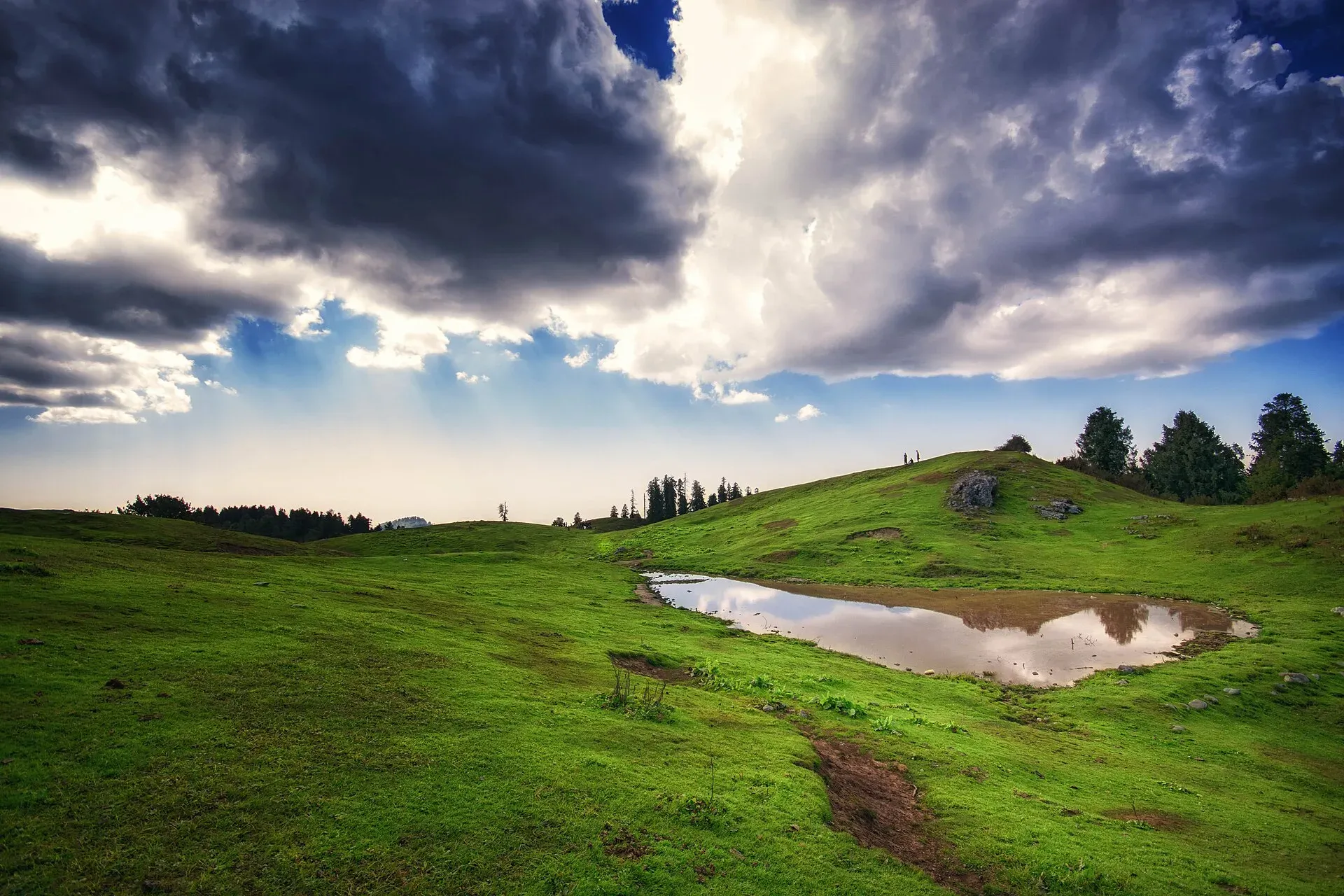
Photo: Arslan70, with thanks · CC BY-SA 4.0 · via Wikimedia Commons · temporary stand-in photo

Mushkpuri Top Trail
- Duration
- 1 day
- Distance
- 4 km
- Grade
- Moderate
- Max altitude
- 2,800 m
- Season
- May – Oct
A short climb above Dunga Gali to the grassy summit of Mushkpuri, the second-highest peak in the Galyat (about 2,800 m). Roughly 4 km each way; allow 1.5 to 3 hours up.
Overview
Mushkpuri Top is a grassy peak above Dunga Gali, in the Nathia Gali hills of Abbottabad District, about 90 km north of Islamabad. It lies in Ayubia National Park. Wikipedia gives its height as 2,800 m (citing the tourism department) and Dawn's 2010 walking feature gave 2,813 m, so use about 2,800 m. Some blogs quote 2,900 to 3,150 m, but there is no known official source for those higher figures. Miranjani (2,992 m on Wikipedia) is the higher peak. Dunga Gali, where the climb starts, is at about 2,500 m (Wikipedia), so the climb from the village is only a few hundred metres.
The hills around Dunga Gali and Nathia Gali are known as the Galyat. They are forested with conifers, and the summit itself is open grass.
About Ayubia National Park
The park covers 3,312 hectares, after a 1998 extension to the 1,684 hectares declared in 1984 (Dawn; Wikipedia). It rises from about 1,050 m in the valleys to about 3,027 m on the tops. Dawn describes three forest zones: subtropical pine forest, moist temperate conifer forest and sub-alpine meadow. Wikipedia lists deodar cedar, blue pine, yew, silver fir, horse chestnut and oak among the trees. Mammals include Indian leopard, red fox, golden jackal and rhesus macaque, and the park has recorded more than 200 bird species, among them kalij and koklass pheasants. Climate is cool in summer and harsh in winter, with monsoon rain from late July. The Khyber Pakhtunkhwa Wildlife Department manages the park, and its headquarters are at Dunga Gali.
Who it suits
Hikers of ordinary fitness. The climb is short and popular, though steep in places. Children who walk well can manage it. It is the easier of the two main Galyat summits to reach from Dunga Gali.
When to go
May to October is the usual hiking season. Winter snow can make the route a snow hike that needs proper footwear. Mornings are clearest. Monsoon fog and rain make the grass slippery, and the monsoon peaks in late July and August.
The route
There are two main approaches. From Dunga Gali (the eastern side) the track climbs through forest and then over open slopes. From Nathia Gali (the western side) Wikipedia describes a steady climb of about 4 km, often passing the Lalazar meadow. Blogs give about 4 to 4.5 km for the Dunga Gali route, which Wikipedia calls steeper. The summit is open grass, colder and windier than the towns below. The views cover the Galyat and, on clear days, distant ranges.
Several tracks cross the slopes around Dunga Gali, including the separate Pipeline Track, a level 4 km walk along a buried water pipe built by the British in 1930 (Dawn). Do not confuse the two: the pipeline walk stays on the contour, while the Mushkpuri route climbs. A large circular steel water tank above Dunga Gali, about 30 m across, is a landmark of that older system.
From Islamabad, Wikipedia places the peak about 90 km north. Murree is roughly 1,000 m lower than Dunga Gali, so expect it to be cooler and windier than where you started.
Culture and people
Dunga Gali and Nathia Gali are small hill towns that depend on summer visitors. The Dawn feature counts over 250,000 visitors a year to the park, mostly in summer, and more than 50,000 people living in villages around it. Respect farmland and forest, and buy water and food in town before you leave.
Practical information
- Allow roughly 1.5 to 3 hours up and 1 to 2 hours down (blog and operator figures from 60 minutes to 4 hours exist, so sources do not agree).
- There is no reliable water on the way.
- Wear warm layers; the top is cold even in summer.
- Leopards and other wildlife live in the park: keep to groups and daylight hours.
Highlights
- Second-highest summit in the Galyat
- Open grassy top with views
- Short climb from Dunga Gali
- Can be linked with Lalazar and Nathia Gali
Day by day
- StartDunga Gali
- Day 1Mushkpuri Top
- Day 1Dunga Gali
| Day | Route | Hours | Distance | Ascent / descent | Camp and altitude |
|---|---|---|---|---|---|
| Day 1 | Dunga Gali to Mushkpuri Top | 1.5–3 h | 4 km | not given | not given |
Day 1 notesStart from Dunga Gali and climb through forest, then over open grassy slopes to the summit. The slope is steady but steep in places. Rest at the top, enjoy the views and eat before heading down. | |||||
| Day 1 | Descent to Dunga Gali | 1–2 h | 4 km | not given | not given |
Day 1 notesReturn by the same route, taking care on wet grass and loose stones. | |||||
Getting there
From Islamabad drive via Abbottabad or Murree to Dunga Gali, about 2.5 to 3 hours. Local vans and taxis serve the Galyat road. The track begins from the village; ask a local for the exact start, as signage is limited. Nathia Gali, on the western side, is the other starting point.
Permits and rules
- Permit needed
- Usually not, Open zone
- Fee
- Current fees will be added soon
- Last checked
- 16 November 2026
Mushkpuri is inside Ayubia National Park. There is no confirmed official fee. Current fees will be added soon; ask locally at Dunga Gali.
How trekking permits, NOCs and registration work: Visa and permits.
Season
Best: May – Oct
Water and camps
Carry all your water. Camping in the park is not standard; stay in Dunga Gali or Nathia Gali.
Gear and safety
Altitude
Under 3,000 m, so altitude sickness is unlikely; wind chill is the main issue.
Wildlife
Leopards live in Ayubia National Park. Go in daylight and in groups.
Weather
Fog, rain and thunderstorms arrive fast. Winter hikes need snow gear.
Getting lost
Several tracks cross the slope. Keep to the main path and check with locals.
Variations
Link Mushkpuri with Lalazar meadow and Nathia Gali (one hard day or two easy days). Add the Pipeline Track, a level walk of about 4 km, in the afternoon.
Tips
- Start early to avoid afternoon cloud
- Carry a windproof layer
- Take water and snacks from town
- In snow, wear boots with traction
Stay and eat near the trek
Within 10 km of the trek's map point, nearest first.
Places to stay
- Hotel Elites NathiaGaliCall Hotel Elites NathiaGaliMap of Hotel Elites NathiaGali in Google Maps
- Richmond Boutique Hotel Nathia GaliCall Richmond Boutique Hotel Nathia GaliMap of Richmond Boutique Hotel Nathia Gali in Google Maps
- Raees Khana Hotel Nathia galiCall Raees Khana Hotel Nathia galiMap of Raees Khana Hotel Nathia gali in Google Maps
- Ombi Heights NathiagaliCall Ombi Heights NathiagaliMap of Ombi Heights Nathiagali in Google Maps
- Hotel Summer Retreat NathiagaliCall Hotel Summer Retreat NathiagaliMap of Hotel Summer Retreat Nathiagali in Google Maps
- Zesora Nathia GaliCall Zesora Nathia GaliMap of Zesora Nathia Gali in Google Maps
Places to eat
- Cafe FoodsterCall Cafe FoodsterMap of Cafe Foodster in Google Maps
- D.Dream grill cafe & Pizza houseCall D.Dream grill cafe & Pizza houseMap of D.Dream grill cafe & Pizza house in Google Maps
- Desi Butt Karahi nathiagali abbotabad road kpkCall Desi Butt Karahi nathiagali abbotabad road kpkMap of Desi Butt Karahi nathiagali abbotabad road kpk in Google Maps
- The GreyCall The GreyMap of The Grey in Google Maps
- Kaldis Cafe & GrillCall Kaldis Cafe & GrillMap of Kaldis Cafe & Grill in Google Maps
- Soy Pan AsianMap of Soy Pan Asian in Google Maps
Essential services ATMs, pharmacies and hospitals and clinics
ATMs
- MCB BANKMap of MCB BANK in Google Maps
Pharmacies
- Kashif Medical Store, Nathia GhaliMap of Kashif Medical Store, Nathia Ghali in Google Maps
Hospitals and clinics
- Shaheen Women and children hospital kalabagh Nathiagali Abbottabad- Paediatric Medical SevicesCall Shaheen Women and children hospital kalabagh Nathiagali Abbottabad- Paediatric Medical SevicesMap of Shaheen Women and children hospital kalabagh Nathiagali Abbottabad- Paediatric Medical Sevices in Google Maps
- BHU Nagri BalaCall BHU Nagri BalaMap of BHU Nagri Bala in Google Maps
Listings come from Google Maps data and are unverified: phone numbers, opening months and prices may have changed. Report a problem · Own one of these? Claim it
Health and emergency
Mobile signal is patchy on most treks, so tell someone your plan before you go. Emergency numbers
Sources and last checked
Last checked Confidence medium6 sources6 still to check
- Last checked
- Method
- Desk research from published sources
- Confidence
- medium
- Checked by
- trek.pk research team
Researched from published sources; not yet checked on the ground by our team. Spot something out of date? Report a mistake.
Sources
- Mushkpuri Top · Wikipedia · checked
- Exploring the famous Mushkpuri peak · Graana.com blog · checked
- Pakistan treks and mountain ranges (trek.pk research report) · trek.pk research · checked
- Environment: A walk in the woods (14 February 2010) · Dawn · checked
- Dunga Gali · Wikipedia · checked
- Ayubia National Park · Wikipedia · checked
Still to be checked on the ground (6)
- Times up and down (Wikipedia gives none; blogs range from about 1 to 4 hours)
- Which side is easier (sources conflict: Wikipedia says the Dunga Gali side is steeper; one blog calls Nathia Gali longer but easier)
- Dunga Gali route length (blogs 4 to 4.5 km; Wikipedia gives 4 km only for the Nathia Gali side)
- Entry fee for Ayubia National Park (no amount in Wikipedia or any official source found)
- Park visitor figures differ (Dawn 2010: over 250,000 a year; Wikipedia body text: over 100,000)
- Whether any signboard or staff at Dunga Gali mark the start of the Mushkpuri path
Nearby and related

Miranjani Top Trail

Pipeline Track

Ansoo Lake Trail

Mushkpuri
Mushkpuri Top (about 2,800 m) is the second highest peak of the Galyat, above Dunga Gali in Ayubia National Park. A 4 km climb from Nathia Gali leads through deodar forest.

Dunga Gali
A small Galyat hill town at about 2,500 m, 3 km from Nathia Gali, once a British sanatorium. It is the headquarters of Ayubia National Park and a base for walks to Mukeshpuri and Miranjani.

Ayubia National Park
A cool pine and fir forest park in the Galyat hills above Abbottabad, with the Pipeline Track, a chairlift, leopards and many birds. Established 1984, about 33 square kilometres.