

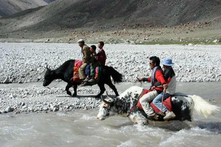
Photo: Pm.pfeiffer, with thanks · Public domain (CC0) · via Wikimedia Commons · temporary stand-in photo

Shimshal Pamir
The high summer pastures above Shimshal village at about 4,350 to 4,700 m, grazed by yaks, sheep and goats, with two lakes and Shimshal Pass (4,735 m) at the upper edge. Reached on foot only.
Overview
The Shimshal Pamir is a wide area of high summer pasture above Shimshal village in the Gojal part of Hunza. The Shimshal people use it to graze yaks, sheep and goats. Our trek page puts the pastures above 4,500 m and says about a thousand yaks and thousands of sheep and goats graze there each summer. Wikipedia lists the Pamir among Shimshal's extensive pasture lands, which are several days' walk from the village.
It lies on the watershed between South and Central Asia. Shimshal Pass (4,735 m) is at its upper edge, with two lakes close by. The Pamir is a working landscape first and a trekking destination second.
Plan your visit
- Nearest town
- Shimshal
- Getting there
No road reaches the Pamir. From the Karakoram Highway near Passu, a rough jeep road of about 56 km runs up the Shimshal River gorge to Shimshal village (about three hours by jeep; unsealed and exposed to rockfall). More
Best months
Jun – Sep
- Shimshal Pamir
- Related places nearby: Shimshal Pass, Shpodeen Pass, Shachmirk Pass, Gojal and Shimshal, Khunjerab National Park
What to see and do
- Grassland and herds. Open ground with flowers in summer, yaks and flocks, and summer settlements such as Shuizherav (4,350 m) and Shuwerth.
- Shuwerth. The main summer settlement. Women make milk products there and welcome visitors. Ask before photographing people or entering a hut.
- The lakes and Shimshal Pass. Two lakes lie near the pass. Camps near the lakes are the best on the route.
- Yak race. Wikipedia says villagers hold a yak race and festival at Shimshal Pass each year in the last week of July or the first week of August. Confirm the dates with people in Shimshal.
- Peaks. Hispar Muztagh peaks can be seen from Gar-e-Sar, and Mungalig Sar to the east of Purien-e-Sar. Mungalig Sar (5,931 m) can be climbed from the lakes by properly equipped parties (see the trek page).
Wildlife
Wikipedia records 1,692 blue sheep (bharal) counted in the Shimshal area in a 2025 survey, and the page for Khunjerab National Park lists the bharal there as endangered. The park as a whole protects Marco Polo sheep, snow leopards and Siberian ibex. Whether any of these are seen on the Pamir itself depends on the day, and none can be promised.
Shimshal and its setting
Shimshal village stands at about 3,113 m and is the highest settlement in Hunza District. Wikipedia gives the valley an area of about 3,800 km2, and a population of more than 2,000 (the text cites about 3,000 in 450 households). The jeep road from Passu opened in October 2003. Around the valley rise Distaghil Sar (7,885 m), Kunjut Sar (7,790 m), Trivor (7,577 m) and Yukshin Gardan Sar (7,530 m). See the Gojal and Shimshal page.
Culture and seasons
The Shimshalis are Wakhi and have a long link with the Pamir. Women and children move up to the pastures in late May, to Shuwerth in June, back to Shuizherav in early September and home in early October. A local custom asks visitors not to enter the women's pastures in a sad mood; singing is the best way in.
Getting to the Pamir
There is no road. From Shimshal village the usual way is the gorge ("tang") trail along the Pamir-e-Tang River, which was widened and bridged in 1997. The harder "uween" (pass) trail crosses Shachmirk Pass (4,560 m) and Uween-e-Sar (4,650 m) in one very long day. Our trek page describes a five-day round trip from Shimshal village, with camps at Wuch Furzeen (3,365 m), Shuizherav and the lakes below Shimshal Pass. Local help is needed on the exposed sections.
When to visit
June to September. From June to early September the pastures are at their busiest.
Where to stay and eat
There are no hotels on the Pamir. Trekkers camp, and food is carried in. Shimshal village has basic guesthouses; arrange them through an operator. Current prices will be added soon.
Permits and safety
- The old guidebook lists the trek as open with no permit. Some operators call it a restricted-zone trek and say the Pamir is open to Shuwerth only. No official notice was found. Dawn reported in February 2026 that foreign trekkers in restricted zones need permits from the Gilgit-Baltistan tourism department and that fees rose sharply. Check with a licensed Pakistani operator before you book.
- Shimshal Pass is near the Chinese border. Expect checks. Do not cross the border.
- Most of the Shimshal Pamir lies inside Khunjerab National Park, according to our trek page, though Wikipedia says the Shimshal Pass itself is not part of the park. Ask about park rules.
- Travel advice. For foreign visitors: the UK FCDO (checked 17 November 2026) does not advise against Gilgit-Baltistan as a whole, but it advises against all travel on the Karakoram Highway between Mansehra and Chilas and within 10 miles of the Line of Control. Check the live page before you travel.
- There is no phone signal. Carry a satellite messenger and a full first-aid kit.
Related passes and treks
- Shimshal Pamir trek: five days from Shimshal village.
- Shimshal Pass, Shachmirk Pass and Shpodeen Pass.
Highlights
- Yak pastures above 4,500 m on the South-Central Asia watershed
- Two lakes below Shimshal Pass (4,735 m)
- Summer herder settlements at Shuizherav and Shuwerth
- Gorge trail or the harder Shachmirk and Uween-e-Sar route
Getting there
No road reaches the Pamir. From the Karakoram Highway near Passu, a rough jeep road of about 56 km runs up the Shimshal River gorge to Shimshal village (about three hours by jeep; unsealed and exposed to rockfall). From the village the Pamir is reached on foot: about two days to Shuizherav (4,350 m) and a third day to the lakes and Shimshal Pass, according to our trek page.
Tips
- Go with a local guide; the gorge trail has exposed sections
- Sleep at 4,350 m and 4,700 m: go up slowly
- Enter the pastures singing, as local custom asks
- Agree the number of stages with porters before you start
- Ask before photographing people or entering a hut
Wildlife
Photos we still need: the Shimshal Pamir grasslands and herds; the lakes near Shimshal Pass; the Pamir-e-Tang gorge trail. Send us yours
Sources and last checked
Last checked Confidence low5 sources6 still to check
- Last checked
- Method
- Desk research from published sources
- Confidence
- low
- Checked by
- trek.pk research team
Researched from published sources; not yet checked on the ground by our team. Spot something out of date? Report a mistake.
Sources
- Shimshal Pamir (trek.pk) · trek.pk · checked
- Shimshal · Wikipedia · checked
- GB winter adventure tourism hit by soaring permit fee, visa delays · Dawn (1 Feb 2026) · checked
- Foreign travel advice: Pakistan · UK FCDO · checked
- Khunjerab National Park (wildlife, Shimshal bharal count) · Wikipedia · checked
Still to be checked on the ground (6)
- Extent and altitude range of the Pamir (no published figure; 4,350 to 4,735 m taken from camps on the trek page)
- Coordinates are those of the trek (Shimshal area), not a surveyed centre of the pastures
- Permit rules for foreigners to reach the Pamir, Shuwerth and Shimshal Pass (sources disagree; no official notice found)
- Whether the Pamir lies inside Khunjerab National Park (trek page says most of it does; Wikipedia says only that the pass is outside)
- Yak race dates (Wikipedia: last week of July or first week of August)
- Distances and times are from a c. 2002 guidebook
Nearby and related

Shimshal Pamir

Shimshal Village

Qachqar-e-Dur and Shpodeen Pass

Boisum and Chafchingol Passes
Shimshal Pass
A high pass of about 4,735 m above Shimshal, on the watershed between the Indus and Tarim basins near the Chinese border. Reached on a five-day trek; yak race festival in summer.
Shpodeen Pass
A snow-covered pass of about 5,346 m in the South Ghuzherav mountains above Shimshal, crossed without glacier travel on a seven-day loop.
Shachmirk Pass
A pass of 4,560 m on the Shimshal Pamir uween trail, crossed in one very long day together with Uween-e-Sar (4,650 m). Strong parties only. Restricted-zone area near the Chinese border.

Gojal and Shimshal
Upper Hunza: Gulmit, Ghulkin, Passu and Sost on the Karakoram Highway, with big glaciers and the Passu Cones, plus the remote Shimshal valley, its Wakhi village and its mountaineering community.

Khunjerab National Park
A high-altitude park on the Pakistan-China border, created in 1975 to protect Marco Polo sheep, snow leopard and Himalayan ibex. It surrounds the Khunjerab Pass on the Karakoram Highway.