

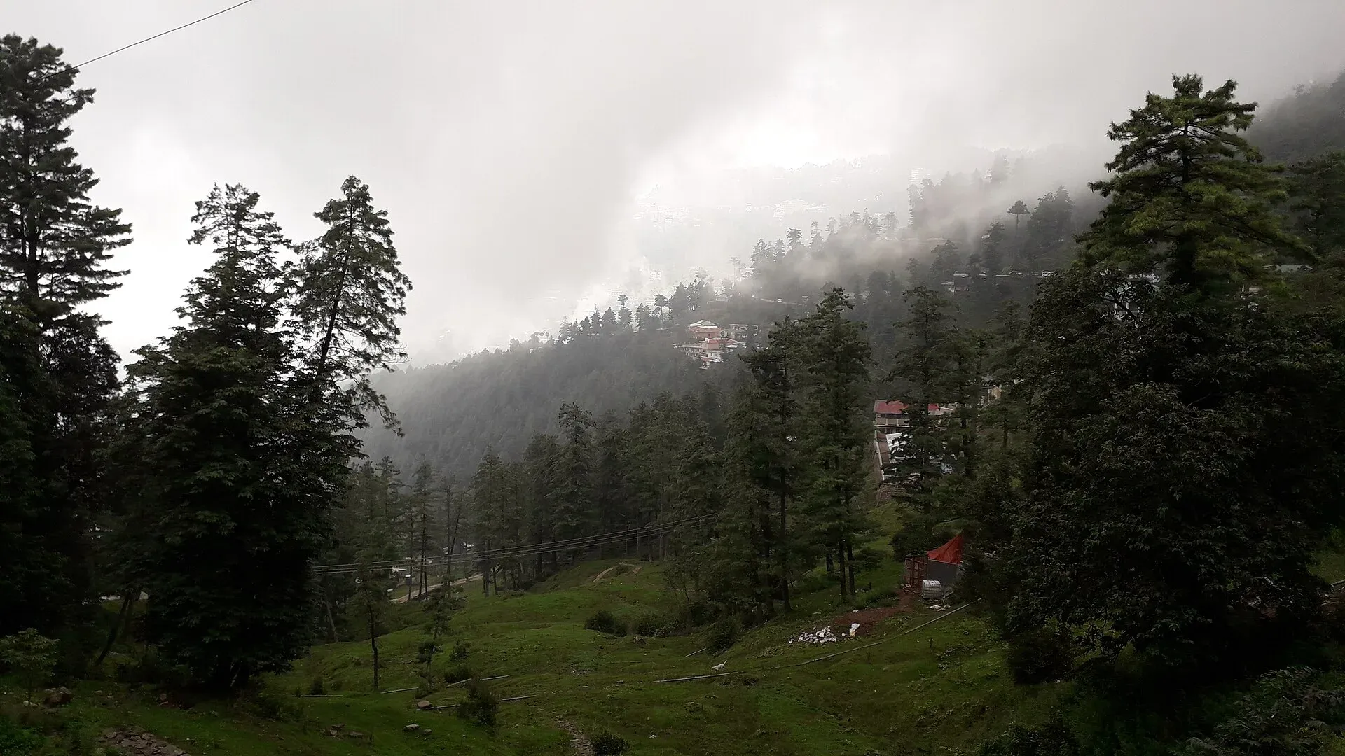
Photo: King Eliot, with thanks · CC BY-SA 4.0 · via Wikimedia Commons · temporary stand-in photo

Galyat Pine Forests
The conifer and mixed forests of the Galyat hills between Murree and Abbottabad: pine, fir and oak at 2,000 to 2,400 m, with Ayubia National Park and a UNESCO biosphere reserve.
Overview
Galyat is a hill region about 50 to 80 km north-east of Islamabad, across the Khyber Pakhtunkhwa and Punjab border between Murree and Abbottabad. Its high point is given as about 2,410 m. Wikipedia describes it as forested with pine, cedar, walnut, oak and maple (its Ayubia National Park page names deodar, blue pine, yew, silver fir, horse chestnut and oak), and says UNESCO included the region among its biosphere reserves in 2023.
The word Galyat comes from "gali", an Urdu word for a pass between two mountains that is not the highest point of the range. Many town names carry it. The towns include Ayubia, Nathia Gali, Thandiani, Khanspur, Dunga Gali and Bara Gali in KP, and Murree, Ghora Gali and Jhika Gali on the Punjab side.
Plan your visit
- Nearest town
- Nathia Gali
- Getting there
From Islamabad, Nathia Gali is about 86 km by road (OSRM, modelled 1.3 h) and Ayubia about 80 km (1.2 h). Murree and Abbottabad are the usual approach towns. More
Best months
Apr – Jun, Sep – Oct
People and history
Early British officials, among them James Abbott around 1846 to 1847, first documented the Galyat tracts. The British developed hill resorts here to escape the summer heat of the plains. After 1947 the area was neglected for a time, then developed again from the 1960s as a resort region. The Karlal tribe, which the British called the "Karral country", is still the dominant tribe, and the language is Hindko (the local dialect is called Dhundi-Kairali).
Walking in the forest
The forest is mainly a walking landscape. The best-known walking route is the Pipeline Track in Ayubia National Park, which Wikipedia gives as 4 km between Ayubia and Nathia Gali. The park also has a chairlift to Mukeshpuri summit, billed as the first of its kind in Pakistan; see Ayubia Chairlift. Ayubia National Park is described on its own page: Ayubia National Park. See also Miranjani.
Forest paths can be muddy and slippery after rain; wear shoes with grip. Moisture from the monsoon keeps the forest green in summer, and the air is cooler than Islamabad.
Ayubia National Park
Ayubia National Park covers about 3,312 hectares and was declared in 1984 and enlarged in 1998. It is named after President Ayub Khan and managed by the KP Wildlife Department. Its headquarters is at Dunga Gali, about 50 km from Abbottabad and 25 km from Murree. The park averages about 2,400 m, receives about 1,644 mm of rain a year and has 104 plant species, 23 mammals and 203 birds (Wikipedia). Over 100,000 visitors a year come to the park and nearby places. In September 2023 a proposal to de-notify the park was contested by wildlife officials and conservationists (Wikipedia); its current status is not confirmed.
Wildlife
Mammals include Indian leopard, leopard cat, golden jackal, red fox, yellow-throated marten, rhesus macaque, Indian porcupine and flying squirrels. Birds include kalij and koklass pheasants, speckled wood pigeon, great barbet, golden eagle and Kashmir nuthatch. Wikipedia gives no status for the leopard, so how common it is locally is not known. Walk in groups, keep dogs under control and do not disturb animals. Monkeys are common near picnic spots, so keep food packed away.
When to visit
April to June and September to October are the pleasant months. The monsoon brings mist and heavy rain, and winter can bring snow. Ayubia's winters are cold; snow can lie through the later part of the season, and rain turns to snow as the west winds arrive (Wikipedia).
Where to stay and eat
Nathia Gali, Ayubia and Dunga Gali have many hotels and guest houses. Food is simple and local.
Good to know
- Road access: Islamabad to Nathia Gali is about 86 km (modelled 1.3 h) and to Ayubia about 80 km (1.2 h) (OSRM). See the Murree, Galyat and Abbottabad route.
- Forest pressure: Murree and Galyat forests have suffered from illegal cutting and fires. The 2026 wildfires in the neighbouring Kotli Sattian forests burned over 3,000 hectares, showing how vulnerable these pine slopes are in dry spring weather. Never light open fires, and put cigarettes out fully.
- Travel advice: For foreign visitors: the UK FCDO notes KP emergency measures and Governor's Rule since 11 October 2026. Check the live page for Abbottabad district before you go.
- Entry or park fees may apply; current fees will be added soon.
- Weekends and holidays in summer bring heavy traffic on the narrow hill roads, so start early.
Highlights
- Pine, fir and oak forest at 2,000 to 2,400 m
- Ayubia National Park and the Pipeline Track
- UNESCO biosphere reserve listing (2023)
- Short drive from Islamabad
Getting there
From Islamabad, Nathia Gali is about 86 km by road (OSRM, modelled 1.3 h) and Ayubia about 80 km (1.2 h). Murree and Abbottabad are the usual approach towns.
Tips
- Start walks early
- Never light fires in the forest
- Check weather: monsoon mist is heavy
- Carry your own water
Photos we still need: Thandiani or Dunga Gali town view. Send us yours
Sources and last checked
Last checked Confidence medium5 sources4 still to check
- Last checked
- Method
- Desk research from published sources
- Confidence
- medium
- Checked by
- trek.pk research team
Researched from published sources; not yet checked on the ground by our team. Spot something out of date? Report a mistake.
Sources
- Galyat (Wikipedia) · Wikipedia · checked
- Ayubia National Park (Wikipedia) · Wikipedia · checked
- Wildfires ravage Kotli Sattian forests (June 2026) · The Express Tribune · checked
- Pakistan travel advice (updated 27 October 2026) · UK Foreign, Commonwealth & Development Office · checked
- OSRM driving routes (modelled distance and time) · OSRM project · checked
Still to be checked on the ground (4)
- Biosphere reserve boundary and date (2023, Wikipedia only; unesco.org page was refused and the Wikipedia list page does not exist)
- How common leopards are locally (Wikipedia lists the Indian leopard in Ayubia National Park but gives no status)
- Current status of the 2023 proposal to de-notify Ayubia National Park (Wikipedia, no later source opened)
- Whether the 4 km Pipeline Track figure and start and end points are current
Nearby and related

Ayubia National Park
A cool pine and fir forest park in the Galyat hills above Abbottabad, with the Pipeline Track, a chairlift, leopards and many birds. Established 1984, about 33 square kilometres.

Nathia Gali
A pine-forest hill station at about 2,410 m in the Galyat hills, with a wooden colonial church, walks to Miranjani and Mukeshpuri, and snow from December to February. Roads often close in heavy snow.

Thandiani
A thickly forested hill station at about 2,750 m above Abbottabad, started by British missionaries and a sanatorium. Snow can close the road for days, so check conditions in winter.

Murree
Hill resort and district capital at about 2,300 m in the Galyat hills above Islamabad. Mall Road, viewpoints, cool summers and winter snow; busy at weekends.

Dunga Gali
A small Galyat hill town at about 2,500 m, 3 km from Nathia Gali, once a British sanatorium. It is the headquarters of Ayubia National Park and a base for walks to Mukeshpuri and Miranjani.

Khanspur
A small Galyat hill resort at about 2,250 m in the Ayubia area of Abbottabad district, next to Ayubia National Park. Cool summers and heavy winter snow.