

Photo: Gali mallot, with thanks · CC BY-SA 4.0 · via Wikimedia Commons · temporary stand-in photo

Bagh, Azad Kashmir
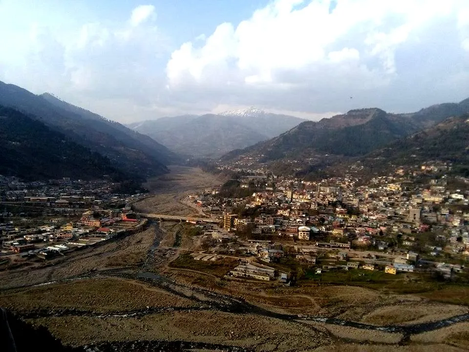
Bagh is the headquarters of Bagh District in Azad Kashmir, a mountain town in the Pir Panjal foothills and the base for Sudhan Gali and Ganga Choti. For foreign visitors: the UK FCDO advises against all but essential travel to AJK.
Overview
Bagh is the chief town and district headquarters of Bagh District in Azad Jammu and Kashmir. Wikipedia and Wikivoyage place it where two streams meet, the Malwani and the Mahl (Wikivoyage spells it Mall), and give the surrounding Bagh Valley a height of about 1,038 m. Wikipedia gives the town a 2017 population of 33,548. It is about 80 km from Muzaffarabad (the district page lists 80 km via Sudhan Gali and 97 km via Kohala) and 46 km from Rawalakot.
The district was formed in 1988 from Poonch District. Wikipedia gives its area as 770 sq km and its 2017 census population as 371,919. It is wholly mountainous, in the Pir Panjal range, with general heights of 1,500 to 2,500 m, pine forest, the Mahl stream as the main river, and about 1,500 mm of rain a year. Most people speak Pahari. Wikipedia's district page lists three tehsils (Bagh, Dhirkot and Haveli), but its town page names Hari Gehal instead of Haveli, so the list is unconfirmed.
Plan your visit
- Nearest town
- Bagh
- Getting there
Bagh is about 80 km from Muzaffarabad by the Sudhan Gali road or 97 km by Kohala, and about 160 km from Islamabad according to Wikipedia. An online routing check gives about 156 km and under two hours of driving; More
Best months
May – Oct
- Bagh, Azad Kashmir
- Related places nearby: Sudhan Gali, Ganga Choti, Azad Jammu and Kashmir, Muzaffarabad, Neelum Valley, Panjal Mastan National Park, Toli Pir National Park, Subri Lake, Kotla Waterfalls (Bagh), Rawalakot, Dhirkot
History in brief
Bagh was destroyed in the earthquake of 8 October 2005, which killed many people, a large number of them schoolchildren. The town has been rebuilt. Wikipedia's page carries maintenance warnings, so its figures should be treated with care.
What to see and do
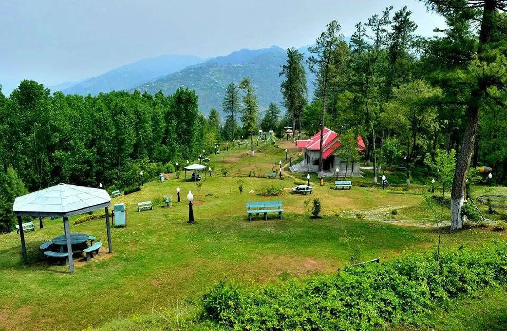
Photo: Gali mallot, with thanks · CC BY-SA 4.0 · via Wikimedia Commons · temporary stand-in photo

Bagh is mainly a base for the hills around it. Wikivoyage lists these sights for the district: Dhirkot, a hill station; Ganga Choti, the highest peak at about 3,044 m; the Khotla waterfall (Kotla Waterfalls); Neela But; Las Danna; and Panjal Mastan National Park, whose high plateaus average about 2,800 m. Wikivoyage says the park has wildflowers in spring, snow in winter and occasional wild boar, monkeys and leopards.
- Sudhan Gali and Ganga Choti. The main outing from Bagh. Sudhan Gali is a hill resort on the Muzaffarabad road. A 2016 Dawn travel account puts it at about 7,800 feet on a signboard, with a small bazaar, simple eateries that close early and walking trails. The same writer describes the hike or lift to the Ganga Choti viewpoint as about 8 km uphill from Sudhan Gali, on a road that turns from paved to rocky, then about 20 minutes on foot from where vehicles stop. The writer advises against going in cloud, when there is nothing to see.
- Local life. The bazaar is the place to buy supplies and arrange transport.
TDAP's 2021 guide lists the Bagh Valley and several lakes (Baghsar, Chitta Katha, Ratti Gali, Ganga and Subri) among Azad Kashmir attractions. Which of them lie in Bagh District, and how to reach them, has not been checked.
Getting there and around
Public minibuses ("wagons") ran between Bagh and Rawalakot when the 2016 Dawn writer travelled; that report is the only transport source found, and current services are unconfirmed. The same writer's coaster from Bagh to Sudhan Gali took about two hours against a driver's estimate of one hour, so allow extra time on mountain roads. Beyond Sudhan Gali, access to Ganga Choti depended on trucks.
When to visit
Wikipedia gives temperatures of 2 to 40 degrees C across the district. No seasonal guide was found; May to October is a reasonable estimate for the hills. Landslides in the rains can close mountain roads.
Where to stay and eat
Bagh has hotels and restaurants for the district's traffic, but no official list has been found. Wikivoyage names one, Hotel Deewan-e-Aziz International on Janglat Road in the centre, described as a hotel with a restaurant. Sudhan Gali has simple lodging nearer to the peak; the 2016 Dawn account mentions a tourism-department guesthouse and a private hotel there, and typical meals of paratha, egg and tea, chicken karahi, or daal with bread.
Good to know
- Travel advice. For foreign visitors: the UK FCDO (updated 27 October 2026, checked 16 November 2026) advises against all but essential travel to Azad Jammu and Kashmir, and against all travel within 10 miles of the Line of Control. Parts of Bagh District may be within that 10-mile zone; this has not been measured. Read the live page and ask local officials.
- Fees. None known for the town itself.
- Respect. Many families lost children in 2005. Be sensitive when asking about it.
- Nearby. Sudhan Gali, Ganga Choti, Rawalakot, Muzaffarabad and Neelum Valley.
Highlights
- District headquarters in the Pir Panjal foothills
- Base for Sudhan Gali and Ganga Choti
- Rebuilt after the 2005 earthquake
- About 80 km from Muzaffarabad
Hotels, food, fuel and services in Bagh, Azad Kashmir
Places to stay
- Urwa Hotel & RestaurentCall Urwa Hotel & RestaurentMap of Urwa Hotel & Restaurent in Google Maps
- Hotel Al-Shangrila Palace & ResidentsCall Hotel Al-Shangrila Palace & ResidentsMap of Hotel Al-Shangrila Palace & Residents in Google Maps
- Diyar Resort BaghMap of Diyar Resort Bagh in Google Maps
- PWD Rest House DHQ BaghCall PWD Rest House DHQ BaghMap of PWD Rest House DHQ Bagh in Google Maps
Places to eat
- Hotel Kashmir InternationalCall Hotel Kashmir InternationalMap of Hotel Kashmir International in Google Maps
- Abbasi Hotel & RestaurantMap of Abbasi Hotel & Restaurant in Google Maps
- Kashmir Savour FoodsCall Kashmir Savour FoodsMap of Kashmir Savour Foods in Google Maps
- Ahmed Bakers Main BranchMap of Ahmed Bakers Main Branch in Google Maps
Essential services fuel stations, mechanics and hospitals and clinics
Fuel
- BAGH KASHMIR PETROLEUM- Total Petrol StationCall BAGH KASHMIR PETROLEUM- Total Petrol StationMap of BAGH KASHMIR PETROLEUM- Total Petrol Station in Google Maps
- ShellMap of Shell in Google Maps
- SHAHID PETROLEUM SERVICECall SHAHID PETROLEUM SERVICEMap of SHAHID PETROLEUM SERVICE in Google Maps
- AKHTAR's PETROLEUMCall AKHTAR's PETROLEUMMap of AKHTAR's PETROLEUM in Google Maps
Mechanics and tyre shops
- Bukhari Honda CentreCall Bukhari Honda CentreMap of Bukhari Honda Centre in Google Maps
- Shani AutosCall Shani AutosMap of Shani Autos in Google Maps
Hospitals and clinics
- DHQ HospitalMap of DHQ Hospital in Google Maps
- Inayat Eye HospitalMap of Inayat Eye Hospital in Google Maps
- Basic Health Unit Kharl AbbasianMap of Basic Health Unit Kharl Abbasian in Google Maps
- Ashraf Memorial HospitalMap of Ashraf Memorial Hospital in Google Maps
Listings come from Google Maps data and are unverified: phone numbers, opening months and prices may have changed. Report a problem · Own one of these? Claim it
Tips
- Check the FCDO AJK and Line of Control advice first
- Allow a full day from Islamabad
- Plan mountain drives for dry weather
- Be sensitive about the 2005 earthquake
Photos we still need: the bazaar or a street in Bagh town for the getting-there section. Send us yours
Sources and last checked
Last checked Confidence low9 sources7 still to check
- Last checked
- Method
- Desk research from published sources
- Confidence
- low
- Checked by
- trek.pk research team
Researched from published sources; not yet checked on the ground by our team. Spot something out of date? Report a mistake.
Sources
- Bagh, Azad Kashmir · Wikipedia · checked
- Bagh District · Wikipedia · checked
- Dhirkot Tehsil · Wikipedia · checked
- Pakistan Tourism Guide 2021 · TDAP · checked
- Sudhan Gali will make you forget Murree (18 September 2016) · Dawn · checked
- Pakistan travel advice (updated 27 October 2026) · UK Foreign, Commonwealth & Development Office · checked
- Bagh · Wikivoyage · checked
- Route Islamabad to Bagh (OSRM) · OSRM · checked
- Travel account of Bagh, Sudhan Gali and Ganga Choti (2016) · Dawn · checked
Still to be checked on the ground (7)
- Town altitude (Wikipedia gives 1,676 m in the summary box and 1,038 m for the valley, so omitted)
- Tehsil structure of the district (Wikipedia pages disagree: Haveli or Hari Gehal)
- Public transport services (no source; Dawn 2016 mentions a minibus to Sudhan Gali)
- Hotels and facilities beyond the one hotel Wikivoyage lists
- Whether parts of the district fall within 10 miles of the Line of Control
- Whether the minibus services between Bagh and Rawalakot described in 2016 still run
- Current state of the road from Sudhan Gali to the Ganga Choti viewpoint (2016 account: paved then rocky, vehicles sometimes stuck in mud)
Nearby and related

Ganga Choti Trail

Sudhan Gali
A small hill resort at about 2,100 m on the Bagh-Muzaffarabad road in Bagh District, Azad Kashmir, and the usual start for the Ganga Choti hike. Quiet and basic. For foreign visitors: the UK FCDO advises against all but essential travel to AJK.

Ganga Choti
A 3,045 m peak of the Pir Panjal in Bagh District, Azad Kashmir, reached by a steady 8 km uphill walk or an off-road track from Sudhan Gali. Wide views over the hills. For foreign visitors: the UK FCDO advises against all but essential travel to AJK.

Azad Jammu and Kashmir
A green, hilly region in the Himalayan foothills: Muzaffarabad, the Neelum and Leepa valleys, lakes and waterfalls. Visit with local advice on permission and the Line of Control.

Muzaffarabad
The capital of Azad Jammu and Kashmir, at 737 m where the Neelum and Jhelum rivers meet. It is the gateway to the Neelum Valley and a rebuilt city after the 2005 earthquake.

Neelum Valley
A long, forested river valley in Azad Kashmir running north-east from Muzaffarabad to Sharda, Kel and Arang Kel. It runs close to the Line of Control, so check access before you go.

Panjal Mastan National Park
A high plateau park in Bagh district, Azad Kashmir, at about 2,800 m in the Pir Panjal range. Known for spring wildflowers, fog and a cold, snowy winter.
Toli Pir National Park
A rugged mountain park in the Rawalakot area of Azad Kashmir, rising from about 1,500 m to over 6,000 m by Wikipedia's account, with black bear and leopard.
Subri Lake
A small lake about 8 km south-east of Muzaffarabad on the Chakothi road, said to have formed after a cloudburst in 1975. Little visitor information is available.
Kotla Waterfalls (Bagh)
Waterfalls near Kotla village in northern Bagh district, Azad Kashmir, listed as a popular tourist spot. Little detailed information is published.

Rawalakot
The main town of Poonch district in Azad Kashmir, at about 1,640 m, and the usual base for Banjosa Lake and Toli Pir. Cool in summer, with snow in winter. FCDO advises against all but essential travel to AJK.
Dhirkot
A small town and tehsil seat in Bagh district, Azad Kashmir, on the Kohala-Dhirkot road towards Bagh and Poonch. Not set up for tourism; FCDO advises against all but essential travel to AJK.