

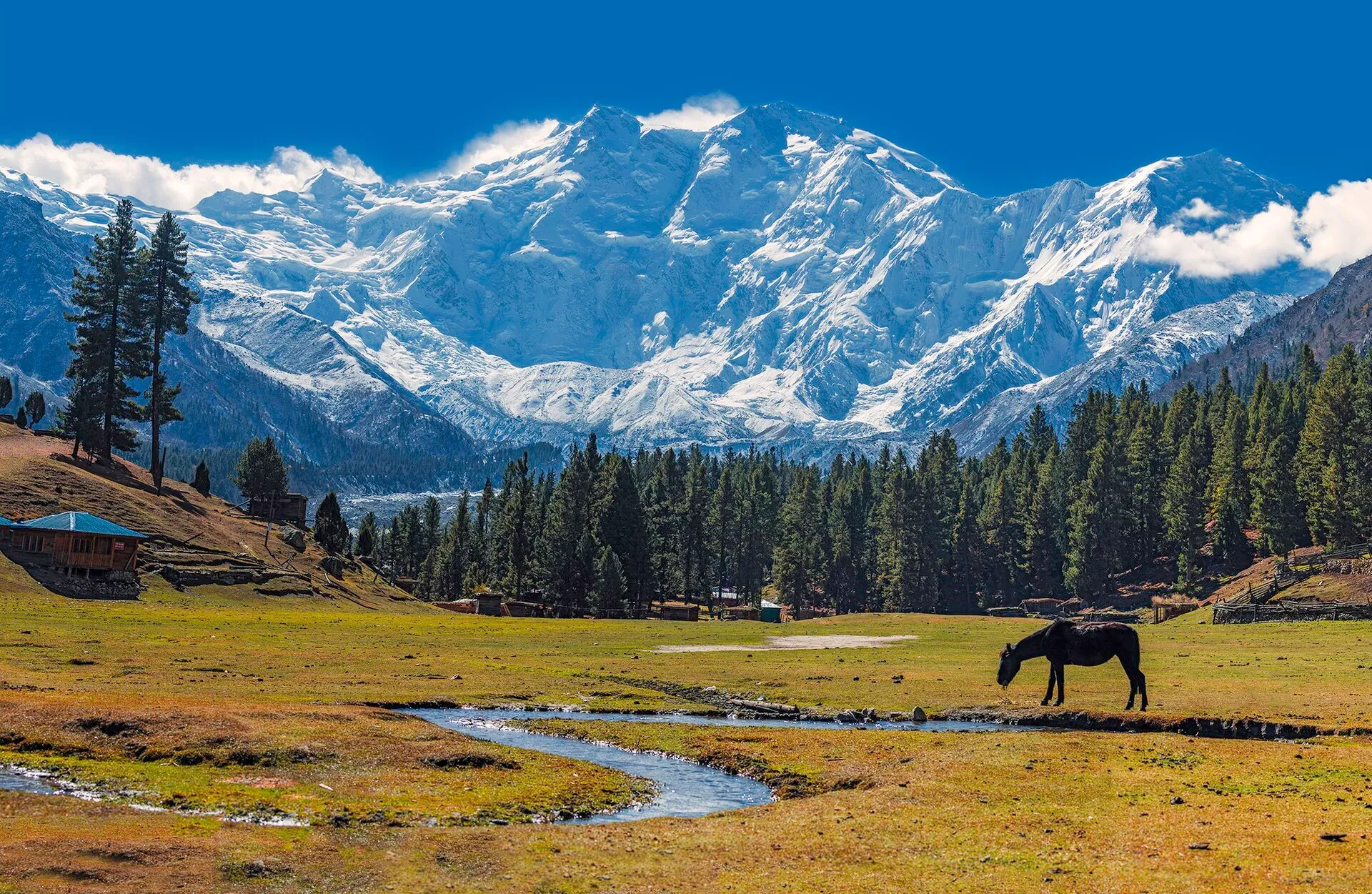
Photo: Imrankhakwani, with thanks · CC BY-SA 4.0 · via Wikimedia Commons · temporary stand-in photo

Beyal Camp Viewpoint
Beyal is a quiet high meadow camp beyond Fairy Meadows at about 3,500 m, with the 'View Point' boulder (3,667 m) 30 minutes further, looking at the icefalls of Nanga Parbat's north face.
Overview
Beyal is a meadow camp at about 3,500 m, an easy walk beyond Fairy Meadows on the north side of Nanga Parbat. The name is said to mean "cave-like", after the rocks across the stream. It is usually quieter than Fairy Meadows. About 30 minutes beyond it a boulder at the edge of the moraine (the ridge of rock and debris left along the side of a glacier) is called View Point and stands at about 3,667 m.
Plan your visit
- Nearest town
- Chilas
- Getting there
From the Karakoram Highway at Raikot Bridge, take a local jeep about 15 km to Tato (private vehicles are not normally allowed). Walk about 5 km to Fairy Meadows (Wikipedia says 3 to 4 hours; More
Best months
Jun – Sep
The walk from Fairy Meadows
The route from Fairy Meadows (about 3,300 m) is about 5 km and takes around 1.5 hours. The trail follows the edge of the terrace above the end of the Raikot (Rakhiot) Glacier, then runs through pine and fir beside a birch-lined stream. Fairy Meadows sits in thick alpine forest: blue pine, spruce and fir on the higher slopes, with birch and willow scrub in the shadier high ground and juniper on the southern slopes. Beyal has a spring and a view back down the valley.
Before that, the access is the usual Fairy Meadows one. A local jeep covers the steep, narrow 15 km track from Raikot Bridge to Tato, and a walk of about 5 km (3 to 4 hours by one account, as little as 2 by others) leads up to Fairy Meadows. See the Fairy Meadows page and the Fairy Meadows to Nanga Parbat Base Camp trek.
What to see and do
From Beyal you look down the valley towards the Indus and Rakaposhi. From View Point the close views include four icefalls from the Chongra peaks (6,448 to 6,830 m), Raikot Peak (7,070 m) and Nanga Parbat's north face, which together feed the Raikot Glacier. Looking north you see the Indus valley and the distant Rakaposhi-Haramosh range.
Seen from the meadows, the peak that looks like the summit is the North Peak (7,816 m). The true summit (8,126 m) is hidden behind it and the Silver Saddle.
From View Point the trail continues across the rubble-covered ice of the Ganalo Glacier on a cairned (stone-marked) route to Nanga Parbat Base Camp at about 3,970 m. The trek page lists this as roughly 3 to 4 hours from Beyal, 8 km there and back from Beyal.
Wildlife and woodland
Brown bears live in the forests around Fairy Meadows, though their numbers are falling, and so does the endangered musk deer. Fairy Meadows has been a national park since 1995 and part of Nanga Parbat National Park since 2021. Local people stopped timber cutting to protect the forest.
When to visit
The usual season runs from late May to mid-October; another source gives April to the end of September for the Fairy Meadows area. Mornings are normally clearest. Beyal can run short of water late in the season when snowmelt stops. Snow covers the trail in winter.
Where to stay and eat
Beyal has simple tent camps, huts and a spring. A camping fee applies; current fees will be added soon, so ask when you arrive. Herders also use sod-roofed huts here in summer.
Good to know
- Getting there: Raikot Bridge to Tato by jeep (about 15 km; local jeeps only), then about 5 km on foot to Fairy Meadows, then about 5 km and 1.5 hours to Beyal.
- Safety: Altitude above 3,000 m can cause headaches, so go slowly. The jeep track is steep and exposed, and the road to Tato is described as one of the most dangerous jeep roads in the world. Weather turns quickly and the glacier moraine is loose. Carry a warm layer.
- For foreign visitors: the UK FCDO does not advise against Gilgit-Baltistan generally; it does advise against the KKH between Mansehra and Chilas (updated 27 October 2026). Check the live page.
Highlights
- Quieter high meadow beyond Fairy Meadows
- View Point boulder at about 3,667 m
- Icefalls of Nanga Parbat's north face
- Start of the day walk to Nanga Parbat Base Camp
Getting there
From the Karakoram Highway at Raikot Bridge, take a local jeep about 15 km to Tato (private vehicles are not normally allowed). Walk about 5 km to Fairy Meadows (Wikipedia says 3 to 4 hours; other reports say as little as 2), then about 5 km (1.5 hours) to Beyal. View Point is about 30 minutes further on.
Tips
- Take a warm layer and rain protection; nights are cold.
- Carry water treatment, as the stream can dry up late in the season.
- Spend a night at Beyal to see the peak at dawn.
- Use only local jeeps on the track; private vehicles are not normally allowed.
Facilities
- Tent camps and huts
- Spring water (may dry up late in the season)
Photos we still need: Beyal meadow in summer, and the View Point boulder itself. Send us yours
Sources and last checked
Last checked Confidence medium6 sources5 still to check
- Last checked
- Method
- Desk research from published sources
- Confidence
- medium
- Checked by
- trek.pk research team
Researched from published sources; not yet checked on the ground by our team. Spot something out of date? Report a mistake.
Sources
- Trekking in the Karakoram and Hindukush (Fairy Meadow and Beyal stages; facts only) · Lonely Planet (owner's books data) · checked
- Fairy Meadows (Wikipedia) · Wikipedia · checked
- Nanga Parbat (Wikipedia) · Wikipedia · checked
- District Diamer tourist guide and map · Government of Pakistan tourism portal · checked
- Pakistan travel advice: warnings and insurance (updated 27 October 2026) · UK Foreign, Commonwealth & Development Office · checked
- Fairy Meadows to Nanga Parbat Base Camp (trek page, route stages) · trek.pk · checked
Still to be checked on the ground (5)
- Beyal altitude: 3,500 m (LP) and View Point 3,667 m (LP), sources vary; no second source found
- Walking time from Fairy Meadows to Beyal (about 1.5 hours, one source only)
- Current camp operators and fees
- Track condition after the 2025 floods
- Whether the 'View Point' photo captions match the exact viewpoint (the glacier photo is taken from the trail above Fairy Meadows)
Nearby and related

Fairy Meadows and Nanga Parbat Base Camp

Fairy Meadows
A grassy terrace at about 3,300 m below the north face of Nanga Parbat, reached by a rough jeep track from Raikot Bridge and then a walk of a few hours.
Raikot Glacier
A 13 km glacier below the north (Raikot) face of Nanga Parbat. You see it on the walk from Tatto to Fairy Meadows and Beyal, and it leads to Nanga Parbat Base Camp.

Nanga Parbat
Nanga Parbat (8,126 m), the ninth-highest mountain on Earth, rises above the Indus in Diamer and Astore. Fairy Meadows and the Rupal Valley give the best treks to its north and south faces.

Raikot and Tatto (Fairy Meadows access)
Raikot Bridge on the Karakoram Highway is the start of the jeep track to Tatto, the road-end village below Fairy Meadows and the north face of Nanga Parbat.

Fairy Meadows and Nanga Parbat View
A 5-day trip from Islamabad on the Karakoram Highway to Raikot Bridge, a jeep and short hike to Fairy Meadows, and the north face of Nanga Parbat (8,126 m).