

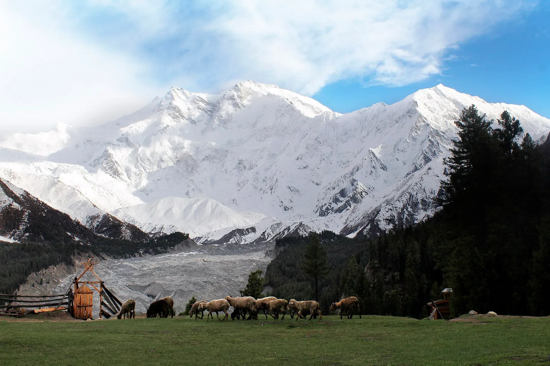
Photo: Zaki Khan89, with thanks · CC BY-SA 4.0 · via Wikimedia Commons · temporary stand-in photo

Raikot Glacier
A 13 km glacier below the north (Raikot) face of Nanga Parbat. You see it on the walk from Tatto to Fairy Meadows and Beyal, and it leads to Nanga Parbat Base Camp.
Overview
The Raikot Glacier is an S-shaped ice stream of about 13 km at the foot of Nanga Parbat (8,126 m), in the Raikot valley of Diamer District. It is also spelled Rakhiot, the form used in mountaineering books. Four major icefalls from the Nanga Parbat massif meet to form it, below the Raikot (north) face. The figure of about 13 km comes from an older guidebook; there is no known recent measurement. Pine and fir forest, streams and meadows line its sides.
Nanga Parbat National Park covers the area.
Plan your visit
- Nearest town
- Raikot Bridge
- Getting there
From the KKH at Raikot Bridge, a local jeep takes you about 15 km up a steep track to Tato (Tatto), the road end, and a walk leads to Fairy Meadows. More
Best months
May – Oct
The mountain above
Nanga Parbat's north side is the Rakhiot (Raikot) flank. Wikipedia says it rises about 7,000 m from the Indus valley to the summit in only 25 km, one of the ten greatest elevation gains over such a short distance on Earth. Rakhiot Peak (7,070 m) stands on the ridge above the glacier's head.
The face has a long mountaineering history. Albert Mummery died on the Rakhiot face during a reconnaissance in 1895. The 1932 German-American expedition and a 1937 German expedition tried the route by Rakhiot Peak; in 1937 an avalanche buried Camp IV below the peak and killed sixteen people. Hermann Buhl made the first ascent of Nanga Parbat on 3 July 1953 by the Rakhiot flank. Trekkers at Fairy Meadows look across the glacier at this face.
What to see and do
- Fairy Meadows. A climb of about 5 km from the road end at Tatto leads to the meadows at about 3,300 m with the best close views of the north face. The Raikot Glacier lies below.
- Beyal and the viewpoint. From Fairy Meadows, an easy path along the terrace above the glacier's snout reaches Beyal and then the viewpoint at about 3,667 m (see Beyal camp and viewpoint). Nanga Parbat Base Camp lies between the Raikot and Ganalo glaciers, just south of where they meet.
- Longer options. Peaks such as Buldar (5,602 m) and South Jalipur (5,206 m) are reached from Beyal and need two to three days.
When to visit
May to October. Snow covers the trail in winter. The monsoon (July and August) can bring heavy rain and landslides on the road.
Where to stay and eat
Fairy Meadows has seasonal cottages and campsites. Beyal is a high camp. Book through local operators and carry a warm layer.
Good to know
- Permits. Fairy Meadows is in the open zone, and older sources say no trekking permit was needed. Gilgit-Baltistan changed permit fees for foreign trekkers in 2024, and a Chief Court case held up permits in 2025. In May 2025 the Gilgit-Baltistan Tourism Department notified a reduced fee schedule (The News, 25 May 2025). Ask a licensed operator which permits and fees apply to your dates. Current fees will be added soon.
- Climate. Glaciers in the central and western Karakoram have behaved differently from most of the world's glaciers. Some studies report them holding steady or even gaining mass, which is called the "Karakoram anomaly"; eastern Karakoram glaciers have been retreating more clearly. Even so, rising temperatures bring hazards. Pakistan's climate ministry and UNDP report 3,044 glacial lakes in Gilgit-Baltistan and Khyber Pakhtunkhwa, of which 33 were assessed as prone to dangerous outburst floods (GLOFs). The UNDP-run GLOF II project, funded by the Green Climate Fund, covers 24 valleys with early-warning systems.
- Safety. The jeep track to Tatto is narrow and steep. Do not walk on the glacier itself without a guide.
- Travel advice. For foreign visitors: the UK FCDO page for Pakistan (updated 27 October 2026, checked 16 November 2026) does not advise against Gilgit-Baltistan as a whole. It does advise against all travel on the Karakoram Highway (KKH) between Mansehra and Chilas, the usual road route from Islamabad, so check the live page before you plan and consider flying to Gilgit or Skardu (weather permitting). The Raikot Bridge turn-off is on this KKH stretch, so most road visitors from Islamabad cross the area the FCDO warns about.
Highlights
- About 13 km long (older guidebook figure)
- Four icefalls below Nanga Parbat's north face
- Reached on the Fairy Meadows trek
- Nanga Parbat National Park
Getting there
From the KKH at Raikot Bridge, a local jeep takes you about 15 km up a steep track to Tato (Tatto), the road end, and a walk leads to Fairy Meadows. Wikipedia's Fairy Meadows page gives about 5 km on foot and 3 to 4 hours, from 2009 and 2013 sources, while other guides say 2 to 2.5 hours; allow for the longer figure. Wikipedia says the gravel road is narrow and dangerous and that locals provide the transport. Raikot Bridge is on the KKH, about 78 km (1.5 hours) from Gilgit and about 55 km from Chilas. For foreign visitors: the UK FCDO page for Pakistan (updated 27 October 2026, checked 16 November 2026) does not advise against Gilgit-Baltistan as a whole. It does advise against all travel on the Karakoram Highway (KKH) between Mansehra and Chilas, the usual road route from Islamabad, so check the live page before you plan and consider flying to Gilgit or Skardu (weather permitting).
Tips
- Take warm layers; it is cold at Fairy Meadows.
- Hire a licensed jeep driver for the Tatto road.
- Do not stand under the icefalls.
- Check road reports; landslides are common in the monsoon.
Sources and last checked
Last checked Confidence medium9 sources3 still to check
- Last checked
- Method
- Desk research from published sources
- Confidence
- medium
- Checked by
- trek.pk research team
Researched from published sources; not yet checked on the ground by our team. Spot something out of date? Report a mistake.
Sources
- Fairy Meadows Nanga Parbat Base Camp (old trek.pk page, text from Lonely Planet Trekking in the Karakoram and Hindukush, c. 2002; facts only) · trek.pk / Lonely Planet · checked
- Nanga Parbat · Wikipedia · checked
- Gilgit-Baltistan tourism bounces back despite Middle East war (permit rules for open and restricted zones, 29 March 2026) · Dawn · checked
- Glacier-Related Hazards Along the International Karakoram Highway: Status and Future Perspectives · Frontiers in Earth Science (2021) · checked
- Glacial Lake Outburst Flood GLOF-II · Ministry of Climate Change and Environmental Coordination, Pakistan · checked
- Scaling-up of GLOF risk reduction in Northern Pakistan (GLOF II) · UNDP Pakistan · checked
- Pakistan travel advice · UK Foreign, Commonwealth & Development Office · checked
- Fairy Meadows National Park · Wikipedia · checked
- GB slashes mountaineering, trekking fees to promote tourism (25 May 2025) · The News · checked
Still to be checked on the ground (3)
- Current glacier length (13 km is from an older guidebook; no recent measurement found)
- Current permit and fee rules for Fairy Meadows and Nanga Parbat base camp (gbtourism site not reachable; Dawn 29 Mar 2026 only says open-zone foreign visitors need no permit)
- Walking time from Tatto: 2 to 2.5 h on the page vs 3 to 4 h on Wikipedia (2009 and 2013 sources)
Nearby and related

Fairy Meadows and Nanga Parbat Base Camp

Rupal Valley and Nanga Parbat Rupal Face

Raikot and Tatto (Fairy Meadows access)
Raikot Bridge on the Karakoram Highway is the start of the jeep track to Tatto, the road-end village below Fairy Meadows and the north face of Nanga Parbat.

Chilas
Headquarters of Diamer on the Karakoram Highway and the Indus, with thousands of ancient rock carvings, views towards Nanga Parbat, and the road junctions for Fairy Meadows and Babusar Pass.

Gilgit
Gateway to Gilgit-Baltistan on the Karakoram Highway: a busy mountain town with the Kargah Buddha and the base for Hunza, Naltar and Skardu.