

Photo: Nomi887, with thanks · CC BY-SA 4.0 · via Wikimedia Commons · temporary stand-in photo

Bukkur Island
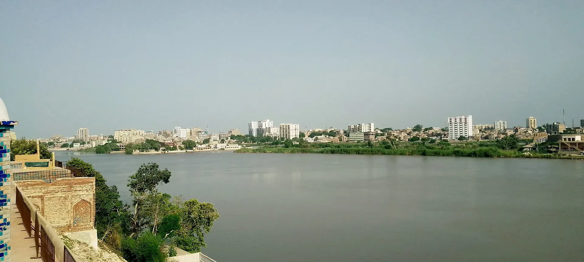
A limestone island fort in the Indus between Sukkur and Rohri, about 730 m long. Interior access is limited; most visitors view it from the bridges and riverbanks.
Overview
Bukkur, also written Bakhar or Bhakkar, is an island fort in the Indus between Rohri and Sukkur. It is an oval limestone rock about 730 m long, 270 m wide and 7.6 m high. A railway line divides it into two sections. It is sometimes called Old Sukkur. The rock on the island and the outcrop on the Sukkur bank form a narrow gap in the river, sometimes called the Sukkur Gorge or the Gate of Sindh, which historically marked the northern limit of Sindh.
Plan your visit
- Nearest town
- Sukkur
- Getting there
Sukkur is about 5 km by road from the island area (OSRM). Boats run from the riverbank. There is no known official visitor timetable. More
Best months
Oct – Mar
- Bukkur Island
- Related places nearby: Sukkur, Sadh Belo, Lansdowne Bridge (Sukkur), Khairpur, Kot Diji, Sukkur Barrage (Lloyd Barrage)
History
The fort is dated to 944-45 AD, though that is disputed and the builders are unknown. The Chach Nama, a chronicle of the Arab conquest of Sindh, mentions a fort on the opposite side of the river, belonging to Raja Dahir and run from Aror. Tradition credits Sayyid Muhammad al-Makki, who came from Yemen in about 1246-47, with naming the place Bakhar, though this is partly legend. In the 13th century Ali al-Kufi translated the Chach Nama into Persian at Bhakkar.
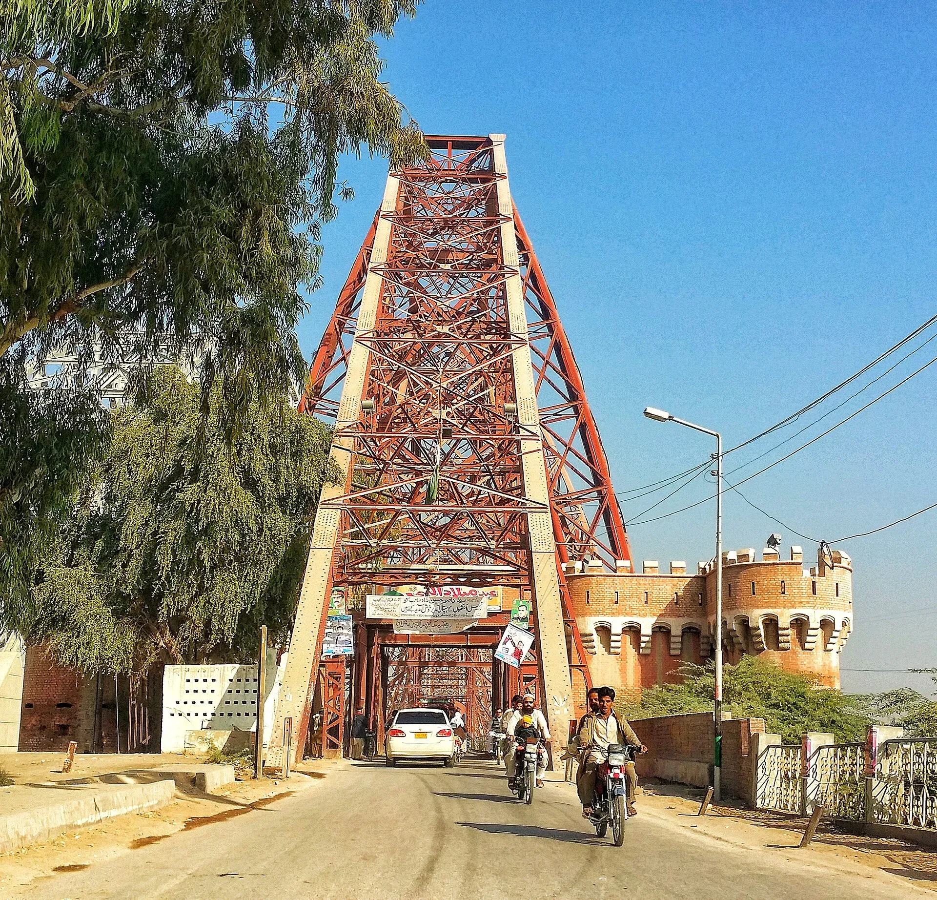
Photo: Fassifarooq, with thanks · CC BY-SA 4.0 · via Wikimedia Commons · temporary stand-in photo

In the 15th century the Samma ruler Jam Tughlaq Juna II appointed his brothers as governors of Sehwan and Bhakkar, and Jam Nizamuddin II later strengthened the fortifications. The Arghuns took Bhakkar after the Sammas, and the fort is also recorded in the hands of the Sur Empire under Haibat Khan Niazi and then the Mughals. In the 17th century the town was known for cotton manufacture. Later the Kalhoras (under Mian Noor Mohammad) and the Talpurs held it. A treaty of 24 December 1838 gave the British control. They renamed it Victoria, but the name did not stick.
What the fort looks like
A wall follows the island's edge on all sides, with the river against it. Parts still stand, including semicircular and elliptical bastions and gates of different sizes, many of them now blocked with rubble. The fort is listed as a ruin.
What to see and do
The best views are from the riverbanks and from the Lansdowne Bridge. Boat rides circle the island. Sadh Belo, an island with Hindu temples, lies close by. Around the island are other sights of Sukkur and Rohri:
- Lansdowne Bridge. A metal bridge finished in 1889 that joins Sukkur and Rohri and was among the first to cross the Indus. It uses two large supports rather than a row of piers.
- Sukkur Barrage. Built between 1923 and 1932 and about 1,524 m long, it feeds seven canals that irrigate nearly ten million acres.
- Masum Shah Minaret. The shrine and minaret of Masum Shah date from 1607. The minaret is 26 m tall.
- Manzilgah Mosque. Built in 1598, according to Wikivoyage.
- Shahi Bazaar in Sukkur, listed by Wikivoyage as a sight.
Food in Sukkur
Wikivoyage lists chicken karahi, fruit chaat, channa cholay with naan, makhan nihari, kachori and samosa, and dhood pati chai (milky tea), with thadal as a cold drink. Sukkur is also known for its dates.
A day around the island
A day built from the sights above could look like this: the Lansdowne Bridge and riverbanks in the morning for views of the island, the Masum Shah Minaret and the Shahi Bazaar at midday, then Sadh Belo or the barrage later. Boat trips and any landing on the island depend on local permission.
When to visit
October to March. Summers are very hot: Sukkur regularly passes 50 degrees Celsius.
Where to stay and eat
Stay and eat in Sukkur, where there are many hotels and restaurants.
Good to know
- The Endowment Fund Trust's Sindh heritage page says the island is occupied by an Army public school. It does not say whether visitors may land, and there is no known official statement either way, so ask before landing.
- Ask the district administration or local police about current conditions before you go. For foreign visitors: the UK FCDO advises against all but essential travel to Sindh north of and including Nawabshah, which includes Sukkur (checked 16 November 2026).
- Fees will be added soon.
Highlights
- Oval limestone island about 730 m by 270 m
- Fort walls and bastions, dated to 944-45 AD
- Views from the Lansdowne Bridge and river
- Boat rides on the Indus
Getting there
Sukkur is about 5 km by road from the island area (OSRM). Boats run from the riverbank. There is no known official visitor timetable.
Tips
- Ask in Sukkur before planning to land on the island.
- Go in the cool months.
- Avoid photographing any military areas.
- Wear sun cover on the river.
Photos we still need: the fort wall and bastions; the island from the riverbank; Masum Shah Minaret. Send us yours
Sources and last checked
Last checked Confidence medium7 sources4 still to check
- Last checked
- Method
- Desk research from published sources
- Confidence
- medium
- Checked by
- trek.pk research team
Researched from published sources; not yet checked on the ground by our team. Spot something out of date? Report a mistake.
Sources
- Bukkur · Wikipedia · checked
- Sadh Belo · Wikipedia · checked
- OSRM driving route calculation · OpenStreetMap / OSRM project · checked
- Pakistan travel advice (updated 27 Oct 2026) · UK Foreign, Commonwealth & Development Office · checked
- Bakhar (Bukkur) heritage record · Endowment Fund Trust for the Preservation of the Heritage of Sindh · checked
- Sukkur (Wikipedia) · Wikipedia · checked
- Sukkur (Wikivoyage) · Wikivoyage · checked
Still to be checked on the ground (4)
- Whether visitors may land and enter the island (Army public school occupies it; no official statement found)
- Boat rates and landing points (Wikivoyage only says 'boat ride at river Indus side')
- Which body manages the fort (not stated by Wikipedia or the heritage record)
- Who runs boat rides and whether landing is allowed
Nearby and related

Sukkur
Sindh's third-largest city on the Indus, with the 1932 Sukkur Barrage, the 1889 Lansdowne Bridge, Masum Shah's Minaret and the river islands of Rohri.

Sadh Belo
A Hindu temple complex on an Indus island at Sukkur, with nine temples founded in 1823. Visitors need permission; the process is harder for non-Hindus.

Lansdowne Bridge (Sukkur)
An iron cantilever bridge over the Indus between Sukkur and Rohri, opened in 1889. Trains stopped using it in 1962, when the Ayub Bridge beside it took the railway. It has since carried road traffic and pedestrians.

Khairpur
Former capital of the Talpur princely state of Khairpur and now district headquarters, 24 km from Sukkur, home of Faiz Mahal. For foreign visitors: the UK FCDO advises against all but essential travel here.

Kot Diji
A fort on a rocky hill in Khairpur district, built by the Talpurs in the late 18th century, below an early Indus-era town that gave its name to the Kot Dijian culture. Across the Indus from Moenjodaro.
Sukkur Barrage (Lloyd Barrage)
A 1932 barrage across the Indus at Sukkur, originally named Lloyd Barrage. About 2 km long, it feeds seven canals and waters a large part of Sindh.