

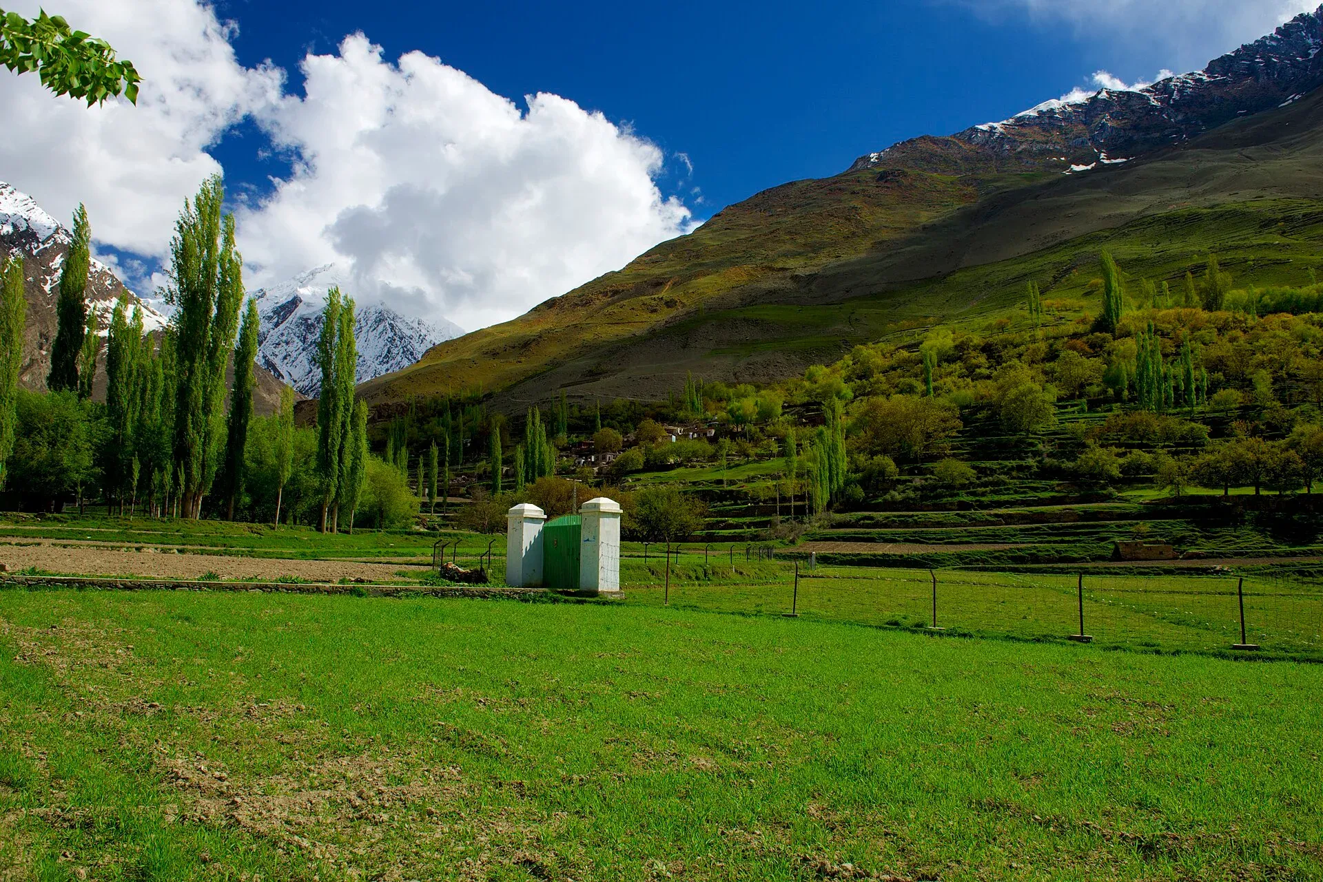
Photo: Najeebmahmud, with thanks · CC BY-SA 4.0 · via Wikimedia Commons · temporary stand-in photo

Hopar Glacier (Bualtar)
The Bualtar or Hopar Glacier fills the head of the Hopar valley in Nagar, below Diran and Miar peaks. A quick viewpoint trip from Nagar, and the start of the Barpu Glacier trek. Its length is not well documented.
Overview
The Hopar Glacier, properly the Bualtar Glacier, ends beside the Hopar valley (also spelled Hoper or Hopper) in Nagar, on the opposite bank of the Hunza River from Karimabad. Hopar is a group of five villages, called tsindigram, "five hamlets", in Burushaski, along the south-west edge of the glacier. The ice and its tributaries come from the north side of Diran and Miar peaks in the Rakaposhi-Haramosh range.
There is no reliable published length or area for the Bualtar. Travel blogs give figures from 12 to 18 km that do not agree, so none is stated here. The nearby Barpu Glacier is about 33 km long, but the two do not join, despite what the Swiss 1:250,000 map shows.
Plan your visit
- Nearest town
- Nagar Khas
- Getting there
Hopar is in Nagar, about 10 km from Nagar Khas, reached by road from the Hunza River crossing near Aliabad and Karimabad. Ask locally for jeep or taxi options; roads can be rough. More
Best months
Jun – Oct
The valley
Hopar lies about 10 km from Nagar Khas. Wikipedia lists the settlements as Hakalshall, Ratal, Broshall, Holshall and Ghoshoshall, and says everyone in the valley speaks Burushaski. It lists five glaciers in the valley: Hoper, Barpu, Miar, Daranci and Geentur (also called Supulter). The valley serves as a base for treks into the Hispar Muztagh. Spantik (7,027 m), Miar Peak (7,257 m) and Bawalter Peak (7,126 m) are among the peaks above it. Wikipedia describes seasons as spring from April to June, summer from July to September, autumn in October and heavy snow from November to March. Summer is the usual trekking season.
What to see and do
- Viewpoint. From Hopar you can reach the edge of the glacier on a short walk or drive, and see the dark rubble-covered ice below the peaks.
- Barpu Glacier trek. The six-day trek from Hoper to Girgindil starts here (see our Barpu Glacier trek) with several glacier crossings. A guide is essential.
- Walks between villages. Fruit trees and terraced fields run along the valley floor.
When to visit
June to October. Summer is greenest, and autumn is clear. Winter brings snow and cold.
Where to stay and eat
Karimabad, across the Hunza River, has the most choice of hotels. Ask in Hopar about guesthouses and camping.
Good to know
- Changing ice. The old guide describes the Bualtar as constantly shifting, with the route across it changing day to day. A guide or knowledgeable porter is needed for every crossing. In the early 2000s the Barpu outwash stream flowed into an advancing Bualtar; check what has changed since.
- Permits. This is an open-zone area. Dawn reported on 29 March 2026 that foreign visitors to open-zone areas do not need a trekking permit, while permits are needed only for restricted zones; an older 2017 interior-ministry NOC rule was reported at the time, and there is no known 2025-26 source confirming it still applies. Check with the Gilgit-Baltistan Tourism Department or a local operator. Current fees will be added soon.
- Climate. Glaciers in the central and western Karakoram have behaved differently from most of the world's glaciers. Some studies report them holding steady or even gaining mass, which is called the "Karakoram anomaly"; eastern Karakoram glaciers have been retreating more clearly. Even so, rising temperatures bring hazards. Pakistan's climate ministry and UNDP report 3,044 glacial lakes in Gilgit-Baltistan and Khyber Pakhtunkhwa, of which 33 were assessed as prone to dangerous outburst floods (GLOFs). The UNDP-run GLOF II project, funded by the Green Climate Fund, covers 24 valleys with early-warning systems.
- Safety. Read our glacier travel basics. Meltwater streams rise fast on warm afternoons.
- Travel advice. For foreign visitors: the UK FCDO page for Pakistan (updated 27 October 2026, checked 17 November 2026) does not advise against Gilgit-Baltistan as a whole. It does advise against all travel on the Karakoram Highway (KKH) between Mansehra and Chilas, the usual road route from Islamabad, so check the live page before you plan and consider flying to Gilgit or Skardu (weather permitting).
Highlights
- Known as Bualtar, Hopar or Hoper Glacier
- Below Diran and Miar peaks
- Start of the Barpu Glacier trek
- Five villages along its edge
Getting there
Hopar is in Nagar, about 10 km from Nagar Khas, reached by road from the Hunza River crossing near Aliabad and Karimabad. Ask locally for jeep or taxi options; roads can be rough. For foreign visitors: the UK FCDO page for Pakistan (updated 27 October 2026, checked 17 November 2026) does not advise against Gilgit-Baltistan as a whole. It does advise against all travel on the Karakoram Highway (KKH) between Mansehra and Chilas, the usual road route from Islamabad, so check the live page before you plan and consider flying to Gilgit or Skardu (weather permitting).
Tips
- Hire a Hopar guide for any glacier crossing.
- Go in the morning; meltwater rises later.
- Combine with Karimabad and Altit on the opposite bank.
- Check road conditions after rain.
Photos we still need: the Bualtar Glacier itself, and the glacier-edge viewpoint above Hopar (the existing photo shows the valley and is used on several pages). Send us yours
Sources and last checked
Last checked Confidence low8 sources4 still to check
- Last checked
- Method
- Desk research from published sources
- Confidence
- low
- Checked by
- trek.pk research team
Researched from published sources; not yet checked on the ground by our team. Spot something out of date? Report a mistake.
Sources
- Barpu Glacier (old trek.pk page, text from Lonely Planet Trekking in the Karakoram and Hindukush, c. 2002; facts only) · trek.pk / Lonely Planet · checked
- Hopar Valley · Wikipedia · checked
- Gilgit-Baltistan tourism bounces back despite Middle East war (permit rules for open and restricted zones, 29 March 2026) · Dawn · checked
- Glacier-Related Hazards Along the International Karakoram Highway: Status and Future Perspectives · Frontiers in Earth Science (2021) · checked
- Glacial Lake Outburst Flood GLOF-II · Ministry of Climate Change and Environmental Coordination, Pakistan · checked
- Scaling-up of GLOF risk reduction in Northern Pakistan (GLOF II) · UNDP Pakistan · checked
- Pakistan travel advice · UK Foreign, Commonwealth & Development Office · checked
- Foreign travel advice Pakistan: warnings and insurance · UK FCDO · checked
Still to be checked on the ground (4)
- Length and area of the Bualtar (Wikipedia Hopar Valley gives neither; not found in reliable sources)
- Road condition from Nagar Khas (distance is about 10 km per Wikipedia; condition not found)
- Photo shows the valley, not the glacier
- Current permit and fee rules (Dawn, 29 Mar 2026: open zones need no permit; no fees given)
Nearby and related

Barpu Glacier

Rush Phari (Rush Lake)

Ultar Meadow

Nagar Valley
The quieter bank of the Hunza River, facing Karimabad: Minapin, Hoper and Hispar villages, Rakaposhi viewpoints and easy treks below Rakaposhi, Diran and Spantik.

Nagar (district HQ)
Nagarkhas, also called Oyum-Nagar, the administrative centre of Nagar District in Gilgit-Baltistan and the old capital of the Nagar state, beneath Rakaposhi.

Karimabad (Hunza)
The main town of Hunza, set on a terrace below Baltit Fort with Rakaposhi, Ultar and Diran in view. A good base for forts, viewpoints, Attabad Lake and the road to Gojal.