

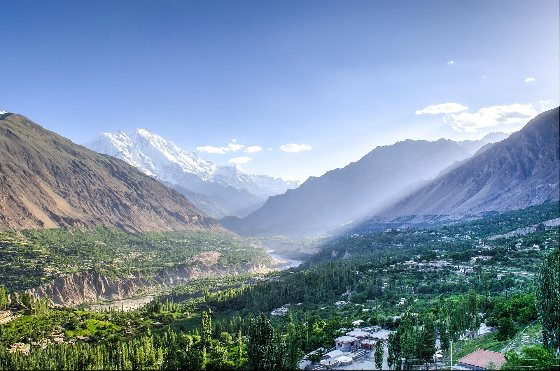
Photo: FaizanAhmad, with thanks · CC BY-SA 3.0 · via Wikimedia Commons · temporary stand-in photo

Hunza Karimabad Camping
Where people camp around Karimabad in Hunza: guesthouse tent space and the Ultar and Duikar hikes. There is no known official list of approved sites.
Overview
Karimabad, at about 2,500 m, is the main base in Hunza. It stands on the west bank of the Hunza River, with Baltit Fort at the top of the town and Altit about 3 km to the west. It has the most hotels in the valley, and camping here is mostly a matter of tent space at guesthouses and trip camps on the hikes above the town. There is no known official list of approved campsites in Karimabad, so this page says what is known and what to ask.
Plan your visit
- Nearest town
- Karimabad
- Getting there
From Gilgit take the Karakoram Highway north to Aliabad, then the link road up to Karimabad. OSRM: about 99 km and 75 minutes (optimistic). Buses and vans run Gilgit to Aliabad. More
Best months
May – Oct
- Hunza Karimabad Camping
- Related places nearby: Karimabad (Hunza), Hunza Valley, Baltit Fort, Altit Fort, Ultar Sar, Attabad Lake
The setting
Orchards of apple, apricot and walnut fill the terraces below the town, and irrigated fields grow maize, fruit and vegetables. Viewpoints for Rakaposhi, Diran, Golden Peak and Ultar Sar are in or just outside town. Most residents are Ismaili Muslims, and the Aga Khan Foundation has supported schools, roads and water supply. See Karimabad and Hunza Valley for the wider area.
Where people camp
- In and near town. Some guesthouses and private camps offer tent pitches with toilets and water. Ask your host rather than pitching in orchards or on terraces, which belong to families.
- Ultar Meadows. An operator page gives the meadow about 3,270 m and reaches it by a trail from near Baltit Fort and the irrigation channels. The trek page puts the climb at about 770 m from the village, with camps inside a walled area or local tents. Camps there are basic trekking camps. See the Ultar trek and Ultar Sar.
- Duikar and Eagle's Nest. The district sheet calls Duikar the best place for sunrise, sunset and stars. It lies north-west of the town. Heights quoted for Eagle's Nest vary between 2,600 and 2,850 m.
Access
The district sheet gives Attabad Lake as 28 km from Aliabad. Karimabad is just above Aliabad on a link road. OSRM measures about 99 km from Gilgit to Karimabad, about 75 minutes, which is optimistic. Buses and jeeps leave from Aliabad.
Who manages it, and the rules
- Permit. The GB Tourism Department FAQ says camping is allowed in designated areas and tourists need a permit from the department. Check with the Hunza tourism office (the district sheet lists it) which places count.
- Fuel. The sheet asks visitors to use LPG or kerosene instead of firewood.
- Waste. Dispose of litter properly and leave campsites clean, says the sheet. See the article on leave no trace and waste.
- Guides. The sheet advises hiring a local guide for trekking and camping.
- Fees. Camping charges may apply; current fees will be added soon.
Best months
May to October. Wikivoyage gives May daytime temperatures of about 14 to 27 C and October about 0 to 10 C, so nights at the meadow are cold even in summer. Late April brings apricot blossom, and October brings autumn colour. Winter is cold, many places close and roads can be blocked.
Food in the valley
Wikivoyage lists Hunza dishes including giyalin (thin pancakes), burus berikutz (cheese bread), baterin xy dawdo (dried apricot soup) and diram fiti (sweet bread). Dried apricots are a local product. Ask at your guesthouse what is cooked locally.
Safety
- Rockfall and glacier meltwater can affect side valleys; ask locally about conditions. The lower Ultar gorge is loose and prone to rockfall after rain.
- For foreign visitors: the UK FCDO (updated 27 October 2026) does not advise against Gilgit-Baltistan generally. Its warning for the KKH covers the stretch between Mansehra and Chilas, which you pass on the road from Islamabad.
Nearby
Baltit Fort and Altit Fort, Ultar Sar, Attabad Lake and the Ultar trek.
Highlights
- Tent space at guesthouses and trip camps above town
- Ultar Meadows and Duikar viewpoints
- No official list of approved sites found
- Karimabad is about 99 km from Gilgit (OSRM)
Getting there
From Gilgit take the Karakoram Highway north to Aliabad, then the link road up to Karimabad. OSRM: about 99 km and 75 minutes (optimistic). Buses and vans run Gilgit to Aliabad.
Tips
- Ask your host before pitching a tent on any terrace or orchard.
- Cook on LPG or kerosene.
- Check with the Hunza tourism office about permits.
Photos we still need: a tent pitch or camp in or above Karimabad; Ultar Meadows camp; Duikar / Eagle's Nest viewpoint (the first photo is a general valley view reused on other pages). Send us yours
Sources and last checked
Last checked Confidence low8 sources3 still to check
- Last checked
- Method
- Desk research from published sources
- Confidence
- low
- Checked by
- trek.pk research team
Researched from published sources; not yet checked on the ground by our team. Spot something out of date? Report a mistake.
Sources
- Land of Culture: District Hunza tourist guide sheet · Tourism & Culture Department, Gilgit-Baltistan · checked
- Ultar Meadows trek · Apricot Tours (operator) · checked
- Eagle's Nest, Hunza · Wild Frontiers (operator) · checked
- Pakistan travel advice: warnings and insurance (updated 27 October 2026) · UK Foreign, Commonwealth & Development Office · checked
- OSRM driving route service (distances and times measured 16 November 2026; times are optimistic) · OSRM · checked
- Karimabad, Gilgit-Baltistan (Wikipedia) · Wikipedia · checked
- Hunza (Wikivoyage) · Wikivoyage · checked
- Frequently asked questions (camping in designated areas, permit from the tourism department) · Gilgit-Baltistan Tourism Department · checked
Still to be checked on the ground (3)
- Which camps are licensed and permitted
- Ultar Meadows and Eagle's Nest heights
- Current camping charges
Nearby and related

Ultar Meadow

Karimabad (Hunza)
The main town of Hunza, set on a terrace below Baltit Fort with Rakaposhi, Ultar and Diran in view. A good base for forts, viewpoints, Attabad Lake and the road to Gojal.
Hunza Valley
A long Karakoram valley on the Karakoram Highway, with Karimabad, Baltit and Altit forts, Ganish village and Attabad Lake, below Rakaposhi and Ultar Sar. About 100 km from Gilgit.

Baltit Fort
A restored fort and museum above Karimabad in Hunza, once the home of the Mirs of Hunza. Its core is centuries old and it has been on UNESCO's tentative list since 2004.

Altit Fort
An old fort above the Hunza River at Altit, restored by the Aga Khan Trust for Culture and open to visitors since 2007. Often described as the oldest monument in Gilgit-Baltistan.

Ultar Sar
Ultar Sar (7,388 m) towers about 10 km north-east of Karimabad in Hunza. Its south flank rises over 5,300 m above the river. The Ultar Meadow trek is the standard way to get close.

Attabad Lake
A turquoise lake about 21 km long in Gojal, Hunza. It formed when a landslide blocked the Hunza River on 4 January 2010. The Karakoram Highway now passes it through five tunnels.