

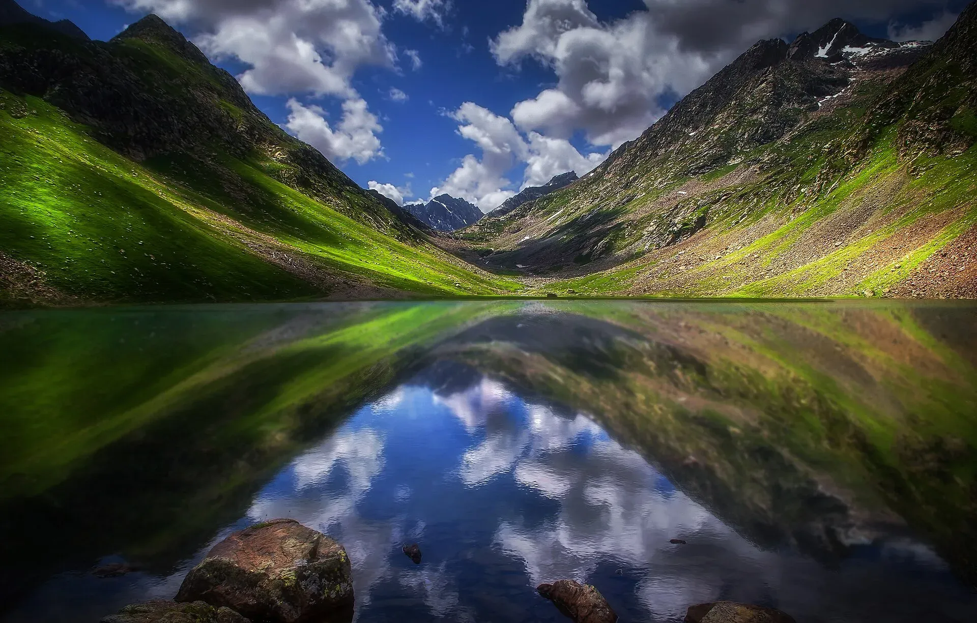
Photo: Tariq siddiq kohistani, with thanks · CC BY-SA 4.0 · via Wikimedia Commons · temporary stand-in photo

Utror Camping (Swat)
Summer tent camping in the Utror valley above Kalam in upper Swat, near the meadows and the track to Kundol Lake. UK advice is against all travel to Swat.
Read this first: current advice
Ask the district administration or local police about current conditions before you go. For foreign visitors: the UK FCDO (updated 27 October 2026, checked 16 November 2026) advises against all travel to Swat, and the Khyber Pakhtunkhwa government has been under Governor's Rule since 11 October 2026. This page describes the place for information and does not recommend travelling against that advice.
Plan your visit
- Nearest town
- Kalam
- Getting there
From Mingora the road runs about 95 km to Kalam, and Utror is about 16 km beyond Kalam on a rougher road (Wikipedia). Hire a local 4x4 for the last stretch. Allow a full day from Islamabad. More
Best months
Jun – Sep
- Utror Camping (Swat)
- Related places nearby: Kalam, Utror and Gabral, Kundol Lake, Izmis Lake, Kalam, Swat Valley
Overview
Utror (also spelt Atror) is a valley and union council in upper Swat, about 16 km from Kalam by Wikipedia's figure. It borders Kalam to the south, Gabral to the north, the Bhan valley to the east and Upper Dir District to the west, and covers about 474 sq km. The village sits at about 2,300 m, and the valley rises to around 2,900 m at Kundol Lake by the Utror article (the Kundol Lake article on Wikipedia says about 3,033 m, so treat the lake height as roughly 2,900 to 3,000 m). The 2017 census counted 16,048 people. Utror is one of the Swat Kohistan valleys, home to the Gawri people. The Badogai Pass leads from here towards Upper Dir.
Visitors come for the meadows, forest and the walks to Kundol and Izmis lakes, and some stay in tents.
Getting to the valley
From Mingora the road runs about 95 to 100 km to Kalam, and Utror is about 16 km beyond Kalam on a rougher road; Wikivoyage puts it about 120 km from Mingora. Hire a local 4x4 for the last stretch. Dawn (18 June 2019) describes a jeep route along a stony track beside the river that enters thick pine forest, with springs along the way. See Swat and Kalam.
The meadows
Chinaitshing is the best-known camping meadow. Dawn describes it as a long pasture about 10,500 feet (roughly 3,200 m) above sea level, ringed by snow peaks, with grass, blue and red wildflowers, and hundreds of small streams of clear water. It is roughly two hours from Utror Bazaar, about half by jeep and about an hour on foot. A Dawn photo caption shows tourists pitching tents there. Another meadow, Kalam Banda, lies on the route on towards Izmis Lake. A banda is a summer pasture.
Kundol Lake
Wikipedia gives Kundol Lake (also Kundol Dand) a surface height of 3,032.7 m and describes it as a glacial lake about 1.5 km long and 1 km wide, about 19 km from Kalam. A link road ends at Ladu, and from there the hike takes roughly four to six hours. The trail follows the stream that flows out of the lake, through forest and past waterfalls, and is described as easy to follow. The lakeshore is a summer campsite for trekkers. The lake's outflow forms the Utror stream, a main tributary of the Swat River. Local folklore says a golden bowl appears at the centre of the lake each month. See Kundol Lake.
Izmis Lake
Dawn (20 June 2019) describes a hike from the Utror forest to the Izmis base camp through the Chinaitshing meadows. The lake itself is above the tree line. See Izmis Lake and the Izmis Lake trail.
When to visit
Summer, roughly June to September, is the practical camping season. Heavy snow closes the upper valley roads in winter, and nights are cold even in July. Monsoon rain can bring landslides and flash floods on the Kalam road.
Where to stay and eat
There are guesthouses and small hotels in Utror village and many more in Kalam. There is no confirmed official campground at Utror. The Khyber Pakhtunkhwa government has installed camping pods at other Swat sites such as Gabin Jabba, but there is no known report of pods at Utror. Any camping charges are set locally; current fees will be added soon. Carry food, a stove and water treatment, as the high camps have no shops.
Good to know
- Permission: There is no known official rule on who permits camping at Utror. Ask the village elders or your guesthouse before you pitch a tent, as the land is owned by local families and used for grazing.
- Safety: Do not camp in a dry stream bed or beside the river, as water can rise quickly. Check weather and road news in Kalam first.
- Leave no trace: Take all rubbish out, use no open fires on grazing land, and keep away from the water source of the village. Dawn's 2019 article asked visitors not to leave plastic bags. See leave no trace.
- Official advice: Read the FCDO page before any plan to visit Swat.
Highlights
- Summer tent camping in the upper Swat valley
- Meadows at Chinaitshing on the way to Izmis Lake
- Starting point for the Kundol Lake walk
- About 16 km from Kalam
Getting there
From Mingora the road runs about 95 km to Kalam, and Utror is about 16 km beyond Kalam on a rougher road (Wikipedia). Hire a local 4x4 for the last stretch. Allow a full day from Islamabad. Roads in the upper valley can be damaged after monsoon rain.
Tips
- Check the FCDO page and local conditions before going; Swat is under 'all travel' advice.
- Ask the village or your guesthouse before pitching a tent.
- Bring all food and a stove; the upper valley has no shops.
- Avoid stream beds and riverbanks as camping spots.
Photos we still need: tents at Chinaitshing meadow. Send us yours
Sources and last checked
Last checked Confidence low7 sources5 still to check
- Last checked
- Method
- Desk research from published sources
- Confidence
- low
- Checked by
- trek.pk research team
Researched from published sources; not yet checked on the ground by our team. Spot something out of date? Report a mistake.
Sources
- Utror · Wikipedia · checked
- Tourists fix tents in Chinaitshing, Utror valley (photo caption, 2019) · Dawn · checked
- In pictures: Mirror-like Izmis glacial lake draws tourists to Utror valley (2019) · Dawn · checked
- Kundol Lake · Wikipedia · checked
- Your camping trip to Swat just got a lot easier with these fully featured pods · ProPakistani · checked
- Pakistan travel advice: warnings and insurance (updated 27 October 2026) · UK FCDO · checked
- Swat Valley (Wikivoyage) · Wikivoyage · checked
Still to be checked on the ground (5)
- Whether any organised or official campground exists at Utror (none found)
- Who gives permission to camp and any charges (no official source; a Dawn reader comment about a park fee is unverified and not used)
- Altitude of Kundol Lake (Utror article 2,900 m; Kundol Lake article 3,032.7 m, citing pakifunda)
- Security situation and road state before travel
- Whether Chinaitshing (about 10,500 ft in Dawn) is the same camping meadow used today
Nearby and related

Izmis Lake Trail

Kalam, Utror and Gabral
The head of the Swat valley: Kalam town where the Ushu and Gabral rivers meet, with Ushu forest, Utror and Kundol Lake, Gabral, and jeep tracks to Mahodand Lake.

Kundol Lake
A glacial lake at about 3,030 m above Utror in Swat, reached by a 4x4 track to Ladu and then a hike of around four to six hours.
Izmis Lake
A high glacial lake above the tree line, south-west of Utror in Swat. A jeep track ends at Loypanrghalay and the lake is a 3 to 6 hour walk beyond.

Kalam
The last large town in the upper Swat Valley, at about 2,000 m where the Ushu and Gabral rivers meet. Kalam is the base for Ushu, Utror, Mahodand Lake and Kundol Lake.

Swat Valley
A long green river valley in northern Khyber Pakhtunkhwa, with Gandhara Buddhist sites, orchards, hill towns and the road up to Kalam. Check the current security advice before you plan a trip.

Swat and Kalam
A 4-5 day road trip from Islamabad up the Swat valley by the M-16 and N-95 to Mingora, Madyan, Bahrain and Kalam, with Mahodand Lake and Ushu forest in summer.