

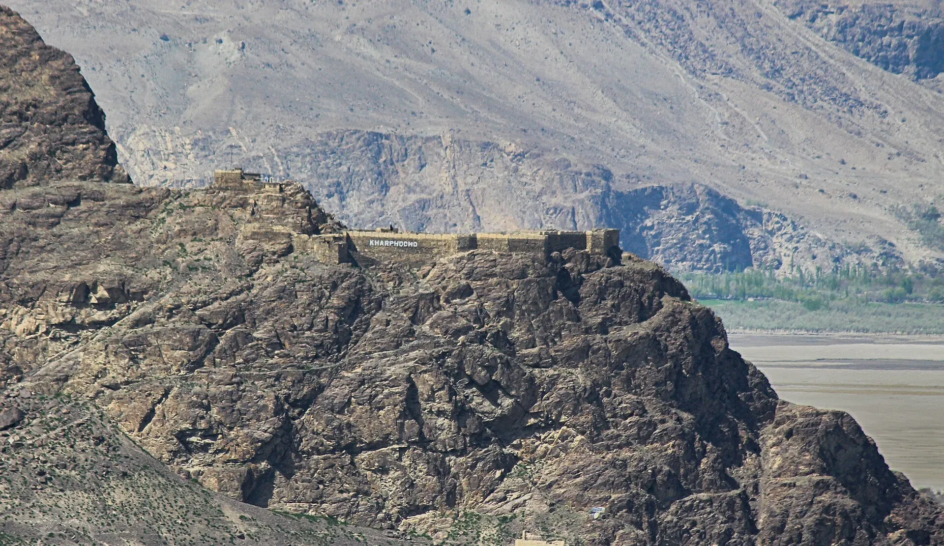
Photo: Rgyalchan, with thanks · CC BY-SA 4.0 · via Wikimedia Commons · temporary stand-in photo

Kharpocho Fort
A ruined hilltop fort above the Indus at Skardu, linked to the Maqpon rulers of Baltistan and to a 1840 Dogra attack. Visit for the history and the view over the valley.
Overview
Kharpocho (also spelled Kharphocho, and called Skardu Fort) is a fort on the Skardu rock, a rocky hill rising above the junction of the Indus and Shigar rivers. Its name is often translated as "King of Forts" in Balti. It was a stronghold of the Maqpon dynasty, who ruled Baltistan, and it served as a military lookout. The ruins give views over Skardu town and the wide valley below.
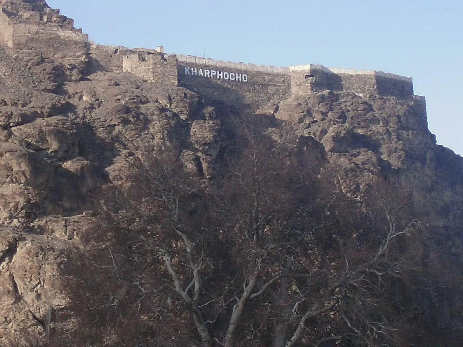
Photo: ShahsawarBalti, with thanks · CC BY-SA 3.0 · via Wikimedia Commons · temporary stand-in photo

Plan your visit
- Nearest town
- Skardu
- Getting there
The fort is on the edge of Skardu town. You can reach it by taxi from the main bazaar or on foot with a steep climb at the end. More
Best months
Apr – Oct
- Kharpocho Fort
- Related places nearby: Satpara Lake, Deosai National Park, Gilgit-Baltistan
History
King Ali Sher Khan Anchan is credited with building the earliest fort. Sources disagree on the date: the Gilgit-Baltistan tourism department gives 1490 to 1505, while Wikipedia places the earliest structure at the end of the 16th century. The fort remained the centre of the Maqpon dynasty until the Dogras overthrew the last Maqpon ruler, Ahmad Shah, in the 19th century.
In 1840, during the Dogra invasion of Baltistan, General Zorawar Singh stormed and razed the fort. He then had another fort built on level ground beside the hill. A drawing of that Dogra fort in 1850 appears in Thomson's 1852 book.
In the first Indo-Pakistani war of 1947 to 1948, the fort at Skardu was besieged. Wikipedia names the attackers as the Ibex Force and the Chitral Scouts, under Colonel Mata ul-Mulk, and the defenders as the Jammu and Kashmir State Forces under Lieutenant Colonel Sher Jung Thapa. The defenders surrendered on 14 August 1948, after running out of rations. Wikipedia does not say which of the two forts the siege centred on.
What to see and do
- The entrance and the walls. Much of the fort is in ruins, with parts of the walls still standing.
- The mosque. Wikipedia calls the mosque inside the fort ancient and includes a photograph of it from 1924.
- Mendok Khar. The palace of Ali Sher Khan Anchan's Ladakhi queen, Mandok Gyalmo, stood just beside the fort.
- The view. The hill looks over the Indus, the Shigar junction and the town of Skardu.
Expect a short but steep walk up. You do not need more than an hour. Other forts in Gilgit-Baltistan that Wikipedia groups with this one are Shigar Fort, Khaplu Palace, Baltit Fort and Altit Fort.
When to visit
April to September is best. Snow can limit access in winter. Early morning gives the softest light over the river.
Where to stay and eat
Skardu has hotels and restaurants for every budget.
Good to know
- Entry and opening hours: no official fee or hours were found. Ask the caretaker or your hotel before you go; do not assume an informal charge is official.
- Dress and behaviour: treat the ruins and the mosque with respect, and do not climb on fragile walls.
- Photography: fine for personal use.
- Condition: reports differ on how well the mosque is kept. Check locally.
Highlights
- Maqpon-era fort on the Skardu rock
- Burned and stormed in 1840 during the Dogra invasion
- Views over the Indus and Shigar junction
- Short climb from Skardu
Getting there
The fort is on the edge of Skardu town. You can reach it by taxi from the main bazaar or on foot with a steep climb at the end. Skardu is reached by flight from Islamabad (weather permitting) or by the Karakoram Highway and Skardu road.
Tips
- Go in the morning for clearer views.
- Wear good shoes for the loose stone.
- Ask in Skardu about caretaker access.
- Combine with Satpara Lake and other Skardu sights.
Sources and last checked
Last checked Confidence medium3 sources3 still to check
- Last checked
- Method
- Desk research from published sources
- Confidence
- medium
- Checked by
- trek.pk research team
Researched from published sources; not yet checked on the ground by our team. Spot something out of date? Report a mistake.
Sources
- Kharpocho Fort (Wikipedia) · Wikipedia · checked
- Skardu Fort (Kharpocho) · Gilgit-Baltistan Tourism Department · checked
- Skardu Fort (Kharpocho) · Wikipedia · checked
Still to be checked on the ground (3)
- Construction date (GB tourism page gave 1490-1505; Wikipedia says end of 16th century; the GB page returned 404 on 17 November 2026, so not re-checked)
- Whether any fee or official hours apply
- Current condition of the mosque and path
Nearby and related

Satpara Lake
A large lake at about 2,600 m, a short drive south of Skardu. It supplies Skardu's water and fed the Satpara Dam. Trout, a small island and the road to Deosai make it an easy half-day outing.

Deosai National Park
A vast high plateau at about 4,100 m above Skardu and Astore, covered in wildflowers in summer. Created in 1993 to protect the Himalayan brown bear. Open only in summer.

Gilgit-Baltistan
Pakistan's far north: three great ranges meet here, with K2, Nanga Parbat, giant glaciers, the Karakoram Highway and the valleys of Hunza, Skardu and Gilgit.