

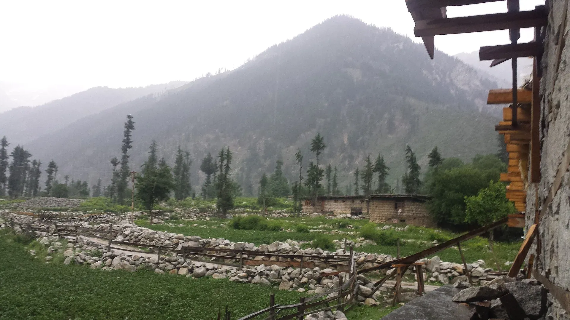
Photo: Umair khan, with thanks · CC BY-SA 4.0 · via Wikimedia Commons · temporary stand-in photo

Kumrat Valley Campsites
Riverside campsites among the deodar forest of Kumrat in Upper Dir. For foreign visitors: the UK FCDO advises against all travel to Upper Dir, and floods have cut access in 2025 and 2026.
Overview
Kumrat is the upper Panjkora valley in Upper Dir, known for flat deodar forest beside the river. Riverside camps and simple huts stand among the trees, most of them seasonal. The valley also has Kala Chashma, Katora Lake and the Jahaz Banda meadow, which have their own pages.
Plan your visit
- Nearest town
- Thal
- Getting there
By road from Dir through Thal, then unpaved 4x4 road to Kumrat. OSRM Islamabad to Thal is about 363 km and 4.4 hours (optimistic). Access has been cut by floods and a collapsed bridge; check first. More
Best months
May – Jun, Sep – Oct
- Kumrat Valley Campsites
- Related places nearby: Kumrat Valley, Jahaz Banda, Katora Lake, Kalam, Utror and Gabral
The valley and its forests
Kumrat is the upper part of the Panjkora valley, in Sharingal tehsil of Upper Dir, about 346 km² in all. It lies in Upper Dir Kohistan, behind the Gabral area of Swat Kohistan. The Panjkora splits into several channels in places, and the camps stand on the flat ground beside it.
The upper valley has pine forest and the lower valley oak. The deodar grows on level ground along the river, with blue pine, Himalayan fir, holly oak, Himalayan birch, walnut, Indian horse-chestnut and poplar. The deodar woods are shrinking because winter fuel is cut from them. Wildlife reported in the valley includes Asiatic black bear, grey wolf, red fox, yellow-throated marten, Kashmir musk deer and Astor markhor. The valley is mainly home to the Gawri people.
The valley has several waterfalls and Kala Chashma (Black Spring). Around Eid al-Fitr about 2,000 vehicles a day have been reported entering, which is why camps and roads fill up then.
Check the travel advice first
The UK Foreign Office (updated 27 October 2026, checked 16 November 2026) advises against all travel to Upper Dir and Lower Dir, and notes emergency measures in Khyber Pakhtunkhwa. Read the live page and local news before you plan anything here. This page describes the site; it is not a recommendation to go.
Access
The road runs from Dir town through Thal. Beyond Thal it is unpaved and needs a 4x4. OSRM measures Islamabad to Thal at about 363 km and 4.4 hours, which is optimistic. The Express Tribune reported on 27 April 2026 that the Thal to Kumrat link bridge had collapsed and not been rebuilt, and an August 2026 report said floods had swept away bridges and left tourists stranded. Ask the Upper Dir district administration about the current position.
Who manages it, and the rules
- Kumrat Development Authority. A 2020 ARY News report said the KP tourism department set rules for the Kumrat and Kalam development authorities, with fines for violations, to protect the valley. The current rule text and an official list of campsites have not been found.
- Land. Camps stand on local land. Ask the owner, agree the charge and do not pitch on private fields.
- Trees. Do not cut deodar for fuel. The Tribune and local officials have criticised illegal construction and tree-cutting. Bring stove fuel.
- Waste. Take rubbish out; the valley has little collection.
- Fees. Camp and hut charges apply; current fees will be added soon.
Best months
May to October. The valley is snowbound in winter. Eid and early summer bring crowds and strain roads and camps.
Safety
- Floods. Several floods have hit Kumrat. Do not camp on river flats or in dry channels, and watch the sky upstream.
- Stranding. If a bridge fails you may be stuck for days. Carry spare food and a charged phone.
- Roads. Use a 4x4 with a local driver. Do not travel after dark.
- Wildlife. Black bear and wolf are reported; keep food sealed.
Nearby
Kumrat Waterfall, Jahaz Banda, Katora Lake and Kalam.
Highlights
- Riverside camps among deodar forest
- For foreign visitors: the UK FCDO advises against all travel to Upper Dir (16 November 2026)
- Bridges and roads cut by floods in 2025 and 2026
- Gateway to Jahaz Banda and Katora Lake
Getting there
By road from Dir through Thal, then unpaved 4x4 road to Kumrat. OSRM Islamabad to Thal is about 363 km and 4.4 hours (optimistic). Access has been cut by floods and a collapsed bridge; check first.
Tips
- Check live travel advice and the bridge status before planning.
- Never camp on river flats.
- Bring stove fuel; do not cut trees.
Photos we still need: riverside camps among the deodar trees; the Thal to Kumrat road. Send us yours
Sources and last checked
Last checked Confidence low6 sources3 still to check
- Last checked
- Method
- Desk research from published sources
- Confidence
- low
- Checked by
- trek.pk research team
Researched from published sources; not yet checked on the ground by our team. Spot something out of date? Report a mistake.
Sources
- Pakistan travel advice: warnings and insurance (updated 27 October 2026) · UK Foreign, Commonwealth & Development Office · checked
- Kumrat Valley · Wikipedia · checked
- Kumrat tourism hit as neglect persists (27 April 2026) · The Express Tribune · checked
- KP's Kumrat Valley remains disconnected after main bridge collapse (1 August 2026) · The Pakistan Connect · checked
- KP defines rules for preserving scenic beauty of tourist spots (2020) · ARY News · checked
- OSRM driving route service (distances and times measured 16 November 2026; times are optimistic) · OSRM · checked
Still to be checked on the ground (3)
- Whether the road and bridges are open
- Current rules and who allocates campsites
- Camp and hut charges
Nearby and related

Jahaz Banda Day Hike

Kumrat Valley
The upper Panjkora valley in Upper Dir, known for deodar forest, the Jahaz Banda meadow and Katora Lake. Access has been cut by floods and a collapsed bridge in 2025 and 2026.

Kumrat Waterfall
A waterfall in Kumrat Valley, Upper Dir, in the Panjkora river area. Sources are thin and sometimes confusing. For foreign visitors: the UK FCDO advises against all travel to Upper Dir.
Jahaz Banda
A large high meadow at about 3,100 m in the upper Kumrat Valley, Upper Dir, reached by a rough jeep road and a walk. UK travel advice is against all travel to Upper Dir.

Katora Lake
An alpine glacial lake at about 3,500 m above Jahaz Banda in the Kumrat valley, Upper Dir. A trek of several hours from the end of the jeep road.

Kalam, Utror and Gabral
The head of the Swat valley: Kalam town where the Ushu and Gabral rivers meet, with Ushu forest, Utror and Kundol Lake, Gabral, and jeep tracks to Mahodand Lake.