

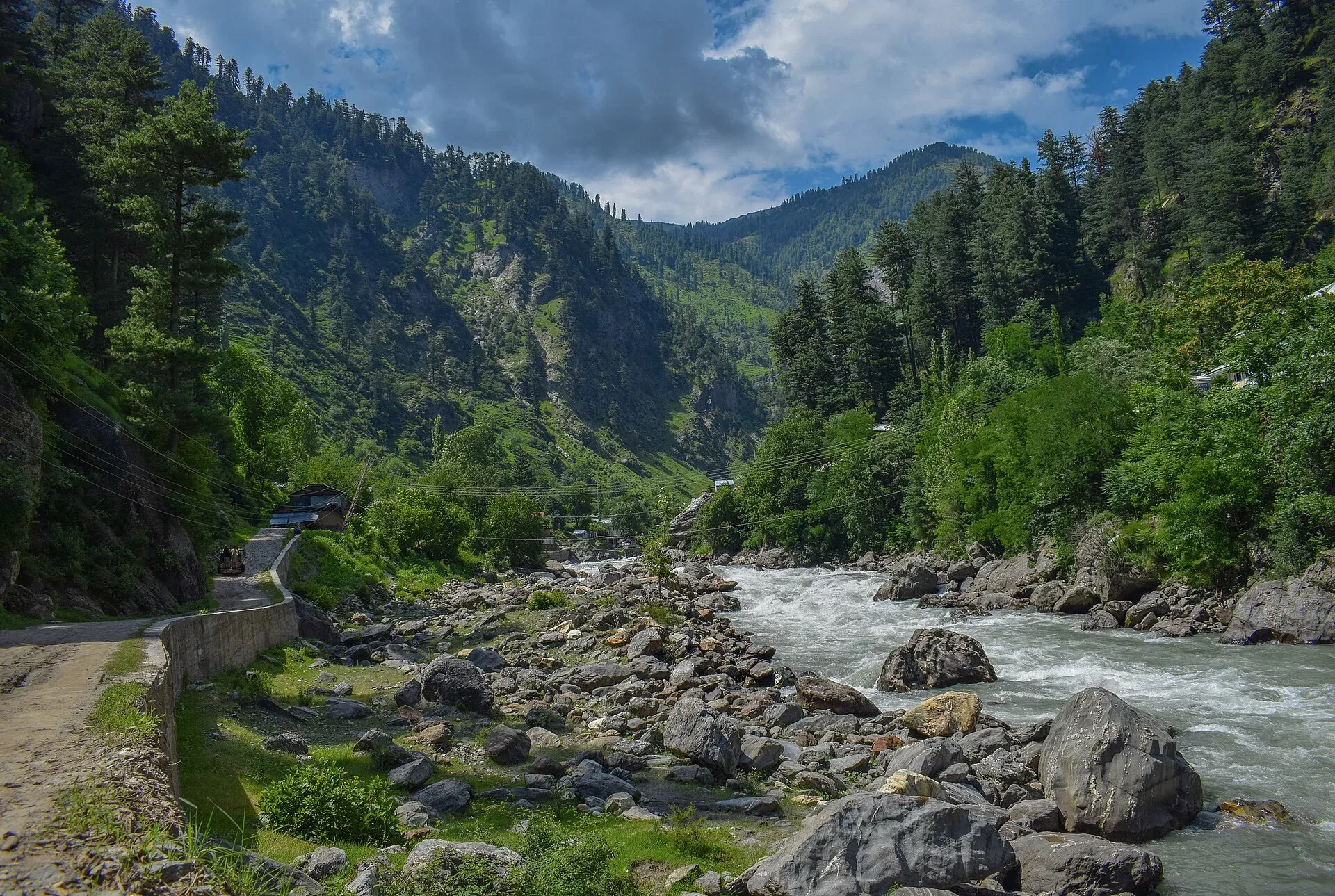
Photo: Yousuf Salemwala, with thanks · CC BY-SA 4.0 · via Wikimedia Commons · temporary stand-in photo

Kunhar River
A snowmelt river of about 177 km that rises at Lulusar Lake, runs the length of the Kaghan Valley past Naran and Balakot, and joins the Jhelum near Muzaffarabad.
Overview
The Kunhar is about 177 km long and part of the Indus basin. It rises at Lulusar Lake near Babusar Pass in the Kaghan Valley (sources give the lake's height as 3,455 m or 3,950 m, so treat it as about 3,400 to 3,900 m). It is the main river of the Naran Valley and flows past Balakot in Mansehra District. Melting snow and many side streams feed it, and the mean flow at Garhi Habibullah was about 101 cubic metres a second for 1961 to 2000. Emperor Jahangir called it Darya e Nainsukh, which Wikipedia translates as "repose of the eyes".
Plan your visit
- Nearest town
- Naran
- Getting there
Naran is reached from Islamabad via Abbottabad, Mansehra, Balakot and the N-15 up the Kaghan Valley. Check seasonal road status; the road beyond Naran to Babusar Pass opens only in summer. More
Best months
Jun – Sep
Course
From Lulusar it flows south-west through Naran, then drops steeply through Kaghan to Balakot and the edge of the plains at Garhi Habibullah. A weir near Patrind feeds a hydropower plant. Sources disagree on the meeting with the Jhelum: some place it near Pattan, others a short way downstream of Muzaffarabad, and a Friday Times article says the Kunhar and the Neelum run roughly parallel and join the Jhelum a few kilometres apart.
Up the valley
A 2022 Friday Times account of the road up the valley describes these stops beyond Naran, in the order it gives them:
- Batakundi. A growing stop with new hotels and restaurants, and the start of a jeepable track to Lalazar (about 10,500 feet).
- Burawai. Where the road crosses the Jora Nala and the Kunhar. Tiger Peak (4,580 m), nicknamed "mini K2", fills the southern skyline.
- Jhalkand. A wide valley where the Jhalkand Nala joins the Kunhar, popular for camping. An unpaved road from here over Noori Top (12,900 feet) to the Neelum Valley is open only from June to September and suits experienced drivers in modified 4x4s. Pyala Lake, a small round lake, is nearby.
- Besal. A broader stretch of valley where the Purbi Nar and Sadullah Nar streams join. The Purbi Nar drains Dudipatsar Lake, one of the river's main sources, about 15 km away.
- Lulusar Lake. The other main headwater, a semicircular glacier-fed lake inside the Lulusar-Dudipatsar National Park. See Lulusar Lake.
What to see and do
- Naran riverside. The N-15 road runs beside the river. Riverside cafes and walkways give easy views and photographs. About 10 km from Naran, a multi-tier waterfall drops off the northern edge of Malika Parbat into the Kunhar, and many visitors walk up to the first or second tier. See Naran.
- Fried trout. Trout farms line the river, and fried trout is a local speciality.
- Balakot. The lower river passes the town, which was badly damaged by the 2005 earthquake. See Balakot.
- Rafting. Several operators run rafts near Soch, east of Naran, on stretches of about 1.5, 5 and 8 km, with life jackets and helmets, according to the Friday Times. Dawn (3 July 2008) called rafting the most popular adventure sport in Kaghan, with boats of up to eight people and instructors. Season advice conflicts between sources (one says May to September, another mid-September to November), and no official list was found. Pick a licensed operator, check helmets and life jackets, and ask the district tourism office.
- Trout fishing. The Kunhar and its streams hold brown and rainbow trout. A permit from the Khyber Pakhtunkhwa Fisheries Department is generally required and fishing is closed in spawning season. Dawn (26 January 2015) reported that fishing was allowed for four months a year under a permit, rod only; those rules may have changed. Current fees will be added soon; ask the department.
When to visit
Naran is open to vehicles from about May or June until snow arrives. Naran's population swells to thousands from April to September and drops to a few hundred in winter, according to the Friday Times. Flow is highest in July and August. Landslides and washouts can close the road at any time in monsoon.
Where to stay and eat
Naran has the widest choice of hotels and restaurants; Balakot and Kaghan have simpler options.
Good to know
- Cold, fast water can sweep adults away. Stay out of the river, and do not sit on rocks or gravel in the channel.
- Check NDMA and PMD alerts for flash floods before you travel.
- Streams and glaciers cross the road above Naran in places. Do not walk under a glacier edge; they can collapse.
- Ask the district administration or local police about current conditions before you go. Safety. For foreign visitors: the UK FCDO page (updated 27 October 2026, checked 16 November 2026) does not name the Kaghan Valley, but advises against all travel on the KKH between Mansehra and Chilas and in several other KP districts, and notes KP emergency measures. Read the live page before you plan.
Highlights
- Rises at Lulusar Lake near Babusar Pass
- Runs the length of the Kaghan Valley
- Passes Naran and Balakot
- Joins the Jhelum near Muzaffarabad
- Rafting and trout fishing near Naran
Getting there
Naran is reached from Islamabad via Abbottabad, Mansehra, Balakot and the N-15 up the Kaghan Valley. Check seasonal road status; the road beyond Naran to Babusar Pass opens only in summer. Read current FCDO advice before travelling.
Tips
- Use a licensed rafting operator with proper gear
- Check road and weather reports before driving to Naran
- Do not sit or swim in the river
- Ask the KP Fisheries Department about trout permits
Photos we still need: rafting on the Kunhar near Soch; the Kunhar at Naran or Balakot; Lulusar Lake or Besal. Send us yours
Sources and last checked
Last checked Confidence medium5 sources5 still to check
- Last checked
- Method
- Desk research from published sources
- Confidence
- medium
- Checked by
- trek.pk research team
Researched from published sources; not yet checked on the ground by our team. Spot something out of date? Report a mistake.
Sources
- Kunhar River (Wikipedia) · Wikipedia · checked
- Road to Kaghan II · The Friday Times · checked
- White water rafting in Kaghan enthrals tourists · Dawn · checked
- Trout fishing permits report · Dawn · checked
- Pakistan travel advice (updated 27 October 2026) · UK Foreign, Commonwealth & Development Office · checked
Still to be checked on the ground (5)
- Exact confluence point with the Jhelum (Wikipedia's text says Pattan, its infobox says Muzaffarabad)
- Source height (Wikipedia text 3,455 m, infobox 3,950 m; no official figure)
- Rafting season and licensing (only Dawn 2008; no official list)
- Trout permit rules and current fees (only Dawn 2015; fee not taken from a news report)
- Order of the stops between Naran and Lulusar (Friday Times 2022 gives the sequence used here; confirm on the road)
Nearby and related

Kaghan Valley (with Naran)
A 155 km Himalayan valley above Balakot along the Kunhar River, with Shogran, Naran, Saiful Muluk and Lulusar lakes, and the road to Babusar Pass. Open mainly from May to October.

Naran
The main base of the Kaghan Valley, at 2,409 m beside the Kunhar River. Naran is the starting point for Saiful Muluk, Lulusar and the road to Babusar Top.

Lulusar Lake
A large lake beside the Naran-Babusar road in upper Kaghan, at roughly 3,350–3,410 m. It is the main source of the Kunhar River and the gateway to Lulusar-Dudipatsar National Park.

Lulusar-Dudipatsar National Park
A high national park at the head of the Kaghan Valley, created in 2003. It protects Lulusar Lake, Dudipatsar Lake and the wildlife of the Babusar area.

Balakot
The gateway to the Kaghan Valley, on the Kunhar River in Mansehra District. Balakot was destroyed in the 2005 earthquake and is the last big town before Naran, Shogran and Siri Paye.

Saiful Muluk
The best-known lake of the Kaghan Valley, at 3,224 m above Naran, with Malika Parbat behind it. It is about 9 km from Naran, reached by jeep, and is snowbound and frozen in winter.

Jhelum River
A river of about 725 km that rises at Verinag in Kashmir, passes Srinagar and Muzaffarabad, fills Mangla Dam, crosses Punjab past Jhelum city and joins the Chenab at Trimmu.

Neelum River
A 245 km river called the Kishanganga in India. About 195 km flows through Azad Kashmir's Neelum Valley before it joins the Jhelum at Muzaffarabad. Border-zone travel advice applies.

Naran, Kaghan and Babusar
A 4-day summer road trip from Islamabad up the Kaghan valley to Naran, Saiful Muluk and Lulusar Lake, over Babusar Pass (4,173 m) to Chilas on the KKH.