

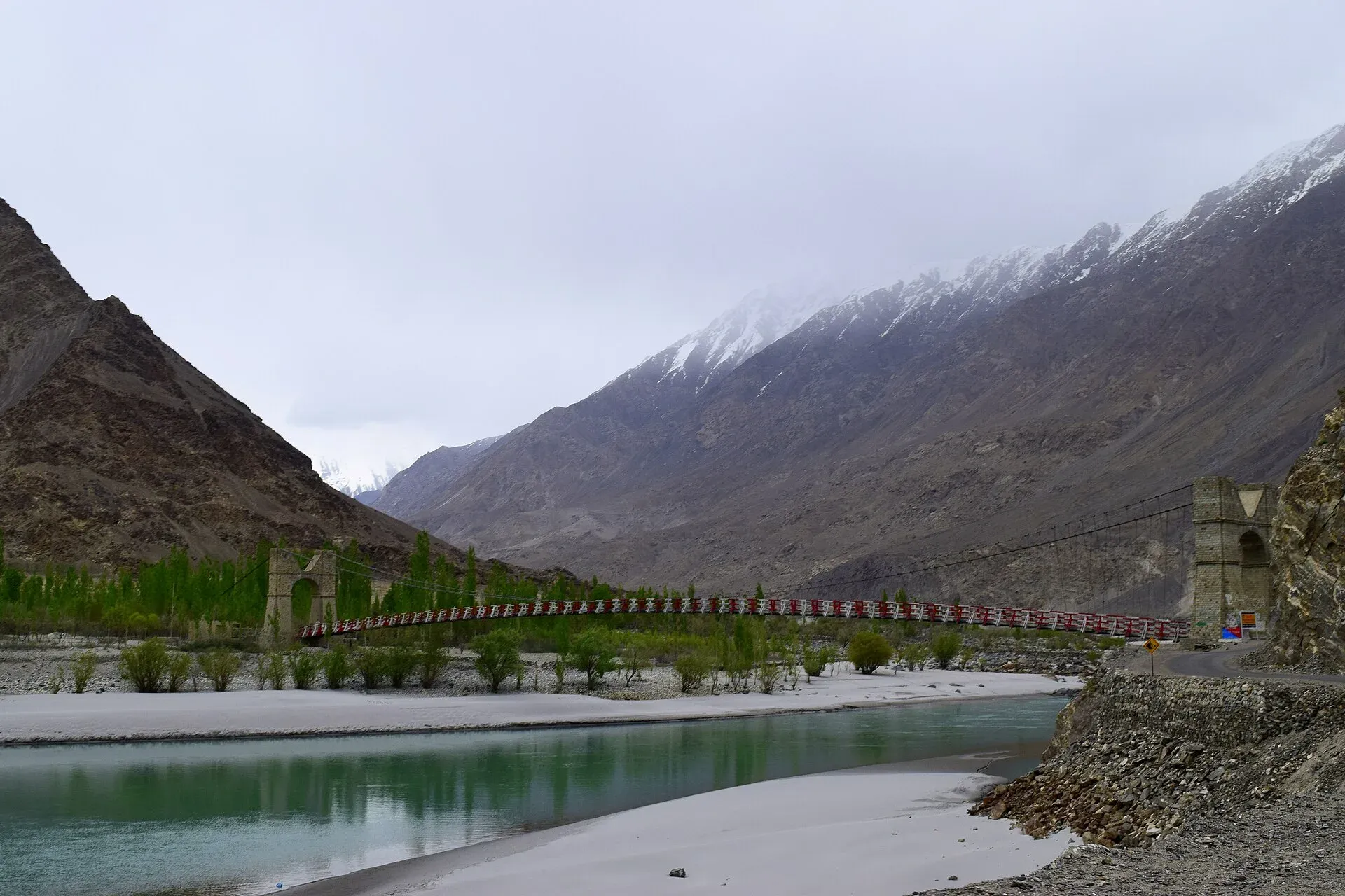
Photo: Rizwan Saeed, with thanks · CC BY-SA 4.0 · via Wikimedia Commons · temporary stand-in photo

Shigar River
A glacier-fed river of Baltistan, carrying meltwater from the Baltoro and Biafo glaciers down the Shigar Valley to join the Indus at Skardu. The valley road to Askole and the K2 treks follows its upper course.
Overview
The Shigar River is the main right-bank tributary of the Indus at Skardu. It drains the Shigar Valley in Baltistan and is fed by meltwater from the Baltoro and Biafo glaciers, two of the longest glaciers outside the polar regions. A reference gauge at Shigar recorded a mean annual flow of about 223 cubic metres a second for 1985 to 1998, with a minimum near 142 and a maximum near 330. The catchment is about 6,610 sq km. No source opened gives its length.
Plan your visit
- Nearest town
- Shigar
- Getting there
Skardu has flights from Islamabad (weather permitting) and road links via Gilgit. Shigar is a short drive from Skardu and the road continues towards Askole, the roadhead for Baltoro treks. More
Best months
May – Oct
Course
Above Shigar the river is known as the Braldu. The Braldu is formed by the Biafo and Biaho streams, which in turn come from the Biafo, Panmah and Baltoro glacier systems. Trekkers heading for Concordia and K2 cross the Braldu on a footbridge at Askole, the last village on the road. Below the Shigar valley the river broadens across wide gravel flats, and meets the Indus in the Skardu Valley. Skardu itself lies on the Indus below a huge rock outcrop, a short way from the junction.
The valley it drains
The Shigar Valley runs about 170 km from Skardu to Askole, the last settlement before the high mountains, and is described as the gateway to the Karakoram. Shigar is the largest settlement and is now a district in its own right. The main language is Balti, and about 70,000 people lived in the valley in 2014, mostly Shia Muslims. Fruit trees include cherry, apple, apricot and mulberry. Polo is the traditional game of Baltistan.
What to see and do
- Shigar Valley road. The drive from Skardu to Shigar and on to Askole follows the river through orchards, villages and canyon sections. A suspension bridge across the river near the Shigar area is a popular photo stop.
- Shigar Fort. The restored fort and its village are the main cultural stop. See the Shigar Fort page.
- Walk and photograph. Early morning, when flow is lowest and the water is clearest, is best for photographs. Do not wade.
- Glacier trekking. The Baltoro and Biafo treks begin up this river. See the Baltoro Glacier and Biafo Glacier pages. Trekking permits and fees apply: current fees will be added soon; check with Gilgit-Baltistan Tourism.
- Rafting and fishing. There is no known official source for rafting or angling on the Shigar. Ask Gilgit-Baltistan Tourism.
When to visit
April to October is the usual season. In the cool months, flow is low and the water is clear and blue-green. In July and August the glaciers melt hard, and the river runs wide, brown and cold. Roads along the river can be blocked by landslides or washed out by floods.
Where to stay and eat
Skardu has the widest choice of hotels and restaurants. Shigar village has guesthouses, and small stops with simple food are along the road towards Askole.
Good to know
- Glacial rivers rise quickly in the afternoon. Never cross by wading; read the river crossings guide before any trek along the Braldu.
- The river's flow is highest in mid-summer. Wait or choose a different day if the water has risen.
- For foreign visitors: the UK FCDO (updated 27 October 2026, checked 16 November 2026) does not advise against Gilgit-Baltistan generally. Check roads and flights to Skardu before you go.
Highlights
- Carries meltwater from the Baltoro and Biafo glaciers
- Main right-bank tributary of the Indus at Skardu
- Valley road to Askole follows the river
- Passes Shigar Fort and village orchards
Getting there
Skardu has flights from Islamabad (weather permitting) and road links via Gilgit. Shigar is a short drive from Skardu and the road continues towards Askole, the roadhead for Baltoro treks. Check the road status in Skardu before leaving.
Tips
- Photograph in the morning when flow is lower
- Never wade across glacier streams
- Check landslide reports on the Skardu–Askole road
- Carry permits for trekking beyond Askole
Photos we still need: the Braldu footbridge at Askole; the Shigar valley road above the river, with orchards; the Shigar River meeting the Indus near Skardu. Send us yours
Sources and last checked
Last checked Confidence medium6 sources4 still to check
- Last checked
- Method
- Desk research from published sources
- Confidence
- medium
- Checked by
- trek.pk research team
Researched from published sources; not yet checked on the ground by our team. Spot something out of date? Report a mistake.
Sources
- Shigar River (Wikipedia) · Wikipedia · checked
- Shyok River (Wikipedia) · Wikipedia · checked
- Trekking in the Karakoram and Hindukush (facts only) · Lonely Planet (owner-provided) · checked
- Pakistan Tourism Guide 2021 · Trade Development Authority of Pakistan (TDAP) · checked
- Pakistan travel advice (updated 27 October 2026) · UK Foreign, Commonwealth & Development Office · checked
- Shigar Valley · Wikipedia · checked
Still to be checked on the ground (4)
- River length not sourced (Wikipedia Shigar River and Shigar Valley give none)
- Photo is of the Shigar area; exact river section not confirmed
- Rafting and fishing arrangements (no source mentions either)
- Trekking permit fees (GB Tourism site not reachable from here)
Nearby and related

Baltoro Glacier and K2 Base Camp

Shigar Valley
A green valley north-east of Skardu with Shigar Fort, old wooden mosques and orchards, leading to Askole and the trailheads for the Baltoro, Biafo and Hispar treks.

Shigar Fort (Fong-Khar)
A 17th-century palace of the Amacha rajas of Shigar, restored by the Aga Khan Cultural Service Pakistan in 1999-2004 and now a museum and heritage hotel.

Skardu
The main town of Baltistan, where the Indus meets the Shigar river. Skardu is the base for the Deosai Plains, the Kachura and Satpara lakes, Shigar, and the K2 and Baltoro treks.

Baltoro Glacier
About 62 km long, the Baltoro is the glacier you walk up to reach K2 Base Camp and Concordia. A restricted-zone trek of about two weeks from Askole, inside Central Karakoram National Park.

Biafo Glacier
A glacier of about 63 km that runs from Snow Lake down to Askole. With the Hispar Glacier it forms one of the longest glacier routes outside the polar regions, a serious roped trek over the Hispar La.

Indus River
Pakistan's greatest river, rising in Tibet and running about 3,180 km to the Arabian Sea. It crosses Gilgit-Baltistan, meets the Gilgit near Jaglot and the Kabul at Attock, and feeds the plains from Tarbela to the delta.
Braldu River
A glacier-fed river in Shigar District that rises at the Baltoro and Biafo glaciers. It forms the road and trail approach to the Baltoro and K2, and ends at Tingstun where it joins the Basha Basna to form the Shigar River.