

Photo: Yousaf Feroz Gill, with thanks · CC BY-SA 4.0 · via Wikimedia Commons · temporary stand-in photo

Biafo Glacier
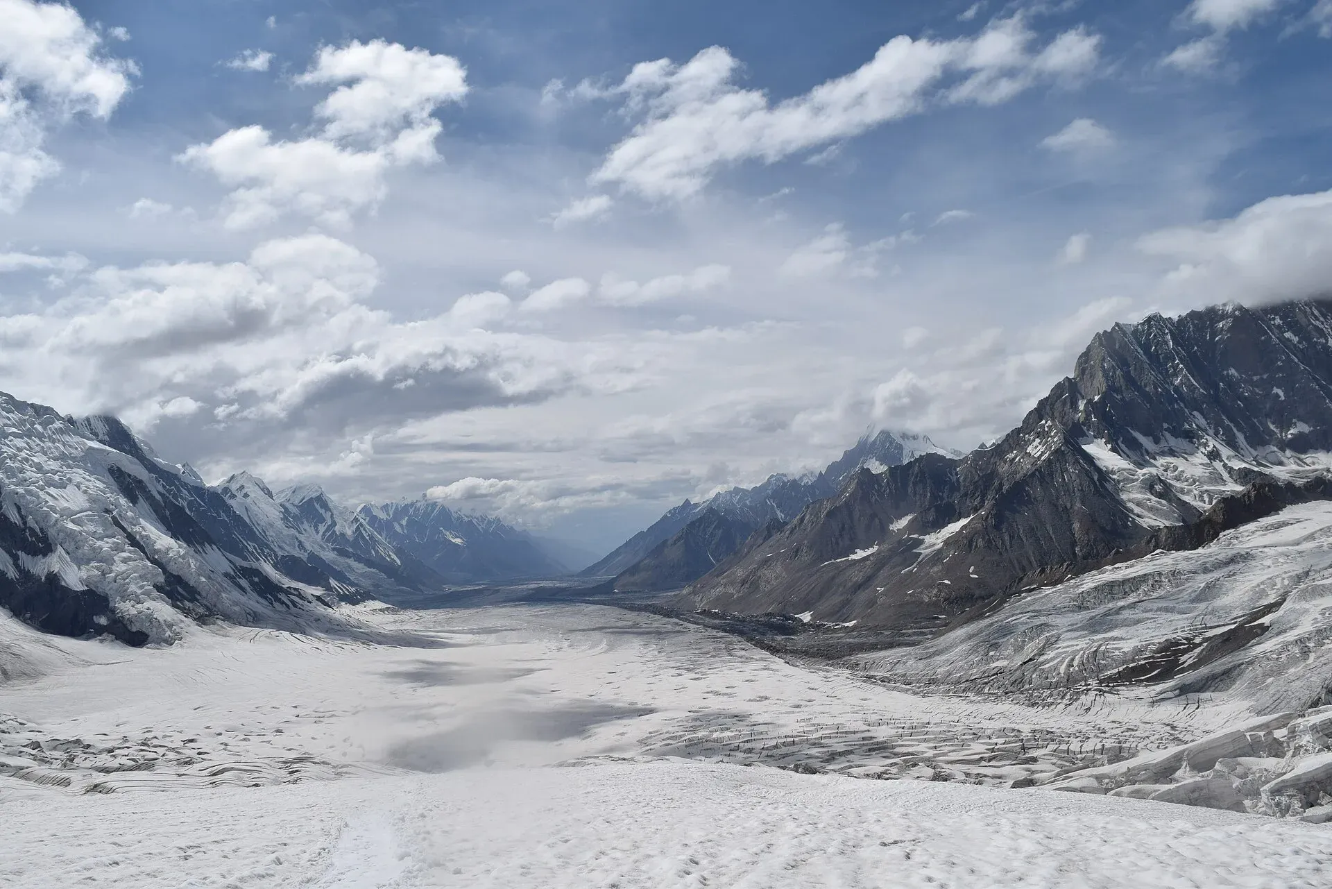
A glacier of about 63 km that runs from Snow Lake down to Askole. With the Hispar Glacier it forms one of the longest glacier routes outside the polar regions, a serious roped trek over the Hispar La.
Overview
The Biafo Glacier runs north to south from the high basin called Snow Lake (Lukpe Lawo) down towards Askole in Shigar District. The CKNP gives its length as 63 km, and Wikipedia's Karakoram article agrees; the Wikipedia article on the glacier itself says 67 km. A 1989 study by Hewitt and colleagues, cited by Wikipedia, gives the basin as 853 km², of which 628 km² is permanent snow and ice. These are older measurements, so use them as a guide only. Wikipedia ranks it as the third-longest non-polar glacier, after the Fedchenko and the Siachen.
At the top, Snow Lake collects five major glaciers in a basin of over 80 km² (CKNP). Above it stand granite towers such as Lukpe Lawo Brak (6,593 m) and Baintha Brak, "The Ogre" (7,285 m), and the Latok group.
Plan your visit
- Nearest town
- Askole
- Getting there
Take a jeep road from Skardu through Shigar to Askole, about a day. Most people walk the Biafo from the Askole side, with a check post at Thungol. More
Best months
Jun – Sep
- Biafo Glacier
- Related places nearby: Central Karakoram National Park, Shigar Valley, Skardu, Latok I, Baintha Brakk (The Ogre)
Getting to Askole
The Biafo is walked, not driven to. The trek starts at Askole, the last village on the Braldu valley road. A jeep road runs from Skardu through Shigar to Askole, about a day, along the Braldu gorge. A check post stands at Thungol, on the way to the glacier. See Skardu, Shigar Valley and Braldu River.
The route up the glacier
The classic route is the Biafo-Hispar traverse: up the Biafo from Askole, across the Hispar La (about 5,128 to 5,151 m) and down the Hispar Glacier to Hispar village and Huru in Nagar. The CKNP describes it as about 17 days and as mountaineering rather than trekking, needing crampons, ice axe, rope and crevasse-rescue skills. Our Hispar La trek page has the stage-by-stage route. Over two thirds of it is on glacier, and sections need roped teams.
The surface changes as you climb.
- Askole to Namla. The first day follows the canal and the Biafo River's right bank before the climb to a cairn and a first view of the ice. Namla, a camp on the western edge of the glacier, is often covered in flowers, with a waterfall close to camp.
- Mango and the lower glacier. The ice here is mixed with lateral moraine, boulder fields and bands of white ice. Wikipedia calls it several days of strenuous boulder hopping. The route crosses crevasses in the moraine to a medial moraine, then white ice to Mango, a green camp in a side valley. Camps sit off the glacier beside lateral moraines.
- Baintha. A large green meadow with several streams, often used as a rest day. Wikipedia mentions rock climbing and rappelling nearby. Latok peaks stand across the glacier.
- The upper Biafo. From Baintha the route runs onto the central ice, an "ice highway" to Nakpogoro (4,380 m) and Marpogoro (4,410 m). Early in the season snow can hide crevasses and roping is needed.
Snow Lake
Snow Lake is not a lake but a high basin of snow and ice, about 4,877 m up and roughly 16 km wide by Wikipedia's figures. Wikipedia says up to 1,600 m of ice lies beneath it. It sits at the head of the Biafo and Hispar glaciers, which flow away from each other from the Hispar La. Martin Conway, the first foreign visitor, named it in 1892 and called the view of the mountains the finest he knew; in 1899 the Workmans guessed it might be an ice cap. A side route from Marpogoro reaches Snow Lake. Wikipedia says only about 200 people reach it each year.
Wildlife
Ibex and markhor are commonly seen on the slopes beside the glacier. Himalayan brown bears and snow leopards live in the area, but sightings are rare. Lower pastures along the glacier are used by herders from the Braldu valley.
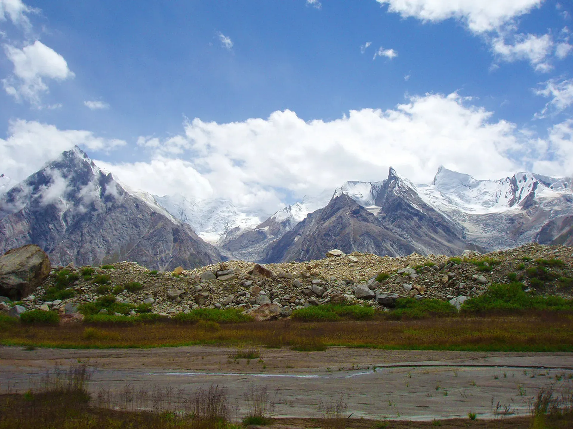
Photo: BlackZero_007, with thanks · CC BY 2.0 · via Wikimedia Commons · temporary stand-in photo

When to visit
June to September. The pass is hardest early in the season, when snow hides crevasses, and late in the season when the weather turns.
Preparation and gear
This is a serious, technical expedition, not a first Karakoram trek. You need to be able to rope up, use crampons and an ice axe, and carry out crevasse rescue. Wikipedia's Snow Lake article says a guide is mandatory because the route visits restricted areas inside Central Karakoram National Park. Carry food for the glacier days; porters traditionally bring their own food as far as Baintha. Read the glacier travel basics and altitude sickness guides first.
Where to stay and eat
You camp. Stay in Skardu or Shigar before the walk and in Nagar or Karimabad afterwards.
Good to know
- Permits. Sources disagree. The CKNP lists the Biafo and Hispar glaciers in its core zone, which means a trekking permit, a registered guide and park fees; older guidebooks call the route open-zone. Ask a licensed operator which paperwork applies. Fees changed in 2024-25 and were disputed in court in 2025, so current fees will be added soon.
- Glacier safety. Read our glacier travel basics page. Crevasses, hidden snow bridges and whiteouts are the main risks, and a guide with current knowledge of the route is essential.
- Climate. Glaciers in the central and western Karakoram have behaved differently from most of the world's glaciers. Some studies report them holding steady or even gaining mass, which is called the "Karakoram anomaly"; eastern Karakoram glaciers have been retreating more clearly. Even so, rising temperatures bring hazards. Pakistan's climate ministry and UNDP report 3,044 glacial lakes in Gilgit-Baltistan and Khyber Pakhtunkhwa, of which 33 were assessed as prone to dangerous outburst floods (GLOFs). The UNDP-run GLOF II project, funded by the Green Climate Fund, covers 24 valleys with early-warning systems.
- Travel advice. For foreign visitors: the UK FCDO page for Pakistan (updated 27 October 2026, checked 16 November 2026) does not advise against Gilgit-Baltistan as a whole. It does advise against all travel on the Karakoram Highway (KKH) between Mansehra and Chilas, the usual road route from Islamabad, so check the live page before you plan and consider flying to Gilgit or Skardu (weather permitting).
Highlights
- About 63 km long (sources: 60 to 67 km)
- Snow Lake basin, where five glaciers meet
- Part of the Biafo-Hispar traverse over the Hispar La
- Granite spires including The Ogre
Getting there
Take a jeep road from Skardu through Shigar to Askole, about a day. Most people walk the Biafo from the Askole side, with a check post at Thungol. For foreign visitors: the UK FCDO page for Pakistan (updated 27 October 2026, checked 16 November 2026) does not advise against Gilgit-Baltistan as a whole. It does advise against all travel on the Karakoram Highway (KKH) between Mansehra and Chilas, the usual road route from Islamabad, so check the live page before you plan and consider flying to Gilgit or Skardu (weather permitting).
Tips
- Treat the Biafo-Hispar traverse as a mountaineering trip, not a first trek.
- Get crevasse-rescue training and travel roped on the upper glacier.
- Check the current permit zone with a licensed operator.
- Carry spare food for weather delays.
Photos we still need: Askole and the Thungol check post. Send us yours
Sources and last checked
Last checked Confidence medium9 sources5 still to check
- Last checked
- Method
- Desk research from published sources
- Confidence
- medium
- Checked by
- trek.pk research team
Researched from published sources; not yet checked on the ground by our team. Spot something out of date? Report a mistake.
Sources
- Karakoram glaciers: Baltoro, Biafo, Hispar · Central Karakoram National Park (cknp.org) · checked
- Biafo Glacier · Wikipedia · checked
- Karakoram · Wikipedia · checked
- Hispar La (old trek.pk page, text from Lonely Planet Trekking in the Karakoram and Hindukush, c. 2002; facts only) · trek.pk / Lonely Planet · checked
- Glacier-Related Hazards Along the International Karakoram Highway: Status and Future Perspectives · Frontiers in Earth Science (2021) · checked
- Glacial Lake Outburst Flood GLOF-II · Ministry of Climate Change and Environmental Coordination, Pakistan · checked
- Scaling-up of GLOF risk reduction in Northern Pakistan (GLOF II) · UNDP Pakistan · checked
- Pakistan travel advice · UK Foreign, Commonwealth & Development Office · checked
- Snow Lake (Wikipedia) · Wikipedia · checked
Still to be checked on the ground (5)
- Glacier length: CKNP 63 km, Wikipedia infobox 67 km (and 51 km of it on the trekking route); area 853 km2 basin per a 1989 study via Wikipedia. Sources still differ
- Whether the route is open zone or CKNP core zone now (CKNP glacier page says only that the glacier runs 'through CKNP'; no zone or permit rule found)
- Current fees
- Wikipedia says a guide is mandatory because the route visits restricted areas of Central Karakoram National Park; the current permit rules still need an official source
- Snow Lake size: Wikipedia gives 4,877 m height and about 16 km width
Nearby and related

Hispar La (Biafo–Hispar traverse)

Rush Phari (Rush Lake)

Central Karakoram National Park
Pakistan's largest protected area, covering about 10,500 square kilometres of the highest mountains on earth: K2, Gasherbrum I and II, Broad Peak and the Baltoro, Biafo and Hispar glaciers.

Shigar Valley
A green valley north-east of Skardu with Shigar Fort, old wooden mosques and orchards, leading to Askole and the trailheads for the Baltoro, Biafo and Hispar treks.

Skardu
The main town of Baltistan, where the Indus meets the Shigar river. Skardu is the base for the Deosai Plains, the Kachura and Satpara lakes, Shigar, and the K2 and Baltoro treks.

Nagar Valley
The quieter bank of the Hunza River, facing Karimabad: Minapin, Hoper and Hispar villages, Rakaposhi viewpoints and easy treks below Rakaposhi, Diran and Spantik.
Latok I
Latok I (7,145 m) is the highest peak of the Latok group in the Panmah Muztagh, above the Biafo Glacier. It was first climbed in 1979; its north ridge is famous among climbers.

Baintha Brakk (The Ogre)
Baintha Brakk, also called The Ogre (7,285 m), is a granite peak in the Panmah Muztagh above the Biafo Glacier. Its first ascent in 1977 became one of the best-known stories in mountaineering.