

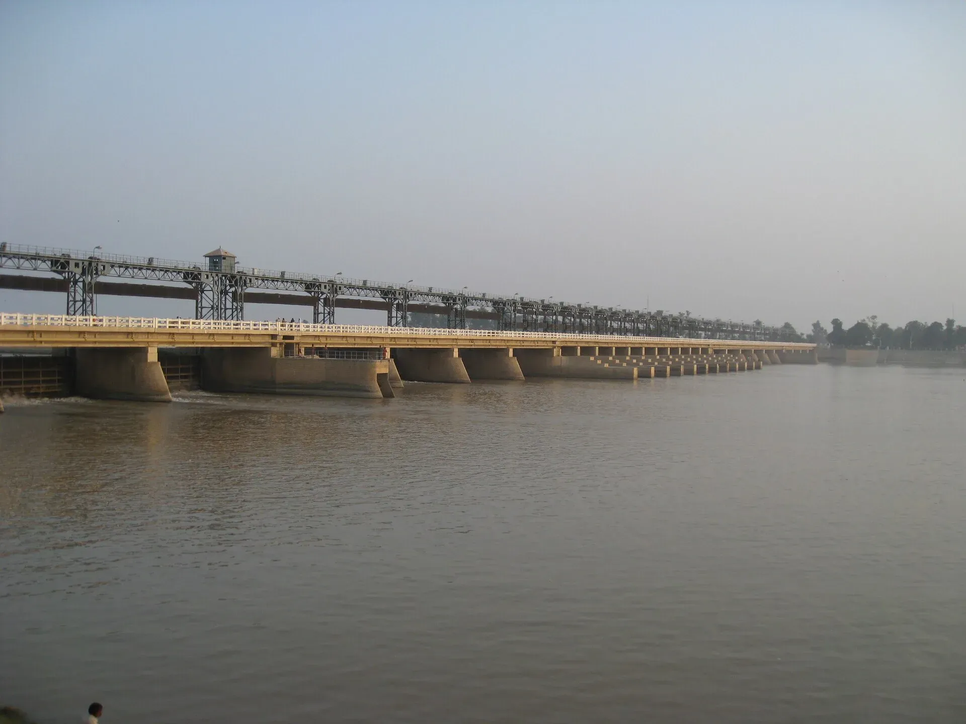
Photo: Ammarkh, with thanks · CC BY-SA 4.0 · via Wikimedia Commons · temporary stand-in photo

Sutlej River
The longest of Punjab's five rivers, about 1,450 km from Lake Rakshastal in Tibet. It enters Pakistan east of Kasur, passes Sulemanki and Islam headworks, and meets the Chenab north of Uch Sharif to form the Panjnad.
Overview
The Sutlej is about 1,450 km long and the longest of the five rivers of the Punjab. It rises near Lake Rakshastal and Lake Manasarovar on the southern slope of Mount Kailash in Tibet at about 4,570 m and flows west-north-west for about 260 km before it enters India at Khab in Himachal Pradesh. It leaves the Shivalik hills near Ropar and runs about 360 km west-south-west to meet the Beas near Harike. It then enters Pakistan about 15 km east of Bhedian Kalan in Kasur District. No source consulted gives the river's length inside Pakistan.
Older names include Satadru and Shutudri in Sanskrit and Zaradros in Greek. Geologists call it an antecedent river, one that is older than the mountains it cuts through.
Plan your visit
- Nearest town
- Bahawalpur
- Getting there
Bahawalpur is the main base, with an airport, railway and the N-5 road. Islam Headworks is near Hasilpur. Local roads connect to the headworks. Confirm access with local officials. More
Best months
Oct – Mar
Course in Pakistan
From the border the Sutlej runs south-west through the plains of southern Punjab and the former princely state of Bahawalpur. Kasur, Bahawalnagar and Bahawalpur districts lie on its banks. Dawn's 2025 flood figures also name Okara, Pakpattan, Multan and Vehari, so the river or its floodplain touches those districts too.
Two headworks, which are barrages that divert river water into canals, control the flow: Sulemanki in Bahawalnagar District and Islam in Bahawalpur District. About 17 km north of Uch Sharif the Sutlej joins the Chenab to form the Panjnad, which reaches the Indus about 100 km west of Bahawalpur. See the Panjnad River and Chenab River pages.
Canals and headworks
The Sulemanki headworks, at Sulemanki village in Minchinabad Tehsil, opened on 12 April 1926 as part of the Sutlej Valley Project. The project was developed at the request of the Nawab of Bahawalpur and the British government, for irrigation and flood control. Three canals leave it: the Upper Pakpattan Canal from the right bank, and the Fordwah and Eastern Sadiqia canals from the left. The Islam headworks, completed in the same period, feeds canals that watered the former state of Bahawalpur.
Sulemanki is only about 2 km from the Indian border. After partition its left bank fell in India; it was transferred to Pakistan in 1961 in exchange for the right-bank area of the Hussainiwala headworks. Because of the border, check the rules before travelling here.
Treaty and the desert
The Indus Waters Treaty of 1960 allocates the Sutlej's waters to India, and much of the flow is diverted to Indian canals, so the river in Pakistan is often low outside the monsoon. The two governments disagree about the treaty's present state, but this does not affect visitors. South-east of the river lies the Cholistan Desert. A fainter older channel, the Hakra, runs through it; some scholars link a shift of the Sutlej to the drying of the Ghaggar-Hakra and to Cholistan's desertification, though the evidence is uncertain.
What to see and do
- Islam Headworks. A working barrage near Hasilpur; ask permission before visiting.
- Bahawalpur and Uch Sharif. The river valley holds Bahawalpur's palaces and the shrines of Uch Sharif. See the Bahawalpur, Uch Sharif Monuments and Derawar Fort pages.
- Cholistan. The desert beside the old Hakra channel is a short drive away. See the Cholistan route.
- Fishing and boating. No official source describing fishing licences or boating on the Sutlej has been found.
When to visit
October to March is pleasant on the plains. Summer is extremely hot, and the monsoon flood season runs from July to September.
Where to stay and eat
Bahawalpur has the widest choice of hotels and restaurants. Smaller towns have simple lodgings.
Good to know
- Floods. In late August and September 2025 Sutlej flows were high at Ganda Singh Wala near Kasur, Sulemanki and Islam, and embankments near Islam Headworks collapsed, flooding villages, according to Dawn and the PDMA. Dawn (29 August 2025) counted 361 submerged Sutlej villages: Bahawalnagar 104, Okara 86, Kasur 72, Multan 27, Bahawalpur 25, Pakpattan 24 and Vehari 23. Check PDMA alerts from July to September.
- Do not cross embankments or low bridges when the river is high.
- Ask the district administration or local police about current conditions before you go. Border. For foreign visitors: the UK FCDO (updated 27 October 2026, checked 16 November 2026) advises against all but essential travel within 5 miles of the Pakistan-India border, which includes parts of the upper Pakistani Sutlej.
Highlights
- About 1,450 km, rising near Mount Kailash
- Enters Pakistan east of Kasur
- Sulemanki and Islam headworks, both completed 1927
- Meets the Chenab north of Uch Sharif to form the Panjnad
- Linked to the drying of Cholistan (uncertain)
Getting there
Bahawalpur is the main base, with an airport, railway and the N-5 road. Islam Headworks is near Hasilpur. Local roads connect to the headworks. Confirm access with local officials.
Tips
- Check PDMA flood alerts from July to September
- Ask permission before visiting headworks
- Mind the border zone near Kasur
- Visit in the cool months
Photos we still need: Sulemanki headworks and canal off-takes; the Sutlej-Chenab confluence at Panjnad. Send us yours
Sources and last checked
Last checked Confidence medium7 sources3 still to check
- Last checked
- Method
- Desk research from published sources
- Confidence
- medium
- Checked by
- trek.pk research team
Researched from published sources; not yet checked on the ground by our team. Spot something out of date? Report a mistake.
Sources
- Sutlej (Wikipedia) · Wikipedia · checked
- Chenab River (Wikipedia) · Wikipedia · checked
- 1.5m affected as Punjab reels from worst flood in decades (2025) · Dawn · checked
- Punjab floods news coverage (Sutlej figures) · Dawn · checked
- Pakistan travel advice (updated 27 October 2026) · UK Foreign, Commonwealth & Development Office · checked
- Sutlej River · Wikipedia · checked
- Sulemanki Headworks (Wikipedia) · Wikipedia · checked
Still to be checked on the ground (3)
- Exact list of districts the river crosses (Wikipedia names Kasur, Bahawalnagar, Bahawalpur; Dawn's flood list adds Okara, Pakpattan, Multan, Vehari)
- Fishing and boating rules (none found)
- Sulemanki opening year: its own article says 12 April 1926; the Sutlej article says both headworks were completed in 1927
Nearby and related

Bahawalpur
Former capital of a princely state on the edge of the Cholistan Desert: Nawabi palaces, a museum, desert crafts, and a base for Lal Suhanra, Derawar Fort and Uch Sharif.

Uch Sharif Monuments
A cluster of tiled Sufi tombs and a mosque in the old town of Uch Sharif near Bahawalpur, dating from the 13th to 15th centuries. The group is on UNESCO's tentative list (2004).

Derawar Fort
A square mud-brick fort of 40 round bastions in the Cholistan Desert, south of Ahmedpur East. Dated to the 9th century, rebuilt in 1732, and on UNESCO's tentative list since 2016.

Kasur
Old fortified town south of Lahore, 54 km away, home to the shrine of the Sufi poet Bulleh Shah. Close to the India border; check advice.

Chenab River
A river of about 974 km formed in Himachal Pradesh where the Chandra and Bhaga meet. It enters Punjab at Marala near Sialkot, passes four headworks, takes in the Jhelum at Trimmu and joins the Sutlej as the Panjnad.

Indus River
Pakistan's greatest river, rising in Tibet and running about 3,180 km to the Arabian Sea. It crosses Gilgit-Baltistan, meets the Gilgit near Jaglot and the Kabul at Attock, and feeds the plains from Tarbela to the delta.

Panjnad River
The short river formed where the Chenab and Sutlej meet, about 16 km north of Uch Sharif, before it joins the Indus at Mithankot. Panjnad Headworks feeds canals for Punjab and Sindh.
Cholistan and Derawar Fort
A 2-3 day road trip from Multan to Bahawalpur and on to Derawar Fort in the Cholistan Desert: 185 km one way. Derawar's 40 bastions are best seen in the cool season, around the February jeep rally.