

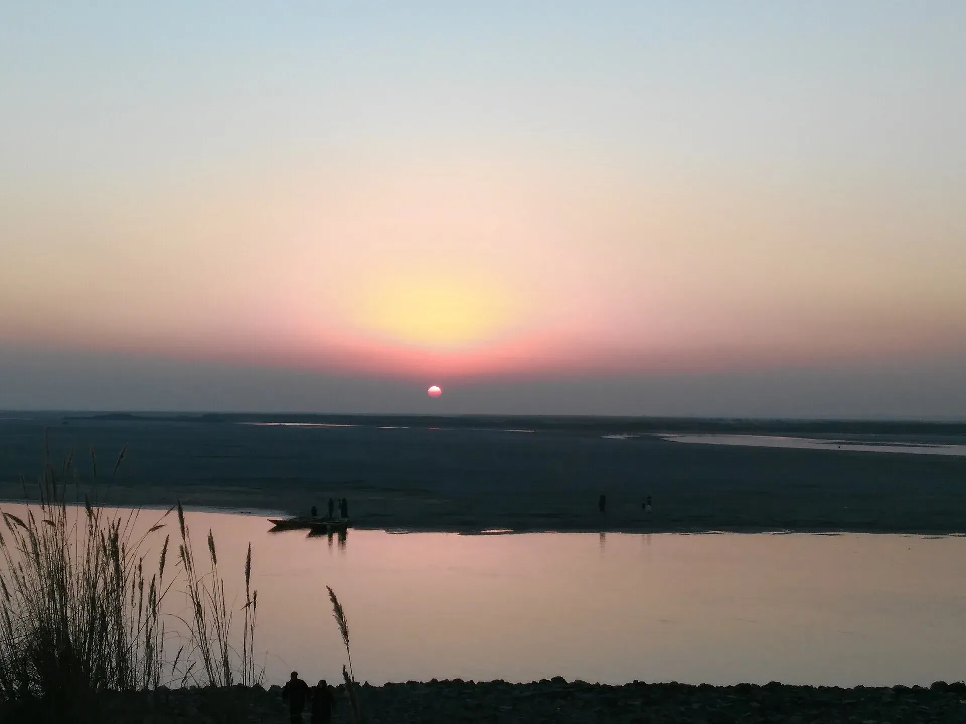
Photo: Ehtisham Rana Khan, with thanks · CC BY 4.0 · via Wikimedia Commons · temporary stand-in photo

Chenab River
A river of about 974 km formed in Himachal Pradesh where the Chandra and Bhaga meet. It enters Punjab at Marala near Sialkot, passes four headworks, takes in the Jhelum at Trimmu and joins the Sutlej as the Panjnad.
Overview
The Chenab is about 974 km long. It forms at Tandi in Himachal Pradesh, India, where the Chandra and Bhaga rivers meet, flows through Jammu, and enters Pakistan's Punjab plains. It joins the Sutlej to form the Panjnad, which meets the Indus at Mithankot. It is one of the five rivers that give Punjab its name.
The two source streams are short and steep. The Bhaga rises at Surya Taal and runs about 60 km, and the Chandra rises from glaciers near Chandra Taal and runs about 115 km, both through narrow gorges near the Baralacha La pass. In the Rigveda the river is called Asikni, "dark-coloured waters". Greek writers called it Akesines, and the name Chenab developed in the early medieval period. At Marala the mean flow is about 977 cubic metres a second. Recorded flows there range from about 311 to more than 31,000 cubic metres a second, which is why the river is dangerous in flood.
Plan your visit
- Nearest town
- Sialkot
- Getting there
Sialkot has its own airport and railway. Wazirabad and Gujranwala are on the Grand Trunk Road, and Multan is on the M-5 and railway. Headworks sites are reached by local road. More
Best months
Oct – Mar
Course in Pakistan
The Chenab enters Pakistan near Sialkot and passes four main headworks: Marala near Sialkot, Khanki in Gujranwala District, Qadirabad in Mandi Bahauddin District and Trimmu in Jhang District. The Jhelum joins the Chenab at Trimmu. The river then passes Multan and carries on to meet the Sutlej near Uch Sharif. Reference works list the Tawi and Ravi as left-bank tributaries and the Jhelum, Ansi and Manawar Tawi as right-bank tributaries.
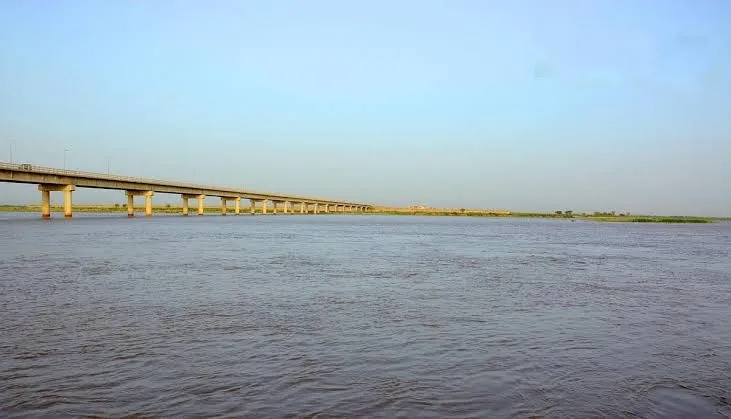
Photo: Shehzad, with thanks · CC BY-SA 4.0 · via Wikimedia Commons · temporary stand-in photo

Away from the headworks, the river is a broad, braided channel with sandbars, flood embankments and long road and rail bridges, set in flat farmland. Access is mostly by local roads to barrages and bridges.
Dams in India
Upstream, India operates the Baglihar (900 MW), Salal (690 MW) and Dul Hasti (390 MW) hydropower plants. The Indus Waters Treaty of 1960 allocates the Chenab's waters to Pakistan, while India may make non-consumptive uses such as hydropower and store up to 1.2 million acre-feet. The two governments disagree about the treaty's present state, but this does not affect visitors.
What to see and do
- Head Marala. The headworks near Sialkot are a quiet place for sunset photographs. Check access first because the area is close to the Indian border.
- Wazirabad and Gujranwala. The river passes between these old cities. See the Gujranwala and Wazirabad pages.
- Trimmu. The meeting of the Jhelum and the Chenab is at the Trimmu Head barrage in Jhang. See the Jhang page.
- Multan. The river passes close to Multan. See the Multan pages.
- Fishing and boating. We have not found official sources for either. Ask the Punjab Fisheries Department about licences.
History and culture
The Chenab flows through the heartland of Punjab, where canals and headworks built since the 19th century turned dry plains into farmland.
When to visit
October to March is best for visiting the plains. July to September is flood season; the river can run bank-full.
Where to stay and eat
Sialkot, Gujranwala, Wazirabad, Jhang and Multan have hotels and restaurants. Headworks areas have few facilities, so bring water.
Good to know
- Floods. In late August and September 2025 floods on the Chenab, Ravi and Sutlej affected more than a million people in Punjab, according to Dawn, with villages submerged and many evacuated. Check PDMA and NDMA alerts between July and September.
- Do not walk on embankments or cross low bridges when the river is high.
- Headworks are controlled sites. Ask before photographing, flying a drone or entering.
- Ask the district administration or local police about current conditions before you go. Safety. For foreign visitors: the UK FCDO (updated 27 October 2026, checked 16 November 2026) advises against all but essential travel within 5 miles of the Pakistan–India border, with exceptions for the Wagah route and the Kartarpur Corridor, and against all but essential travel to Dera Ghazi Khan. Check how the zone affects Marala before you go.
Highlights
- About 974 km from Tandi to the Panjnad
- Four main headworks: Marala, Khanki, Qadirabad and Trimmu
- Joined by the Jhelum at Trimmu
- Allocated to Pakistan under the 1960 Indus Waters Treaty
- One of the five rivers of Punjab
Getting there
Sialkot has its own airport and railway. Wazirabad and Gujranwala are on the Grand Trunk Road, and Multan is on the M-5 and railway. Headworks sites are reached by local road.
Tips
- Check flood alerts between July and September
- Ask before visiting headworks or flying drones
- Allow for the border zone near Marala
- Carry water; facilities at headworks are limited
Photos we still need: Qadirabad or Khanki headworks, and a Chenab ferry or riverside scene near Wazirabad. Send us yours
Sources and last checked
Last checked Confidence medium6 sources4 still to check
- Last checked
- Method
- Desk research from published sources
- Confidence
- medium
- Checked by
- trek.pk research team
Researched from published sources; not yet checked on the ground by our team. Spot something out of date? Report a mistake.
Sources
- Chenab River (Wikipedia) · Wikipedia · checked
- Jhelum River (Wikipedia) · Wikipedia · checked
- Sutlej (Wikipedia) · Wikipedia · checked
- 1.5m affected as Punjab reels from worst flood in decades (2025) · Dawn · checked
- Pakistan travel advice (updated 27 October 2026) · UK Foreign, Commonwealth & Development Office · checked
- Marala Headworks · Wikipedia · checked
Still to be checked on the ground (4)
- Length within Pakistan not sourced (Wikipedia gives only the total, 974 km)
- Whether Marala falls inside the 5-mile border zone (no distance given by Wikipedia's Marala Headworks article)
- Fishing and boating rules
- Construction dates of the Pakistani headworks (not in the sources opened)
Nearby and related

Sialkot
Industrial district capital near the Jammu border, famous for sports goods and surgical instruments and as the birthplace of the poet Allama Iqbal.

Wazirabad
District capital on the Chenab and the Grand Trunk Road, known as the city of cutlery. A railway junction with a Victorian bridge, 45 km from Sialkot.

Gujranwala
The City of Wrestlers and grilled chicken on the Grand Trunk Road, a short run from Lahore, with Sikh-era memorials, a Sheranwala Bagh baradari and the old gates of the bazaar quarter.

Jhang
Old Sial capital on the Chenab, known for the tomb of Heer and Ranjha and the shrine of Sultan Bahu at Garh Maharaja nearby. About 86 km from Faisalabad.

Multan
The City of Saints in southern Punjab: blue-tiled Sufi shrines, a crowded old city, blue pottery, sohan halwa and mangoes.

Jhelum River
A river of about 725 km that rises at Verinag in Kashmir, passes Srinagar and Muzaffarabad, fills Mangla Dam, crosses Punjab past Jhelum city and joins the Chenab at Trimmu.

Ravi River
The river of Lahore, about 720 km long, rising in Himachal Pradesh and running along the Indo-Pakistan border before passing Shahdara, Jahangir's tomb and Lahore, then joining the Chenab. Heavily polluted and often low.

Sutlej River
The longest of Punjab's five rivers, about 1,450 km from Lake Rakshastal in Tibet. It enters Pakistan east of Kasur, passes Sulemanki and Islam headworks, and meets the Chenab north of Uch Sharif to form the Panjnad.

Indus River
Pakistan's greatest river, rising in Tibet and running about 3,180 km to the Arabian Sea. It crosses Gilgit-Baltistan, meets the Gilgit near Jaglot and the Kabul at Attock, and feeds the plains from Tarbela to the delta.

Panjnad River
The short river formed where the Chenab and Sutlej meet, about 16 km north of Uch Sharif, before it joins the Indus at Mithankot. Panjnad Headworks feeds canals for Punjab and Sindh.
Head Marala (Marala Headworks)
Headworks on the Chenab near Sialkot, begun in the Triple Canals scheme of 1906 to 1912. It feeds the Upper Chenab Canal and the Marala-Ravi Link Canal.
Trimmu Headworks (Trimmu Barrage)
A barrage on the Chenab in Jhang district, built in 1938 to 1939 below the Jhelum confluence. It protects Jhang from floods and feeds link canals.
Qadirabad Barrage
A Chenab headworks in Mandi Bahauddin district, one of four on the river in Pakistan. Little visitor information exists.