

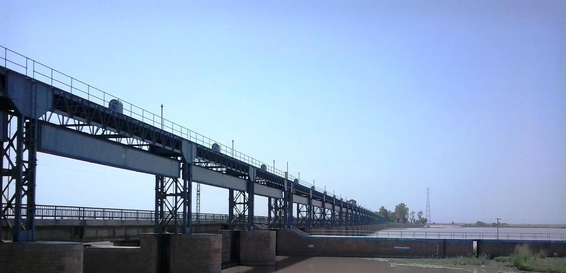
Photo: Alirazakh, with thanks · CC BY-SA 4.0 · via Wikimedia Commons · temporary stand-in photo

Panjnad River
The short river formed where the Chenab and Sutlej meet, about 16 km north of Uch Sharif, before it joins the Indus at Mithankot. Panjnad Headworks feeds canals for Punjab and Sindh.
Overview
Panjnad means "five waters". The river is about 71 km long and begins where the Sutlej and the Chenab meet in southern Punjab. Between them these two rivers carry the water of all five rivers that give the Punjab its name: the Jhelum and the Ravi join the Chenab, and the Beas joins the Sutlej. Wikipedia places the confluence about 16 km north of Uch Sharif, in Muzaffargarh District. From there the Panjnad runs south-west to Mithankot, where it flows into the Indus.
The river drains a basin of about 395,000 sq km, and its average discharge near Mithankot is about 2,500 cubic metres a second. Both figures are from Wikipedia.
Plan your visit
- Nearest town
- Uch Sharif
- Getting there
Uch Sharif, the nearest town of interest, is reached by road from Bahawalpur, about 84 km away. The headworks lies about 12 km north of Uch Sharif and the confluence about 16 km north. More
Best months
Nov – Mar
How the five rivers join
The meeting happens in stages. The Jhelum and the Ravi reach the Chenab first, and the Beas reaches the Sutlej, so only two rivers are left to join at the Panjnad itself. The Taunsa-Panjnad Link Canal, added in 1970, also carries Indus water across into the Chenab (see the Taunsa Barrage page). The name joins the Persian panj (five) with the Sanskrit nadi (river).
Panjnad Headworks
The headworks is a gated barrage on the river, about 12 km north of Uch Sharif and just below the Chenab and Sutlej confluence. It belongs to the Punjab Irrigation Department and has 47 radial gates.
- Building it. Work began in 1927 under executive engineer James L. Roy, as part of the British-era Sutlej Valley Project. The first design had 33 bays, each 18.2 m wide. After the Islam Headworks collapsed in 1929, the design was revised to 47 bays for better flood safety. The work was finished in two phases by May 1931, the river was turned over the weir on 19 December 1931, and the headworks opened formally in 1932.
- Canals. Two canals were taken from the left bank when it opened: the Panjnad Canal (88.5 km, designed for 270 cubic metres a second) and the Abbassia Canal (69 km). The Panjnad Canal irrigates about 588,817 hectares. The Abbassia Link Canal was added later to move water between the Sutlej and Chenab systems.
- Floods. In August 1973 inflow passed 22,653 cubic metres a second, and engineers breached the left marginal bund to protect the gates, which flooded large parts of Bahawalpur Division. Asian Development Bank records list similar high flows in 1976 and 1992.
- Rebuilding. The road bridge over the gates was declared dangerous and closed in August 2018. A rebuilt dual-carriageway bridge reopened on 14 August 2020. A larger rehabilitation, financed by the Asian Development Bank, began in November 2018 and added three spillways and strengthened the canal head regulators.
What to see and do
The river is not a developed visitor destination. Wikipedia describes the headworks as a riverside picnic spot where visitors can see the merging of the rivers, and says the site appears in regional folklore and Sufi poetry. No viewpoints, opening hours or facilities are described in the sources checked, and the barrage is working irrigation infrastructure.
The nearest place of interest is Uch Sharif, with its tiled tombs and shrines (see the Uch Sharif Monuments page). Wikipedia does not list wildlife for this river.
When to visit
Winter and early spring are cooler. Summers are very hot, and floods can follow monsoon rain; the 1973 event shows how high the river can rise.
Getting there
Uch Sharif, the nearest town of interest, is reached by road from Bahawalpur, about 84 km away. The headworks lies about 12 km north of Uch Sharif and the confluence about 16 km north (Wikipedia gives both figures). Public access to the barrage is not described in the sources checked.
Good to know
- Ask local officials before approaching the headworks. It is working irrigation infrastructure.
- Safety. For foreign visitors: the UK FCDO advice (updated 27 October 2026, checked 17 November 2026) advises against all but essential travel to areas of Sindh north of and including Nawabshah. It does not list Bahawalpur or Muzaffargarh among its areas to avoid. Check the current advice.
Highlights
- Formed by the Chenab and Sutlej, about 16 km north of Uch Sharif
- Carries the water of the five rivers of the Punjab
- Panjnad Headworks, built 1927 to 1932
- Ends at the Indus at Mithankot
Tips
- Combine with a visit to Uch Sharif
- Ask locally before approaching the headworks
- Summer heat is severe
Photos we still need: the confluence of the Chenab and Sutlej, and the river below the headworks. Send us yours
Sources and last checked
Last checked Confidence low4 sources4 still to check
- Last checked
- Method
- Desk research from published sources
- Confidence
- low
- Checked by
- trek.pk research team
Researched from published sources; not yet checked on the ground by our team. Spot something out of date? Report a mistake.
Sources
- Panjnad River (Wikipedia) · Wikipedia · checked
- Panjnad Headworks (Wikipedia) · Wikipedia · checked
- Pakistan travel advice (updated 27 October 2026) · UK Foreign, Commonwealth & Development Office · checked
- Taunsa Barrage (Wikipedia) · Wikipedia · checked
Still to be checked on the ground (4)
- Whether the public can visit the headworks
- Wikipedia gives two distances for the headworks from Uch Sharif (12 km) and the confluence (16 km); confirm locally
- Which district holds the confluence (Wikipedia says Muzaffargarh)
- Wikipedia says the rebuilt bridge reopened in 2020 restores a section of the N-5; confirm which road crosses the headworks
Nearby and related

Uch Sharif Monuments
A cluster of tiled Sufi tombs and a mosque in the old town of Uch Sharif near Bahawalpur, dating from the 13th to 15th centuries. The group is on UNESCO's tentative list (2004).

Chenab River
A river of about 974 km formed in Himachal Pradesh where the Chandra and Bhaga meet. It enters Punjab at Marala near Sialkot, passes four headworks, takes in the Jhelum at Trimmu and joins the Sutlej as the Panjnad.

Sutlej River
The longest of Punjab's five rivers, about 1,450 km from Lake Rakshastal in Tibet. It enters Pakistan east of Kasur, passes Sulemanki and Islam headworks, and meets the Chenab north of Uch Sharif to form the Panjnad.

Indus River
Pakistan's greatest river, rising in Tibet and running about 3,180 km to the Arabian Sea. It crosses Gilgit-Baltistan, meets the Gilgit near Jaglot and the Kabul at Attock, and feeds the plains from Tarbela to the delta.

Bahawalpur
Former capital of a princely state on the edge of the Cholistan Desert: Nawabi palaces, a museum, desert crafts, and a base for Lal Suhanra, Derawar Fort and Uch Sharif.

Muzaffargarh
District capital in south Punjab, between the Chenab and Indus. A farming town of citrus and mango orchards, 37 km from Multan.

Jhelum River
A river of about 725 km that rises at Verinag in Kashmir, passes Srinagar and Muzaffarabad, fills Mangla Dam, crosses Punjab past Jhelum city and joins the Chenab at Trimmu.

Ravi River
The river of Lahore, about 720 km long, rising in Himachal Pradesh and running along the Indo-Pakistan border before passing Shahdara, Jahangir's tomb and Lahore, then joining the Chenab. Heavily polluted and often low.