

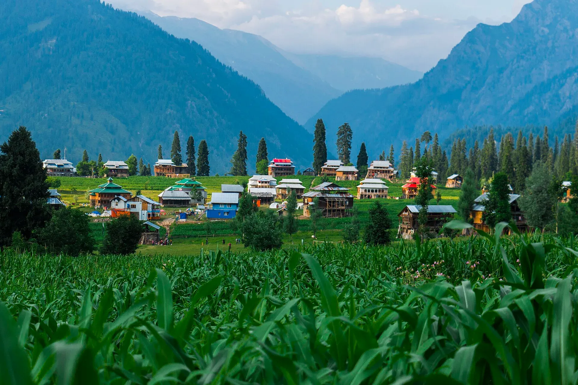
Photo: Jahanzeb Ahsan, with thanks · CC BY-SA 4.0 · via Wikimedia Commons · temporary stand-in photo

Arang Kel Trail
- Duration
- 1 day
- Grade
- Easy
- Max altitude
- 2,554 m
- Season
- May – Oct
A short climb from Kel to Arang Kel, a hilltop village at 2,554 m in Neelum Valley. A chairlift crosses the river; the walk then takes 30 to 60 minutes (1.5 to 3 hours all on foot).
Overview
Arang Kel is a village on a hilltop above Kel in the Neelum Valley of Azad Kashmir, at about 2,554 m. It is known for a meadow, wooden houses and mountain views. The standard way up is a chairlift across the river, then a steep walk.
The Neelum Valley is about 144 km long and follows the Neelum River, which flows from the Gurez Valley in Indian-administered Kashmir and joins the Jhelum at Muzaffarabad. The Line of Control (LoC) runs through the valley, in places along the river itself, which is why access rules matter here.
Who it suits
Most visitors of average fitness. The walk is short but steep. If you walk the whole way from Kel, expect 1.5 to 3 hours. Children and older walkers use the chairlift and walk slowly. It is a day outing, though guesthouses and tents in the village allow an overnight stay.
When to go
May to October (our estimate). Wikivoyage describes heavy snowfall and temperatures below freezing in winter, and landslides, mudslides and flash floods in the monsoon. Snow covers the village in winter and the road can be closed by landslides. Monsoon rain makes the track slippery.
Getting to Kel
Kel is about 145 km from Muzaffarabad by road (OSRM estimate: 2 hours 47 minutes of pure driving; the narrow Neelum road takes far longer in practice) and about 278 km from Islamabad by way of Muzaffarabad. The road follows the Neelum River upstream through the valley. Dawn reported on 14 May 2025 that a temporary ban on tourists entering Neelum Valley, imposed for public safety, had been lifted; entry can be restricted at short notice, so check with the district administration.
The route
The order of the day is simple. From Kel, cross the river on the chairlift. Sources give its length as about 1 to 2 km, and some call it a cable car or aerial lift. On the far bank the path climbs the hillside on stone steps and dirt tracks. It is steep throughout. Walking time from the chairlift is 30 to 60 minutes (a tour operator says 35 to 40 minutes; one guide says about an hour; another says a 2-hour trail). Walking the entire way from Kel takes 1.5 to 3 hours.
At the top, the village sits on a hill with a meadow, wooden houses and views of snow-capped peaks. Guesthouses and tents offer overnight stays. Return by the same route before dark.
Culture and people
Arang Kel is a small village. Dress modestly, ask before photographing homes or people, and respect local guidelines near the Line of Control.
Preparing for the day
Wear shoes with a good grip, because the steps and tracks are steep and slippery after rain. Carry water for the climb, a warm layer (the village is at 2,554 m) and a rain jacket in the monsoon. Start early. Carry ID, as checkpoints are common in the valley. Wikivoyage notes that foreign visitors to Azad Kashmir are listed as needing a permit from the AJK Home Department in Muzaffarabad, with exceptions that do not name the Neelum Valley. That is an unofficial source, so confirm the current position with AJK tourism before you travel.
Practical information
- Chairlift tickets are sold at Kel; fees are unconfirmed.
- Mobile signal may be poor.
- Bring cash; there are few ATMs.
Highlights
- Hilltop village at 2,554 m
- Chairlift over the Neelum River
- Meadow and mountain views
- Short climb from Kel
Day by day
- StartKel (chairlift station)
- Day 1Arang Kel
| Day | Route | Hours | Distance | Ascent / descent | Camp and altitude |
|---|---|---|---|---|---|
| Day 1 | Kel to Arang Kel | 0.5–1 h after chairlift (1.5 to 3 all on foot) | not given | not given | Arang Kel, 2,554 m |
Day 1 notesTake the chairlift across the river, or walk to the crossing. Then climb the steep path up the opposite hillside to the village. Enjoy the meadow, then return by the same route before dark. | |||||
Getting there
Drive from Muzaffarabad up the Neelum Valley to Kel, a long day by road (OSRM gives 145 km and 2 hours 47 minutes of pure driving; guide-book figures of 7 to 9 hours are for real conditions on the narrow road). The chairlift and trail are at Kel.
Permits and rules
- Permit needed
- Usually not, Open zone
- Fee
- Current fees will be added soon
- Last checked
- 16 November 2026
Neelum Valley is near the Line of Control. Foreign visitors may be refused or may need clearance at checkpoints. Check with AJK tourism before travel. The chairlift is ticketed; the amount is unconfirmed and current fees will be added soon.
How trekking permits, NOCs and registration work: Visa and permits.
Season
Best: May – Oct
Water and camps
Guesthouses and tents in Arang Kel; carry water for the walk.
Gear and safety
Line of Control
Kel and Arang Kel are close to the LoC. Follow instructions of security staff and local officials.
Landslides
The Neelum road can be cut by landslides, especially in the monsoon.
Steepness
The walk is steep; take your time.
Ask the district administration or local police about current conditions before you go. For foreign visitors: the UK FCDO advises against all but essential travel to Azad Jammu and Kashmir, and against all travel within 10 miles of the Line of Control (advice updated 27 October 2026, checked 16 November 2026). Read the live advice before you plan.
Variations
Continue by road to Taobat, or longer treks from Kel such as Chitta Katha (not covered here).
Tips
- Travel with ID
- Check military and checkpoint rules
- Carry cash and warm layers
- Start early to avoid afternoon cloud
Health and emergency
Mobile signal is patchy on most treks, so tell someone your plan before you go. Emergency numbers
Sources and last checked
Last checked Confidence medium8 sources6 still to check
- Last checked
- Method
- Desk research from published sources
- Confidence
- medium
- Checked by
- trek.pk research team
Researched from published sources; not yet checked on the ground by our team. Spot something out of date? Report a mistake.
Sources
- Arang Kel · Wikipedia · checked
- A tourist guide to Arang Kel · Graana.com blog · checked
- Pakistan Tourism Guide 2021 · TDAP · checked
- Pakistan treks and mountain ranges (trek.pk research report) · trek.pk research · checked
- OSRM driving route service: road distances and times measured 16 November 2026 (driving only, optimistic on mountain roads) · OSRM / OpenStreetMap contributors · checked
- Temporary ban on tourists in Neelum Valley lifted (14 May 2025) · Dawn · checked
- Neelum Valley (district article) · Wikipedia · checked
- Azad Kashmir (travel guide) · Wikivoyage · checked
Still to be checked on the ground (6)
- Walking time (sources range from 30 minutes to 3 hours) and chairlift length
- Foreigner clearance rules near the LoC (sources conflict on whether an NOC is needed; no official notice found)
- Chairlift price and operating dates (blogs quote Rs 150 to 600; no official source)
- Whether Neelum Valley is open to tourists (a 2025 ban was lifted on 14 May 2025)
- Season and road status
- Foreign-visitor permit for Azad Kashmir: Wikivoyage lists an AJK Home Department permit with exceptions; no official notice found for the Neelum Valley
Nearby and related

Chitta Katha Lake Trek (Shounter Valley)

Ganga Choti Trail

Ratti Gali Lake Trek from Dowarian

Arang Kel
A hilltop village and meadow at about 2,554 m above Kel in the Neelum Valley, reached by a chairlift across the river and a steep walk.

Neelum Valley
A long, forested river valley in Azad Kashmir running north-east from Muzaffarabad to Sharda, Kel and Arang Kel. It runs close to the Line of Control, so check access before you go.