

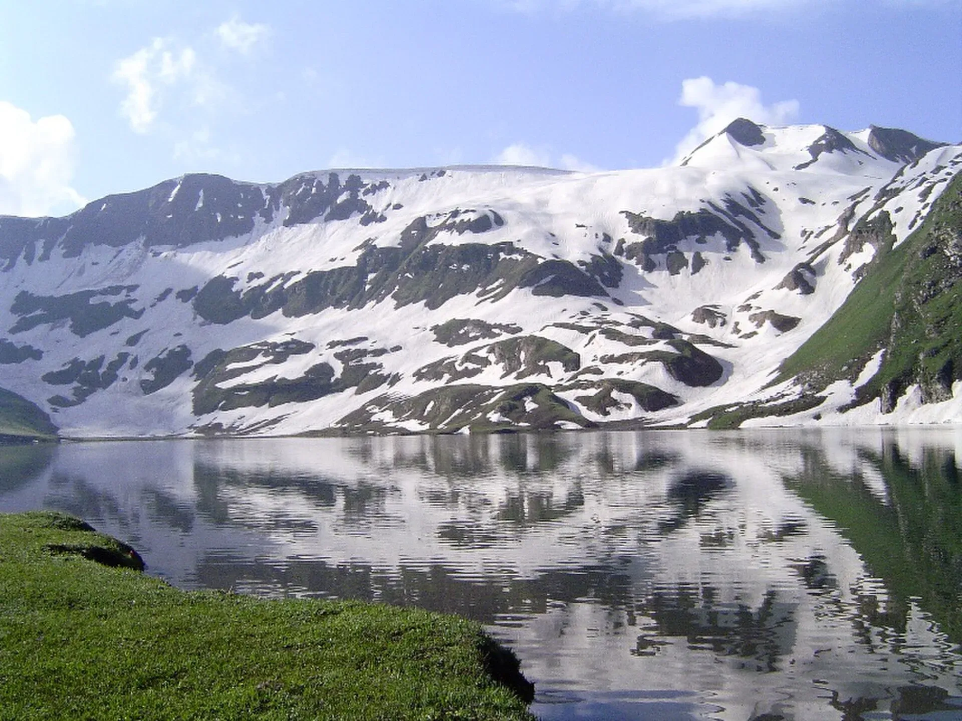
Photo: Chumer at English Wikipedia, with thanks · CC BY-SA 3.0 · via Wikimedia Commons · temporary stand-in photo

Dudipatsar Lake Trek from Besal
- Duration
- 1–3 days
- Distance
- 18 km
- Grade
- Moderate
- Max altitude
- 3,800 m
- Season
- Jun – Sep
A walk from Besal, on the Babusar road in the upper Kaghan Valley, to Dudipatsar Lake at about 3,800 m. Wikipedia gives about 18 km and a climb of 640 m, as a long day or an overnight with a stop at Mulla ki Basti.
Overview
Dudipatsar Lake (also Dudipat) is a shallow glacial lake in Lulusar-Dudipatsar National Park, at the northern end of the Kaghan Valley. Wikipedia puts it at 3,800 m, about 835 m long and 600 m wide. The walk starts at Besal, a village on the Babusar road, and follows the Purbi Nar (a nar is a mountain stream) to the lake at its head. The Friday Times describes the Purbi Nar as carrying the water of Dudipatsar, one of the main sources of the Kunhar River.
Wikipedia's trail article gives about 18 km and a total climb of 640 m. Its lake article says the lake is about 15 km from Besal. Neither figure is sourced, so treat the distance as approximate.
Getting to Besal
Besal lies on the Babusar road a little before Lulusar Lake. The Friday Times describes the river valley there as broad, with the Purbi Nar joining from the east and the Sadullah Nar from the west. Besal is about one to two hours by road from Naran, and a 4x4 is the usual choice because rockfall can damage the road. Wikipedia says Besal has a driver hotel and a police check post, lodging and space to pitch tents. Vehicles are parked at the owner's risk, but someone can be hired to watch them for a day or two.
The route
The trail runs inside the national park and passes through several life zones, from forest to alpine meadow. Wikipedia lists what the walker meets: boulders, meadows, a plateau, early-summer snow in the ravine below the plateau, and streams. The path crosses the stream on log bridges in a couple of places, and there is one bridge that Wikipedia calls a buggy bridge. The plateau is marshy in places.
Nature Adventure Club describes the walk in two parts: Besal to Mulla ki Basti in about 4 to 5 hours, then about 1.5 hours more to the lake. Mulla ki Basti is a group of stone huts used by herders in summer. Wikipedia places it about 2 km short of the lake, so the two figures sit together awkwardly. Treat the times as a guide, not a schedule.
Wikipedia lists three ways to do the trek:
- One day. About 3 to 5 hours up and 3 to 4 hours down. Wikipedia advises it for moderate to experienced walkers.
- Two days. A night at Mulla ki Basti or at the lake. Up takes 6 to 10 hours in all, and down 5 to 6 hours.
- Three days. Two nights, which leaves a full day at the lake.
Terrain and conditions
The gain is modest, about 640 m, but it is made at altitude, so Wikipedia rates the trail medium and the lake article calls it hard for unfit or new trekkers. Expect wet ground on the plateau and snow in the ravine early in the season. Wikipedia advises waterproof boots. The track is used by herders who set up summer homes along it.
When to go
Wikipedia gives mid-summer as the main season, and the lake infobox gives May to September. Use mid-June to late September as a working window until a local source confirms it. In mid-September herders and the Mulla ki Basti families go down for the winter. After that the makeshift hotels close and no food is sold for 9 to 10 km from the start, so carry food and a tent. Wikipedia says the abandoned stone houses at Mulla ki Basti can be used for a night's shelter.
Practical information
- Mules can be hired at Besal to carry luggage and rations, and Wikipedia recommends it.
- Guides are available at Besal. Wikipedia says experienced walkers can go alone by following the stream, because the lake is at its head.
- Carry tents and sleeping bags if you plan to stay out. Wikipedia advises spending the night at Mulla ki Basti and going on to the lake in the morning, citing security concerns.
- The lake and its wetlands are important for resident animals and migratory waterfowl. Wikipedia lists snow leopard, black bear, lynx, marmot and Himalayan snowcock for the park.
Highlights
- Shallow glacial lake at about 3,800 m inside a national park
- Walk beside the Purbi Nar through forest, meadow and a marshy plateau
- Stone-hut summer village at Mulla ki Basti
- Can be done as a long day or over two or three days
Day by day
- StartBesal (Babusar road, above Naran)
- Day 1Mulla ki Basti
- Day 2Dudipatsar Lake
| Day | Route | Hours | Distance | Ascent / descent | Camp and altitude |
|---|---|---|---|---|---|
| Day 1 | Besal to Mulla ki Basti | 4–5 h (Nature Adventure Club) | not given | not given | Mulla ki Basti |
Day 1 notesLeave Besal on foot and follow the Purbi Nar upstream through forest and meadow. The path crosses the stream on log bridges. Mulla ki Basti, the stone-hut herders' village, is the usual overnight stop. Mules can carry luggage from Besal. | |||||
| Day 2 | Mulla ki Basti to Dudipatsar Lake and return | about 1.5 h up (Nature Adventure Club) | not given | not given | Dudipatsar Lake, 3,800 m |
Day 2 notesContinue up the plateau, which is marshy in places, to the lake. Spend time at the shore, then walk back to Mulla ki Basti or down to Besal. Wikipedia gives 5 to 6 hours for the descent from the lake on a two-day schedule. | |||||
Getting there
Drive from Naran up the Kaghan road towards Babusar to Besal, about one to two hours depending on the road. Hire a 4x4 in Naran, as rockfall can damage the road. The walk starts at Besal.
Permits and rules
- Permit needed
- Usually not, Open zone
- Fee
- Current fees will be added soon
- Last checked
- 17 November 2026
No confirmed fee or permit was found. The trek lies inside Lulusar-Dudipatsar National Park, so a park charge may apply, but none of the sources opened gives one. Current fees will be added soon. Ask at Besal or Naran.
How trekking permits, NOCs and registration work: Visa and permits.
Season
Best: Jun – Sep
Water and camps
The route follows the Purbi Nar and its tributaries, so water is close, but treat it before drinking. Camp at Mulla ki Basti or at the lake with your own tent and sleeping bags. Lodging and camping space are available at Besal. After mid-September the makeshift hotels on the trail close.
Gear and safety
Weather and ground
Rain and cold can come at any time. Wear waterproof boots for the marshy plateau. Early in the season, snow lies in the ravine below the plateau.
Streams
The path crosses the stream on log bridges. Take care after rain.
Altitude
The lake is above 3,500 m. Go up slowly.
Ask the district administration or local police about current conditions before you go. For foreign visitors: the UK FCDO advises against all travel on the Karakoram Highway between Mansehra and Chilas, and does not name Mansehra or Kaghan as districts (advice updated 27 October 2026, checked 17 November 2026). Read the live advice before you plan.
Variations
Lonely Planet's Eastern Kaghan route, as summarised on the Other treks in Diamir page, ends in the Purbi valley at Besal after passing Dudibach Lake (3,962 m). Lulusar Lake and Saiful Muluk lie nearby on the same road.
Tips
- Hire a mule at Besal to carry food and a tent
- Wear waterproof boots for the marshy plateau
- Carry food and shelter after mid-September, when the huts close
- Start early and keep a guide for the first trek
- Take rubbish down with you
Stay and eat in Naran
Naran is the nearest town to the trek: somewhere to sleep and stock up before and after.
Places to stay
- HOTEL deMANCHICall HOTEL deMANCHIMap of HOTEL deMANCHI in Google Maps
- Fairy Meadows HotelCall Fairy Meadows HotelMap of Fairy Meadows Hotel in Google Maps
- Mount Feast Hotel NaranCall Mount Feast Hotel NaranMap of Mount Feast Hotel Naran in Google Maps
- Serene Resorts NaranCall Serene Resorts NaranMap of Serene Resorts Naran in Google Maps
- Northern Retreat by Hotel DemanchiCall Northern Retreat by Hotel DemanchiMap of Northern Retreat by Hotel Demanchi in Google Maps
- New Park Hotel & RestaurantCall New Park Hotel & RestaurantMap of New Park Hotel & Restaurant in Google Maps
Places to eat
- Moon RestaurantCall Moon RestaurantMap of Moon Restaurant in Google Maps
- SubwayCall SubwayMap of Subway in Google Maps
- Bar B.Q. Tonight Restaurant NARANCall Bar B.Q. Tonight Restaurant NARANMap of Bar B.Q. Tonight Restaurant NARAN in Google Maps
- N-15 Cafe & DeliCall N-15 Cafe & DeliMap of N-15 Cafe & Deli in Google Maps
- Al Noor Restaurant NaranCall Al Noor Restaurant NaranMap of Al Noor Restaurant Naran in Google Maps
Essential services fuel stations, mechanics and banks
Fuel
- PSO Petrol Pump Sajjad Fill StationCall PSO Petrol Pump Sajjad Fill StationMap of PSO Petrol Pump Sajjad Fill Station in Google Maps
- Pakistan State Oil - Yasir Haroon Filling StationCall Pakistan State Oil - Yasir Haroon Filling StationMap of Pakistan State Oil - Yasir Haroon Filling Station in Google Maps
- FLOW PETROLIUMCall FLOW PETROLIUMMap of FLOW PETROLIUM in Google Maps
Mechanics and tyre shops
- Baig Suzuki center& Rental Bike NaranMap of Baig Suzuki center& Rental Bike Naran in Google Maps
Banks and money exchange
- Allied Bank LimitedMap of Allied Bank Limited in Google Maps
Listings come from Google Maps data and are unverified: phone numbers, opening months and prices may have changed. Report a problem · Own one of these? Claim it
Health and emergency
Mobile signal is patchy on most treks, so tell someone your plan before you go. Emergency numbers
Sources and last checked
Last checked Confidence medium7 sources7 still to check
- Last checked
- Method
- Desk research from published sources
- Confidence
- medium
- Checked by
- trek.pk research team
Researched from published sources; not yet checked on the ground by our team. Spot something out of date? Report a mistake.
Sources
- Dudipatsar Trail · Wikipedia · checked
- Dudipatsar Lake · Wikipedia · checked
- Lulusar-Dudipatsar National Park · Wikipedia · checked
- Road to Kaghan - II (27 August 2022) · The Friday Times · checked
- Top lakes of Pakistan (Dudipatsar entry: Besal to Mulla ki Basti 4 to 5 hours, then 1.5 hours) · Nature Adventure Club · checked
- Other treks in Diamir (Eastern Kaghan route summary) · trek.pk · checked
- Pakistan travel advice (warnings and insurance; updated 27 October 2026) · UK FCDO · checked
Still to be checked on the ground (7)
- Walking distance (18 km on the Wikipedia trail article, 15 km on the lake article, both unsourced)
- Times: one-day 3 to 5 hours up (Wikipedia) against 4 to 5 hours to Mulla ki Basti plus 1.5 hours (Nature Adventure Club)
- Position of Mulla ki Basti: Wikipedia says about 2 km short of the lake
- Drive time from Naran to Besal (one to two hours on our place page; Nature Adventure Club gives about four hours from Naran to the lake area)
- Park, guide and mule charges
- Lake height: 3,800 m on Wikipedia, uncited
- Hero photo is only 816 px wide; a larger photo of the lake is needed
Nearby and related

Ansoo Lake Trail

Bashigram Lake Trail

Broghil and Karambar An

Dudipatsar Lake
An alpine lake at about 3,800 m in Lulusar-Dudipatsar National Park, reached by a 5 to 8 hour walk from Besal on the Babusar road. Mid-June to late September.

Lulusar-Dudipatsar National Park
A high national park at the head of the Kaghan Valley, created in 2003. It protects Lulusar Lake, Dudipatsar Lake and the wildlife of the Babusar area.

Lulusar Lake
A large lake beside the Naran-Babusar road in upper Kaghan, at roughly 3,350–3,410 m. It is the main source of the Kunhar River and the gateway to Lulusar-Dudipatsar National Park.

Saiful Muluk
The best-known lake of the Kaghan Valley, at 3,224 m above Naran, with Malika Parbat behind it. It is about 9 km from Naran, reached by jeep, and is snowbound and frozen in winter.

Naran
The main base of the Kaghan Valley, at 2,409 m beside the Kunhar River. Naran is the starting point for Saiful Muluk, Lulusar and the road to Babusar Top.

Kaghan Valley (with Naran)
A 155 km Himalayan valley above Balakot along the Kunhar River, with Shogran, Naran, Saiful Muluk and Lulusar lakes, and the road to Babusar Pass. Open mainly from May to October.